Compare 411 North Carolina waterfall visits by the approach, terrain, and where to start. Some routes have closures or unresolved details; read the individual guide before travelling.
From Brevard, take US 276 north 11.7 miles and turn right on gravel Forest Road 1206 (Yellow Gap Road). Go about 1.2 miles to where the blue-blazed Barnett Branch Trail crosses the road and park in the small pull-off. Walk a short way up the road, turn left on the Barnett Branch Trail and climb just over a quarter mile. The waterfall is just off the trail, with a very short side path to the base right before the trail starts switchbacking. Return the same way.
About 2 miles return (Waterfall Hero hike length: 0.9 mile trail plus 0.1 mile path each way)
Bull Cove Falls is a two-part cascade of about 40 feet in the Southern Nantahala Wilderness, reached by driving up the Tallulah River from Georgia. From the lower Beech Creek Trail (#378) trailhead on Forest Road 56, the trail climbs steeply over a ridge and drops to a crossing of Beech Creek, then follows an old mining road upstream. At 0.9 mile it crosses Bull Cove Creek; turn right and follow an obvious path upstream about 0.1 mile to the falls. The crossing of Beech Creek can be tricky in high water.
From the fish hatchery parking lot, pass the gate on gravel FR 475C and turn right onto the Cat Gap Loop Trail (#120). Cross Cedar Rock Creek on rocks (the footbridge was lost in the 2021 flood). Past the junction with the new Butter Gap Trail, keep left on the hikers-only Cat Gap Trail and climb. At about 0.7 miles an unsigned side path leaves on the left at a V; follow it down to a rock wall and a short scramble over roots to the base of the 20-foot falls. Return the same way.
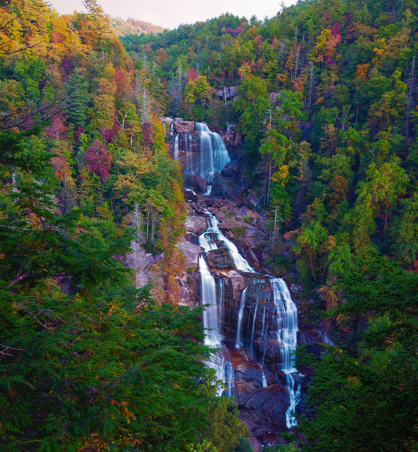
From the Whitewater Falls Recreation Area parking, follow the paved Whitewater Falls Trail to the first overlook, then the stairs down to the second overlook of Upper Whitewater Falls. Continue down to the Foothills Trail and turn left, switchbacking down to the Whitewater River and its footbridge. In another 0.1 miles a small footbridge crosses Corbin Creek with the lowest part of the falls immediately upstream. An obvious path on the left bank leads a little way up the cascades. Return the same way, climbing back to the parking.
From the lot, take Elk Falls Trail to the right of the gated road. Continue past the upper viewing area, staying back from the edge, then descend steps and roots to the lower viewing rock. Do not enter the plunge pool or river above the falls.
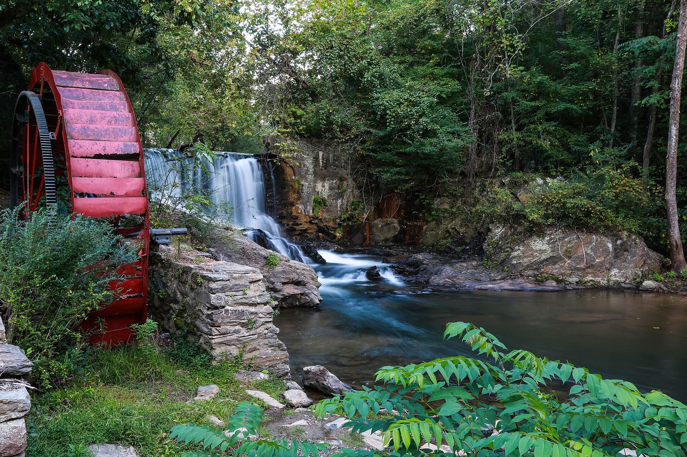
From the pull-off beside NC 215, walk toward the small red house on the south side of the ministry complex and enter the woods to its left; a short path drops to the river at the falls. French Broad Falls is the wide 15 foot drop on the North Fork French Broad River, beside the Shoal Creek falls below the old mill. Return the same way.
Roadside overlook; short optional path to another viewing area
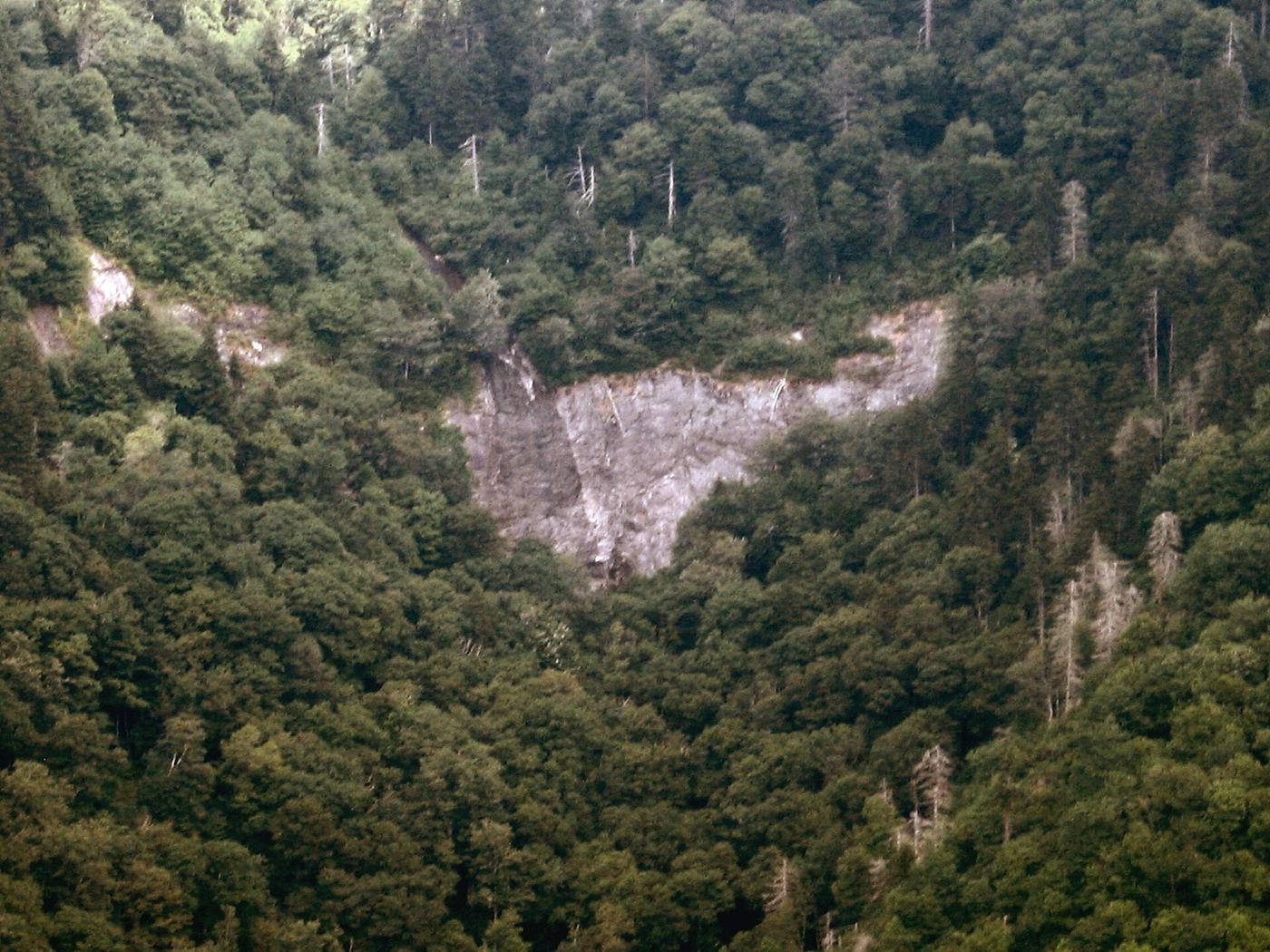
Park at Glassmine Falls Overlook and look across the valley for the thin waterfall. A short path leads to a second viewing area. There is no public access to the falls themselves, which lie within the Asheville watershed.
Drive the park road to the upper parking area. The Hickory Nut Falls Trail starts at the last sharp switchback just below the lot; walk carefully back down the road, or take the stairs beside the upper restrooms down to the trail. The trail follows the side of the gorge to an observation platform at the base of the falls. Return the same way.
About 0.5 miles to the overlook; about 0.8 to 0.9 miles to the base
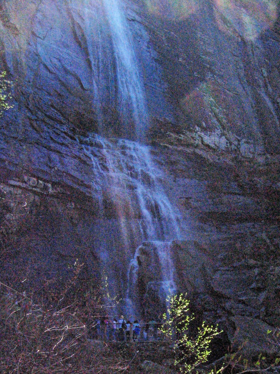
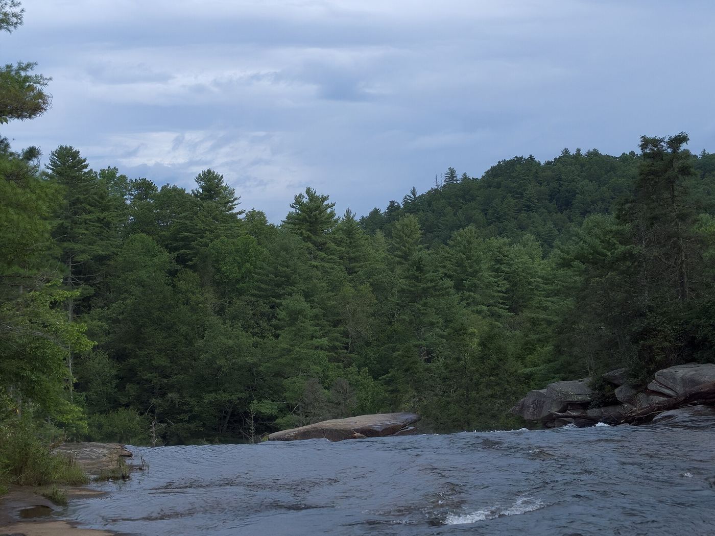
From Brevard drive south on US 276 about 11 miles and turn left on Cascade Lake Road. After 2.5 miles turn right on Staton Road and drive 1.4 miles to the visitor center and High Falls access parking on the right. From the far end of the lot take High Falls Loop Trail. At 0.3 miles keep right and continue 0.2 miles to the overlook below the picnic shelter. To reach the base, continue about 0.1 miles and turn right on the spur trail, about a quarter mile down. High Falls slides about 120 feet down a granite face on the Little River.
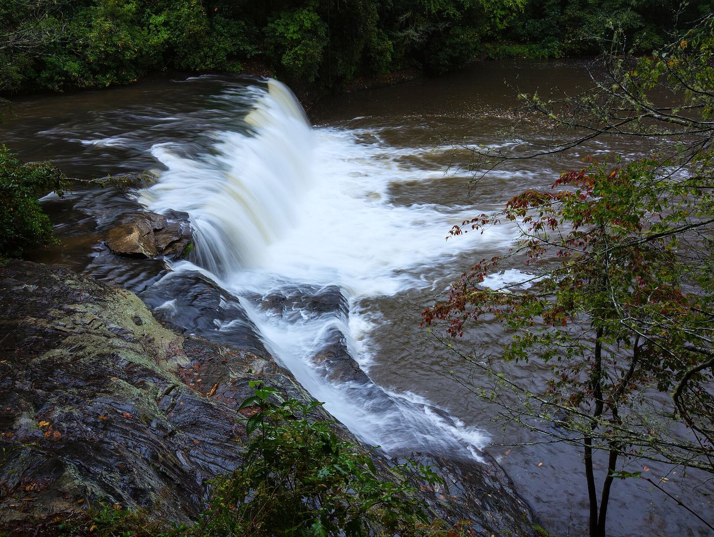
Hooker Falls is a wide 13 to 15 foot waterfall on the Little River in DuPont State Recreational Forest. From the Hooker Falls Access Area, take Hooker Falls Trail from the upper side of the parking lot beside the restroom building. The trail passes Moore-Hooker Cemetery after about a quarter mile and descends to the river near the base of the falls. The old riverside trail is closed. Do not take Triple Falls Trail, which crosses the river on the footbridge.
Short walk on the park path; the full lake loop is about 0.6 miles
This is a partial guide. Lake Louise Park is a town park in Weaverville owned and maintained by the Town of Weaverville, with a man-made lake of more than five acres and a walking track. A 2023 visitor tip on Komoot says the paved path around the lake crosses bridges and visits a waterfall. The sources do not say exactly where on the path the waterfall is.
Walk a short way up Yellow Gap Road and turn left on the blue-blazed Barnett Branch Trail #618. In 10 to 15 minutes, just before the trail starts switchbacking, a short side path leads to the main 25-foot falls. For the upper falls, continue on the trail: it heads up to the right, switchbacks left over a log bridge, returns to the creek at a slide, and continues a short distance to a 30-foot falls covered in downed wood. The sources do not give this upper falls a name.
About 1.4 to 1.6 miles return (about 0.8 miles each way)
Little Moore Cove Falls is a 25 to 35 foot falls over a bluff in the cove west of Moore Cove Falls, Pisgah Ranger District. Cross Looking Glass Creek on the footbridge and follow Moore Cove Trail (#318) toward Moore Cove Falls. About 100 feet before the Moore Cove Falls viewing area, take the path on the left. After 40 feet, cross the creek into a small clearing, leave it to the left, cross the creek coming from Little Moore Cove Falls, and climb about 200 feet to an open view. A path continues down to the creek and upstream toward the base.
Begin at the gate on Forest Road 5043, on the outside of the curve. At 0.2 miles cross a wide wooden bridge; a side path just before it goes to Discovery Falls. Continue 0.3 miles to a second bridge over Log Hollow Branch. The 38-foot sliding falls is visible from the bridge, and a path just past the bridge climbs a few feet to the base. Return the same way.
From Brevard drive east on US 64/US 276 to the split and stay left on US 276. After 5.3 miles turn left on Forest Road 475 toward the Pisgah Center for Wildlife Education. In 1.5 miles, just past the center, bear right on steep gravel FR 475B (Headwaters Road) and drive 1.1 miles to a small parking area on the right, the start of Slick Rock Falls Trail. Take a path down to the roadside campsites and follow Slick Rock Creek downstream. After the last campsite, cross to the right bank (facing downstream) and pass a large rock wall. The 20 foot falls is just past it. Dead trees cover much of it; the source found the best view from the middle.
McGalliard Falls is a 40-foot waterfall on McGalliard Creek in McGalliard Falls Park, owned by the Town of Valdese. From I-40 exit 112, go north to Main Street in Valdese, west 0.8 miles, right on Church Street, then about 1.5 miles to the park entrance on the right. A short path leads to the falls. The park also has the rebuilt Meytre Grist Mill, picnic facilities, restrooms and a volleyball court. Do not swim near or above the falls.
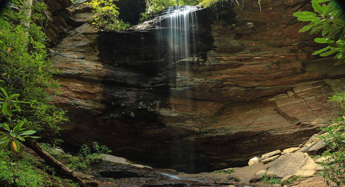
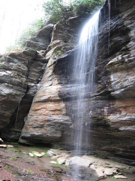
This is Mooney Falls near Standing Indian in Macon County, North Carolina. The local visitor guide describes a short but steep trail from signed parking on FR 67.
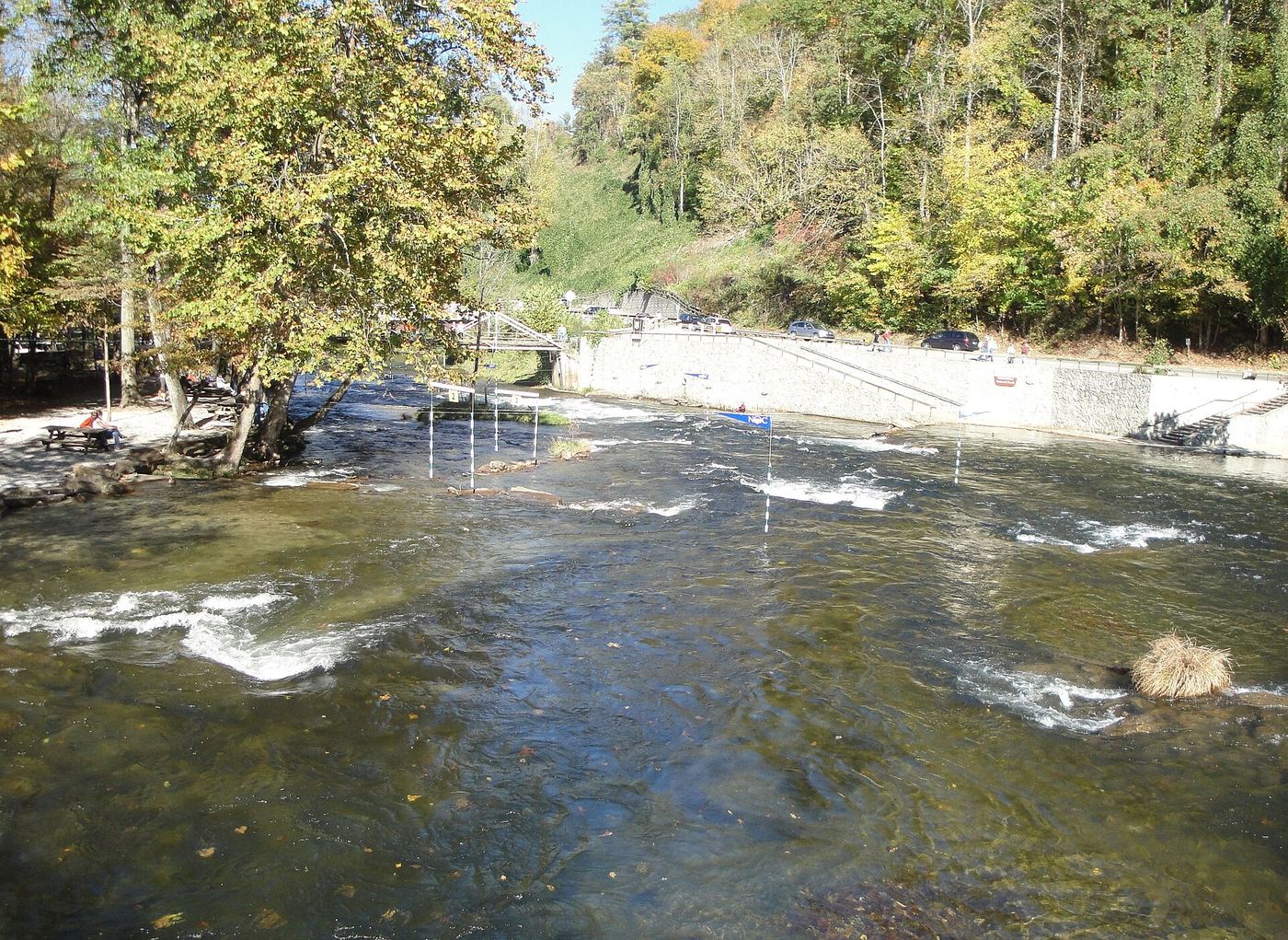
Nantahala Falls, also called Lesser Wesser, is a Class III rapid on the Nantahala River at the Nantahala Outdoor Center. From the parking area, cross back over the main road and turn left on US 19. Walk past the restaurant and the take-out area to a viewpoint. The main viewing deck is reserved for professional photographers, but you can climb down to the river below to see the rapid.
Walk up the gated old logging road (the gate is out of sight of FR 79). In about half a mile the road passes through a wildlife clearing and ends at a creek. Do not cross; turn right and follow the creek a short way upstream to the waterfall, which drops in front of a deep rock overhang you can walk behind.
About 0.3 miles each way with many steps (NCWaterfalls.com)
Rainbow Falls drops about 200 feet down the gorge wall opposite Chimney Rock. The road and path to the falls are private and the land around the tract is private, so there is no public route to the falls. View it from Inspiration Point: drive to the top of the park entrance road, follow the Skyline Trail uphill to the open rock at Inspiration Point, and use the peak finder display to locate the falls. Bring binoculars.
From US 64 at Lake Toxaway, take NC 281 north just under a mile and bear left on Cold Mountain Road. Go to the end of the road (about 5.7 to 5.8 miles), turn left on gravel Panthertown Road, and turn right into the Cold Mountain Gap parking area, the east entrance to Panthertown Valley. Take Panthertown Valley Trail (#474) from the far end of the parking lot behind the kiosk. After a short distance, turn left on an old road that switchbacks down toward Greenland Creek. Right after the bridge over Greenland Creek, turn left on Little Green Trail (#485) and follow it to boardwalks. The beach in front of the 20 foot falls is just beyond a campsite on the left. Stepping stones across the creek lead to a side view and a path behind the falls.
From the far right corner of the parking area (back to the road), follow the trail along an old forest road, level for 0.25 miles, then down to a small stream crossing at 0.4 miles. Continue to a second creek crossing on a footlog, climb 0.1 miles to a junction and take the more obvious path left. Descend less than 0.1 miles to a long series of Forest Service steps to the base of the 53-foot falls, which has a pool and sandy beach.
Walk into the campground and cross the bridge over the South Toe River, then turn left on the combined River Loop and Mount Mitchell trails. In about 0.3 to 0.4 miles, after the Mount Mitchell Trail turns off, take the Setrock Creek Falls Trail (#197). It crosses Briar Bottom Camp Road and ends at the base of the 75-foot tiered falls.
Soco Falls is a 50-foot double waterfall where Brush Creek meets Soco Creek on Eastern Band of Cherokee Indians land. In 2025 the EBCI built a new parking area with picnic tables, portable toilets and a kiosk. The old pullout above the falls is fenced off. The trail starts at the kiosk at the lower end of the parking area and is marked and easy to follow, with a steep section.
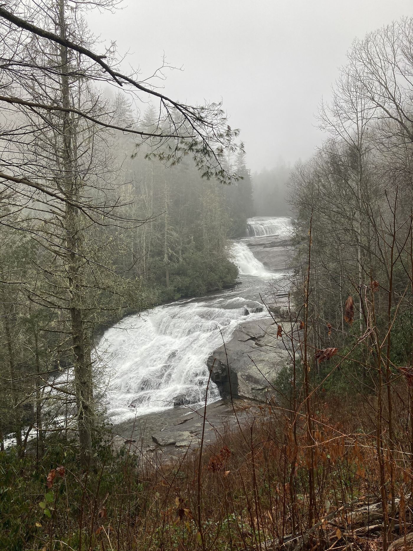
Triple Falls is a three-level waterfall of about 100 feet on the Little River in DuPont State Recreational Forest. From the kiosk at Hooker Falls Access Area, cross the Little River on the footbridge, pass under the road and follow the river on a level path for a quarter mile. A steeper final 0.1 miles leads to a fence with a view of all three drops. NC Waterfalls says the stairs just beyond, which used to reach the lower drop, are closed for safety.
Start on Catawba Falls River Trail to the right of the restrooms. Cross the river on the footbridge by the old hydropower ruins and follow the river upstream past the Lower Catawba Falls overlook to the base of Catawba Falls. Climb the stair system (about 500 to 580 steps) to the top, then continue about 0.1 miles toward the upper falls. Return the same way, or cross the river below the upper falls and take Catawba Falls Ridge Trail back to the parking area.
Upper Linville Falls is the smaller upper drop of Linville Falls, where the Linville River widens above the main falls. The Upper Falls Overlook looks at the upper falls and down to where the river enters the gorge. Since Hurricane Helene some trails here remain closed. The National Park Service trail status map says all open trails can be reached from the Forest Service gravel parking area on Old NC 105, and gives 0.8 miles out and back from that lot to Upper Falls. From the gravel lot the trail runs about 0.3 miles before it joins the route that comes from the Parkway visitor center, then continues to the overlook. Follow the open trails and signs.
Upper Little Moore Cove Falls is a series of small falls and slides about 22 feet high on a branch of Moore Creek in Pisgah National Forest. NC Waterfalls rates it for experienced off-trail hikers only. Follow Moore Cove Trail toward Moore Cove Falls. About 100 feet before the Moore Cove Falls viewing deck, take the path on the left, cross the creek into a small clearing, then cross the creek that flows from Little Moore Cove Falls and climb about 200 feet to a view of that falls. Continue up the fairly steep path for just over 0.1 miles to a small creek crossing. Less than 100 yards past it, where the path swings left to follow the creek upstream, leave it at a small dip in the outside berm (GPS 35.312497, -82.778996). Descend toward the sound of water, work around a small cliff and follow its base to the falls. Return the same way.
Upper Log Hollow Falls is a 30-foot waterfall on Log Hollow Branch in Pisgah National Forest. Walk past the gate on FS 5043 about half a mile to the second bridge, below Log Hollow Falls. Just beyond the bridge, a short path climbs to Log Hollow Falls, and another path continues a little over 0.1 miles up to the upper falls.
Upper Silver Run Falls is a steep cascading falls about 20 feet high on Silver Run Creek in Nantahala National Forest, upstream of the popular Silver Run Falls. Follow the short trail from the NC 107 pullout toward Silver Run Falls; the county map describes crossing a stream on a bridge before the falls. Before the trail drops to the pool at the base of Silver Run Falls, it passes a rock face covered with roots. Climb this near-vertical rock face, using the roots like ladder rungs. From the top, work upstream along several braided paths under and over rhododendron for about 0.1 miles to the falls. Return the same way, taking care on the descent of the rock face.
Roadside view when the road is open to vehicles; walking distance from the current vehicle closure is unknown
Walker Falls is a 40 to 45 foot waterfall on Walker Branch beside Big Ivy Road (FR 74), on the way to the Douglas Falls trailhead. Before Hurricane Helene, visitors drove about four miles up the unpaved road from the end of Dillingham Road and pulled off on the left just before the falls. A steep scramble leads to the base, where only the lower part is visible. After Helene the Forest Service closed the Big Ivy road to motor vehicles past the parking area on Ranger Road. A news report on the Forest Service recovery work says drivers can only reach the Ranger Road and Coleman Boundary Road intersection, and vehicle access to Douglas Falls is targeted for summer 2027. The walk from there to Walker Falls was not described.
Take Panthertown Valley Trail (#474) from behind the kiosk at the far end of the parking lot. It joins an old road that switchbacks down toward Greenland Creek. At one mile, just before the bridge over Greenland Creek, turn right on Devils Elbow Trail (#448). Follow it about half a mile, under the powerlines, to a clearing with a fire ring. A path on the left leads down to the top of the falls; a scramble path on the right drops to the base. Crossing the river gives the best view.
About 1.5 miles each way to the campsite above the falls
Windy Falls is a very tall series of falls and cascades on the Horsepasture River, where the river drops about 720 feet in a quarter mile. Waterfall Hero says it is in Toxaway Game Land and reached through Gorges State Park. From the Rainbow Falls trailhead parking at the Grassy Ridge Access, follow the blue-blazed Raymond Fisher Trail and turn left at an intersection to stay on it. At 0.4 miles turn right on gravel Chestnut Mountain Road, and after about 0.1 miles turn left into the woods on an old road at a boulder. Follow it down to another old road and continue straight to a campsite on the river at the top of the falls. Return the same way. Both sources warn against going down beside the falls; NC Waterfalls says people have died there. Waterfall Hero needed ropes on that descent. The route description dates from 2021.
Yellowstone Falls is the lowest of the three waterfalls on Yellowstone Prong in Graveyard Fields, Pisgah National Forest: two drops separated by a rock pool, with steep cascades below. Start beside the restroom building at Graveyard Fields Overlook. Take the steps and paved path down to the footbridge over Yellowstone Prong. Continue straight on the boardwalk; 30 yards past its end, take the left fork (the right fork goes to Second Falls) about 0.19 miles to the Mountains-to-Sea Trail. Turn right on it. In just under a quarter mile you reach a flat open area where you can hear the falls (published point 35.324511, -82.841538). A side path passes a campsite and reaches the creek at the top of the falls. Cross the creek, which is usually an easy rock-hop, and take the steep scramble path down through rhododendron beside the falls; it gives views of the upper section. Waterfall Hero reported that a landslide made the last scramble to the base very difficult and dangerous and did not recommend it.
Drive Alarka Road to its end at a small turnaround after it crosses Alarka Creek. Do not take the gated forest road passed on the right before the parking area. From the turnaround, go straight on the obvious trail upstream along Alarka Creek; two paths over jeep mounds join after a few hundred feet. Near the end the trail is close to the creek and very rocky. The waterfall is tall and hard to see in full from one spot.
Park at the overlook parking area at the end of Rendezvous Mountain Road. Walk up the road a short way to the Amadahy Waterfalls Trail, which follows a ridge and descends steeply to Purlear Creek in just over a mile. The trail then follows the creek upstream, and the falls are visible from the trail. A short, steep bushwhack leads to the base. Return the same way, climbing back up.
About 1 mile; the source does not say if that is one way or return
From Brevard, take US 276 north into Pisgah National Forest. 2.2 miles past the US 64 split, turn right on Avery Creek Road (FS 477). Drive 2.3 miles on gravel to the Avery Creek Trail #327 pull-off on the right; a larger pull-off is a quarter mile farther. Follow the blue-blazed Avery Creek Trail down to the creek and cross the footbridge. Go left to stay on Avery Creek Trail. About a quarter mile past the bridge, the trail passes near the top of the falls. A short, steep path leads to the base.
About a quarter mile one way off-trail from the road curve; more if FS 340 is gated
Bald Springs Falls is a multi-ledge falls nearly 100 feet high on Bald Springs Branch, a tributary of Fires Creek in the Nantahala National Forest. There is no trail. From the curve on FS 340, bushwhack straight down the broad ridge to the confluence with Fires Creek, wade across, and creekwalk up Bald Springs Branch. Climb around Lower Bald Springs Falls and continue upstream to Bald Springs Falls. In June 2025 FS 340 was gated because of Helene damage with no reopening date, so you may have to walk the road or use Bald Springs Trail #78 as described by the source.
From the Balsam Lake Recreation Area trailhead on Charleys Creek Road, cross Wolf Creek on the footbridge and follow the trail to Balsam Lake Dam. At the dam an obvious but unofficial path heads downstream to Balsam Falls, a 25-foot two-tier waterfall. A short, steep scramble path drops to the base and pool.
Barbara Falls, also called Upper Shoals, is a steep cascading falls about 40 feet high on Catheys Creek in Pisgah National Forest. It is close to the road but has no trail. From the pullout, walk down the road around the curve before entering the woods, then bushwhack down the bank toward the sound of the water. The left bank (facing downstream) near the falls is cliffy; it may be easier to reach the creek below the falls and follow it back up. The right bank (facing downstream), which has the best view, is private property.
From the small lot for North Harper Creek Shortcut (Trail 266A) on gravel FR 464, descend 1 mile to North Harper Creek at a campsite. Follow North Harper Creek Trail (266) downstream. The trail crosses the creek at about 1.3 miles. About 0.4 mile later it passes the top of Bard Falls; a couple hundred feet on, an obvious path drops to the base. A large pothole sits beside the falls.
Bartram Falls is a 30-foot falls on Ledbetter Creek in the Cheoah Backcountry Area of Nantahala National Forest. From the parking area, take the path up over the railroad tracks to the yellow-blazed Bartram Trail and turn left across Ledbetter Creek. The trail climbs steeply for about 0.8 mile, then descends to a creek crossing at 1.6 miles and another just before 2 miles. Stay on the same side of the creek, the right bank as the water flows, about 0.6 mile to the falls, which are seen from the trail. The base is overgrown.
Connestee Falls Park is a Transylvania County park on US 276, about 6 miles south of the US 276, US 64 and NC 280 junction in Brevard. From the parking lot, a short accessible boardwalk leads to a viewing platform at the top of Connestee Falls. Batson Creek Falls is straight across from the platform. Batson Creek Falls itself is on private property in the Connestee Falls community, so view it only from the public platform.
Bear Canyon Falls is a 25-foot falls in a small canyon on Bearwallow Creek deep in Gorges State Park. From the Frozen Creek Access parking, take the combined Augur Hole and Cane Brake trails, then stay right on the Augur Hole Trail at 0.7 mile. Cross the Toxaway River at a concrete ford at 3.6 miles. At 4.4 miles, at the Bearwallow Creek ford, do not cross. From there there is no trail: bushwhack upstream through steep, dense rhododendron past smaller cascades to where the creek turns right and the falls drop through a small canyon. Current status of the Augur Hole Trail was not confirmed; a search result reported a 2019 landslide closure on another section.
About 4.7 miles each way (source figure), including a 0.2-mile bushwhack
From the parking area at the end of Lakeview Drive in Great Smoky Mountains National Park, walk Lakeshore Trail through the tunnel and on to Forney Creek. Turn right up Forney Creek Trail, then left on Bear Creek Trail across two auto bridges. Climb to a left switchback at Welch Branch and continue about 0.4 mile until the falls are heard. No trail leads down; the source gives the leaving point as GPS 35.47257, -83.57304, then less than 0.2 mile through woods and rhododendron to the falls.
About 5.8 miles each way, added up from a 2006 account
A 2006 account describes Bearcamp Falls (also called Hilliard Falls), about 60 feet, on a short marked spur of the Foothills Trail between the Thompson and Horsepasture rivers. From the Foothills Trail parking inside the Bad Creek gate in South Carolina, hike 0.7 mile to the Foothills Trail at the Whitewater River, turn right, follow the white blazes 2.7 miles to the Thompson River footbridge, then 2.2 miles more to the marked spur, which leads less than a quarter mile to the base. The account does not give coordinates, so the match to this waterfall is probable, not confirmed.
About 2.3 miles one way from the Parkway; about 4.3 miles one way from Trace Ridge Trailhead
Upper start: Big Creek Trail begins at the south end of Little Pisgah Ridge Tunnel, Blue Ridge Parkway milepost 406.9, about 1.7 miles north of Mount Pisgah Inn. It descends steeply about 2.1 miles to the Bee Branch crossing. Lower start: from Trace Ridge Trailhead off FS 142, hike gated FS 142 1.6 miles to Hendersonville Reservoir, then Big Creek Trail about 2.5 miles with four creek crossings. From the Bee Branch crossing, follow Bee Branch upstream on the left bank as you face downstream about 0.2 mile, first on an old logging grade and then off trail, to the lower section of the falls. Seeing the upper sections needs a harder, steep bushwhack.
About 0.6 mile return, mostly road walking, plus a short bank scramble
From Beech Gap on the Blue Ridge Parkway, drive about 6 miles south on NC 215 and park on the right at the start of Forest Road 5030. There is nowhere to park at the falls. Walk 0.3 mile south along NC 215 until you hear and see the falls from the road, then climb down the bank to the base. You can also park across from Forest Road 140 and walk 0.3 mile north. Return the same way.
This unnamed falls in Bell Park, a Henderson County park opened in November 2024, has a 12-foot free fall with more water above and below. From the gate at the parking area, walk the Overlook Trail 0.15 mile to the junction with the Nature Trail Connector, then continue a little over 100 yards to the viewing deck with a bench beside the falls. There are several flights of stairs. The park also has 1.8 miles of trails.
Park on FS 475B (Headwaters Road) just before the bridge. Walk the gated FS 5032 across the road. Ten yards before a sharp right 180-degree turn (under 0.5 mile from the gate), take the obvious path on the left along an old logging grade; go right at the split. At 0.15 mile, about 50 feet before a creek crossing, take the side path on the right that climbs steeply a little under 0.2 mile to the base of the falls.
About 0.6 mile, including about a quarter mile wading in the river
From US 64 near Rosman, drive 4.6 miles north on NC 215 and park in the pullout on the left. Follow the obvious path and old roadbed, then descend steeply to the river. Go upstream about 50 yards past a campsite and wade across the North Fork French Broad River. Follow the path upstream under the power line for about a quarter mile to the river again. From there the river is the route: wade about a quarter mile upstream to the falls. NC Waterfalls warns the wade is deep and to turn around if the water is up at all.
From US 64 just before Lake Toxaway, drive 6.8 miles north on NC 281 to a pull-off at a gated forest road. Walk the gated FSR 5077 past FSR 5077B (about 1 mile) and FSR 5077A (1.5 miles), staying left on 5077 into an open area and bearing right through a meadow. Rock-hop Miser Creek at about 2 miles, continue to a T-junction and go right past a walnut tree. Just before the track climbs, take a path right across Miser Creek near the top of the falls, go right to an old road, then left to a steep path down to the falls. Return the same way.
About 1.8 miles one way, 3.6 miles return, including off-trail travel
Berry Branch Falls is a 15-foot falls on Berry Branch next to Little Beartrap Falls, just outside the Middle Prong Wilderness in Pisgah National Forest. Park at the FR 97 gate about a quarter mile from NC 215. Walk FR 97 about 1.5 miles to the second switchback, then follow FR 97H upstream along Middle Prong. In under a quarter mile the trail crosses Little Beartrap Falls. From there the source says to climb down and cross to the next drainage to see Berry Branch Falls. That last part is off-trail and not described in detail.
View from the parkway overlook; no walk to the falls
Betseys Rock Falls is a tall waterfall on North Prong Lewis Fork that is on private property but can be seen from a Blue Ridge Parkway overlook. From Boone, take US 421 south about 10 miles, join the parkway southbound and drive 8.6 miles to the View Betseys Rock Falls overlook on the right at milepost 267.8. The view is best in high water when the leaves are off the trees.
About 2.9 miles one way, including about 0.3 mile of creek walking
Beverly Hillbilly Falls, also called Screaming Right Hand Turn Falls, is a double-slide falls on Steels Creek in Pisgah National Forest. Start at the Steels Creek Trail and Mountains-to-Sea Trail gate on FR 496 and head east past the gate on the wide forest road track. At about mile 2.6, leave the trail and get into Steels Creek, walking upstream about 0.2 mile to a boulder field and 0.35 mile to the base of the falls. The source advises skipping the creek walk if you are not comfortable with it. No source gives the exact location of the falls, so check that you are at the double-slide falls described.
From NC 215 just past Sunburst Campground, turn onto Forest Road 97 and park at the gate about a quarter mile in, after the ford. Walk FR 97 about 1.5 miles to the second switchback, then follow FR 97H upstream along Middle Prong past Little Beartrap Falls. At a fork just under a mile on, go right onto an unnamed road for 0.2 mile to Big Beartrap Branch. A steep, narrow path on the right climbs along the creek 0.4 mile to the lower falls; continue a short way to the base of the main upper drop. Return the same way.
Big Bearwallow Falls is a steep cascading falls about 35 feet high on Big Bearwallow Creek in Pisgah National Forest. There is no official trail. From the middle of the pullout, a steep path descends to a junction; turn right past a small cliff and scramble upstream to the falls. The path is not easy to follow. The source warns that the road banks have been used as a garbage dump and that fallen trees cover the falls area. Do not use the gated, posted road just north of the pullout.
NC Wildlife requires written approval for the restricted zone. Rutherford Outdoor Coalition additionally reports the trail closed after Hurricane Helene.
A few yards to the viewpoint; under 0.1 mile to the base
Big Creek Falls, about 25 feet high, is beside US 19W in the Pisgah National Forest. From Burnsville, take US 19E west about two miles, Jacks Creek Road 4.6 miles, Coxes Creek Road 4 miles, then US 19W south 4.3 miles to a pull-off on the left. You can hear and partly see the falls from the pull-off. A steep path leads a few yards down to a frontal view and on to the creek at the base.
About 7.1 miles return (3.55 miles each way, 2018 GPS track)
Begin behind the gate at the Brewer Road and NC 281 intersection. Follow the unofficial trail on an old logging road; ford the Thompson River at about 1.2 miles. Stay left at the Y-splits. At 3.3 miles a flagged side path on the left (N35 02.706 W82 59.091) drops about 450 feet very steeply to the river, including a 15-foot rock notch where a rope is often present. Turn left and scramble 250 feet upstream to the base.
In the Standing Indian Basin, find the trail sign on the right of Forest Road 67, five miles beyond the Backcountry Information Board. Cross the bridge and take the right fork toward Big Laurel Falls; the left fork goes to Timber Ridge Trail. The trail ends at the waterfall.
Park at the gate 0.6 miles down FR 476 (Wolf Ford Road) from Yellow Gap Road and walk the remaining 0.7 miles of road to the old parking area. Follow the South Mills River Trail along the river. At 1.7 miles from the parking, where the trail turns right to cross a concrete bridge, do not cross; take the narrower unofficial path on the left down the left bank. Just before that path crosses Billy Branch, take a footpath on the left up the creek for less than five minutes to the 20-foot waterfall. A scramble path drops to a closer view. Return the same way.
Kevin Adams and Waterfall Hero describe the same route. From the gravel pull-off beside NC 215, walk the short path toward the small red house and Mill Shoals, then take the obvious path on the left that follows the North Fork French Broad River downstream. The path reaches a rock wall above Pulpit Falls at about 0.1 miles and ends at the base of Bird Rock Falls. Return the same way.
Roadside view a few feet from the car, or a few steps down to the pond at the base inside the mine attraction
Bon Ami Falls drops about 25 feet into the pool at the entrance of the historic Bon Ami Mine at Emerald Village, a private gem-mining attraction near Little Switzerland. NC Waterfalls says you can view the waterfall from a gravel pullout along McKinney Mine Road a few feet off the road, and that the best view is from the self-guided underground mine tour at the North Carolina Mining Museum. Flow is small after dry weather.
Kevin Adams describes two paths leaving the south end of the pull-off. Take the left fork, which descends steeply for 0.3 miles to a riverside campsite, then follow the path upstream for 0.5 miles to a river crossing. Cross only when the water is low and clear. Continue upstream on a rough scramble path for 0.25 miles to a side path down to the river; the waterfall is seen from a boulder in the riverbed or by wading. Return the same way.
From the Pilot Rock Trail parking on Yellow Gap Road (FS 1206), start on the Pilot Rock Trail, bear right past a campsite and cross the footbridge over Bradley Creek. In less than 0.2 miles, at the junction, leave the Pilot Rock Trail and bear left onto the wider old logging road, which narrows to a path through shrubs. At just under 0.5 miles it reaches a tributary with the remains of a log bridge. The road ends here; mark the spot, then continue through the woods, crossing another tributary, to the steep ground where the 20 to 25 foot falls slides down a rock face. Return the same way.
About 4.2 miles return from Fawn Lake Access; about 4.8 miles return from High Falls Access
From High Falls Access, follow Buck Forest Road past the gate and over the covered bridge, turn right on Conservation Road, then right on Bridal Veil Falls Road to the traffic circle, where a wide path reaches the base of the falls. From Fawn Lake Access, Waterfall Hero follows Conservation Road 1.5 miles to Bridal Veil Falls Road and then half a mile to the end. A sign at the base says to stay on the marked trail. Return the same way.
Under half a mile return; about 100 yards on an old road, a steep side path to Case Falls, then a short bushwhack downstream. Measured distance unknown.
Briefcase Falls is a steep 15-foot sliding cascade on a Hungry River tributary in Green River Game Land, just downstream of Case Falls. NC Waterfalls describes entering the woods on the gated old road opposite the kayaker lot, walking about 100 yards to a faint side path in a left curve, and descending to Case Falls; Briefcase Falls is reached by leaving that path before the rhododendron and following the easiest line down. Lower Briefcase Falls is a few yards farther. The author has not returned since Tropical Storm Helene (2024) and says the area was severely affected, so the waterfall may look different.
From Highlands, take NC 28 south from the US 64 stoplight for about 2 miles and turn right on Clear Creek Road. Drive 1.2 miles and turn right on gravel Forest Road 367, the first right after a hairpin on Clear Creek Road. Drive about 2.3 to 2.4 miles down FR 367 and the 50 foot waterfall is on the right, visible from the road. A short scramble path on the left bank (facing downstream) leads down for a closer view. FR 367 continues to FR 79 and the Picklesimer Rock House Falls area.
About 2.8 miles return (Waterfall Hero hike length)
Brushy Ridge Falls is a 15-foot falls and set of rapids on the Linville River in the Linville Gorge Wilderness. From the Pine Gap trailhead on Kistler Memorial Highway, hike down Pine Gap Trail 0.7 mile to a four-way intersection with Bynum Bluff Trail, continue straight on Linville Gorge Trail about 0.6 mile to a sharp bend in the river with a campsite; the falls are visible from the campsite, and you can climb down to river level when the rocks are dry. There are no signs or blazes in the wilderness.
From the pullout on NC 215, 1.8 to 1.9 miles north of the Blue Ridge Parkway at Beech Gap, go under the guardrail at the eroded gap and climb down the steep bank. Walk through the flat campsite area, cross the small tributary, and climb a few rocks to the base of the sliding falls. A small path on the left side leads up the open rock beside the falls to the upper section and swimming holes. Return the same way.
About 1 mile return (Waterfall Hero hike length); steep bushwhack with no trail
Buck Creek Falls is a roughly 100-foot cascade on Buck Creek in Nantahala National Forest between Highlands and Franklin. From the pull-off in a sharp curve of Buck Creek Road, hike down gated FR 4571, make a sharp right at about 0.1 mile and a sharp left onto an overgrown road at 0.3 mile, then bushwhack steeply down to the creek at the top of the falls (flagging tape was present on one visit). A steep but obvious path continues down the right bank (facing downstream) to a partial view. The legacy NC Waterfalls page describes the same approach under the name Upper Buck Creek Falls. There is no trail and the base view was blocked by high water on the Waterfall Hero visit.
Waterfall Hero describes a waterfall in several sections on private property that can only be viewed from the road. From the pull-off, cross the street and walk to the end of the guardrail for an obscured view, especially in summer when leaves block it.
About 1 mile loop; currently walked as an out-and-back of about 0.8 miles
Start behind the playground at the Buckeye Recreation Center on the white-blazed Falls Trail, which runs with the Buckeye Lake Loop. At the split in 0.2 miles turn right. The trail descends beside the creek to Grassy Gap Creek near its meeting with Buckeye Creek. The 25-foot falls is just upstream on Buckeye Creek, with a footbridge below it for the view. Return the same way while the loop bridge is out.
From the Blue Ridge Parkway, take NC 215 north 0.4 miles to a large pulloff on the left. Follow the Mountains-to-Sea Trail a short way to a split and go left on Haywood Gap Trail (#142) into Middle Prong Wilderness. The trail descends steeply beside Haywood Gap Stream and crosses Middle Prong in just over a mile. Get into the creek and go upstream to where Buckeye Creek enters on the left, then follow Buckeye Creek up for just under a quarter mile, climbing a series of cascades, to the falls, which drops in several sections. The banks are steep with dense rhododendron, so the route stays in the creek. This is a partial guide: the last part is off trail in the creek, and wilderness trails are not signed or blazed.
Enter Stone Mountain State Park on John P Frank Parkway and drive 3.5 miles on the main park road to the small trailhead on the right, just before the road crosses Bullhead Creek. A gated dirt road leads up along the creek. Within a couple hundred feet, take the obvious path on the left down to the pool and gravel beach at the base of this 12 to 13 foot sliding waterfall. Return the same way.
Burgan Creek Falls is a 65-foot near-vertical slide of black rock in Nantahala National Forest near Robbinsville. From the gate on the old forest road off Atoah Road, follow the road 0.1 mile to a fork, turn right, pass an old fuel tank, climb steeply 0.3 mile to a ridge, descend to Burgan Creek, cross it twice (easy crossings) and reach the falls. NC Waterfalls says the route was flagged and cleared by a retired forest technician and should be easy to follow. A good view is from the right bank (facing downstream) a short distance below the falls.
From the end of FR 197 (Raven Cliff Road) walk down the old road past the jeep mounds; this is the Greentown Shortcut Trail (#268A). The first three quarters of a mile is moderate on an old road bed, then the trail becomes very steep and narrow. At about 1.5 miles it climbs over Raven Cliff and descends to cross Burnthouse Branch at 2 miles. After the crossing turn right on an obvious path to the base of the 25-foot falls. Return the same way.
About 0.6 mile return (Waterfall Hero hike length for both falls)
Camp Branch Falls is a 10-foot falls with a pool on a tributary of Wayah Creek in Nantahala National Forest near Wayah Bald, not the larger Camp Branch Falls on the Nantahala River. From the gate on FR 316, where the road turns right to cross Camp Branch on a bridge, go straight on an old road up the right bank (facing downstream), pass two old explosives magazines in under 0.2 mile, cross a tributary, and take the side path on the right down to the falls. Upper Camp Branch Falls is about a hundred feet farther on the main trail and is covered in fallen timber.
Waterfall Hero describes a 200 foot waterfall seen from Wayah Road across the Nantahala River. There is no good single viewpoint and no place to see the whole drop. Walking upstream along the road shows more of the upper part; walking downstream shows the lower part. Do not try to cross the river.
About 1.5 miles return (Waterfall Hero hike length); half a mile of road then a trail-less descent
Cane Creek Falls is a 25-foot waterfall on Cane Creek, a tributary of the Chattooga River, in Nantahala National Forest south of Cashiers. Waterfall Hero describes walking down gated FR 2052 for just over half a mile, leaving the road at an unobvious break in the vegetation near the 2760-foot contour, and bushwhacking down to the creek below the falls, with the slope getting very steep near the bottom. Hiking the Appalachians reached the same falls by spur paths and a short bushwhack from the Chattooga River Trail. There is no trail to the waterfall.
From the pull-off on FS 475 just before the single-lane bridge, 3.1 miles from US 276, walk up the gated road across the road toward the Cove Creek Group Campground, passing a cascade on Cove Creek at 0.3 miles. Go through the campground and pick up Caney Bottom Trail (#361). At 0.9 miles a short scramble path gives a view of a cascade on Caney Bottom. Continue 0.2 miles to the trailside view of Caney Bottom Falls. Return the same way.
From US 276 in Cedar Mountain, south of Brevard, turn north on Rich Mountain Road and drive 1.8 miles to a pullout on the right on the outside of a sharp left curve. This is the Wilkie Trail trailhead in DuPont State Recreational Forest. Follow Wilkie Trail on an old road for less than 0.2 miles to a side path on the right that descends to the falls. A second, more obvious side path about 130 feet farther along is a little longer but easier. The falls is a 15 foot multilevel drop on a very small stream and is best after rain.
From the Cold Mountain Gap parking, take Mac's Gap Trail 482 downhill, then the Greenland Creek Trail 488 upstream to the base of Greenland Creek Falls. A steep unofficial path climbs the right bank (facing downstream) to the top, then follows Greenland Creek upstream on a narrow winding path past Halfway Falls to the base of Carlton Falls. Return the same way.
About 1 mile return (the 0.5 mile one-way trail); Waterfall Hero lists 0.8 miles
Carter Falls on Big Elkin Creek near Elkin was hidden from the public until 2018 and opened through a public-private partnership led by the Elkin Valley Trails Association. From the gravel lot on Pleasant Ridge Road the Carter Falls Trail, blazed with Mountains-to-Sea Trail white circles, descends toward the creek and switchbacks to a large rock outcrop above the falls; at the junction with Powerhouse Trail turn right and descend steeply to the base. Water runs through fissures in the rock for about a hundred feet before dropping to the pool.
From the turnaround at the end of Gallimore Road, enter the old gated road opposite the kayaker parking lot. After about 100 yards, where the road swings left, a faint side path turns right on the outside of the curve and descends steeply to the base of Case Falls. Do not climb down the waterfall if you reach the creek near the top. Return the same way.
About 100 yards each way (Highlands Chamber lists 0.1 mile)
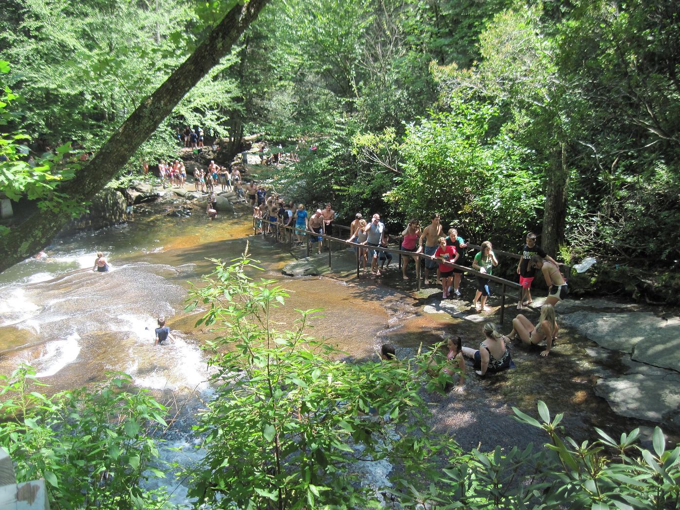
Cashiers Sliding Rock is a natural slide with potholes, a small beach and a cold pool on the headwaters of the Chattooga River where Whiteside Cove Road crosses the river south of Cashiers. From the small parking area just past the bridge, a short trail through rhododendron reaches the rock and pool. The Laurel Magazine notes a second parking area and trail, and that the site is busy in summer. There are no lifeguards.
From Morganton take NC 181 north about 5 miles, turn left on Frank Whisnant Road, bear right on NC 126 west for 9.8 miles, then make a sharp right on Old NC 105 (Kistler Memorial Highway). Continue 10.4 miles on this steep, rough gravel road to the Conley Cove trailhead on the right. Conley Cove Trail (#229) descends steeply 1.4 miles into Linville Gorge to Linville Gorge Trail (#231). Turn left and hike about 0.6 miles. A short scramble path leads down to the river across from Cathedral Falls, a 50 foot waterfall on a tributary entering from the far bank. Return the same way with a steep climb out.
About 250 yards return (a little over 100 yards one way)
Catheys Creek Falls is a long steep sliding cascade about 80 feet high into a large pool in Pisgah National Forest west of Brevard. From the tiny pullout on FS 471, 0.2 mile beyond where the road crosses Catheys Creek, an obvious path leads down to the falls. The last stretch needs a little scrambling, and an open view usually means wading into the pool. The falls are not visible from the road.
From Lake Toxaway, drive north on NC 281 about 11 miles and turn right on Tanasee Creek Road just after the bridge at the head of Tanasee Creek Lake. Go 1 mile, continue onto Wolf Mountain Road, and park at the pulloff on the right in 0.4 miles, before the road becomes four-wheel-drive. An old logging road follows Tanasee Creek upstream high above the creek. Stay right at an open section at about 0.5 miles to remain on national forest. At about 2 miles wade Tanasee Creek, follow it along the left bank (facing downstream) about 0.3 miles and wade back; the road is overgrown and confusing here, and there are two old roads. On the upper road, at 2.6 miles, cross a tributary. Cavern Falls is upstream: go about 50 feet past the crossing and bushwhack up to the left away from the rhododendron, reaching Lower Cavern Falls at about 3480 feet and then the base of the 100 foot overhanging Cavern Falls. This is a partial guide: there is no trail for the last section.
About 1.2 mile loop (Hiking Project Purple Trail); the Town lists its Cedar Falls Trail at 1.5 miles
Cedar Falls is a small falls on the creek inside Cedar Falls Park, a Town of Chapel Hill park on Weaver Dairy Road. The Town page confirms a natural-surface trail, parking and restrooms at the park, open dawn to dusk. Hiking Project describes the purple-marked outer loop with a waterfall feature; The Outbound lists the park loop as passing a waterfall. The Town page itself does not mention the falls, and the exact spot where the loop meets the falls is described only in community trail listings.
Waterfall Hero describes a 20 foot waterfall on Charley Creek that can be heard from Charleys Creek Road but is hard to see from the bridge. From the pull-off at FR 4655, walk back along the road about a hundred feet from the bridge, pick the best place to climb down the very steep bank to creek level, then creek walk up to the base.
From Highlands, drive south on NC 28 for 6 miles and turn right on Blue Valley Road, which turns to gravel and becomes FR 79 in the national forest. Go 4.5 miles to where the road curves right and pull off. Walk down the old, overgrown logging road toward East Fork Overflow Creek for a little over 0.1 miles; it narrows to a trail and reaches the top of the 20 foot falls, where a fall would be fatal. For the base, backtrack and head down to the creek. You must cross the creek, which is difficult or dangerous in high water, to see the chasm from the other side.
Start at the Bradley Fork Trailhead at the far north end of Smokemont Campground. Follow the Bradley Fork Trail 1.2 miles to the Chasteen Creek Trail junction and turn right. Pass backcountry campsite 50 and continue about three quarters of a mile to a fork; the left branch goes to a horse hitching post, and a short path beyond it leads upstream to the 15 foot cascade. Return the same way.
Roadside view from the gravel road; a short walk back down the road from a pull-off. Measured distance unknown.
This roughly 50-foot section of cascades on Chastine Creek sits beside narrow gravel Chastine Creek Road (SR 1745) off Caney Fork Road, the last left before the Rough Butt Falls parking. The legacy NC Waterfalls account (2006) says the first part of the road is private property, with Nantahala National Forest boundary signs near the waterfall less than half a mile up. The author viewed the cascades from the road and found the bank down to the creek very steep, with barbed wire to cross, and noted trash dumped at the site. More cascades above were not safely reachable.
Park on FS 475B (Headwaters Road) 0.15 miles from US 276, just before the bridge. Walk the gated FS 5032 across the road; pass the gate in 80 yards and continue to a sharp 180-degree right turn in under half a mile. Ten yards before the turn take the obvious path on the left along an old logging grade. At the split go right and climb; pass a side path to Bennett Cove Falls and make two easy creek crossings. After the second crossing take the path on the right, turn right again in under 100 feet, and climb beside a long sliding waterfall. At the top the path splits; go left away from the creek and climb steeply a little under 0.2 miles to a faint side path down to the two-level, 64-foot Cherry Cove Falls. Return the same way.
From NC 181 north of Morganton, turn right on Pittman Gap Road (becomes Clarktown Road), then left on Old Jonas Ridge Road and right on Old Mortimer Road at the church. The road becomes gravel FR 464. Drive 4.4 miles to a pulloff on the left opposite a gated road. Take North Harper Creek Falls Trail (#239) down about a mile to North Harper Creek Trail (#266). Turn left and descend about 0.1 miles to the creek at the top of the waterfall. Right goes to North Harper Creek Falls; turn left on #266 and in about a hundred feet an obvious path on the right leads to the base. The falls is a sliding cascade on North Harper Creek where Chestnut Cove Branch enters at the base. Wading is usually needed for a full view.
About 2 miles return from the FR 140 gate; about 7 miles return if FR 140 is closed at NC 215
Kevin Adams describes walking past the gate on FR 140 about 0.1 miles to FR 5031 (Kiesee Creek Road) on the right, following it uphill and staying left at every fork for a little over 0.8 miles to a grassy fork, then taking an overgrown path on the left several hundred feet to Chestnut Creek near the falls. Wade up to the base or scramble around on the right bank (facing downstream). Return the same way.
A few hundred feet each way by faint path and bushwhack
From the small pullout on the left of Cascade Lake Road, 1.9 miles past the Staton Road turn and just past Merry Falls, a faint path starts at the upper end of the pullout and winds a little over 100 feet to a small bluff above the pool below the falls. The path to the right down to the creek is dicey; the author recommends bushwhacking through the woods around it, then wading upstream a few yards to see the 26-foot falls under its overhanging rock. An alternative is to creekwalk a few hundred feet downstream from Merry Falls.
About 6.2 miles return, including the off-trail descent
From US 64 west of Brevard, turn left on Frozen Creek Road and drive 3 miles to the Frozen Creek Access parking of Gorges State Park on the right. Take the combined Auger Hole and Cane Brake Trail; at 0.7 miles stay right on Auger Hole Trail. At about 3 miles the trail runs high above Chub Line Falls, roughly 300 feet before the Wintergreen Trail split, and the falls can be heard. There is no trail from here. The descent to the Toxaway River is very steep, and seeing the 25 to 40 foot falls from the base requires wading in the river. Both accounts call this suitable only for experienced off-trail hikers. This is a partial guide: the final approach is an unmarked bushwhack.
About 2 miles return (Waterfall Hero hike length), plus about 1.6 miles of road walking if the FR 477 closure noted in late 2024 remains
This 12 to 15 foot waterfall on Clawhammer Cove Creek is in the Avery Creek area of Pisgah National Forest near Brevard. From the blue-blazed Avery Creek Trail (#327) trailhead on FR 477, descend to Avery Creek, cross the footbridge and go right on Clawhammer Cove Trail (#342), which follows Clawhammer Cove Creek upstream and crosses it on a footbridge in about 0.75 mile. Just after the crossing, where two blue blazes mark a tree, leave the trail and go about 100 feet up the creek to the falls; a steep bank must be scrambled for a clear view.
About 0.8 miles each way by land; about 0.1 miles from the lake
From downtown Hayesville, take Tusquitee Road (SR 1307) 10.3 miles to the end of the pavement and continue on the dirt road, which needs a high-clearance vehicle. At 3.25 miles from the pavement the road fords Clear Creek, passes an open area with an old house and RVs, fords a smaller stream, and a quarter mile later reaches a gated road cutting back to the right with a single parking space on the left. Walk the old road beyond the gate, cross Stephens Branch, and follow Clear Creek down. At about 0.5 miles cross an open field on its left side, re-enter the woods past a campsite, pick up another old road and, less than 0.2 miles from the field, take the path to the right toward the creek. Pass a small waterfall and continue downstream to the 35 foot Clear Creek Falls; the descent to the base is very steep. Kevin Adams prefers the lake approach: paddle Nantahala Lake to the Clear Creek cove, where a path on the right bank (facing downstream) goes a little over 0.1 miles to the falls. This is a partial guide: the ownership of the gate and parking spot is not stated, and the road requires high clearance.
Cliff Branch Falls is a steep cascading falls about 18 feet high beside Newfound Gap Road (US 441) in Great Smoky Mountains National Park north of Cherokee. NC Waterfalls says it is 6.45 miles north of Oconaluftee Visitor Center and 3.35 miles north of Smokemont Campground; if your car is pointed north, look out the driver side window. It is pretty in spring and after rain and unremarkable at normal flow.
About 1.8 miles return from the FS 140 gate; about 6.8 miles return while FS 140 is closed at NC 215
FS 140 (Courthouse Creek Road) leaves NC 215 6.65 miles south of Beech Gap on the Blue Ridge Parkway. Normally you drive 2.5 miles to the gate; while the road is closed, park beside NC 215 across from FS 140 and walk the road. From the gate continue 0.5 miles to the bridge over Courthouse Creek. The Summey Cove Trail starts just beyond the bridge and follows the creek downstream 0.3 miles to where it swings right; take the obvious side path on the left toward Courthouse Falls, then 70 feet along it take the side path that turns right and descends steeply to Mill Station Creek a few yards below Cody Falls. Walk up the creekbed to the base of the 22-foot slide. Return the same way.
A short concrete path leads from the parking area to a boardwalk and a viewing deck at the top of Connestee Falls, looking across to Batson Creek Falls. Access to the base is prohibited and fenced. The park is a Transylvania County park created after Conserving Carolina acquired the land.
From the parking area on FR 475, walk up the gated road toward the Cove Creek Group Campground, passing a cascade on Cove Creek at about 0.3 miles. Turn left on the blue blazed Caney Bottom Trail 361, then bear left on the yellow blazed Cove Creek Trail 340. At about 1.1 miles a signed spur on the right drops steeply to the base of the 50 foot falls. Return the same way.
Cover Falls is a steep spray-cliff waterfall on Britton Creek in Andrews, on the 57-acre Cover Falls Preserve bought by Mainspring Conservation Trust in 2024 and opened with a ribbon cutting on June 5, 2026. NC Waterfalls describes the trail: about 30 feet beyond the gate bear right, pass under a power line in a little over 0.1 mile, cross Britton Creek on a footbridge 0.2 mile later, then switchback steeply up for 0.2 mile to the falls. Mainspring gives the height as 30 feet; NC Waterfalls measured about 55 feet.
From the paved pullout on the right of NC 107, 4.4 miles south of US 64 in Cashiers and just past the Silver Run Falls trailhead, follow the obvious path upstream along Little Whitewater Creek. At a fork after a little over 0.1 miles keep right. Just before the falls climb down a short, steep section of roots and rock, then scramble onto the boulders for the best view of the 48-foot falls. Return the same way.
From Boone take NC 105 south about 5 miles, turn right on Broadstone Road toward Valle Crucis, then left on NC 194 south for about 1.3 miles and make a sharp right on Skiles Road into Valle Crucis Conference Center. Stay left at the fork and park in the signed Waterfall Parking lot by the Church of the Holy Cross. Walk past Johnson Hall and up the gravel path; both trailheads start a short way into the tree line, the old trail on the left and the newer, gentler trail on the right. Climb about half a mile to a bench where a side path with stone steps descends to the wooden overlook at the bottom of the 40 foot cascading falls. Return on either trail to make the loop.
Cullasaja Falls is seen from a narrow pullout on US 64 in the Cullasaja Gorge between Highlands and Franklin. Kevin Adams says trees now block the view from the road, so for an open view you walk up the road a short distance, climb the little knoll and descend a steep slope with loose rock. The Forest Service lists Cullasaja Falls among the gorge waterfalls with no fee.
From I-40 Exit 73 in Old Fort, follow Catawba River Road 3.1 miles to its end at the large Catawba Falls parking area. Take Catawba Falls River Trail past Lower Catawba Falls and Catawba Falls, then climb the stair system of about 500 steps to Upper Catawba Falls. Before the steps down to the Upper Catawba Falls viewing deck, a side path on the right climbs the bank beside the falls. It crosses the river four times, two of them usually rock hops, before a short side path on the left drops to Davids Falls, an 18 foot cascade and slide. Return the same way, or complete the loop on Catawba Falls Ridge Trail.
From the junction of NC 281 and US 64 west of Lake Toxaway, drive 4.95 miles south on NC 281 and park on the right at a gate, a few hundred feet north of the Johns Jump Falls trailhead. Walk past the gate through an old campsite and start up an old road. About 125 feet from the campsite a side path turns left, marked by a Y-shaped tree a few feet in. The path leads less than 100 yards to this 12 foot freefalling waterfall on Mill Creek. A short scramble down the bank gives the best view.
From the end of FS 4663B, two old roads leave on the right. Take the lower one that descends and looks like a trail (the one climbing sharply right goes to Upper Dill Falls). Paths bypass the holes dug to stop vehicles. In less than a quarter mile the old road reaches Tanasee Creek just below the falls, with a view up to the nearly 100-foot drop and slide. Work a little upstream on the rocks for a closer view. Return the same way.
From the junction of US 64, US 276 and NC 280 near Brevard, drive north on US 276 for 10.3 miles and turn left on unpaved FS 475B (Headwaters Road). Drive about 1.6 miles to a sharp left curve and park on the outside of the curve at the forest management sign. Walk past the gate on FS 5043 for about 0.2 miles to a wide wooden bridge. Just before the bridge a path turns right and follows the tributary upstream along its left bank (facing downstream) for about 0.25 miles to Discovery Falls, a cascading waterfall about 50 to 65 feet high. The path gets steeper near the falls. Return the same way.
From the Forest Service gate at the end of a short unnamed road off NC 281 (Waterfall Hero names it Winding Gap Road), follow the old road, crossing several small branches, under power lines at about 1 mile, to the West Fork French Broad River. Cross on rocks and climb an unmaintained path past Lower Rhapsodie Falls and Rhapsodie Falls. Above Rhapsodie Falls the path climbs the ridge, then descends very steeply, with ropes in places, to Dismal Creek at the base of Dismal Falls. Return the same way.
From US 64 in Highlands, drive south on NC 106 for 9.3 miles to a small pulloff on the right at a yellow school bus sign, with room for one or two cars. Follow the path down under the power lines to a split; go left up a ridge, ignore side paths, turn right where a trail comes in from private property at 0.2 miles, and at about 0.3 miles pass the side path to the top of Middle Creek Falls. Before the base of Middle Creek Falls, leave the trail and head down and away from the creek through dense rhododendron to an unnamed tributary at about 0.5 miles, then creek-walk downstream around cascades to the base of Dome Falls, a 30 foot drop split around a rock dome, viewed from an island just downstream. This is a partial guide: there is no trail, the source's author could not find the old logging road and did not think the trip was worth the effort.
Walk up gated FR 9999 for a little under a quarter mile to where the road starts downhill at a clearing with a campsite and bends sharply right. Leave the road on the left and bushwhack southeast toward the sound of falling water to the base of the falls. Return the same way.
About 3.6 miles return (Waterfall Hero hike length); just under 1.6 miles of trail each way plus an off-trail descent
Double Drop Falls is a 15-foot waterfall on Auger Fork Creek in Gorges State Park near Rosman. From the Frozen Creek access, hike the Auger Hole Trail for just under 1.6 miles; the falls are not visible from the trail but can be heard. Leave the trail to the left and descend to the creek at the base. The descent is off-trail bushwhacking and the rocks are very slippery.
From US 64 west of Lake Toxaway, drive south on NC 281 for 0.9 miles and turn left into Gorges State Park. Drive 0.95 miles to the visitor center, turn left and drive 0.8 miles to the Grassy Ridge parking area. From the kiosks, hike 0.3 miles to a T-junction and turn right on the orange-blazed Rainbow Falls Trail. The trail leaves the state park and enters Pisgah National Forest, passing Hidden Falls, Rainbow Falls and Turtleback Falls. Above Turtleback Falls take the left fork; the trail ends at a fence a little under 0.2 miles later. The fence is the boundary with private land. Follow the path along the fence down to the riverbed for a view of Drift Falls, a 42 foot river-wide slide. Do not go up to the plunge pool, which is private property. Sliding is prohibited.
From the Duggers Creek end of the Linville Falls parking lot, opposite the visitor center, take the trail from the upper far corner of the lot and bear left toward the creek. In a very short distance a footbridge crosses Duggers Creek just below the 15 to 20 foot falls in its small layered-rock gorge. People scramble down on the left beyond the bridge to creek level for a view under the bridge. The trail loops on for less than a quarter mile back to Linville Falls Road near the lot.
About 200 yards return (less than 100 yards one way)
East Fork Falls is a 12-foot cascade with a deep swimming hole on the East Fork French Broad River in Headwaters State Forest south of Rosman. From the wide pullout on East Fork Road an obvious path leads first to a peek at the top of the falls and then down over roots and rocks to a small standing area at the base. A full open view means getting out in the river, and the cascades below the pool need a wade across.
Elbow Falls is a 10-foot drop on the Tuckasegee River in Panthertown Valley where the river turns 90 degrees into a deep crevice, with potholes and a swimming hole. From Cold Mountain Gap, descend Panthertown Valley Trail (#474) about a mile, turn right on Devils Elbow Trail (#448), pass the Riding Ford Trail (#450) split after Little Green Creek, continue 0.3 mile to where the trail turns right, and take the obvious path left; at a fork in 0.1 mile go left downstream to Elbow Falls. A big rock near the base gives the view. The legacy NC Waterfalls account marks the side path by a small rock in the trail after a wet seep.
From I-26 Exit 53 (Upward Road) southeast of Hendersonville, go east about 1.5 miles and turn right on Big Hungry Road. Bear left at the first fork and right at the second to stay on Big Hungry Road, and drive a total of about 5.3 miles to a small gravel parking area on the right at the Long Ridge trailhead. Do not block either gate. Take the gated road on the right that leads into a field, not the main gravel Long Ridge Road. In about a quarter mile the road ends at a T-junction with Bishop Branch Trail. Turn left; the trail passes the 12 foot falls and a short scramble path drops to the base and pool.
Measured total not published; just under 2 miles up Hyatt Ridge Trail, a descent on Enloe Creek Trail to Raven Fork, then about a quarter mile upstream, one way
From the Hyatt Ridge trailhead on Straight Fork Road (the continuation of Big Cove Road into the national park), climb Hyatt Ridge Trail for just under two miles, all uphill, to the Enloe Creek Trail junction. Turn left and descend to Raven Fork where Enloe Creek joins it; an 8-foot fall is just below the footbridge. Cross the footbridge and follow Enloe Creek Trail upstream about a quarter mile, then leave the trail where the rhododendron opens and bushwhack toward the creek. The 2014 party crossed the creek on a large log and climbed rocks to the base. Return the same way; the climb back up Enloe Creek Trail is strenuous.
From the Deshazo Mill Access parking area in Mayo River State Park, follow the Fall Creek Falls trail past the picnic area and down to Fall Creek. The trail reaches the top of the 15 foot falls first and continues to the base. Beyond the falls it follows Fall Creek to the Mayo River and upriver to the Virginia line. Return the same way.
From the gated old road 12.2 miles from US 19E on NC 197 and Ewart Wilson Road, walk 200 feet to a powerline field, cross it angling left and pick up an old road into the woods (GPS 35.806083, -82.313633). Continue straight past a road on the right; in another tenth of a mile the road reaches Falling Water Branch. About 100 feet before the creek a narrow, overgrown, steep grade climbs beside the creek. Follow it up, cross another old road rather than turning down to the creek, and keep climbing the very steep grade to a clear view of the lower section of the 130-foot cascade. To reach the lower drop you must descend a slope of loose, shifting rock with poison ivy. Return the same way.
From the Pinnacle Park parking area at the end of Fisher Creek Road, hike the West Fork Trail up Fisher Creek. In 0.3 miles turn right onto the East Fork trail. At 1 mile from the trailhead the cascading falls on East Fork Fisher Creek is down to the right of the trail. Return the same way.
From I-26 Exit 59 at Saluda, head east on Holbert Cove Road and in less than 0.1 miles turn left on Green River Cove Road. Drive 2.4 miles to the large Fishtop Access Area on the left. From the kiosk, cross a small stream, and in less than 100 yards take the left fork, which climbs for a couple hundred yards and then drops 50 yards to rejoin the river path. Squeeze between rhododendron and a boulder, descend to the river, and Fishtop Falls is about 100 yards upstream. It is a Class V rapid on the Green River below The Narrows rather than a tall waterfall. This is a partial guide: Kevin Adams noted after Hurricane Helene that Green River Cove Road was closed to everyone except property owners, and the current status is unconfirmed.
About 1.6 miles return to the brink (0.7 mile of trail plus a little over 0.1 mile of side path each way)
Flat Creek Falls is a steep sliding cascade with a main drop of about 50 feet in Great Smoky Mountains National Park off Heintooga Ridge Road. From the Flat Creek Trailhead, 5.2 miles up Heintooga Ridge Road from the Blue Ridge Parkway at Milepost 458.2, hike Flat Creek Trail 0.7 mile to a faint unsigned side path on the left; it descends a little over 0.1 mile to the creek at the brink. NC Waterfalls states there is no good view from there, the rocks are very slippery, and the scramble paths to lower views are steep and dangerous. The park removed the falls from trail signs for safety and resource protection and prefers that visitors keep away.
From US 64 in Cashiers, drive south on NC 107 for about 6.9 miles and turn right on Bull Pen Road. Drive 2.6 miles, the road turning to gravel, to a pulloff on the right just before the bridge over Fowler Creek. Ellicott Rock Trail (#431) starts across the road. It crosses tributaries, climbs a ridge and descends. At 2.3 miles, at the second left-hand switchback, leave the trail and bushwhack down toward the creek. The route is extremely steep through dense rhododendron, with loose rock at the bottom, and reaches the creek just below the 40 foot falls. This is a partial guide: the final descent has no trail. Ellicott Rock Wilderness trails are not marked.
Frolictown Falls is a creek-wide, nearly vertical drop of about 15 feet on Frolictown Creek on the west side of Panthertown Valley. From the Salt Rock Gap gate, descend Panthertown Valley Trail (#474) 0.3 mile to the Salt Rock view and on to a road fork at 0.59 mile; take the right fork, Deep Gap Trail (#449), for about 0.43 mile to the ford of Frolictown Creek. Twenty yards before the ford a side path on the left leads a few yards to the base of the falls; the path on the right leads to Wilderness Falls.
Rich Stevenson describes walking a gated dirt road three quarters of a mile from Holbert Cove Road to a turnaround inside the Green River Game Land, crossing Ostin Creek on the trail from the parking area, and after about 0.1 mile leaving the old road on the left to descend off trail to the base of the upper falls. Return the same way.
From the pull-off before FR 4648 fords Gage Creek, walk up the old road on the right (not FR 4648) and cross Gage Creek in about 0.1 miles. Pick up the old road on the far side and follow it upstream; the small falls is in less than half a mile. Return the same way.
About 1.6 miles return (Waterfall Hero hike length); no trail for the last 0.3 mile
Gemini Falls is an 80-foot waterfall on a tributary of Laurel Fork in the Davidson River area of Pisgah National Forest. From the pull-off just past the FR 475 bridge over Laurel Fork, cross back over the bridge and pick up a faint path on the left up the right side of Laurel Fork. At about 0.4 to 0.5 mile a rock ledge above Lower Laurel Fork Falls must be climbed or bypassed. Shortly after, where the path turns right toward a tributary crossing, do not cross; follow the tributary upstream about 0.3 mile with no trail to the falls. The ground gets very steep near the end. Both sources call this a difficult bushwhack for experienced off-trail hikers only.
From the Pinnacle Park parking area, hike the West Fork Trail up Fisher Creek, passing Split Rock at about 0.5 miles. The trail steepens. At just under 2 miles, where the trail turns left just before ending at the Pinnacle Trail, go right and bushwhack down; after a small side stream bear left down to Fisher Creek near the base of the cascading falls. Return the same way.
From the Annie Cannon Gardens trailhead off Laurel Lane in Blowing Rock, follow the Glen Burney Trail down New Years Creek. It passes the ruins of the old sewer plant at 0.4 miles, crosses the creek on a footbridge, passes the top of the Cascades at about 0.6 miles and steepens. A side path reaches a viewing deck at the top of Glen Burney Falls, where the view is poor; do not go onto the rocks at the top. At just under a mile the trail splits; turn right to reach the base of the 40-foot falls. Left continues to Glen Marie Falls. Return uphill the same way.
About 1 mile return to the first overlook; approximately 2 miles for the longer walk
From the parking area take the left-hand trail downhill to the first observation deck. Continue farther downhill for the middle and lower waterfall views, then return uphill the same way.
From the Blue Ridge Parkway at milepost 308.2, drive south on gravel SR 1511 (Roseboro Road), which becomes FR 981, about 4.8 miles to the parking area at the bridge over Gragg Prong. Cross back over the bridge and go left on Lost Cove Trail (#262), also the Mountains-to-Sea Trail, following Gragg Prong downstream. The trail crosses the creek at about 0.5 miles, passes a path to Upper Gragg Prong Falls at 0.7 miles, crosses twice more between 1.0 and 1.1 miles, passes Middle Gragg Prong Falls at 1.2 miles and reaches the top of Gragg Prong Falls, a 30 foot slide, at 1.5 miles before climbing away. Return the same way.
Under 0.1 mile from the parking area to the platform
Granite Falls is a 25 to 35 foot waterfall on Gunpowder Creek in the town of Granite Falls, beside the town sewer plant. Waterfall Hero reached it by driving Meandering Way through a golf course community to a gate, then to a second gate with a small parking area on the right and a viewing platform beside it. The author says the view is not great and is not certain public access is allowed, and advises against exploring beyond the platform. Public access has not been confirmed by the town.
County guide lists 1.25 miles; return convention not stated
Start at Salt Rock Gap on Panthertown Valley Trail #474. Stay left at the Deep Gap fork, then turn right onto Macs Gap Trail #482 at the next main junction. Follow it through the pine plantation and across Panthertown Creek. Beyond the bridge turn right onto Granny Burrell Falls Trail #486 for the short final approach.
Start at the High Falls Access and Visitor Center in DuPont State Recreational Forest, east of Brevard off Cascade Lake Road. Friends of DuPont Forest says Grassy Creek Falls is 1.3 miles along gravel road from the visitor center, passing the covered bridge at the top of High Falls on the way. The waterfall is a long slide on Grassy Creek. The sources read do not describe the final turn from the forest road to the falls, so carry the DuPont trail map and check it at the visitor center. Climbing on rocks or wading above waterfalls is prohibited in the forest.
From the cabled gravel drive on the left of Glady Fork Road, 2.6 to 2.8 miles from East Fork Road, walk past the cable and the Headwaters State Forest sign. At 0.1 miles take the right fork downhill. Stay on the main road past overgrown side roads; at 0.5 miles pass a path on the right. Where the road ends two trails continue toward the falls: the right one reaches the top of the 20-foot cascade (stay on dry rock, away from the brink), the left one passes a view of the falls and then a short, steep scramble to the base and its sandy pool. Return the same way.
Drive NC 9 north from I-40 Exit 64 into Montreat, where the road becomes Assembly Drive. Just past Assembly Inn and Lake Susan, bear left on Graybeard Trail (the road) and follow it 0.8 miles to the small trailhead on the right. The blue-blazed Graybeard Trail crosses Flat Creek on a footbridge and follows the creek up, crossing it three times. At about 2.8 miles the trail reaches a switchback at a T-junction near the creek. Go straight about 200 feet on the level grade to the falls, a 15 to 21 foot slide on Flat Creek that was a stop on the Mount Mitchell Railroad. The upper approach from the Blue Ridge Parkway is longer and that section of the Parkway was closed after Tropical Storm Helene.
Green Mountain Falls drops in two sections, one above US 221 and one below, split by the road since 1892. Both sections are visible from the roadside. Kevin Adams says seeing the lower section from its base needs a somewhat difficult climb down the bank; Waterfall Hero believes the lower drop is on private land and does not scramble down.
Greenland Creek Falls is a two-part waterfall of about 45 to 50 feet in Panthertown Valley, Nantahala National Forest. From the Cold Mountain Gap access, Macs Gap Trail (#482) starts immediately after the turn off Cold Mountain Road, passes under a power line and meets Greenland Creek Trail (#488) at 0.57 mile. Continue on the combined trail to a small clearing by the creek; where Macs Gap Trail turns right across the creek, follow Greenland Creek Trail into the woods on the left for 0.31 mile to the rocks at the base of the falls. Scramble out on the rocks for the view.
From the fish hatchery lot, pass the gate on FR 475C and turn right onto the Cat Gap Loop Trail (#120). Rock-hop Cedar Rock Creek, climb past the Cedar Rock Falls side path at 0.7 miles, and at 0.8 miles turn right onto Butter Gap Trail (#123) at Picklesimer Fields. Pass the Long Branch Trail junction at 1.4 miles and stay on Butter Gap Trail. At 1.8 miles, where the top of the 15 to 20 foot falls is obvious beside the trail, take the scramble path that cuts hard left and down to the base. Return the same way.
From I-40 Exit 451 at the Tennessee line, take Waterville Road about 3 miles to the Big Creek day-use parking area in Great Smoky Mountains National Park. Hike Big Creek Trail 5.8 miles past Midnight Hole and Mouse Creek Falls to Walnut Bottom, continue 0.5 miles on Camel Gap Trail, then turn left on Gunter Fork Trail, which immediately fords Big Creek. Gunter Fork Trail crosses Gunter Fork five times. Between the third and fourth crossings the lower Gunter Fork waterfall is visible from the trail with a path to its base; the trail crosses the base of the taller Gunter Fork Falls at the fifth crossing. This is a partial guide: this guide's coordinates are about 100 feet from the lower waterfall and about 0.2 miles from the main falls, and the source does not use the name Cascades.
From Bryson City, take US 74 West/US 19 South about 16.4 miles into the Nantahala Gorge and turn right into a small picnic parking area. A path crosses the railroad tracks to the yellow-blazed Bartram Trail. Turn left and cross Ledbetter Creek (the bridge had washed out when the source visited), then climb steeply about 0.8 miles. Near the top of the ridge, turn left on an overgrown old road that descends to Handpole Branch, crosses it a couple of times and fades out. Bushwhack a short way downstream to the top of the falls, where a tributary adds a small waterfall. Climbing down to a viewpoint is extremely difficult. This is a partial guide: the end of the route has no trail and no safe described view of the whole waterfall.
From the Harper Creek trailhead parking, the orange blazed Harper Creek Trail 260 climbs switchbacks to a ridge, passes the Yellow Buck Trail 265 junction and, at about 1.1 miles, the Raider Camp Trail and Mountains to Sea Trail junction. At about 1.4 miles, where Harper Creek Trail and the MST bear right uphill, go straight on the unmarked path to the top of the falls. Scramble paths with ropes drop to the base and to the middle section. Return the same way.
About 3.3 miles return to the viewpoint (1.65 miles one way)
Hatcher Falls is the USGS-named Thurston Hatcher Falls on Rough Run, a tributary of the West Fork Tuckasegee River below Lake Glenville. Hiking the Appalachians reports that the unofficial trail to High Falls from Shoal Creek Mountain Road passes a side path at 1.65 miles leading 100 feet right to a distant view of this roughly 40-foot sliding falls, which it calls Rough Run Falls and identifies as Thurston Hatcher Falls. The falls are on private property across the river, so they can only be viewed from a distance, and foliage can hide them. The trail itself crosses private land that the owners have opened to the public with posted rules.
From the Price Park Picnic Area, start on Boone Fork Trail just beyond the first restrooms on the left. Cross the footbridge over Boone Fork and go right where the loop splits, following the creek downstream. At about 1.5 to 1.6 miles, a sign and an obvious side path on the right lead about 0.1 miles steeply down to Boone Fork at the base of the boulder field. Return the same way, or continue on the 5-mile Boone Fork Trail loop.
From Brevard take US 64 west about 8 miles and turn right on NC 215 north. After about 14 miles turn left on gravel Forest Road 4663 (from the Blue Ridge Parkway it is 2.5 to 2.7 miles south on NC 215, on the right). Drive about 2.9 miles on FR 4663 (sources give 2.5 to 3 miles) and park just after the road crosses Tanasee Creek. Walk back across the bridge and follow an old logging road upstream on the left bank of Tanasee Creek (facing downstream), which is on your right as you walk upstream. After about a quarter mile the old road crosses the creek and turns away from it. Leave the road there and bushwhack upstream on the other bank about another quarter mile to the 20 to 25 foot falls. There is no trail for the last part.
Walk up the forest road past the gate and turn left onto Hickey Fork Trail #292, which immediately crosses East Prong Hickey Fork on a footbridge. The trail swings into the West Prong Hickey Fork drainage, crosses the creek and follows it upstream. At about 1.2 miles it passes a long slide; the 25-foot waterfall is a short way beyond, where a steep path leads down to the creek at its base. Return the same way.
From Brevard take US 64 west to Lake Toxaway, stay on US 64/NC 281 about 2.5 miles, then turn left on NC 281 south. Drive 3.7 miles, passing Gorges State Park, turn left onto Brewer Road and park on the roadside near NC 281. Walk the gated Forest Road 87. In about 1 mile it descends to the Thompson River and fords it. At 2.2 miles, where the main trail crosses a tributary, leave it and climb an overgrown road to the right, through downed trees and rhododendron, for about 0.3 miles to where it crosses another tributary. Follow that tributary from above. After about 0.2 miles it bends sharply left; descend to the creek at a confluence, cross the island between the two streams, and stay above the creek on the left bank (facing downstream) to reach the base of the tall falls.
From the north end of the visitor center parking area, take Indian Creek Trail, which is also the Mountains-to-Sea Trail. It passes through the picnic area and descends gradually to a split at 0.4 miles. Go right a couple hundred feet to the 12-foot waterfall. Window Falls is a short way farther along the trail. Return the same way.
Hidden Falls is one of four waterfalls on Lake Glenville that can be reached only by boat. It is a small waterfall hidden around a curve inside a cove on the lake. Bring your own boat or rent one at Signal Ridge Marina or Lakeshore Marina, then navigate to the published coordinates 35.172896, -83.153930. A guided waterfall cruise is another option.
The usual approach is through Georgia. From Clayton, Georgia, go west on US 76 for 7.5 miles, turn right on Persimmon Road for 4.2 miles, then left on Tallulah River Road. It becomes Tate City Road and then Forest Road 56 in North Carolina. Less than a mile past the state line, park on the left by a primitive campsite. Take Beech Creek Trail (#378) across the road, over a ridge and down to Beech Creek, cross it and follow the old mining road upstream. Pass Bull Cove Falls at about 0.9 miles, cross Beech Creek again, and continue up the gorge past an old rock wall. After the switchbacks start, at the next switchback to the left about half a mile on, a path goes straight to High Falls, about a quarter mile to the base. The source saw a wooden sign at this path.
At the Brewer Road turn, walk up the gated old logging road that leaves NC 281. After a short climb it descends gradually. At about 0.9 miles, take the side trail on the right; if you reach the river ford, you have gone too far. The side trail follows the Thompson River upstream for about 0.4 to 0.5 miles to a steep side path on the left that drops about 0.1 miles to the river near the base. There is little view from the bank; the frontal view needs a wade across the river. Return the same way.
About 1.5 miles return (3/4 mile each way) with many stone stairs
High Falls, also called Cullowhee Falls, is on the West Fork Tuckasegee River just below the Lake Glenville dam. A built trail with many flights of stone stairs starts at the Pines Recreation Area lot, follows a gravel road along the lake for about 0.15 miles, then descends into the gorge to the base of the falls. Return the same way. Most days the flow is small because water is diverted for hydropower; it is much larger on scheduled whitewater release days.
From the gate, walk the last 0.7 mile of FR 476 to the old parking area and continue on the South Mills River Trail. Just before the trail crosses the concrete bridge, take the unmarked path on the left that follows the river downstream; do not cross the bridge. Cross Billy Branch and continue to the river crossing at about 2.4 miles, where you must wade. About a quarter mile past the crossing, a scramble path leads to the base of the 15-foot falls. Return the same way.
No walk; roadside view about 1.2 miles across the valley
The waterfall is on private Highlands Falls Country Club land and is not open to the public up close. The public can see its upper part from Big Bearpen Mountain. From Main Street in Highlands, drive 0.3 mile east on US 64, turn right on Chestnut Street (SR 1602), bear left on Big Bear Pen Road after 0.4 mile, climb 1.1 miles to the loop at the top, turn left and go 0.1 mile to the open view at the Highlands Falls View Wildflower Preserve sign. Binoculars help.
From Lake Toxaway take US 64/NC 281 about 2.5 miles, then NC 281 south about nine miles into South Carolina. Just past the state line turn left on Bad Creek Road into the Duke Energy station; the older guide says the gate opens automatically. After about 2 miles turn left to the Foothills Trail parking. Walk the Bad Creek Spur Trail 0.7 miles to the Foothills Trail at the Whitewater River and turn right after the footbridges toward the Thompson River. Follow the white blazes past the Lower Whitewater Falls spur, into North Carolina, across the Thompson River on a footbridge, over a ridge and down a gated gravel road to the Bearcamp Creek footbridge. Just across the bridge, turn left on the marked spur to the base of the falls, also called Bearcamp Falls.
About 2.75 miles one way along the published route, including side trips
This is a partial guide. Hornet Falls is a 30 foot falls on Democrat Creek, a Whitewater River tributary, named by the author of a 2017 trip report. The report starts from parking before the bridge on Heady Mountain Road, about 3.5 miles from NC 107 south of Cashiers, and follows unofficial, often confusing paths on the south side of the river. Its route passes Exit Falls and Sculpted Falls, returns to a broad trail, turns right at a junction at about 1.65 miles onto a trail with orange blazes, passes an old school bus, and reaches Bedrock Falls on the Whitewater River at 2.4 miles. About 0.1 miles farther the path crosses Democrat Creek. Leave the path and walk up the creek about a quarter mile to the falls. Trail conditions since 2017 are unknown.
An old logging road starts at the end of the parking area and follows Tanasee Creek upstream, high above the creek. After just over half a mile, past a small creek crossing, an open area is reached; go right to stay on national forest land. About three quarters of a mile farther the road crosses another creek. Horseshoe Falls is upstream on that creek. Cross it and bushwhack up the left bank (facing downstream), working around cliffs, to come out beside the 80-foot falls. There is no trail for this last part.
About 1.6 miles return; the trail is about 3/4 mile to 1 mile each way
Hunt Fish Falls is a 10-foot, two-part waterfall on Lost Cove Creek in the Wilson Creek area of Pisgah National Forest, with the 50-foot Hunt Fish Sidekick Falls on a small tributary entering its pool. Take Hunt Fish Falls Trail (#263), which is also part of the Mountains-to-Sea Trail, from the small parking area on FR 464. The trail descends and ends at Lost Cove Trail (#262) above the falls; turn right and cross the base of the sidekick falls, then go down the rock face to view Hunt Fish Falls. Return the same way.
From the small parking area on FR 464, follow the Hunt Fish Falls Trail, which is also part of the Mountains-to-Sea Trail, downhill toward Lost Cove Creek. At a sharp left-hand switchback about 0.7 mile in, an obvious path along the cliffs gives a view of Sidekick Falls. The trail then ends at the Lost Cove Trail; turn right and you cross the base of Sidekick Falls, a 50-foot tributary waterfall flowing into the pool below Hunt Fish Falls. Return the same way, uphill.
From US 441 Business in Franklin drive 2.6 miles north on NC 28 and turn left on Airport Road. After 2.3 miles turn left on Olive Hill Road and drive 3.8 miles to a T. Turn left on Upper Burningtown Road and follow it 2.4 miles to where the pavement ends at a small turnaround. Walk 0.25 miles down the gravel road to its end. Turn right and cross Burningtown Creek (do not take the gated road straight ahead), then work right through the rhododendron to an old logging grade. Follow it about 0.18 miles to a crossing of Indian Camp Creek, walk up the creekbed about 50 yards to the old road on the left bank (facing downstream), and continue to another crossing. Beyond it the path climbs steeply for a few yards, then about 0.5 miles more to the falls, about 50 to 60 feet of cascades. Scramble down the bank for the best view.
Not published; the final bushwhack is about a quarter mile each way
From the Grassy Ridge trailhead, take the Rainbow Falls and Raymond Fisher trails, turn left after about a quarter mile to stay on the blue-blazed Raymond Fisher Trail, cross Chestnut Mountain Road, and continue down to the pond and campground. At the campground, follow a service road past the campsite to a junction and make a sharp right. On the next old road, turn left at the next two intersections and ford Bearwallow Creek. Once across, bushwhack downstream close to the creek past cascades for about a quarter mile to Indian Camp Falls. For a full view, Waterfall Hero waded the creek and climbed onto rocks across from the falls. Below here, cliffs make the route much harder.
Indian Creek Falls is a 25-foot cascade into a large pool in the Deep Creek area of Great Smoky Mountains National Park. From the parking area at the north end of Deep Creek Campground, follow Deep Creek Trail upstream along the creek past Tom Branch Falls. At about 0.8 miles turn right on Indian Creek Trail; almost immediately a short side path on the left leads down to a view of the falls. Return the same way.
From the picnic area at the small parking area, a path goes up over the train tracks and down to the yellow-blazed Bartram Trail. Go straight across it onto a faint path that follows Ledbetter Creek upstream past cascades. A steep scramble path gets around the first cascades, then you return to the creek. Inside Passage Falls is at about 0.3 miles. Going farther upstream means climbing through the rock passage, which Waterfall Hero could not do in high water. Return the same way.
Jagged Rock Falls is a 40-foot roadside waterfall on a small tributary of the Nantahala River. Park just past the Old River Road bridge, walk back across the bridge, and the falls are directly across from where Old River Road splits from Wayah Road. The stream is small and needs high water to look good. Whiteoak Falls is visible upstream from the same bridge.
Jawbone Falls is a sliding waterfall on the upper Tuckasegee River in Panthertown Valley, Nantahala National Forest. From the Cold Mountain Gap parking area, take Panthertown Valley Trail (#474) down the switchbacks. In about a mile turn right on Devils Elbow Trail (#448). After about another mile, past the Little Green Creek crossing, bear left on Riding Ford Trail (#450) and descend to the ford. Do not cross; go left on a path through the woods past a campsite to the base of Jawbone Falls. Riding Ford Falls is immediately downstream of the ford.
From the Fawn Lake Access parking, go right onto Conservation Road. Walk about three quarters of a mile to a right-hand curve and leave the road at a Jeep mound. Bear right and go toward the sound of falling water to the 15-foot falls on a tributary of Reasonover Creek. Return the same way.
Not stated. Bestos Falls is about a quarter mile upriver and Joe Pack Falls is the next falls above it
This is a partial guide based on a single older visitor page. Joe Pack Falls is a waterfall of about 20 feet on the Thompson River in Pisgah National Forest, downstream from Twin Falls, which is on private land. The page says the only way to reach it without crossing private property is to head up the river from NC 281 south, where the road crosses the Thompson River about a quarter mile past White Owl Falls. Bestos Falls is about a quarter mile upriver and Joe Pack Falls is next. There is no trail; expect a mix of bushwhacking and wading in the river. The page does not say where to park at the NC 281 crossing, and its information dates from 2012.
John Neal Falls is a 50-foot waterfall on a tributary of Parker Creek in Transylvania County. Walk the gated FR 9999 for about 0.7 miles and turn left just before the road crosses Parker Creek onto an old logging road that follows the creek downstream. Follow it about a mile, crossing the creek six times in all. After the fifth crossing you should be on the right bank (facing downstream); where an island splits the creek at the tributary mouth, cross before the island and follow the tributary a short way to the falls.
Very short, steep path; no measured distance published
From the north end of the grassy parking area, enter the woods on an unmarked path you can hear the falls from. It goes down the right side of Mill Creek to the base of the 25-foot falls, with rhododendron to hold on the way down. For an open front view you must push through brush or wade the creek. Return the same way, uphill.
West Bridle Loop Trail begins to the right of the information kiosk. It is easy to follow and descends gradually to a ford of Avents Creek. Jumping Fish Falls, a cascade about 5 feet high, is a few yards upstream from the ford; cross the creek and go up the right bank (facing downstream) for the view. Return the same way. This is a bridle trail, so watch for horses.
Juney Whank Falls drops about 80 feet in total in the Deep Creek area of Great Smoky Mountains National Park; a wooden footbridge crosses the falls. Start at the far (upper) end of the large parking area at the end of Deep Creek Road. Juney Whank Falls Loop Trail climbs to join Deep Creek Horse Trail; turn right on the combined trail for a couple hundred feet, then right again to the bridge at the falls. Follow signs, as there are a few turns.
From the junction of US 64 and NC 106 in Highlands, drive about 1.9 miles west on US 64 and park in the pullout on the left just past Lake Sequoyah. The drop over the dam is not the waterfall. An obvious short path leads downstream about 100 feet to the bottom of the dam at the top of the falls, which is Kalakalaski Falls #1 in the NC Waterfalls numbering: two main drops of about 40 feet combined on the Cullasaja River. Other views need a steep, dangerous scramble through rhododendron; the view from below is not recommended.
Katie’s Falls is a 40-foot waterfall on private property that can be seen from Ellijay Road. Pull off on the left next to the falls. A plaque at the falls says Jacob Parker Moore named it for his daughter in the early 20th century. View it from the road and do not enter the private land.
Key Falls is a 60-foot waterfall on a small tributary of the French Broad River on private property. It can be seen from Seven Springs Road. From Old Hendersonville Highway, turn right on Everett Road, go 0.4 miles, turn right onto Seven Springs Road at Key Falls Inn, and go about 0.2 miles; the falls is on the left. View it from the road only. It is a small stream and looks best in high water.
About 6 miles return while FS 140 is closed; about 1.4 miles return from the curve if it reopens
From the sharp left curve on FS 140, follow the old logging road. Go right at the fork at 0.26 mile, then at 0.48 mile take the overgrown road bearing right down to Kiesee Creek (left leads to Upper Kiesee Falls). Scramble down to the creek, cross to the left bank going upstream, and push through dog hobble to a small falls and pool. Climb the bank and come back down a steep, exposed rock face to the creek, then creek walk to the base. There is no safe route down from Upper Kiesee Falls.
About 9.2 miles return (about 4.5 to 4.7 miles each way), including a steep off-trail descent of under 0.2 miles
Kuykendall Falls is a 35 to 40 foot waterfall on Kuykendall Creek in the Pisgah Ranger District. Walk the gated FR 5361 for about 4.5 miles; there are few landmarks. NC Waterfalls gives a GPS point (35.24288, -82.78928) at a sharp left swing around a ridge; continue about 135 feet, then turn right and follow the drainage steeply down toward the sound of the falls, less than 0.2 miles. Waterfall Hero says you come out just upstream of the Hickory Mountain Branch confluence with the falls visible upstream. Return the same way, including the climb back to the road.
At the end of Turkey Creek Road both forks are gated. Walk down the right-hand gated road to South Prong Turkey Creek and cross on rocks. Right after the crossing, turn left on a more overgrown road that follows the creek upstream for about a quarter mile until you hear the 50-foot cascade. There is no real trail to the base; a steep path used by others leads down. If you reach a private property sign, you have gone too far.
Park completely off the road at the pull-off. Carefully cross US 321 and pick up a makeshift path that follows Laurel Creek upstream past cascades just above the road. The 25-foot waterfall and its swimming hole are just above these cascades. Return the same way. Waterfall Hero does not know who owns the land.
Cross back over the bridge and take the faint path on the left that follows Laurel Fork upstream. At about 0.4 to 0.5 miles a seeping rock ledge must be climbed or bypassed above Lower Laurel Fork Falls. About 0.1 miles farther the path reaches a tributary crossing and mostly ends. From there, climb about half a mile up Laurel Fork with no trail, staying uphill in the more open woods on the left bank (facing downstream), away from the thick rhododendron. Near the end the gorge closes in among large boulders; the 50-foot falls is to the left, and the final view needs a drop through dog hobble to the pool. Rich Stevenson says this is only for people with off-trail experience.
Cross Wolf Creek on the footbridge and follow the trail to Balsam Lake Dam. An unofficial path heads downstream from the dam past Balsam Falls. Continue on the path to the pool below Lower Balsam Falls, cross the creek there by the small island, and climb the rough path downstream. Cross Wolf Creek again before Patricia Falls, take the newer route that circles above the cliffs, and follow the built trail a few yards downstream to Lauren Falls, where a side path on the right reaches the base.
Start at Leatherwood Falls Picnic Area in Fires Creek Recreation Area and follow the loop to Leatherwood Falls. The separate 25-mile Rim Trail is not the waterfall loop.
Lemon Falls is a 14 to 20 foot waterfall on Lamance Creek in the Pisgah Ranger District, hidden just below the road. From NC 215, turn on Macedonia Church Road and drive 0.6 miles to a narrow grassy pullout on the left shoulder. The falls is directly below. NC Waterfalls advises walking a few yards toward NC 215 and taking that path, which is easier than the path at the widest part of the pullout.
About 6 miles return, including about 1 mile of wading
From Cold Mountain Gap parking, take the Panthertown Valley Trail (#474) about a mile, turn right on the Devils Elbow Trail (#448) and go about a mile to the Riding Ford Trail split; stay right on Devils Elbow. Side paths on the left lead to Elbow Falls and then down to Red Butt Falls. From Red Butt there is no trail: wade and rock hop about half a mile downstream. Lichen Falls is on a side stream just above the river, among huge boulders; climb onto the ledge on the left for the view.
Little Beartrap Falls is a waterfall in sections on Little Beartrap Branch, a tributary of the Middle Prong West Fork Pigeon River, just outside Middle Prong Wilderness. From NC 215 just past Sunburst Campground, turn into FR 97 and park at the gate about a quarter mile in, just after the ford. Walk FR 97 about a mile and a half to the second switchback and follow FR 97H upstream along Middle Prong. In under a quarter mile the old road crosses the middle of the falls. Climbing up or down to see other sections is difficult. A 15-foot falls on adjacent Berry Branch is in the next drainage.
About 10 miles return from the Bearwallow Mountain trailhead; 2 miles return from the closed Wildcat Rock trailhead
Conserving Carolina says the Wildcat Rock trailhead on Gerton Highway is closed after Hurricane Helene because of restricted roads. Its alternative is to hike the one-mile trail from the Bearwallow Mountain trailhead to the summit, then follow the Wildcat Rock Trail down from the pasture as an out-and-back to the 100-foot falls. When the lower trailhead reopens, the falls is about 1 mile up from US 74A through an orchard on a trail easement, with more than 100 log stairs.
From the Blue Ridge Parkway at Beech Gap, drive north on NC 215 for 5.7 miles to where the road crosses Green Creek. The pull-off just before the creek is small and grassy and easy to miss; the older guide suggests a bigger pull-off about a quarter mile farther and walking back. Cross Green Creek on the road and look for a faint scramble path up the bank just over the guardrail, then follow a path upstream on the left bank (facing downstream) about 0.1 miles to the 20 foot falls.
Hike Thomas Divide Trail, which starts as a gated road. Stone Pile Gap Trail joins from the left in just over a mile. At 3.2 miles the road continues as Indian Creek Motor Trail; turn right to stay on Thomas Divide Trail, now a narrow path that is overgrown in places. At about 5.5 miles, at the four-way junction at Deeplow Gap, turn right on Deeplow Gap Trail. It descends, crosses Little Creek, and switchbacks back toward it; a footbridge crosses the creek below the 60-foot falls. Return the same way.
About 0.4 miles each way: 0.3 miles on a grassy forest road, then about 0.1 miles off trail
Little Creek Falls is a long sliding falls ending in a 12-foot drop in a small rhododendron-draped canyon in Nantahala National Forest near Highlands. Walk up the grassy FS 4622 for 0.3 miles to a sharp right switchback (GPS 35.024927, -83.177499). Mini-cliffs lie between the road and the creek, so NC Waterfalls advises leaving from the uphill side of the switchback on an overgrown road, then heading down to the lower drop using the waterfall's coordinates. If you reach sliding water you are too far upstream.
This is a partial guide. From Waynesville head south on US 276 about 6 miles, turn right on NC 215, drive about 5 miles and turn left on Little East Fork Road. Go just under 4 miles, through Camp Daniel Boone, to the national forest parking area before a bridge over the river. Cross the bridge, walk through the camp and follow Little East Fork Trail (#107) upstream into the Shining Rock Wilderness. Just over a mile in, where a big gnarled tree stands on the left as the trail bends slightly right, a very steep path drops behind the tree to the base of the falls. The falls can also be seen from the trail. Sources give different distances to the falls.
From Cold Springs Creek Road, turn at the sign for the Harmon Den picnic area and horse camp, pass the picnic area, cross the bridge and keep right around the bend to the gate. Of the two small creeks here, follow the second one at the gate. Walk just past the gate and enter the woods on the left. An informal path has formed; if you lose it, follow the creek upstream about 10 minutes to the falls.
From Brevard drive east on US 64/US 276 to the split and stay left on US 276. Drive north about 8.3 miles to a large pullout on the creek side with a picnic table; NC Waterfalls places it 6.7 miles south of the Blue Ridge Parkway. Facing the creek, take the path that starts left of the farthest south of six boulders. At a short split, right goes to the easy view of the upper section. Left drops very steeply to the creek between the middle and lower sections; wade the creek to see the middle section. The lower section can be seen from its top, but reaching its base is a tough scramble. Waterfall Hero says this falls is also called Little Looking Glass Falls and Mystery Falls; NC Waterfalls calls it Looking Glass Creek F2.
From FR 464, walk FR 464A (Lost Cove Road) about 0.8 miles to a worn campsite, keep left around the dirt mounds, and continue on the old road. About half a mile farther, after the road bears left, look for a steep side path on the right that drops toward the creek; in 2010 it was marked with flagging tape. It leads almost straight down to the upper falls. Where the path turns left along the ridge, follow it downstream to the lower falls, staying away from the top of the falls. Cross the creek and climb the boulders for the best view. Return the same way.
Start on the blue-blazed Little River Trail at the northeast end of the parking lot at the end of the park road. It follows an old road past the Raven Rock and Turkey Ridge trail junctions. At 1.7 miles cross the tributary on a footbridge; the trail follows it a short way and turns left uphill. Leave the trail here near the top of the falls, which is dangerous and has no view. Follow the path left a couple hundred feet to a view through the trees, then bushwhack down through rhododendron to the base.
Little Wildcat Falls is a roadside waterfall on a small unnamed tributary of the West Fork Pigeon River near Middle Prong Wilderness. Park at a small pull-off on the right side of NC 215 northbound, about 1.5 miles past the Blue Ridge Parkway; the waterfall is across the road. The stream flows under NC 215. In low water there may be no waterfall to see.
Logging Road Falls is a waterfall on a small tributary in the Davidson River area of the Pisgah Ranger District, right beside an old logging road. Start at the gate on FS 5043 on the outside of the sharp curve on FS 475B. At 0.2 miles is a wide wooden bridge; continue 0.3 miles to another bridge just below Log Hollow Falls; from there it is a little over 0.4 miles to Logging Road Falls, immediately upstream from the road at the third bridge. Return the same way.
Walk past the gate on FR 5095. In just under a mile you hear Long Branch; before the road crosses the creek, take the steep path on the right (the left bank, facing downstream) up to the side of the 25-foot falls. A frontal view requires scooting out on logs and rock. Return the same way.
From the pull-off, walk up FS 340 past the gate at the FS 340C split and cross Long Branch on a bridge. After about a mile the road makes a sharp left turn around a broad ridge. Leave the road and bushwhack straight down the ridge to Fires Creek, where Bald Springs Branch flows in directly across. Wade Fires Creek and creekwalk a short way up Bald Springs Branch to the 35-foot falls. Return the same way.
A little over 0.6 miles each way (about 1.2 miles return)
Lower Balsam Falls is a 22-foot steep cascade on Wolf Creek in Nantahala National Forest, just below Balsam Falls. Cross Wolf Creek on the footbridge and follow the trail to the dam. An unofficial path heads downstream from the dam to Balsam Falls. Keep following the path downstream; it reaches the lower end of the pool below Lower Balsam Falls, where you must cross the creek. NC Waterfalls describes crossing at a tiny island with two trees, then climbing the bank to the old path. Patricia and Lauren Falls are farther downstream.
From the Frozen Creek Access, take the combined Augur Hole and Canebrake trails; at 0.7 mile go right to stay on the Augur Hole Trail. At 3.6 miles cross the Toxaway River at a concrete ford. The trail climbs and turns right around a ridge at 4.1 miles; turn left on the obvious path down the ridge. After a couple hundred feet it turns left and drops very steeply to Bearwallow Creek at the base of the 30-foot falls.
Walk a short way north down NC 215 and turn left onto the Mountains-to-Sea Trail at the white-blazed post. Cross a seasonal stream and rock hop Bubbling Spring Branch. Where the Mountains-to-Sea Trail turns right, go left instead, through a primitive campsite, and cross the creek again. Follow the obvious path up the right bank (facing downstream), crossing the creek three or four more times, to the base of the 20-foot falls. Return the same way. Upper Bubbling Spring Branch Falls is just above.
From the Lower Cascades parking lot, follow the short path through the forest to the edge of the gorge, then descend the steep wooden and stone stairs to the base of the 35-foot waterfall on Cascade Creek. Climb the same stairs back to the lot.
From I-40 Exit 73 in Old Fort take Catawba River Road 3.1 miles to its end at the large Forest Service parking area. Start on Catawba Falls River Trail to the right of the restrooms. After an easy quarter mile cross the 103 foot footbridge over the Catawba River by the old hydropower ruins. Continue about half a mile to Clover Patch Branch, an easy rock hop, then a little less than 0.1 miles on River Trail to the overlook of Lower Catawba Falls with the old Old Fort Dam at its top. The former side path to the base is gone after Tropical Storm Helene. Catawba Falls is about a quarter mile farther.
Follow the old logging road from the end of the parking area upstream above Tanasee Creek; at the open area after just over half a mile, go right to stay on national forest land. At 2 miles, wade Tanasee Creek, follow the left bank (facing downstream) about 0.3 miles, and wade back. The roads here are overgrown and confusing; use the upper road farther from the creek. At 2.6 miles it crosses the tributary. Go about 50 feet past the crossing and bushwhack up to the left, away from the rhododendron by the creek, then cut over to the creek at about 3,480 feet elevation to reach Lower Cavern Falls, about 20 feet high in two sections.
About 7.5 to 8 miles return while FS 140 is closed; about 2.5 miles return from the FS 140 gate if the road reopens
Walk FS 140 to the gate, continue 0.1 mile and turn right on FS 5031. Keep left at forks for a little over 0.8 mile to a grassy fork, then take the faint path on the left to Chestnut Creek at Chestnut Falls. From there follow the creek downstream, mostly in the creekbed, to the top of the next waterfall, then swing wide around the cliffs on the right side and creek walk back up to its base. The author returned by following the creek down to FS 140.
From Robbinsville take NC 143 to Santeetlah Gap, about 10 miles. Bear right toward Joyce Kilmer Memorial Forest and make an immediate left onto Old Santeetlah Road, which becomes gravel Forest Road 81. Drive about 6.5 miles and bear right on Wolf Laurel Road (FR 81F); the source saw no road number sign but a sign for a snow cabin. Go about a quarter mile and pull off where you can. The 40 foot falls on Cold Branch can be seen below the road. There is no trail to the base; it is a steep bushwhack.
Part of a 4 to 5 mile round trip; not measured separately
Walk the old road past the gate, crossing several small branches; the power lines are about a mile in. About a quarter mile later, in a stand of white pines, take the left fork past a campsite and rock hop across the West Fork French Broad River. Climb the very steep path past Lower Rhapsodie Falls, keep left of a large boulder and right of a rock house, and at the next fork go left toward Dismal Creek. About 0.1 miles above Rhapsodie Falls, take the left fork over to Dismal Creek, go down the steep path into the gorge, and follow a rock wall nearly 200 yards upstream. Then climb the large boulders around the bend to the 20 to 30 foot falls. Return the same way.
Total not published; about 3/4 mile from Hutchinson Homestead to the falls trail, then about 1 mile to Lower Falls, one way
The park has closed the Stone Mountain Loop Trail from the chimney near the Upper Trailhead down to the Middle Falls/Lower Falls Trail, so the usual approach past Stone Mountain Falls is not available. From the Lower Trailhead, follow the loop past the Wolf Rock Trail and up to Hutchinson Homestead, then about 3/4 mile down along a tributary to the blue-blazed Middle Falls/Lower Falls Trail. Follow it past the Middle Falls spur and two crossings of Big Sandy Creek; near its end a scramble path leads down to Lower Falls.
This is a partial guide. The town closed the trail after a hiker died in 2025, and reports conflict on whether it has reopened. From US 221 and Main Street in Blowing Rock, go south on Main Street less than a quarter mile, turn right on Laurel Lane, and in about 0.2 miles turn left into Annie Cannon Gardens. Take Glen Burney Trail from the end of the parking area. It passes the old sewer plant ruins and a footbridge, the top of the Cascades at about 0.6 miles, and reaches a split just under a mile in. Turn left (right goes to Glen Burney Falls) and descend past the top of Glen Marie Falls to the base, where the trail ends. Sources name the falls at this point Glen Marie Falls; this map calls it Lower Glen Marie Falls. The lower section is seen from the base.
Facing the turnaround with the kayaker parking on your right, take the old gated road into the woods on the left. Before Hurricane Helene, a side path at about 0.3 mile led about 100 yards to the falls. Since the storm, landslides and fallen trees cover the route and the old road ends at a viewpoint high above the falls. The author reached the base by descending the landslide closest to the falls to the river and walking a short way up the riverbed.
Walk back over the concrete bridge and look for a faint path on the left. Skip the one immediately after the bridge and take the next one, 5 to 10 steps farther. The path first heads away from the creek and returns to it at about 0.1 to 0.2 miles. At about 0.4 miles there is a seeping rock ledge. To reach the falls safely, drop at an angle down to the creek just before the rock wall, then scramble up for a view of the 25-foot falls. Return the same way.
Walk FR 97 about a mile and a half to the second switchback and follow FR 97H upstream along Middle Prong, crossing Little Beartrap Falls and the waterfall on Berry Branch. About half a mile further, go through the gap between two large dirt mounds on the left. The route is flat, then extremely steep down through rhododendron to near the top of the falls. Just before the open rocks at the top, a faint overgrown path follows the cliffs downstream to a spot where you can get down to creek level.
Walk the old road past the gate, crossing several small branches. At about half a mile a side path on the right leads to Aunt Sallys Falls. Continue under the power lines at about a mile, through a rhododendron tunnel, to a stand of white pines where the trail splits. Take the left split past a small campsite and rock hop across the West Fork French Broad River. Head up the trail about 0.1 miles to the 30-foot Lower Rhapsodie Falls on an unnamed tributary. Return the same way, or climb on to Rhapsodie Falls.
Lower Rockhouse Creek Falls is a small waterfall on Rockhouse Creek just above its confluence with the Davidson River in the Pisgah Ranger District. From US 276, turn onto FR 475 toward the fish hatchery and Pisgah Center for Wildlife Education. In about 2 miles, pull off on the left right before the road crosses Rockhouse Creek. The falls is visible from the road, and a short path leads down to the rocks and a small pool.
From the Blue Ridge Parkway at Beech Gap, drive north on NC 215 for 4.1 miles to where the road turns sharply left, and park on the shoulder. If you cross the river a second time at Sunburst Falls, you have gone too far. Walk uphill along the outside of the curve to the end of the guardrail and climb the steep scramble path up the bank to the old logging railroad grade. Turn left and follow the path about 0.2 miles to a large landslide from Tropical Storm Helene in September 2024. Cross it and continue a short distance to Sam Branch in the middle of Lower Sam Branch Falls. Crossing here is just above the lower drops; take care and turn back if the water is up. A path on the far side leads down to the base.
From Highlands, drive south on NC 28 about 3.5 miles to the Satulah overlook on the right. Lower Satulah Falls, over 100 feet tall, is visible across the valley at a distance. The overlook also looks out on Scaly Mountain, Blue Valley and Satulah Mountain. There is no public path closer: the falls are in Nantahala National Forest, but the land in between is private.
Short but very steep; about 0.1 mile to Scotsman Falls, then roughly 10 to 15 minutes of wading and bushwhacking downstream. No measured distance.
Scotsman Falls is a 50-foot waterfall on Scotsman Creek just inside Ellicott Rock Wilderness. Legacy NC Waterfalls describes a second falls of similar size below it, sloping with no free fall, reached by wading and bushwhacking down the creek for about 10 to 15 minutes to its top, then working down the right side (looking downstream) through the woods to the base. To reach Scotsman Falls first, park in the right-hand curve of Bull Pen Road a few hundred feet past gated FR 4564 and follow the faint, very steep path toward the sound of the falls.
Walk a couple hundred feet upstream along the road (toward Horse Cove) to a point about halfway between two utility poles, then head into the woods on a heading of about 300 degrees. You can go straight to Lower Stick Falls using its published GPS point (35.018928, -83.163981), or visit Upper Stick and Stick Falls first and swing around the cliffs to descend to Lower Stick. Kevin Adams calls all of these falls close to the road but difficult and confusing to reach. The 12-foot falls has a pool where Little Creek joins.
About 7.2 miles return while FR 4071 is closed to vehicles; about 2.2 miles return from the permanent gate
Walk Thunderhole Road to the permanent gate and on to a concrete ford over China Creek. Just after the ford, take the China Creek Trail on the left downstream. In about half a mile cross China Creek just above its confluence with Thunderhole Creek, then make two more crossings of Thunderhole Creek. After the third crossing the trail climbs a ridge above the creek; look for a steep path down to the exposed rocks at the small falls and its swimming hole.
From the Blue Ridge Parkway take NC 215 north about 1.9 to 2 miles to a pull-off on the right with a primitive campsite (just past the pull-off for Bubbling Spring Branch Cascades). In winter the 40 foot falls can be seen through the trees across the West Fork Pigeon River, a little way down the road. For a close view, walk north on the road shoulder and pick a spot to go down very steeply to the river; there is no trail. Go upstream a short way to where the tributary enters, cross the river, and the falls is right at the confluence. A pool in front may need to be waded.
From Brevard take US 64 west about 15 miles, turn right on NC 281, and after about 0.9 miles turn left on Cold Mountain Road. Go 5.7 miles to the end of the road, turn left on the gravel road and then right into the Cold Mountain Gap parking area for Panthertown Valley. From the far end of the lot take Greenland Creek Trail (#488) through the powerline clearing and into the woods. In about 0.4 miles a side path on the right drops to Greenland Creek at the 15 foot falls; you should hear it from the trail. Rock-hop to the small island for a good view. Pothole Falls is just downstream.
From the Frozen Creek Access, take the Augur Hole and Canebrake trails, then stay right on the orange-blazed Augur Hole Trail. Just under 2.5 miles from the lot the trail curves right; on the outside of the curve a faint path leads down the ridge to Augur Fork Creek at its confluence with Maple Spring Branch. Maple Spring Branch Falls is to the right, opposite Augur Fork Falls. Its lower part is hidden; a steep, slippery scramble path to the right of the lowest drop climbs to a level spot with a view.
This is a partial guide. The directions were written before Tropical Storm Helene. From I-26 Exit 59 at Saluda, head east on Holbert Cove Road and turn left on Green River Cove Road. Drive 3.75 miles and turn right on the dirt road just before the Green River bridge, signed for the NCWRC game land access, and park at the gate after 0.1 miles. Walk the dirt road 1 mile to a fork and turn left, then 0.3 miles to a wade of Cove Creek. Cross the fields to their far right corner, 0.4 miles, and follow a path 200 yards toward Little Cove Creek. A makeshift path leads upstream to Milton Bradley Falls. Climb the path on the right bank (facing downstream) to its top (very close to the brink), then go about a quarter mile upstream to Bradley Cooper Falls. Just below it a tributary enters from the right bank (facing downstream); Marilou Bradley Falls is a short way up that tributary.
From the pull-off between the two bridges over the North Pacolet River, walk up the old road past the boulders and gate. At the first fork after about 0.1 mile bear left (right goes to the railroad). At the second fork, about 0.4 mile in, take the upper trail; it ends with a steep descent to a cliff overlook of the 60-foot falls. Do not climb down from there. The overgrown lower trail from the second fork leads toward the bottom sections.
About 3.15 miles one way along the published route, including side trips
This is a partial guide. Merge Lane Falls is a 20 foot sliding falls on the Upper Whitewater River. A 2017 trip report starts from parking before the bridge on Heady Mountain Road, about 3.5 miles from NC 107 south of Cashiers, and follows unofficial, often confusing paths on the south side of the river. The route reaches a junction at about 1.65 miles, takes the right-hand trail with orange blazes past an old school bus to Bedrock Falls at 2.4 miles, and continues downstream along the river. At about 3.15 miles, where the river gets noisy, the main path bears left toward 55 MPH Falls and a spur bears right; the base of Merge Lane Falls is 100 feet down the spur. Trail conditions since 2017 are unknown.
Merry Falls is beside unpaved Cascade Lake Road. From the pull-off, an obvious path goes a few feet to an overlook. A path continues down to a middle viewing area and then steeply to the base. Kevin Adams says the falls were on private land in 2016, when visitors had to stay in the road right-of-way; the state has since acquired the land, and Rich Stevenson says it was donated to DuPont State Recreational Forest in 2018.
From the junction of US 64 and NC 106 in Highlands, drive south on NC 106 for 9.3 miles and pull off on the right at a yellow school bus sign. There is room for one or two cars. Follow the obvious path down and under the power lines to a split after a couple hundred feet; right goes to Upper Middle Creek Falls. Go left and up a ridge, where many side paths go nowhere. In about 0.2 miles a trail comes in from the left; it goes to private property, so turn right. In about 0.3 miles a side path on the right goes to the top of the falls. Go back about 50 feet and take the other path right to a viewpoint of the main upper drop, about 75 feet. You can scramble down the rocks to creek level. There is no reasonable way farther down.
Roughly 1.2 miles each way (estimate); just under 1 mile to the side-trail junction, then a few minutes more
Middle Falls is on Big Sandy Creek in Stone Mountain State Park. Legacy NC Waterfalls describes starting at the lot near the Hutchinson Homestead, staying right where the summit trail splits left, passing the homestead, and continuing to the signed side trail for Middle and Lower Falls, where blazes change from orange to blue. About 4 minutes on, at a creek crossing, Lower Falls is straight ahead and Middle Falls is to the right, a few minutes down. The park has closed the Stone Mountain Loop Trail from the chimney near the Upper Trailhead down to the Middle Falls/Lower Falls Trail; this approach from the Lower Trailhead does not use that section. Check with the park before going.
From Linville head east on Roseboro Road to the Blue Ridge Parkway at milepost 308.2 and cross it. The road becomes narrow, steep, winding gravel. After about 4 miles it is paved for about 0.5 miles through Roseboro, then becomes Forest Road 981. Go 0.3 miles more to a parking area on the right just past the bridge over Gragg Prong. Cross back over the bridge and go left on Lost Cove Trail (#262), also part of the Mountains-to-Sea Trail, downstream along the right bank (facing downstream). Cross the creek at about half a mile, pass the path to Upper Gragg Prong Falls at 0.7 miles, make two more crossings between 1 and 1.1 miles, and reach the falls at 1.2 miles: two drops into a large swimming pool.
Short, very steep path from the road; no measured distance
Middle Rockhouse Creek Falls is a small waterfall, under 10 feet, on Rockhouse Creek in the Pisgah Ranger District. Legacy NC Waterfalls (2014) says to drive half a mile back toward the Pisgah Center from Lower Rockhouse Creek Falls, turn left on gravel FR 475B, and go 1.5 miles; the falls is down on the left at a closed campsite, reached by a very steep path. It is partly visible from the road. A safe pull-off is hard to find; you may need to park farther along and walk back.
Mill Creek Falls is one of four waterfalls on the 26-mile shoreline of Lake Glenville that the Jackson County tourism map says can be reached only by boat or other watercraft. The map suggests hiring a lake guide or navigating to the published GPS point, 35.175646, -83.170844, which it credits to Lake Glenville Waterfall Cruises.
This route was written before Helene. From the gate, follow the dirt road 1 mile to a fork and turn left. Hike 0.3 miles to the Cove Creek crossing and expect to wade. The old road then climbs to fields; work through them to the far right corner, 0.4 miles from the crossing. A path enters the woods and leads 200 yards to a point near Little Cove Creek. From there, a winding makeshift path with some flagging leads about 0.45 miles upstream, sometimes in the creekbed, to the 45-foot falls. Kevin Adams expects Helene affected this hike.
Moosejaw Falls is a Class III rapid on the Haw River, not a tall waterfall. Park at the upper access, 348 River Access Road, Pittsboro, by the US 64 bridge. The path starts at the downstream end of the parking area; cross a small branch right away, easiest from the upper corner, then follow the path along the river over sand, roots and rocks. At the steep rock at Gabriels Bend rapid, climb up and around and come back down to the river a little below; the forest is open. Scramble a little on large rocks to reach the falls. From the lower access at Robeson Creek Canoe Launch off Hanks Chapel Road, cross the small stream by a path about 100 feet back up the road and follow the river path upstream about half a mile.
Moravian Falls, about 40 feet high with an old mill and water wheel, is on private property at the Moravian Falls campground. From NC 18, turn onto Falls Road; the falls are about half a mile down on the left. Rich Stevenson asks visitors to stop at the campground store and ask permission before going to the falls.
About 1.2 miles to the lowest section; Waterfall Hero lists 3.8 miles for the full hike
Moses Creek Falls is a waterfall in several sections on West Fork Moses Creek in Nantahala National Forest near Cullowhee. Start at the right-hand switchback on FR 4651 and follow a path upstream along Moses Creek. At about 0.6 miles cross Moses Creek. At 1.2 miles cross West Fork Moses Creek, turn left, and follow an overgrown path upstream to the base of the lowest section. Back on the main path, at 1.6 miles it turns sharply left and climbs an old road that passes the upper section.
About 1.1 miles each way to the base; Waterfall Hero lists 2.9 miles for the hike including a viewpoint farther along the MST
Mount Hardy Falls is a 100-foot waterfall on a tributary of the West Fork Pigeon River in Middle Prong Wilderness. From the pull-off, walk a short way down NC 215 to where the Mountains-to-Sea Trail enters the woods on the left. Cross a small creek and Bubbling Spring Branch, follow the MST right above the road, through an open field, and bear left back into the woods to an easy crossing of the West Fork Pigeon River headwaters, 1 mile from the start. Leave the MST and bushwhack about 0.1 miles up the tributary on the right to the base. For a distant view, continue 0.3 miles west on the MST past a right-hand switchback.
From Asheville take I-40 west about 50 miles into Tennessee and take Exit 451. Turn left under the interstate, then right and left onto the road across the Pigeon River, and immediately left on Waterville Road back into North Carolina. After about 2 miles the road enters the park and turns to gravel; continue about another mile to the Big Creek day-use parking area. The Big Creek Trail starts just before the lot and follows an old road gently uphill along Big Creek. Pass Midnight Hole, a swimming hole, at about 1.5 miles, and in another half mile reach Mouse Creek Falls, a 45 foot falls entering Big Creek from the far side.
No walk; a paddle of a little less than a mile each way
Naiad Falls is a 30-foot cascade dropping into Lake Sequoyah near Highlands, a few hundred feet from US 64 but hidden from it. NC Waterfalls says the only public access is by boat. From the Lake Sequoyah boating access area, paddle past the Big Creek arm on the left to the Cullasaja River arm and follow it to the end, where you can paddle no farther. The falls and the old mill beside it are on private land; view from the water.
From the junction of NC 16 and NC 88 west of Jefferson, drive 0.6 mile west on NC 16/88 and turn left on Cox Road (SR 1156). The road turns to gravel at about 1.3 miles. At 1.55 miles the 35-foot multilevel cascade is on the right, across the road from the South Fork New River.
From Bryson City head west on US 74 about 20 miles and turn left on Wayah Road. After 4.1 miles turn right on Old River Road, which becomes gravel, and drive 0.3 miles to a parking area on the right. The parking area is right near the top of these small cascades on the Nantahala River. A steep path leads from the road down to the base; on the source author's last visit the stairs looked washed out.
About half a mile through the woods, then a creek walk downstream; total not published
From NC 107 about 5.5 miles south of Cashiers, turn left on Heady Mountain Road and drive 1 mile to its end at a bridge over the Whitewater River. Strike out through the woods and follow the river downstream; there is no trail, only a maze of old logging roads and paths. After about half a mile get into the river and creek walk downstream to the small falls. The author found the side view from the top nicer than the base.
Cross Flat Creek by wading or on high logs (a fall from them is dangerous). Continue up the road about 100 feet and take the old logging road on the left, over the mounds. After about a quarter mile, take an obvious path to the left and follow it about half a mile, passing a side trail on the left. Where the old road ends, take a lesser trail bearing left toward the creek for 0.1 miles to a small cascade. Cross the creek; the 25-foot falls is just beyond, and the path goes behind a big rock on the left to the view. Return the same way.
This is a partial guide. The town closed the trail after a hiker died in 2025, and reports conflict on whether it has reopened. From US 221 and Main Street in Blowing Rock, go south on Main Street less than a quarter mile, turn right on Laurel Lane, and in about 0.2 miles turn left into Annie Cannon Gardens. Take Glen Burney Trail from the end of the parking area, at first an old road behind houses. In about 0.4 miles it passes the ruins of the old sewer plant and crosses New Years Creek on a footbridge. At about 0.6 to 0.75 miles it passes the Cascades, a 15 to 20 foot cascading falls. The town tourism page calls this first part moderate; beyond the Cascades the trail becomes steep.
About 0.4 miles return from the old pull-off; add about 0.9 miles each way if the road is closed to cars
From the pull-off, go south on the Mountains-to-Sea Trail for just over 0.1 miles to where it crosses Steels Creek above the top of Newt Falls. Find the best way down for a view, staying as close as possible to the creek, to a rocky spot where you can step into the creek at the base of the upper part of the falls. The falls continue below. Waterfall Hero calls the climb down very difficult.
No Name Cove Falls is a tall series of cascades and free falls, over 100 feet in total, on a small tributary of Looking Glass Creek in the Pisgah Ranger District. Start on FS 5032 across the road from the parking area. In 80 yards, just before a gate, take the side path on the right and climb a little over 0.25 miles to rejoin FS 5032 at a wildlife clearing. Cross the road, walk 400 feet to the upper end of the clearing, and take the faint path from the middle of the clearing 0.15 miles to a point just below the falls. Reaching the base of the main upper section needs a difficult scramble.
From NC 181 north of Morganton, turn right on Pittman Gap Road (it becomes Clarktown Road), left on Old Jonas Ridge Road, and right on Old Mortimer Road at a church. The road becomes gravel FR 464. Drive 4.4 miles to a pull-off on the left opposite a gated road. Two trails start here; take North Harper Creek Falls Trail (#239), the one on the left that heads down. Follow it about a mile to its end at North Harper Creek Trail (#266). Turn left and descend steeply about 0.1 miles to North Harper Creek at the top of Chestnut Cove Branch Falls. Turn right, cross the creek, and follow the trail through a campsite to the base of the falls. The falls is a long slide over bedrock that ends in a 40 foot drop; the whole length cannot be seen from one place.
From the pull-off on Prospect Road, bushwhack down toward Lake Apalachia while staying on national forest land. The slope is open but steep. At lake level, turn right and follow a path up North Shoal Creek, past cascades, to the base of the 30-foot falls. Return the same way.
Norton Falls is one of four waterfalls on the Lake Glenville shoreline that the Jackson County waterfall map lists as reachable only by boat or watercraft. The map suggests hiring a lake guide or using its GPS coordinates. No launch point or route on the lake is given.
Otter Falls is a 15-foot waterfall in a small park owned by the Town of Seven Devils. From the parking area take the Red Trail, which forms a loop, then turn right on the Blue Trail. Turn right on the Orange Trail, which descends to an overlook of the falls and continues down to creek level before looping back up.
Panacea Falls is a small 10 to 12 foot waterfall at the historic Panacea Springs site at 955 Panacea Springs Road in Littleton. NC Waterfalls says the land is private and the falls are viewed from the road. The bridge gives a view of the dam at the top of the falls. The source says you will not see much of the waterfall from elsewhere along the road.
About 4 to 5.4 miles return, including an off-trail section
From Salt Rock Gap, walk down the gated old road (Panthertown Valley Trail #474) and descend via Deep Gap Trail (#449) or Wilderness Falls Trail (#490) to Frolictown Falls. Take Granny Burrell Falls Trail (#486) and, just after the bridge over Panthertown Creek, turn right on Great Wall Trail (#489). Where the trail curves left and starts up Big Green Mountain, near the 3,760-foot contour, leave the trail to the right and contour to the creek. There is no path for this last part. Drop to the creek at the base of the falls.
This is the waterfall on Wolf Creek below Wolf Creek Lake that many people call Paradise Falls. NC Waterfalls calls it by its traditional local name, Wolf Creek Falls. A different Paradise Falls on the East Fork Tuckasegee River is on Duke Energy and private land and is reached by boat. From the US 64 and NC 281 junction east of Lake Toxaway, drive north on NC 281 about 12.7 miles, past Tanasee Creek Lake and across Wolf Creek Dam, to a large pullout on the left 0.4 miles beyond the dam. Two paths drop from the parking area. The path from the middle of the lot descends steeply to a T junction; turn left to the creek, cross it, and follow the path up onto a ridge. Cross the ridge and make the very steep descent to the pool at the base. Staying on the ridge spine leads instead to the top of the falls, which is dangerous.
Cross Wolf Creek on the footbridge and follow the trail to Balsam Lake Dam. At the dam an unofficial path heads downstream past Balsam Falls. Continue to the pool below Lower Balsam Falls and cross the creek near a small island, then follow the rough path downstream. After a small side stream, cross Wolf Creek, climb the bank, and keep straight on the newer route that circles above the cliffs before dropping to the falls.
Paw Paw Falls is the lowest of four waterfalls on Bearwallow Creek in Gorges State Park that were once all called Paw Paw Falls. From top to bottom they are Indian Camp, Split Rock, Chute and Paw Paw Falls. There is no trail. Waterfall Hero describes this route, and the route description dates from 2016. From the Grassy Ridge trailhead, take Rainbow Falls Trail and then the blue-blazed Raymond Fisher Trail down to the pond and campground. Follow a service road past the campsite to a junction and turn sharply right onto another old road. Keep left at the next two intersections and ford Bearwallow Creek. From there, bushwhack downstream close to the creek. Indian Camp Falls is about a quarter mile below the ford, with Split Rock Falls just below it. Cliffs then force a climb high above the creek before you come back down at Chute Falls. The writers crossed the creek at Chute Falls and bushwhacked down to Paw Paw Falls. Rich Stevenson also describes the trip as an all-bushwhack route that is very steep in places.
Walk back across the bridge over Harper Creek and take Phillips Branch Trail (#252), which heads up beside the road and then turns right to follow Phillips Branch upstream. Do not follow any foot path up Harper Creek. In just under half a mile there is a winter view of the 40-foot falls from the trail. A little farther, a steep scramble path drops to the base. The upper part is not visible from the base. Return the same way.
From the junction of US 64, US 276 and NC 280 near Brevard, drive north on US 276 for 11.6 miles (or 3.2 miles south from the Blue Ridge Parkway) to gravel Yellow Gap Road (FR 1206) on the right. Park just off US 276 at the start of FR 1206 without blocking the road. Walk north up the left side of US 276 to the guardrail where Pigeon Branch passes under the highway, then go up the creek. There is no trail. Rich Stevenson stayed on the left side of the creek the whole way; another hiker crossed and found the right side easier near the falls. Keep the creek within hearing. Thick rhododendron hides the 15 to 20 foot falls until you are close; Stevenson’s GPS put it at about 3,600 feet elevation.
Pinky Falls is a series of small cascades on Big Creek in a 5.7-acre preserve owned by the Highlands-Cashiers Land Trust near Highlands. The preserve is reached from Flat Mountain Road, with limited parking at a pull-off near the trailhead. A trail leads through the woods to the creek bank at the falls. The exact location of the pull-off and the trail length are not published.
Pot Branch Falls is a 25-foot series of slides, drops and potholes on Pot Branch in South Mountains Game Land, owned by the NC Wildlife Resources Commission. From the clearing at the end of Old CCC Road, take the gated road on the right. Cross a small creek, keep right, and after a little over 0.1 miles turn right on the path. Cross a small branch, then Pot Branch, and you reach the top of the falls about 100 yards downstream. A steep scramble leads to the base.
NC Waterfalls calls this waterfall Potholes Falls. It is a different waterfall from Pothole Falls on Greenland Creek in Panthertown Valley. From US 64 in Highlands, head east on Horse Cove Road (Main Street) for 4.55 miles to where Whiteside Cove Road turns left. Go straight on unpaved Bull Pen Road (FS 1178) for 3 miles to the bridge over the Chattooga River. Walk a few feet out on the old bridge and look down at the 15 foot cascade through sculpted, potholed rock. A short path also leads from the parking area to the river at the top of the falls. On the far side of the bridge (the left bank, facing downstream), stone steps lead down to the river; from there you must scramble over slippery rocks to reach the falls.
From the far end of the Cold Mountain Gap parking area, take Greenland Creek Trail (#488) through the powerline clearing into the woods. After about 0.4 miles, where the trail turns away from the creek, take the side path to the right toward the creek at Mac's Falls. Continue about 0.1 miles downstream to a spot where you can go out on the rocks at Pothole Falls.
Start on FS 5032 across the road from the parking area. Just before the gate (about 80 yards), take the side path on the right and climb a little over a quarter mile to rejoin FS 5032 at a wildlife clearing. Turn right and follow the road about 0.4 miles to its end at another clearing. Walk through the clearing and follow the path about 0.2 miles to the falls.
About 1.6 miles each way to the confluence; about 3.2 miles return
NC Waterfalls describes Pulliam Creek Trail from a utility pole pullout on Big Hungry Road in Green River Game Land. Stay on the trail past two side paths, cross Pulliam Creek (rock hop or wade), climb steeply, and about half a mile past the crossing take the side path on the right. It drops extremely steeply for just over 0.1 miles, with ropes, to the confluence at Sunshine Falls. The source says Pulliam Creek Falls is upstream on the creek from here but does not describe that last stretch.
Walk toward the small red house on the south side of the ministry complex, toward Mill Shoals. Before reaching Mill Shoals, take the path on the left that leads downstream about 0.1 miles to a rock wall above the river. The upper drop of Pulpit Falls is directly below. A side path about 40 yards farther leads to its base. NCWaterfalls says it is not safe to go down to the base of the lower drop.
Highlands tourism explicitly identifies Quarry Falls as Bust Your Butt Falls on the Cullasaja River. It describes a short walk from roadside pull-offs; rocks are slippery and currents can be strong.
Rainbow Falls is a large waterfall on the Horsepasture River in Pisgah National Forest, reached through Gorges State Park. From the kiosks at the Grassy Ridge parking area, walk 0.3 miles to a T-junction and turn right on the orange-blazed Rainbow Falls Trail. The trail leaves the state park, crosses two creeks and climbs steeply to a split-rail fence with an open view of the falls. A left fork goes down to a lower viewing area. Return the same way.
About 1.3 miles each way from the FS 340C junction
From Hayesville, take Fires Creek Road and then Fires Creek Wildlife Road (SR 1344), which becomes gravel FS 340 at the Fires Creek Picnic Area. Drive to the junction of FS 340 and FS 340C. NC Waterfalls found FS 340 gated there in June 2025 because of Helene damage. Walk the gated road across Long Branch on a bridge for about 0.9 to 1 mile to where it makes a sharp left turn around a broad ridge. Leave the road and go down the ridge to where Bald Springs Branch flows into Fires Creek. Wade Fires Creek and work up Bald Springs Branch, climbing around Lower Bald Springs Falls and then Bald Springs Falls. Rain Forest Falls is the uppermost of the three. For the return, NC Waterfalls suggests climbing up to Bald Springs Trail #78, which meets FS 340 about 0.1 miles from the FS 340C junction.
Ranger Falls is a 30-foot waterfall on Skitty Creek in Nantahala National Forest between Highlands and Franklin. In Cliffside Lake Recreation Area, park at the Clifftop Vista trailhead and take Ranger Falls Trail from the upper end of the lot. It climbs gently for 0.4 miles to a split; go left and descend toward Skitty Creek. In about another half mile the trail crosses the creek just below the falls.
Rattlesnake Falls is a 20-foot waterfall on Rattlesnake Creek just above the Little Tennessee River, in Needmore Game Land. The top of the falls is visible from a small pull-off on Big Dog Road. Waterfall Hero did not find a reasonable way down to the base and did not attempt it.
Ray Cove Falls is a 35-foot waterfall on a small tributary of Wallace Branch in Nantahala National Forest near Franklin. From the parking area at the end of Ray Cove Road, take the Bartram Trail across Wallace Branch on a footbridge. In 0.1 miles the trail crosses the tributary on a second footbridge at the base of the falls.
From US 64 at Lake Toxaway, take NC 281 north just under a mile and bear left on Cold Mountain Road. Go to the end of the road (about 5.7 to 5.8 miles), turn left on gravel Panthertown Road, and turn right into the Cold Mountain Gap parking area, the east entrance to Panthertown Valley. Take Panthertown Valley Trail (#474) from the end of the parking area down the switchbacks. In about a mile, turn right on Devils Elbow Trail (#448). Go about a mile; after crossing Little Green Creek, bear right at the split with Riding Ford Trail (#450) to stay on Devils Elbow Trail. In another 0.3 miles, where the trail turns right, take the obvious path to the left. It reaches another fork in 0.1 miles. Go straight (right) and follow this path about 0.2 miles to Red Butt Falls, a long sliding waterfall on the Tuckasegee River. The left fork goes to Elbow Falls, from which a path follows the river about 0.3 miles down to Red Butt Falls. Climb down the rocks to the base; the two guides name different sides of the river for this.
About 3 to 4.2 miles return from the FS 140 gate; about 5 miles more return if you must walk FS 140 from NC 215
Beyond the FS 140 gate, follow the road past the Courthouse Falls trail to its end at Upper Courthouse Falls. Do not cross toward the base there. Take the path on the left that climbs steeply and follows Courthouse Creek upstream. It is narrow, rocky and overgrown, with four unmarked creek crossings. Where two forks meet, cross and follow the right fork, which is still Courthouse Creek, to the falls. A side path leads down to the base.
About 2.2 to 2.4 miles return (1.1 to 1.2 miles each way)
Reese Place Falls is a 60-foot, two-section waterfall in Headwaters State Forest. From the parking area on East Fork Road, enter the woods at the kiosk, descend about a quarter mile and cross Big Branch, climb to a wider path and turn left (right leads toward private land). Descend to an old logging road, turn left and follow it to its end. A path forks: right to small lower falls, left up beside the creek to the main falls, with a narrow cliffside section and a creek crossing.
From US 64 near Lake Toxaway, drive south on NC 281 for about 3.6 to 3.7 miles, passing the Gorges State Park entrance, to Brewer Road on the left. Park in the wide paved area at the top of Brewer Road beside NC 281 or along the side of the road. Walk up the gated old logging road that starts at the turn. In 0.8 miles, a small path on the left leads down toward Reid Branch. It is just before the more obvious right-hand turn for High Falls. Follow the steep path down. Before reaching the creek, another path leads to a side view of the 20 foot falls. For a front view, the writer had to wade in the creek and push through rhododendron.
From the gate, walk the old logging road about a mile, with several small stream crossings and a power line clearing, to the West Fork French Broad River. Rock-hop across and follow the path about 0.1 miles to the base of 30-foot Lower Rhapsodie Falls. Return to the trail and go right; it climbs very steeply. At a large boulder bear left beside it, pass to the right of a rockhouse, and where the trail forks on more level ground take the right fork to the base of the 70-foot Rhapsodie Falls.
At the Brewer Road turn, walk up the gated logging road. Pass the side path to High Falls at about 1 mile and descend by switchbacks to a ford of the Thompson River. Wade across unless the water is very low. Continue on the logging road, high above the river, for about 1.5 miles. Just after old logging cable sticking up in the road, take the very steep side path on the left down to the river. The falls are just upstream. Return the same way.
Riders Falls is a 20-foot broken waterfall on a very small stream in Stokes County. NC Waterfalls says it is on private property and can be viewed from unpaved Thore Road, 0.1 miles from Flat Rock Road. The closer view is on private land and is not open to the public.
From the end of the Cold Mountain Gap parking area, follow Panthertown Valley Trail (#474) down the switchbacks. In about a mile turn right on Devils Elbow Trail (#448). Go about a mile; after crossing Little Green Creek, bear left on Riding Ford Trail (#450) and descend to the ford of the Tuckasegee River. The sliding falls are immediately downstream. A path on the right bank (facing downstream) leads to the base.
Cross the road from the Busick Work Center parking and follow the signed gravel service road around the gate. Before the road crosses Roaring Fork Creek, take the right-hand footpath over the small wooden bridge. Continue the short rooted path to the waterfall and return the same way.
From the west end of the parking lot, take Forney Ridge Trail down. At 0.1 miles keep left on Forney Ridge Trail. In about 1.1 miles more, turn right on Forney Creek Trail, which descends steeply to a tributary and follows it to Forney Creek. Cross Forney Creek at the confluence, where there is a cascade, and follow the creek downstream less than half a mile to backcountry campsite 68. The falls, also called Forney Creek Cascades, are just past the campsite. Return the same way.
Walk back down Caney Fork Road to where it curves right and turn left on Rough Butt Road, a small gravel drive that ends at a ford of Caney Fork. The old bridge washed out. Wade across and follow old road FSR 4669 for under a mile to where it fords Rough Butt Creek. Right after that crossing, climb the steep bank on the left and follow a faint path up Rough Butt Creek to the base of the 30-foot falls.
Roy Taylor Falls is a 20-foot waterfall on Sols Creek in Nantahala National Forest. From the gravel parking area, walk about 200 feet up Charleys Creek Road past the bridge and turn sharply left onto an overgrown logging road that follows Sols Creek upstream. After less than half a mile you should hear and see the falls through the trees. Bushwhack a short, steep distance down to the creek.
From the junction of US 64 and US 23/441 in Franklin, drive west on US 64 for about 3.8 miles, turn right on Old Murphy Road, and after 0.2 miles turn left on Wayah Road. Drive about 6.3 miles and turn left on gravel Forest Road 388. Drive 2 miles to the trailhead parking area. Follow the blue-blazed Rufus Morgan Trail up switchbacks; at an early double blaze, turn right. At about 0.4 miles the trail crosses Left Prong Rough Fork near a smaller two-part waterfall, and Rufus Morgan Falls is visible upstream. Just past the crossing the trail splits. Right climbs a few hundred feet to the base of the 60 foot falls. Left continues the loop about 0.5 miles downhill to a gate on FR 388 just past the parking area.
About 1.5 miles (NCWaterfalls.com hike distance), off trail
This is a bushwhack for experienced off-trail hikers. NCWaterfalls.com gives only an outline and advises using a map app. From the orange gate, follow old forest roads up to the Richland Mountain ridgeline at about 2,200 feet. Descend the steep slope toward the falls, cross a tributary, climb over a hump, and reach Sally Queen Creek near 1,600 feet. Cross the creek and work upstream to the falls.
Sam Branch Falls is a tall waterfall on a tributary of the West Fork Pigeon River in Pisgah National Forest. From the sharp left curve on NC 215, climb the steep bank to an old railroad grade and follow it about 0.2 to 0.25 miles, across a large Helene landslide, to Lower Sam Branch Falls. Cross the creek, climb the sloping rock, and follow a narrow goat path, then bushwhack and creek walk upstream to the falls. There is no trail for the last part.
Walk up FR 81E about 0.3 miles to where it switchbacks right, away from Sand Creek. Follow the overgrown path that continues upstream. At about 0.5 miles it crosses a tributary where a small bridge has collapsed, then crosses Wolf Laurel Branch. At about 1.2 miles, at an old blue piece of a car, go up to bypass the rhododendron and come out near the base of the 50-foot falls. Downed trees at the base block part of the view.
From Robbinsville, take NC 143 west, turn left on Snowbird Road, and then turn right on Big Snowbird Road. It becomes gravel Forest Service Road 75; drive about 6 miles to its end. Follow Big Snowbird Trail (#64) upstream along Snowbird Creek on an old logging road. At about 2.5 miles the trail passes an old shot-up car and crosses Sassafras Creek. At about 2.8 miles turn onto Sassafras Creek Trail (#65). In about another 0.75 to 0.8 miles, a short spur or scramble path leads down to the base of Sassafras Falls, the highest waterfall in the Snowbird Backcountry Area.
The local visitor map distinguishes Upper Satulah, about 2.3 miles south of Highlands on Highway 28, from Lower Satulah farther south. The gravel pull-off for the lower waterfall does not serve this upper waterfall.
Also spelled Scadin Falls. The path begins across US 64 from the pullout; cross the highway with great care and go over the guard rail. The path descends steeply to a split. NCWaterfalls says to go right for the cliff overlook of the main lower section and left to explore the upper sections, which takes some rock scrambling.
About 0.1 miles (Waterfall Hero hike length), very steep
In the right-hand curve where you park, look for a faint path heading down to the creek. Waterfall Hero found flagging tape. It is barely a trail and very steep; follow the sound of the falls. The 50-foot falls split into two free-falling streams around a small island, with a large rocky area at the base. Return the same way.
From the overlook trailhead near the vault toilets, descend to Yellowstone Prong, cross the bridge and turn right onto the Second Falls spur. Steps lead to the base viewing area.
Sequoah Falls is the water spilling over Lake Sequoyah Dam on the Cullasaja River, a concrete dam about 22 feet high that the Town of Highlands built in 1926. The lake and dam are spelled Sequoyah. From the junction of US 64 and NC 106 in Highlands, drive 1.9 miles west on US 64 and park in the pullout on the left, just past the lake. The dam can be seen from the pullout. A short path descends to the base of the dam, which is the top of Kalakalaski Falls #1, a separate natural waterfall.
From Winston-Salem, take US 421 west to exit 253. Turn right on Old Stage Road, then left on Shacktown Road, and after 0.3 miles turn right on Styers Mill Road. In about 0.5 miles, Shore-Styers Mill Park (1400 Styers Mill Road, Yadkinville) is on the left, just before the bridge over North Deep Creek. The 10 to 12 foot falls can be seen from the parking area. A short, slightly steep dirt path leads down to the creek, and several paths lead to the base.
From the junction of US 64 and NC 106 in Highlands, drive 6.7 miles west on US 64 (10.05 miles east of US 23/441 in Franklin) to a small paved pullout on the left (Cullasaja River) side of the road. Short Creek flows under US 64 at the pullout. Follow the creek upstream; there is no trail, and the right bank (facing downstream) is easier. You pass two smaller waterfalls before reaching Short Creek Falls, a 12 foot sliding and free-falling drop that is the largest and farthest upstream of the three. For the return, NC Waterfalls suggests old road FS 57A, which passes a poor view of the upper falls; it is overgrown and has poison ivy.
Shower Bath Falls, also called Shower Falls, is a small roadside waterfall on a tributary of the Toxaway River. Waterfall Hero says it is on private property but can be seen from the road, 3.9 miles along Cold Mountain Road from NC 281. It recommends taking a picture from the car because there is almost no parking.
From the Daniel Ridge parking lot, go through the gate and cross the bridge over the Davidson River. Turn left at the fork onto the red-blazed Daniel Ridge Loop Trail, an old road also used by mountain bikes. Stay right at a later fork and follow the trail as it climbs beside Right Fork to the Farlow Gap Trail junction. Go left on the blue-blazed Farlow Gap Trail, cross Right Fork, climb the switchbacks, and cross Daniel Ridge Creek. About three quarters of a mile farther the trail crosses the top of the falls. A very steep path on the left, partly over exposed rock, leads to the base.
From I-26, take exit 67 at Columbus and follow NC 108 into Columbus. After about half a mile, turn left on Houston Road and keep right at the fork to stay on Houston Road. In about a mile, turn left on White Oak Mountain Road, which is very steep and winding. About 1.8 to 2 miles up, the falls is right beside the road; a 150 foot section is visible. There is a small gravel pull-off on the left near the falls (Waterfall Hero places it just before the falls, Rich Stevenson just past it). Walk along the road a short way to the view. The falls is on private property: stay in the road right-of-way.
Distance unknown; Sidepocket Falls is about 0.5 miles below Stairway Falls
From the Grassy Ridge parking area in Gorges State Park, take Rainbow Falls Trail into Pisgah National Forest and take the unofficial side path on the left down to Stairway Falls. An older NC Waterfalls page describes a hard-to-follow fisherman path continuing downriver from Stairway Falls to Sidepocket Falls, with no good way down from the ridge; the author descended at a cascade and climbed rocks up to the falls. The route description dates from 2003.
Siller's Falls is a small waterfall on Vaughn Creek along the Vaughn Creek Greenway, maintained by the Town of Tryon. A short trail added in 2017 leads from the picnic shelter on New Market Road to the falls. You can also walk the 0.8-mile greenway, which passes the falls on the left soon after the start and ends at a large tunnel.
Silvervale Falls, over 100 feet high on a small stream, is visible on the left side of Waterfalls Road. The land is private and the falls are viewed from the road. The rocks have heavy graffiti. Flow is best after wet weather.
From US 64 near Lake Toxaway, drive south on NC 281 for about 3.6 to 3.7 miles, passing the Gorges State Park entrance, to Brewer Road on the left. Park in the wide paved area at the top of Brewer Road beside NC 281 or along the side of the road. Walk up the gated old logging road (Forest Road 87). Stay on the main road past an overgrown road on the left and the side paths to Reid Branch and High Falls. After about 1 to 1.25 miles the road descends by switchbacks to the Thompson River. Ford the river; unless the water is very low you will need to wade. Continue on the road, past primitive campsites, for about another half mile to an obvious path on the left. It drops steeply but briefly to the river below the 20 foot sliding falls.
Cross the Parkway at the north side of the overlook and take the obvious spur trail, passing the Dragon Tree, to the Mountains-to-Sea Trail. Follow the MST toward Yellowstone Prong, down some stairs, for under half a mile. The bridge at the creek is gone, so you must rock hop or wade across below the falls. The trail continues up alongside the falls. Tropical Storm Fred in 2021 moved boulders and changed the falls.
Vehicle access is currently in doubt: the Forest Service lists Yellow Gap Road closed from Wolf Ford Horse Camp to North Mills River Campground, and this trailhead appears to lie in that section. When open, the trail starts just over the bridge, marked for the Pilot Cove/Slate Rock loop. It climbs some steps beside small cascades, crosses two small tributaries, and reaches a 20-foot waterfall visible from the trail. The route description asks visitors to avoid the eroded scramble path and instead go back 15 to 20 yards toward the tributary to scramble down to the creek.
No trail; about 0.25 miles straight-line, longer on foot
There is no trail. From the pullout, NCWaterfalls says to head through the woods on a bearing of about 220 degrees to the base of Lower Stick Falls, cross Little Creek at the downstream end of the pool, and follow the creek upstream, leaving it briefly once or twice. Slick Stick Falls is a long, steep slide about 200 feet high. Exploring higher means crawling through woods on the left bank (facing downstream) to one safe viewpoint. Return the same way rather than descending the right bank.
Sols Creek Falls drops 150 feet into a canyon above Bear Creek Lake. NCWaterfalls says the falls are on private property and that going to the base means trespassing. Part of the upper section can be seen from the lake. From the public boat landing, follow the main lake channel upstream about 2 miles to a small island where Robinson Creek enters on the right; stay with the main channel and the falls appear straight ahead.
From the Grassy Ridge trailhead, take the blue-blazed Raymond Fisher Trail across Chestnut Mountain Road and down to the pond and campground. Follow the service road past the campsite and make a sharp right at the junction. On the next old road, turn left at the next two intersections and ford Bearwallow Creek. Bushwhack downstream close to the creek about a quarter mile to Indian Camp Falls. Continue a short way downstream, going up a bit around rocks, to the base of Split Rock Falls.
From US 25/70 in Hot Springs, drive 0.8 miles south on NC 209 to a small pullout on the creek side of the road. A short path descends through poison ivy to a bluff with a view of the cascade on Spring Creek. NC Waterfalls marks this page with a danger caution and says to be careful at the bluff.
From the gravel lot, follow Long Ridge Trail past the gate about half a mile to an open area with a second gate. Go through and turn right on the old road, Turkey Gut Trail, for about 0.6 to 0.7 miles; continue straight past a trail joining on the right to the Stairstep Falls Trail junction. Turn right; the trail crosses Stairstep Creek on footlogs, which may have washed out in Hurricane Helene. About 150 feet past the crossing, a very steep side path descends to the base.
From US 64 near Lake Toxaway, drive south on NC 281 for 0.9 miles and turn left into Gorges State Park. Drive 0.95 miles to the stop sign at the visitor center, turn left, and drive 0.8 miles to the Grassy Ridge parking area. Start at the kiosks at the far end of the parking area. At 0.3 miles turn right on the orange-blazed Rainbow Falls Trail and descend to an easy creek crossing; about 0.1 miles later the trail leaves the state park and enters Pisgah National Forest. About a quarter mile past that creek crossing, the main trail makes a sharp right turn. An unofficial side path goes left along a ridge down to the Horsepasture River near the top of Stairway Falls. Turn left at the river and follow the path down to the base.
From NC 181, turn onto one-lane gravel FR 228 (about 11 miles south of the Blue Ridge Parkway near Jonas Ridge, or about 17 miles north of Morganton). Follow it about 4 miles to the parking area near its end; there is a ford on the road. Walk up the old road along Steels Creek to a swimming hole and a crossing of the creek; wade or rock-hop across. On the far side, join the Mountains-to-Sea Trail heading upstream. In about a half mile, a short, steep side path leads down to a big rock with a view of the upper section of the falls. Getting out onto the rock is tricky; visitors have used a rope. Reaching the base is an off-trail scramble for experienced hikers only.
From Horse Cove Road, drive 1.7 miles on unpaved Walkingstick Road (SR 1608) and park in the small pullout on the right. Walk upstream along the road (toward Horse Cove) a couple hundred feet to a point about halfway between two utility poles. Head into the woods on a compass bearing of 300 degrees. You should reach Big Creek above the falls; follow the creek downstream. Stick Falls is a few yards below Upper Stick Falls. To reach its base, climb back up the bank, swing around, and find a break in the cliff to descend. The 25 foot falls slides and cascades over potholed rock.
From Cullowhee, go south on NC 107 about 2.5 miles and turn left on Caney Fork Road. Drive 8.7 miles and turn right on Sugar Creek Road. The pavement ends at 0.6 miles and it becomes a very narrow gravel road. At 0.8 miles from Caney Fork Road, park just before a bridge over Sugar Creek. Walk the road over the bridge and upstream along Sugar Creek. At about 0.3 miles, cross Sugar Creek. At 0.5 miles, where the road makes a sharp left, go straight on a path to Sugar Creek Falls. Dryland Laurel Branch falls into Sugar Creek at the base, with its own small waterfall just upstream. Upper Sugar Creek Falls is a short but harder walk further on.
Roadside view; about 1.4 miles each way on foot if FS 140 is closed to cars
The tall falls drop into North Fork French Broad River close to the road, but the view is mostly hidden even in winter and barely visible in summer. In high water with no leaves, you can scramble down the bank to the river edge for a more open, still limited view. Wading the river is not advised when flow is high enough to make the falls worth seeing.
Sunburst Falls is a long cascading waterfall on the West Fork Pigeon River in Pisgah National Forest that flows beneath a high arch bridge on NC 215. Park in the small pullout just past the bridge and walk a few yards to the rock wall for the best view. A scramble path across from the pullout descends to the pool, and the right bank (facing downstream) offers views of the upper drops.
Pulliam Creek Trail begins at the utility pole. Stay on it past a side path cutting back left at about half a mile and another on the right about a quarter mile later. Just under 0.4 miles farther, cross Pulliam Creek by rock hop or wade, climb steeply, and in just under half a mile take the side path on the right. It descends extremely steeply about 666 feet, with ropes, to the mouth of Pulliam Creek at Sunshine Falls on the Green River.
From the Newfound Gap parking area on US 441, hike northeast on the Appalachian Trail for 1.7 miles to the signed Sweat Heifer Creek Trail junction. Turn onto Sweat Heifer Creek Trail and descend. In a little under a mile you pass a small waterfall, then reach a second falls where the trail first meets the creek. The largest, Sweat Heifer Cascades, is a short way beyond. Return the same way, climbing back to the Appalachian Trail.
Tanasee Creek Falls is a two-section waterfall in Nantahala National Forest. From the small parking lot with a picnic area on Charleys Creek Road, follow Tanasee Creek downstream on a faint path on the left bank (facing downstream) or by creek walking. At the Pinhook Creek confluence, cross Tanasee Creek to reach the top of the falls, then go a short way downstream on the right bank and find the easiest way down to the base.
Teacups Falls is on upper Steels Creek in Pisgah National Forest near Jonas Ridge. Start at the Steels Creek trailhead on FSR 228 off NC 181. Take Steels Creek Trail, wade across the creek, then follow the Mountains-to-Sea Trail eastbound upstream past the side path to Steels Creek Falls and a campsite, and climb switchbacks up a ridge. A short way farther, scramble down to the upper section of Teacups Falls. A brier-covered path reaches the base. The route description dates from 2016.
From Murphy, go north on Unicoi Turnpike for 2.8 miles and turn right on Hanging Dog Road. Follow it 5.4 miles and turn right on Davis Creek Road. Follow this 10.7 miles and park on the right immediately after crossing the Tellico River. Walk up the gravel road upstream along the river. At 1 mile cross a bridge; just past a campsite the old road reaches a ford of the river. Cross Peckerwood Creek at 1.2 miles. At 1.6 miles a scramble path leads down to the base of the lower section of the falls. The upper section is a little further on the old road.
Ten Foot Falls is a small falls on Wilson Creek that can be seen from the road. You can scramble down the bank for a closer view. After rain, a small tributary just above has its own waterfall. For a better view of it, walk up the road a short way past big boulders and scramble back down to the creek at the top of Ten Foot Falls.
About 0.8 miles return (0.4 miles to the upper viewpoint)
Cascade Falls is a long sliding cascade on Fall Creek in E. B. Jeffress Park on the Blue Ridge Parkway. The interpretive nature trail starts in front of the restrooms at the north end of the parking area. After 250 feet it forks into a loop; either side reaches the footlog over Fall Creek at about 0.35 miles. Head downstream down stone steps to the upper viewpoint at 0.4 miles. A lower viewpoint is a couple hundred feet farther.
The pull-off on Wayah Road is right at the top of the Cascades, a small waterfall on the Nantahala River in Nantahala National Forest. A paved footpath along the river leads to a good view. The spot is popular for fishing, and expert kayakers run the drop.
From NC 181 north of Morganton, turn right onto Brown Mountain Beach Road. Drive 5.1 miles and turn right to stay on Brown Mountain Beach Road, which becomes gravel. Go 8.6 miles and turn right on gravel NC 90, then immediately right into Mortimer Campground. Drive to the back of the campground for the Thorps Creek Trail (#279). If the campground is closed, park at the picnic area and walk through the campground. The trail follows Thorps Creek upstream less than a quarter mile to the 15 to 20 foot falls.
About 1.0 mile return from the permanent gate, plus an unknown road walk while FSR 4071 is closed to vehicles
Thunderhole Falls is a 20-foot waterfall in the China Creek area of Pisgah National Forest near Blowing Rock. Waterfall Hero describes driving FSR 4071 to the permanent gate, walking past it to a concrete ford over China Creek, and taking China Creek Trail (#250) downstream. At 0.4 miles, do not cross China Creek; turn right on Thunderhole Falls Trail (#253) a short distance to the falls. The Forest Service currently lists Thunderhole Road as closed to motor vehicles but open on foot.
From the south side of the Visitor Center parking area, take the Upper Cascades Trail, paved at first, across the park road. On the gravel section the trail curves left at a stone bench. At the bench, leave the trail and follow a path down toward a big rock. At the big rock, turn right and go steeply down to the creek below the falls. This is an off-trail waterfall.
Tom Branch Falls is a 70 to 80 foot waterfall where Tom Branch drops into Deep Creek in Great Smoky Mountains National Park near Bryson City. From the Deep Creek trailhead parking, walk up Deep Creek Trail, a gravel road along the creek. In about a quarter mile, benches on the right face the falls across the creek.
From the junction of US 64, US 276 and NC 280 near Brevard, drive north on US 276 about 5.2 miles and turn left on FR 475 at the sign for the Pisgah Center for Wildlife Education. Drive 3.9 miles (paved, then gravel) to the dirt parking lot on the right. Walk past the gate on FR 5046 and cross the Davidson River on a big bridge. Shortly after, Daniel Ridge Loop Trail (#105) splits left; stay right on the gravel road for less than half a mile. Just after the other end of the loop trail joins from the left, the falls is on the left. You can see it from the road or take a short side trail for a closer view. The falls is also called Daniel Ridge Falls or Jackson Falls.
Follow the trail from the east end of the Tory's Den parking area for less than a quarter mile to the 50-foot falls on a tributary of Vade Mecum Creek. The stream is very small, so visit after heavy rain. Tory's Den, a small cave, is just past the falls.
Visit Smokies describes an easy 2-mile out-and-back hike along Townhouse Branch to a 30-plus foot waterfall in Nantahala National Forest, starting across from the Nantahala Outdoor Center. The route follows the creek on singletrack and old road beds and passes through a railroad tunnel. No turn-by-turn directions were found.
Toxaway Falls is a 301-foot multilevel waterfall immediately below the US 64 bridge, where Lake Toxaway drains into the Toxaway River. For a quick look, cross the road and walk along the catwalks on both sides of the bridge. NCWaterfalls says everyone except experienced off-trail waterfallers should view the falls only from the catwalk; the routes below are steep scrambles on slippery rock.
From Hot Springs, head northeast on US 25/70 for about 5 miles and turn left on NC 208 north. After 3.5 miles, both guides say to turn right and continue north for 12.7 miles to gravel Sugar Loaf Mountain Road on the right; they label that highway NC 218, so check the road number on a map. Sugar Loaf Mountain Road becomes Forest Road 275. Drive just under 1 mile; the 25 foot falls on a tributary of Mill Creek is on the left, right beside the road. It is on private property, so view it from the road.
In the Balsam Grove community, turn off NC 215 onto Tanasee Gap Road (8.3 miles south of the Blue Ridge Parkway and 8.7 miles north of US 64). Drive about 1.4 to 1.45 miles and turn left on unpaved Pressley Fields Road. Park on the side of the road a short way along (NC Waterfalls: 0.1 miles, on the left; Waterfall Hero: about a quarter mile, on the right after the second surveillance sign). There is no trail. Climb down the steep bank to Tucker Creek, then walk upstream in or beside the creek just over 0.1 miles to the base of the falls. NC Waterfalls suggests crossing the creek well downstream to avoid thick rhododendron.
This is an informal route described by one visitor, not a maintained trail, and the route description dates from 2019. Start from Green River Cove Road and follow the unnamed tributary upstream; the description says there was pretty much a trail the entire way. The main drop is about half a mile from the road, with a small cave on the right bank (facing downstream). Climbing above the falls is hard; the description suggests backtracking before heading farther upstream.
From US 64 near Lake Toxaway, drive south on NC 281 for 0.9 miles and turn left into Gorges State Park. Drive 0.95 miles to the stop sign at the visitor center, turn left, and drive 0.8 miles to the Grassy Ridge parking area. Start at the kiosks at the far end of the parking area. At 0.3 miles turn right on the orange-blazed Rainbow Falls Trail. After an easy creek crossing the trail leaves the state park and enters Pisgah National Forest. Pass the side trail to Stairway Falls, cross a larger creek (rock-hop or shallow wade), and follow the Horsepasture River, passing side paths to Hidden Falls. Climb a little over 0.1 miles to the open view of Rainbow Falls at a split-rail fence, take the right fork past the top of Rainbow Falls, and continue about 400 feet to a point directly in front of Turtleback Falls. A short side path leads to a large rock with an open view.
Follow the gravel road beyond the ranger station and past the gate for half a mile on Twentymile Trail to the Wolf Ridge Trail junction. Bear right onto Wolf Ridge Trail and go about 100 yards past the first bridge, then look to the right for the signed foot path to Twentymile Cascade, where the creek slides over sandstone ledges into a boulder-filled bed.
About 5.4 to 5.6 miles return (2.8 miles each way)
Twin Boulder Falls is a 60-foot waterfall on Right Fork of the Davidson River in Pisgah National Forest. From the FR 475 lot, pass the gate on FR 5046, cross the Davidson River bridge and turn left on Daniel Ridge Loop Trail (#105). At about 1.9 miles turn left on Farlow Gap Trail (#106), cross Right Fork and climb the switchbacks. After the third left-hand switchback, follow the faint path straight up Right Fork, cross Lanning Branch, and continue to the two large boulders below the falls.
Twin Falls is beside the road but on private land, where lots were sold and a large home built. An older NC Waterfalls page says the road at the top of the falls is public and you can look down toward the top of the falls from the bridge over the Thompson River. It asks visitors to respect the private property if the old paths down are posted.
Twin Falls is a 20-foot waterfall in two streams on Toxaway River in Gorges State Park, below Toxaway Falls. Waterfall Hero describes this route, and the route description dates from 2019. Cross US 64 with great care and get behind the guardrail. Walk east beside the highway about 0.2 miles to the end of the guardrail, where an old road with a wooden gate goes downhill. Follow the old road and then the path below it down to Toxaway River. The writers found flagging tape on the path. At the river, turn left and follow it downstream a short way to the top of the falls. Cross the river and climb down to the base. This last descent is very steep and needs a rope.
About 3.8 to 4 miles return from the Buckhorn Gap trailhead
From the Buckhorn Gap trailhead, follow the orange-blazed Buckhorn Gap Trail down to Avery Creek. Where the Avery Creek Trail splits off, stay on the orange blazes, cross the creek and follow Henry Branch upstream on footbridges beside the horse fords. At about 1.6 miles, turn left on Twin Falls Trail (#604) to the falls. Return the same way.
About 1.75 miles each way from the Avery Creek Trail pullout
Upper Avery Creek Falls is a 25 foot waterfall on Avery Creek in Pisgah National Forest. From the small pullout on FR 477 marked for the blue-blazed Avery Creek Trail, the trail descends to Avery Creek and crosses it; the footbridge was gone when the route was described, so this was a wet crossing. Keep left on Avery Creek Trail past Avery Creek Falls to the junction with the orange-blazed Buckhorn Gap Trail. Where Buckhorn Gap Trail turns right over the creek toward Twin Falls, stay on Avery Creek Trail for just over half a mile, crossing four small side streams. When the trail starts to climb more steeply, listen for the falls on the right and look for a faint path down the bank to the base. Return the same way. The route description dates from 2025.
Walk Lakeshore Trail through the 0.2-mile tunnel and on to a T-junction at Forney Creek. Turn right on Forney Creek Trail, then left on Bear Creek Trail across Forney Creek and Bear Creek on auto bridges. Continue past the left switchback at Welch Branch. Leave the trail at a small ravine just past a sharp right turn (GPS 35.47136, -83.57748), 0.4 miles beyond the Bear Creek Falls leaving point. Follow the ravine down to the creek near the top of the falls, cross, and work downstream to see the drops. Return up the same ravine.
Upper Bearwallow Falls is a highlight of the Grassy Ridge Access of Gorges State Park. Enter the park from NC 281 on Grassy Ridge Road and follow the park signs to the Bearwallow Falls Trail. The blue-triangle-blazed trail is short but rated strenuous because of the climb back. It ends at an observation deck with a view of part of the falls. The falls cannot be reached from the overlook; stay on the trail. Return the same way.
About 0.2 miles each way on the road shoulder, plus a short bank scramble
Upper Beetree Fork Falls is a 12-foot slide and cascade on Beetree Fork beside NC 215 in Pisgah National Forest. There is nowhere to park at the falls. Park at the start of FS 5030, walk 0.2 miles south along NC 215, and climb down the bank to the creek. Beetree Fork Falls is 0.1 miles downstream, also close to the road.
Upper Bubbling Spring Branch Falls is a 30-foot waterfall a short distance above the lower falls on the same creek, at the edge of Middle Prong Wilderness in Pisgah National Forest. From the pull-off, walk north along NC 215 about 100 feet and turn left onto the Mountains-to-Sea Trail. Cross a small stream and rock-hop Bubbling Spring Branch. Where the Mountains-to-Sea Trail turns right, go left through a primitive campsite and cross the creek again. Follow the obvious path up the creek, crossing it several more times, to the base of the lower falls. Cross once more and climb the steep path to the left of the lower falls. Do not go to the top of the lower falls. Above it, follow the creek a short way upstream and cross one last time to the base of the upper falls. Return the same way.
About 5.7 miles each way, with about 3,000 feet of elevation gain for the round trip
Upper Buff Creek Falls is a waterfall over 100 feet high in Nantahala National Forest. The report says the only public access is a long route on old logging roads. The shorter approach from Buff Creek Road crosses private property and is not permitted. Start on the Blackrock Trail across the Parkway from the Waterrock Knob road. Follow it 2.2 miles to Blackrock Mountain, then 0.55 miles down a very steep section to a broad forest road. Leave the trail there and turn left on the unmarked road for 2.2 miles. At the tributary east of Whiterock Ridge, follow it 0.4 miles to a second road and bear right for 0.15 miles. Then bushwhack about 0.1 miles southeast to Buff Creek and go a short way upstream to the falls. The report author did not hike the forest-road section; another hiker confirmed it. The route description dates from 2018.
Upper Camp Branch Falls is a small waterfall on Camp Branch, a tributary of Wayah Creek, in Nantahala National Forest. Where FR 316 turns right to cross Camp Branch on a bridge, go straight on an old road upstream on the right bank (facing downstream). Pass two old explosives magazines and a side path to Camp Branch Falls, then continue about a hundred feet on the main path to the upper falls.
Upper Cascade Falls is a 25-foot waterfall on Cascade Creek in Hanging Rock State Park. From the south side of the visitor center parking area, take the Upper Cascades Trail. It is paved until it crosses the park road, then gravel. It curves and gradually descends to a viewing platform. Wooden steps lead down to the base. A lower section downstream needs a scramble and is not part of this route.
Upper Cedar Rock Falls is a small, scenic waterfall on Cedar Rock Creek in Pisgah National Forest, just upstream of a primitive campsite. From the fish hatchery parking area, walk toward the closed Pisgah Center building, pass the gate on the gravel road and start the orange-blazed Cat Gap Loop Trail on the right just past the bridge. Cross Cedar Rock Creek on rocks, keep left on the hikers-only Cat Gap Trail at the junction with the new Butter Gap section, and climb about 0.4 miles. Pass the side trail to Cedar Rock Falls. About a tenth of a mile farther, take a steep scramble path on the left down to the campsite; the falls are on the right. Return the same way.
Upper Courthouse Falls is a 7-foot upper drop above a 16-foot slide on Courthouse Creek, upstream of the better-known Courthouse Falls, in Pisgah National Forest. Courthouse Creek Road (FS 140) has been closed to vehicles since Hurricane Helene, so the visit now starts with a long road walk. Park beside NC 215 across from FS 140 and walk up the gravel road. About 3 miles up you reach the bridge over Courthouse Creek, where the trail to Courthouse Falls goes left. For Upper Courthouse Falls, stay on FS 140 for 0.2 miles to a sharp left switchback, go straight ahead on FS 140 (not FS 140B), and follow the creek upstream about 0.75 miles to the end of the road near the falls. Cross the creek and go a short way upstream for the base view; this crossing is harder in high water. A steep path on the left at the end of the road leads to the top of the lower section and a view of the upper drop.
From the parking area take the Upper Falls branch downhill to the cascades and return. The longer loop crosses the creek twice; do not attempt it in high water.
Upper Dill Falls is a 23-foot waterfall on Tanasee Creek in Nantahala National Forest, a short way upstream of Dill Falls. At the end of FS 4663B, take the old road that cuts sharply right and climbs. Reach the top of the climb in a little over 200 yards, continue about 175 feet, then turn left on a side path that drops steeply less than 200 feet to the base.
About 1.5 miles each way from John Rock Overlook, or 1.3 miles from Graveyard Fields Overlook
Upper Falls is the farthest upstream of the three waterfalls on Yellowstone Prong in Graveyard Fields, Pisgah National Forest. From the south end of John Rock Overlook (Parkway milepost 419.4), cross the road and descend 0.6 miles on a wide gravel trail to the Graveyard Fields Loop Trail. Continue straight, past a second loop trail junction, to Yellowstone Prong. There is no bridge here: rock-hop or wade, or go back to the loop trail and use the footbridge downstream. About 75 yards past the creek, turn left on Upper Falls Trail. Stay on the widest path through a network of side paths for just under 0.4 miles, turn left at a T junction and cross a side stream. The trail climbs and becomes rocky. At a jumble of rocks about 0.4 miles from the creek, turn right and scramble up the obvious path to the base of the main upper section. From Graveyard Fields Overlook, take the loop trail from the west end of the lot to the footbridge over Yellowstone Prong; Upper Falls Trail splits left shortly after the bridge.
About 2.2 miles return to the base of Glen Marie Falls
This listing is probably the upper section of Glen Marie Falls; no published guide names an Upper Glen Marie Falls separately. Follow Glen Burney Trail from the end of the parking area past the old sewer plant ruins and the Cascades. At just under a mile, turn left at the split (right goes to Glen Burney Falls). The trail passes near the top of Glen Marie Falls and then descends to the base. About halfway down there is a winter view of the upper portion, which cannot be seen from the base. Do not go out on the rocks at the top of the falls.
Upper Gragg Prong Falls is a 20 foot waterfall with swimming holes on Gragg Prong in the Wilson Creek area of Pisgah National Forest. From the parking area just past the FR 981 bridge, walk back over the bridge and pick up Lost Cove Trail going downstream. The trail is blue-blazed and also white-blazed as the Mountains-to-Sea Trail. It follows the right bank (facing downstream) and at about half a mile crosses Gragg Prong; look for blazes on the far side. At about 0.7 miles, just before a small side stream, take the obvious path on the right down to a campsite. The falls are just upstream. Return the same way.
About 100 yards to the pool; the bridge view needs no walk
The falls is a river-wide cascade below an old dam, visible from the Big Hungry Road bridge. From the pullout, the path closest to the river leads about 100 yards to the pool at the base. A second path leads to the waterfall, where you can walk down a sloping rock to the pool.
About 0.8 miles each way from the curve on FS 140, plus about 2.3 miles each way on the closed road from NC 215
Upper Kiesee Falls is a 16-foot waterfall with a swimming pool on Kiesee Creek in Pisgah National Forest. NCWaterfalls says FS 140 is closed indefinitely, so park beside NC 215 across from FS 140 and walk the road to its sharp left curve. From the curve, follow the old logging road; go right on the lower path at a fork at 0.26 miles and left at another fork at 0.48 miles. About 0.25 miles later, past a small wet-weather branch, a makeshift path descends a few hundred feet to the creek.
Walk down Lost Cove Road (FR 464A), which is closed to vehicles, about 0.8 miles to an old camp site. Stay left around the earth mounds and follow the old road about half a mile more. After you hear the creek on the right, look for a wider area with moss and loose stone where the road bears left; the side path down to the falls is a short distance after that. The path is steep, with rhododendron to hold. It drops almost straight to the base of the upper falls. Return the same way.
Upper Logging Road Falls is a multilevel waterfall about 70 feet high on a small tributary of Big Bearpen Branch in Pisgah National Forest. NC Waterfalls describes this route. Start at the gate on FS 5043 on the outside of the curve. Pass a wide wooden bridge at 0.2 miles and a second bridge near Log Hollow Falls about 0.3 miles later. Continue a little over 0.4 miles to Logging Road Falls beside the road. Go about another quarter mile on FS 5043 to a side path on the right that climbs the ridge beside the creek, shortly after the road swings around the ridge (published start point 35.320288, -82.811681). The path is clear for about 250 yards, then it is an off-trail climb up the broad ridge for a little over 0.3 miles to the old Seniard Ridge Road. Turn right; it is a little over 0.1 miles to the creek crossing above the falls. For the base, leave the old road before the creek and descend to the falls. Return the same way.
Upper Middle Creek Falls is a 40-foot waterfall on Middle Creek in Nantahala National Forest near Scaly Mountain. Follow the path from the pull-off down and under power lines to a split after a couple hundred feet. The left path goes to Middle Creek Falls. Turn right on the path that leads about 100 feet down to a rock above the creek with a view of the upper falls.
Upper Middle Prong Falls is the upper part of Middle Prong Falls, a 40-foot waterfall on Middle Prong of the West Fork Pigeon River just outside Middle Prong Wilderness. Waterfall Hero describes one route to the waterfall as a whole; it reaches the top first. From NC 215 just past Sunburst Campground, turn onto FR 97 and park at the gate about a quarter mile in, just after the ford. Walk FR 97 about 1.5 miles to the second switchback and follow FR 97H upstream. In under a quarter mile it crosses Little Beartrap Falls. About half a mile farther, leave the road through a gap between two large dirt mounds on the left; the spot is not obvious. The ground is flat at first, then extremely steep, and you come out near the top of the waterfall. Just before the open rocks at the top, a faint overgrown path follows the cliffs downstream to a place where you can reach creek level. The sources describe Middle Prong Falls as one waterfall and do not describe the upper drop separately.
Upper Scotsman Falls is a smaller waterfall just upstream of Scotsman Falls, just inside the Ellicott Rock Wilderness in Nantahala National Forest. You can hear and see it from Bull Pen Road. From NC 107, 6.9 miles south of Cashiers, turn right on Bull Pen Road; it becomes gravel Forest Service Road 1178. About 4.2 miles from NC 107 the road makes a sharp switchback left and crosses Scotsman Creek. Just after, park at the overgrown FR 4564 on the right without blocking the road. There is no path. Bushwhack down the very steep, overgrown slope, aiming slightly downstream of the falls to come out at the base.
Upper Sols Creek Falls is a 65-foot waterfall on Sols Creek in Nantahala National Forest, upstream of the privately owned Sols Creek Falls. The trail report starts on the east side of the creek, north of NC 281, and says to start on that side because the west side is private property at first. A faint path leads down to the creek and crosses it twice; later the path follows the creek bed for about 150 feet. After cascades at about 0.35 miles, scramble around the bend to the base.
A couple hundred feet from the creek crossing, plus the walk along FR 496
FR 496 is listed as closed to motor vehicles but open on foot. Walk the gravel road toward Steels Creek. Just past the crossing of Steels Creek, a faint path on the left bank (facing downstream) leads a couple hundred feet up to the base of the 50-foot falls. Return the same way.
Upper Sugar Creek Falls is the upper of two waterfalls on Sugar Creek in the Nantahala Ranger District of Nantahala National Forest. From Caney Fork Road, follow Sugar Creek Road 0.8 miles, the last part a very narrow gravel road, and park just before the bridge over Sugar Creek. Walk the road over the bridge and upstream along the creek. At about 0.3 miles the road crosses Sugar Creek; this may be a wade. At 0.5 miles, where the road makes a sharp left, go straight on a path to Sugar Creek Falls. Climb along the right bank (facing downstream) to the top of the falls and continue a short way to the upper falls on a more difficult path that was flagged when the source visited. Return the same way. The route description dates from 2020.
Upper Toms Spring Falls is a 50-foot waterfall on Toms Spring Branch upstream of Toms Spring Falls, in the Davidson River area of Pisgah National Forest. From the parking area, walk past the gate on FR 5046 and cross Davidson River on a large bridge. Stay right where Daniel Ridge Loop Trail splits left, and continue less than half a mile to Toms Spring Falls on the left. Continue on FR 5046, which turns left. In just under 2 miles the road crosses Toms Spring Branch just downstream of the upper falls; a short path on the right bank (facing downstream) leads to the base. At 2.1 miles the road meets Daniel Ridge Loop Trail. Turn left and descend beside Toms Spring Branch; the trail passes near the top of the upper falls without a good view and ends at FR 5046 just south of Toms Spring Falls. Turn right to return to the trailhead.
Upper Widows Creek Falls is a 12 foot waterfall on Widows Creek in Stone Mountain State Park. From the trailhead parking on the park road, start on the orange-square-blazed Widow's Creek Trail, which is shared with the Mountains-to-Sea Trail at first. The trail climbs steeply, then levels and follows Widows Creek upstream, crossing it three times on footbridges. At 1.1 miles the Mountains-to-Sea Trail splits right; stay straight on Widow's Creek Trail toward the campsites. At the first campsite, just before another footbridge over the creek, an obvious path on the right leads a short way to the falls. Return the same way.
About 11.8 miles return, with long off-trail sections
Upper Wintergreen Falls is a three-part waterfall on the Toxaway River deep in Gorges State Park. Take the Augur Hole Trail about 3 miles to the Wintergreen Trail, which follows the river upstream about a mile to a campsite where it ends. Beyond that the route is a faint, hard-to-follow path: past Panther Branch, up an overgrown old road, along a ridge, and down a steep spur with knife-edge sections to the river at the falls.
Verlie Falls is a roadside waterfall on Avey Creek, a tributary of Lake Santeetlah, in Nantahala National Forest. Park at the wide grassy pull-off just after crossing Avey Creek and walk back along the road to see the falls.
Walker Hollow Falls is a 40-foot waterfall on a tributary of Anthony Creek in the Wilson Creek area of Pisgah National Forest. It is easily seen from the road, or you can scramble down the bank for a closer view.
Walkingstick Falls is a steep sliding and cascading waterfall on Big Creek beside Walkingstick Road near Highlands. The land is private. NC Waterfalls describes only a roadside view, and says trees block much of it, especially in summer. Drive 0.6 miles on unpaved Walkingstick Road (SR 1608) from Horse Cove Road; the falls are on the right. Look for the best view through the trees from the road. Do not leave the road.
Wash Hollow Falls is a 40-foot waterfall in Pisgah National Forest near Shining Rock Wilderness. Climb the steep path up the bank to an old logging grade and turn left. Follow it 0.25 miles to its end at the middle of Lower Sam Branch Falls. Cross the creek carefully, since you are above the lower part of that falls, and continue less than 0.1 miles to Wash Hollow Falls.
About 0.75 miles to Wildcat Falls, then a little over a mile more
This listing covers the cascades on Flat Laurel Creek; which cascade it marks is not confirmed. From the pull-off, follow the old road across Bubbling Spring Branch on Flat Laurel Creek Trail. Pass Wildcat Falls at the concrete bridge and continue a little over a mile to a big turn to the right. A short side path on the right leads down through rhododendron to a flat spot between two cascades, or continue to a wash on the left and scramble down to the creek.
Whaleback Falls is an 8-foot cascade on Davidson River with a large pool, in Pisgah National Forest. It shares a trailhead with Cove Creek Falls. From the parking area, take the gravel path on the same side of the road and follow Cove Creek downstream to Davidson River. Near the river the path splits; either way leads in a few feet to a campsite. The falls are right there but hidden by trees. Walk about 50 feet from the campsite and take the steep scramble path down to the river.
White Owl Falls is a 20 foot cascading falls on the Thompson River in Nantahala National Forest, a short way downstream of the NC 281 bridge. From the pullout, walk a little over 100 yards down the road and cross at the start of the guardrail. Step over the guardrail and find the faint path. It descends a concrete water chute, which can be slippery and can be bypassed. From the bottom of the chute the narrow path runs along the base of the riprap on the road bank, with some rock scrambling, to the top of the falls and then down to the base. For the best view you must wade the river. Return the same way.
Whiteoak Creek Falls is a three-section waterfall on a tributary of the South Toe River in Pisgah National Forest. It is visible from the parking area. A path from the parking area leads to the base of the lowest section. An old road heads upstream; in a couple hundred feet side paths lead down to the middle section and then the upper section.
Whiteoak Falls is a 25-foot waterfall on Whiteoak Creek just above its meeting with the Nantahala River, in the Nantahala River Gorge in Nantahala National Forest. You can see it upstream from the bridge. For a better view, cross the bridge and take the path up the right bank (facing downstream) of the creek about 50 feet to a view of the falls and the cascades below. The path continues about 100 feet to the pool at the base of the main drop.
Widows Creek Falls is a 25-foot waterfall on Widows Creek in Stone Mountain State Park. Park at the signed pull-off just before the bridge over Widows Creek. A short path leads a few hundred feet upstream to the falls, with sliding cascades below the main drop. The path continues up the right bank (facing downstream) to the base of the main drop.
From the pull-off, continue on the old road and rock hop across Bubbling Spring Branch. This old road is Flat Laurel Creek Trail (#346). At 0.2 miles you pass a small drop on a tributary. Continue to where the trail crosses the tributary on a concrete bridge at the waterfall. Return the same way.
Published route distance: 0.9 mile; return convention unclear
From Salt Rock Gap follow Panthertown Valley Trail #474 downhill for about a quarter mile, then turn right onto Wilderness Falls Trail #490. Follow Trail #490 down from the ridge to the base of the waterfall and retrace it to return.
Williamson Creek Falls is a river-wide cascade about 7 feet high on Williamson Creek, on private land beside the road. From US 276 a few miles southeast of Brevard, turn left on Wilson Road (SR 1540), drive 1.25 miles and turn right on Williamson Creek Road. The falls are 0.9 miles along, beside the road. View them from the road only.
From the north end of the visitor center parking area, take Indian Creek Trail through the picnic area. It descends gradually to a split at 0.4 miles; right goes to Hidden Falls. Go left to the top of Window Falls, where you can see the rock window, then continue down to the base. Return the same way.
Wintergreen Falls is a large waterfall on Toxaway River deep in Gorges State Park, not the Wintergreen Falls in DuPont State Forest. From the Frozen Creek Access parking, take Augur Hole Trail. About 3 miles in, shortly before Augur Hole Trail fords Toxaway River, Wintergreen Trail splits left. It follows the river upstream for about a mile, up and down, and ends at a campsite. From there a faint path continues upstream past several drops. About half a mile past the end of the trail, the path crosses Panther Branch and then needs a scramble over rocks at a cliff face. Past the cliff the path flattens and reaches the large pool at the base of the falls. An upper section is not visible from the base.
From the south end of the Guion Farm parking area, follow Tarkiln Branch Road for about a mile to Wintergreen Falls Trail. Turn left and follow it about half a mile to a bike rack. The last 0.1 miles to the base of the falls is a little tricky. Return the same way.
From the turnaround, go past the gate and left on FR 4665. At 0.3 miles the road crosses Yellow Patch Branch. At about 0.5 miles, where the road swings around a ridge, leave it on the left and bushwhack steeply down toward the sound of the falls on Wolf Creek. There is no trail. Return the same way.
Woodfin Cascades is a 15 foot waterfall on Woodfin Creek beside the Blue Ridge Parkway. Waterfall Hero calls this spot Upper Woodfin Cascades. Park at the Woodfin Cascades Overlook, on the left when driving southbound about 3.1 miles from US 74. Cross the Parkway from the overlook and go left. A blue-blazed spur leads to the Mountains-to-Sea Trail here. The falls can be seen from the road; for a better view, a scramble path just left of the spur trail leads down to the base.
Woodruff Branch Falls is a 20-foot waterfall on Woodruff Branch, a tributary of Anthony Creek, in the Wilson Creek area of Pisgah National Forest. From NC 90 west of Lenoir, turn left on Anthony Creek Road just before NC 90 turns to gravel. Go 2.9 miles and pull off on the right just before the bridge over Woodruff Branch. The falls are visible from the road. A path on the left bank (facing downstream) leads up to the main drop but was covered in fallen trees on the visit described.
Yellow Creek Falls is a waterfall about 15 to 30 feet high, with cascades below it, on Yellow Creek, a tributary of the Cheoah River. The legacy NC Waterfalls page says the falls are on private property but the public is welcome; Waterfall Hero says the land is protected by the National Wild Turkey Federation. From the gravel parking area at the trailhead sign, follow the obvious trail upstream beside the creek. After about 0.3 miles the trail leaves sight of the creek, then descends to a large boulder with a view of the falls. Scramble down to the left for more views. Return the same way.
Yellow Patch Falls is a three-section waterfall on Yellow Patch Branch in Nantahala National Forest. From the turnaround at the end of FS 4663, go past the gate and left on FS 4665. At 0.3 miles the road crosses Yellow Patch Branch. The falls is just downstream, but there is no trail. Do not head straight down toward the sound of the water before the crossing, because of cliffs. Sources describe an old logging grade below the crossing that leads to the top of the upper section.