Billy Branch Falls
Transylvania County, North Carolina
Your visit at a glance
- Waterfall height
- Not recorded
- Location
- Transylvania County, North Carolina
- Access status
- Gated forest road and riverside trail; unmarked side path at the end
- The walk
- About 3.6 miles return
- Ground & access
- Gravel road, then a riverside trail that is narrow in places with wet, slippery spots. The last stretch is an unmarked path. The river crossing to High Falls is not needed for this waterfall.
Park at the gate 0.6 miles down FR 476 (Wolf Ford Road) from Yellow Gap Road and walk the remaining 0.7 miles of road to the old parking area. Follow the South Mills River Trail along the river. At 1.7 miles from the parking, where the trail turns right to cross a concrete bridge, do not cross; take the narrower unofficial path on the left down the left bank. Just before that path crosses Billy Branch, take a footpath on the left up the creek for less than five minutes to the 20-foot waterfall. A scramble path drops to a closer view. Return the same way.
Plan your visit
Forest Road 476 and the South Mills River Trail to the side path up Billy Branch
The October 2025 account measures 1.7 miles from the current parking at the FR 476 gate to the concrete bridge on the South Mills River Trail; the Billy Branch side path is a few minutes beyond. The return figure doubles that one-way measurement. If FR 476 reopens to its end, the walk is 1.4 miles shorter.
Gravel road, then a riverside trail that is narrow in places with wet, slippery spots. The last stretch is an unmarked path. The river crossing to High Falls is not needed for this waterfall.
Where to start
The current parking is beside the gate 0.6 miles down FR 476 from Yellow Gap Road (FS 1206), 3.3 miles from US 276. Do not block the gate or FR 5018. The October 2025 account did not know whether the gate is permanent. The Forest Service lists Yellow Gap Road as open from US 276 to the Wolf Ford Horse Camp, which is this turn.
Timing & water
Open year round. The Forest Service Helene page lists the road status; FR 476 was partly open as of October 2025. In high water the river may be unsafe, but this waterfall is before the river crossing.
Before you go
National forest trailhead; no fee is stated by the sources.
Visitor informationVisit sources
More waterfalls nearby
Within 40 straight-line miles. Road and trail distances will differ.
- High FallsPartial guide: unofficial path and river wade; trail beyond Billy Branch not checked since HeleneTransylvania County, NC0.7 miS
- Twin FallsPartial: forest trail documented; road gate status near the trailhead not confirmedTransylvania County, NC2.0 miSW
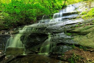 Barnett Branch Trail FallsShort national forest trail walk to fallsTransylvania County, NC2.3 miNW
- Clawhammer FallsPartial guide: short off-trail finish and the FR 477 vehicle closure status is unverifiedTransylvania County, NC2.3 miS
- Lower Thompson Ridge FallsTransylvania County, NC2.3 miN
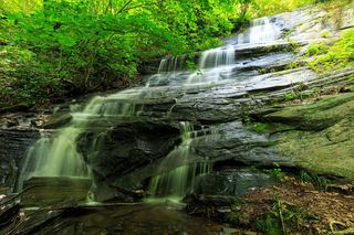 Little Barnett Branch Trail FallsPartial: maintained trail; the sources do not name this upper fallsTransylvania County, NC2.3 miNW
- Bradley Creek FallsPartial guide: the last stretch is off trail with no marked path, and road access to the trailhead may be closedTransylvania County, NC2.4 miN
- Upper Thompson Ridge FallsTransylvania County, NC2.4 miN
- Powerline FallsTransylvania County, NC2.5 miSW