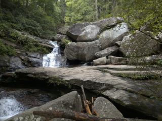
Little River Falls
Burke County, North Carolina
Your visit at a glance
- Waterfall height
- Not recorded
- Location
- Burke County, North Carolina
- Access status
- Partial guide: final approach is a steep bushwhack near a dangerous cliff top
- The walk
- About 4 miles return
- Ground & access
- Trail on an old road, then a steep bushwhack through dense rhododendron. Stay away from the top of the falls; people have died there. You may need to wade in high water.
Start on the blue-blazed Little River Trail at the northeast end of the parking lot at the end of the park road. It follows an old road past the Raven Rock and Turkey Ridge trail junctions. At 1.7 miles cross the tributary on a footbridge; the trail follows it a short way and turns left uphill. Leave the trail here near the top of the falls, which is dangerous and has no view. Follow the path left a couple hundred feet to a view through the trees, then bushwhack down through rhododendron to the base.
Plan your visit
Little River Trail from the end of South Mountains Park Road, then off trail to Little River Falls
Waterfall Hero gives 4 miles for the whole out-and-back hike, with the footbridge over the tributary at 1.7 miles.
Trail on an old road, then a steep bushwhack through dense rhododendron. Stay away from the top of the falls; people have died there. You may need to wade in high water.
Where to start
Jacob Fork access, South Mountains State Park (3001 South Mountain Park Ave., Connelly Springs). Drive the park road to the parking area at its end.
Timing & water
Park opens at 7 a.m.; closing time varies by month. The park lists the Headquarters, Shinny, Possum and High Shoals Falls Loop trails as closed; the Little River Trail is not on that list.
Before you go
No fee for day use.
Visitor informationVisit sources
More waterfalls nearby
Within 40 straight-line miles. Road and trail distances will differ.
 Big Bear FallsBurke County, NC0.9 miSW
- High Shoals FallsBurke County, NC1.3 miSW
- Upper High Shoals FallsBurke County, NC1.3 miSW
- Beautimos FallsCleveland County, NC4.4 miSW
- Black Mountain FallsRutherford County, NC5.1 miSW
- Pot Branch FallsShort walk on old roads in South Mountains Game Land; rough gravel road with a fordRutherford County, NC6.2 miSW
- Sally Queen FallsPartial: bushwhack with no trail; storm blowdowns reportedRutherford County, NC6.9 miW
- Upper Shoal Creek FallsBurke County, NC8.0 miW
- Shoal Creek FallsBurke County, NC8.2 miW