Red Rock Falls
Transylvania County, North Carolina
Your visit at a glance
- Waterfall height
- Not recorded
- Location
- Transylvania County, North Carolina
- Access status
- Partial: FS 140 closed for storm damage; old unmaintained creekside path
- The walk
- About 3 to 4.2 miles return from the FS 140 gate; about 5 miles more return if you must walk FS 140 from NC 215
- Ground & access
- Rough, unmaintained path that clings to steep banks, with rock-hop crossings that can be hard in high water. NCWaterfalls.com warns the route may have changed after storms in 2021 and 2024.
Beyond the FS 140 gate, follow the road past the Courthouse Falls trail to its end at Upper Courthouse Falls. Do not cross toward the base there. Take the path on the left that climbs steeply and follows Courthouse Creek upstream. It is narrow, rocky and overgrown, with four unmarked creek crossings. Where two forks meet, cross and follow the right fork, which is still Courthouse Creek, to the falls. A side path leads down to the base.
Plan your visit
Courthouse Creek Road (FS 140) to its gate and road end near Upper Courthouse Falls, then an old unmaintained path up Courthouse Creek with several crossings
Take a Hike gives a 3-mile round trip and NCWaterfalls.com about 2.1 miles from the gate. NCWaterfalls.com puts the gate 2.5 road miles up FS 140, which is closed, so walking from NC 215 adds about 2.5 miles each way.
Rough, unmaintained path that clings to steep banks, with rock-hop crossings that can be hard in high water. NCWaterfalls.com warns the route may have changed after storms in 2021 and 2024.
Where to start
FS 140 leaves NC 215 about 6.65 miles south of the Blue Ridge Parkway at Beech Gap. With FS 140 closed, NCWaterfalls.com says to park in the area beside NC 215 across from FS 140 and walk the road.
Timing & water
The Forest Service lists Courthouse Creek Road (FS 140) as closed due to storm damage. It does not say whether walking the road is allowed. The route description dates from 2014.
Before you go
Pisgah Ranger District, Pisgah National Forest. No fee is stated by the sources.
Visitor informationVisit sources
More waterfalls nearby
Within 40 straight-line miles. Road and trail distances will differ.
- Upper Courthouse FallsPartial guide: Courthouse Creek Road is closed to vehicles, so the walk is about 4 miles each wayTransylvania County, NC0.6 miSE
- Upper Bubbling Spring Branch FallsNational forest; short creekside path with several crossingsHaywood County, NC0.8 miNW
- Lower Bubbling Spring Branch FallsShort unofficial creekside path with crossingsHaywood County, NC0.8 miNW
- Split FallsHaywood County, NC1.2 miN
- Mount Hardy FallsUnblazed wilderness trail and short bushwhack; needs high water98 ft (30 m) · Haywood County, NC1.2 miNW
- Chestnut FallsPartial guide: FR 140 closed for storm damage; long road walk and faint pathTransylvania County, NC1.3 miSE
- Lower Chestnut FallsPartial guide: access road closed for storm damage; bushwhack and creek walkTransylvania County, NC1.4 miSE
- Little Wildcat FallsRoadside view; needs high waterHaywood County, NC1.5 miNW
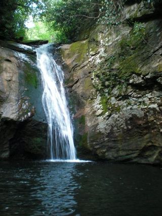 Courthouse FallsApproach road closed due to storm damage; no open parking-to-falls route verified.33 ft (10 m) · Transylvania County, NC1.5 miS