Lower Chestnut Falls
Transylvania County, North Carolina
Your visit at a glance
- Waterfall height
- Not recorded
- Location
- Transylvania County, North Carolina
- Access status
- Partial guide: access road closed for storm damage; bushwhack and creek walk
- The walk
- About 7.5 to 8 miles return while FS 140 is closed; about 2.5 miles return from the FS 140 gate if the road reopens
- Ground & access
- Forest roads, an overgrown path, then a Class III bushwhack and creek walk through dense dog hobble around cliffs. For experienced off-trail hikers only.
Walk FS 140 to the gate, continue 0.1 mile and turn right on FS 5031. Keep left at forks for a little over 0.8 mile to a grassy fork, then take the faint path on the left to Chestnut Creek at Chestnut Falls. From there follow the creek downstream, mostly in the creekbed, to the top of the next waterfall, then swing wide around the cliffs on the right side and creek walk back up to its base. The author returned by following the creek down to FS 140.
Plan your visit
FS 140 and FS 5031 to Chestnut Falls, then down Chestnut Creek to the next falls below
NCWaterfalls gives approximately 1.25 miles one way from the FS 140 gate. The legacy account says the road walk to the Chestnut Falls trailhead is 2.6 miles while FS 140 is closed.
Forest roads, an overgrown path, then a Class III bushwhack and creek walk through dense dog hobble around cliffs. For experienced off-trail hikers only.
Where to start
FS 140 leaves NC 215 6.65 miles south of the Blue Ridge Parkway. With the road closed, NCWaterfalls says to park beside NC 215 across from FS 140 and walk the road. The Forest Service lists FS 140 as closed due to storm damage and does not say whether foot travel is allowed.
Timing & water
FS 140 has been closed since Hurricane Helene. The legacy author reports hikers walking around the road landslide.
Before you go
Current fees and reservation requirements unknown.
Visitor informationVisit sources
More waterfalls nearby
Within 40 straight-line miles. Road and trail distances will differ.
- Chestnut FallsPartial guide: FR 140 closed for storm damage; long road walk and faint pathTransylvania County, NC0.1 miN
- Kiesee FallsPartial guide: access road closed for storm damage; bushwhack with an exposed rock faceTransylvania County, NC0.3 miNE
- Upper Kiesee FallsPartial guide: the access road is closed and the path may have changed since loggingTransylvania County, NC0.4 miNE
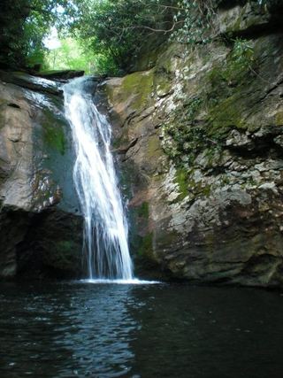 Courthouse FallsApproach road closed due to storm damage; no open parking-to-falls route verified.33 ft (10 m) · Transylvania County, NC0.5 miSW
- Cody FallsPartial guide: Courthouse Creek Road is closed for storm damage and foot access on it is not confirmedTransylvania County, NC0.6 miSW
- Upper Courthouse FallsPartial guide: Courthouse Creek Road is closed to vehicles, so the walk is about 4 miles each wayTransylvania County, NC0.8 miNW
- Summey Cove FallsPartial: FS 140 closed for storm damage; view mostly blocked by treesTransylvania County, NC1.0 miS
- Red Rock FallsPartial: FS 140 closed for storm damage; old unmaintained creekside pathTransylvania County, NC1.4 miNW
- Sassafras Knob FallsTransylvania County, NC1.6 miE