Summey Cove Falls
Transylvania County, North Carolina
Your visit at a glance
- Waterfall height
- Not recorded
- Location
- Transylvania County, North Carolina
- Access status
- Partial: FS 140 closed for storm damage; view mostly blocked by trees
- The walk
- Roadside view; about 1.4 miles each way on foot if FS 140 is closed to cars
- Ground & access
- Roadside. Optional steep scramble down the bank to the river.
The tall falls drop into North Fork French Broad River close to the road, but the view is mostly hidden even in winter and barely visible in summer. In high water with no leaves, you can scramble down the bank to the river edge for a more open, still limited view. Wading the river is not advised when flow is high enough to make the falls worth seeing.
Plan your visit
Roadside view from a small pullout on Courthouse Creek Road (FS 140), across North Fork French Broad River
NCWaterfalls.com puts the viewpoint 1.4 road miles up FS 140. With the road closed, that road distance becomes the walk from NC 215.
Roadside. Optional steep scramble down the bank to the river.
Where to start
Normally a small pullout on FS 140, 1.4 miles from NC 215. With FS 140 closed, NCWaterfalls.com says to park in the area beside NC 215 across from FS 140 and walk the road. Viewpoint coordinates: 35.26309, -82.88932.
Timing & water
The Forest Service lists Courthouse Creek Road (FS 140) as closed due to storm damage. It does not say whether walking the road is allowed. Best after rain with no leaves on the trees.
Before you go
Pisgah Ranger District, Pisgah National Forest. No fee is stated by the sources.
Visitor informationVisit sources
More waterfalls nearby
Within 40 straight-line miles. Road and trail distances will differ.
- Cody FallsPartial guide: Courthouse Creek Road is closed for storm damage and foot access on it is not confirmedTransylvania County, NC0.6 miNW
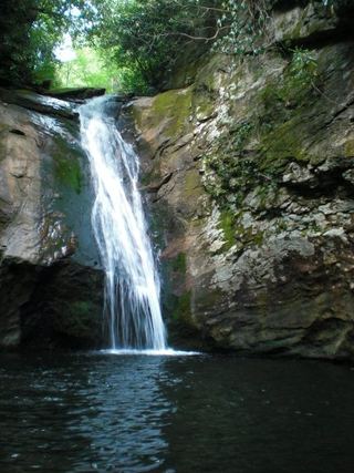 Courthouse FallsApproach road closed due to storm damage; no open parking-to-falls route verified.33 ft (10 m) · Transylvania County, NC0.6 miN
- Upper Beetree Fork FallsShort road walk and bank scramble from a national forest pull-offTransylvania County, NC0.8 miS
- Beetree Fork FallsDocumented road walk and bank scramble on national forest land33 ft (10 m) · Transylvania County, NC0.8 miS
- Lower Chestnut FallsPartial guide: access road closed for storm damage; bushwhack and creek walkTransylvania County, NC1.0 miN
- Chestnut FallsPartial guide: FR 140 closed for storm damage; long road walk and faint pathTransylvania County, NC1.1 miN
- Kiesee FallsPartial guide: access road closed for storm damage; bushwhack with an exposed rock faceTransylvania County, NC1.2 miNE
- Upper Kiesee FallsPartial guide: the access road is closed and the path may have changed since loggingTransylvania County, NC1.3 miNE
- Upper Courthouse FallsPartial guide: Courthouse Creek Road is closed to vehicles, so the walk is about 4 miles each wayTransylvania County, NC1.5 miN