Upper Kiesee Falls
Transylvania County, North Carolina
Your visit at a glance
- Waterfall height
- Not recorded
- Location
- Transylvania County, North Carolina
- Access status
- Partial guide: the access road is closed and the path may have changed since logging
- The walk
- About 0.8 miles each way from the curve on FS 140, plus about 2.3 miles each way on the closed road from NC 215
- Ground & access
- Overgrown logging roads, a makeshift steep path and a steep sloping rock at the creek. NCWaterfalls says a rope is needed if the rock is icy or covered in wet leaves. Do not try to climb down to the lower falls from here; it is surrounded by steep rock walls.
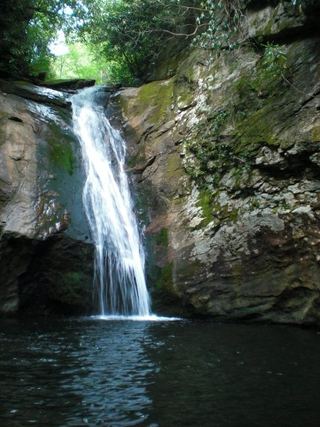
Upper Kiesee Falls is a 16-foot waterfall with a swimming pool on Kiesee Creek in Pisgah National Forest. NCWaterfalls says FS 140 is closed indefinitely, so park beside NC 215 across from FS 140 and walk the road to its sharp left curve. From the curve, follow the old logging road; go right on the lower path at a fork at 0.26 miles and left at another fork at 0.48 miles. About 0.25 miles later, past a small wet-weather branch, a makeshift path descends a few hundred feet to the creek.
Plan your visit
FS 140 (Courthouse Creek Road), closed to vehicles, then old logging roads and a makeshift path down to Upper Kiesee Falls
NCWaterfalls gives about 0.8 miles from the curve on FS 140 and says the curve is 2.3 miles up FS 140 from NC 215. With the road closed, the road walk is added.
Overgrown logging roads, a makeshift steep path and a steep sloping rock at the creek. NCWaterfalls says a rope is needed if the rock is icy or covered in wet leaves. Do not try to climb down to the lower falls from here; it is surrounded by steep rock walls.
Where to start
Area beside NC 215 across from FS 140, 6.65 miles south of Beech Gap on the Blue Ridge Parkway and 10.4 miles north of US 64. Driving up FS 140 is not possible while the road is closed.
Timing & water
FS 140 is closed to vehicles indefinitely according to NCWaterfalls. The route description dates from 2020, when logging was underway, so the path may have changed.
Before you go
No fee is mentioned.
Visitor informationVisit sources
More waterfalls nearby
Within 40 straight-line miles. Road and trail distances will differ.
- Kiesee FallsPartial guide: access road closed for storm damage; bushwhack with an exposed rock faceTransylvania County, NC0.0 miSW
- Chestnut FallsPartial guide: FR 140 closed for storm damage; long road walk and faint pathTransylvania County, NC0.3 miW
- Lower Chestnut FallsPartial guide: access road closed for storm damage; bushwhack and creek walkTransylvania County, NC0.4 miSW
 Courthouse FallsApproach road closed due to storm damage; no open parking-to-falls route verified.33 ft (10 m) · Transylvania County, NC0.9 miSW
- Cody FallsPartial guide: Courthouse Creek Road is closed for storm damage and foot access on it is not confirmedTransylvania County, NC1.0 miSW
- Upper Courthouse FallsPartial guide: Courthouse Creek Road is closed to vehicles, so the walk is about 4 miles each wayTransylvania County, NC1.1 miW
- Summey Cove FallsPartial: FS 140 closed for storm damage; view mostly blocked by treesTransylvania County, NC1.3 miSW
- Sassafras Knob FallsTransylvania County, NC1.3 miE
- Laurel Fork FallsPartial: no trail for the last half mile; difficult bushwhack52 ft (16 m) · Transylvania County, NC1.3 miE