Upper Avery Creek Falls
Transylvania County, North Carolina
Your visit at a glance
- Waterfall height
- Not recorded
- Location
- Transylvania County, North Carolina
- Access status
- Partial guide: forest trail route described; vehicle access on FR 477 was limited and current status is unknown
- The walk
- About 1.75 miles each way from the Avery Creek Trail pullout
- Ground & access
- Trail with a wet creek crossing, mud and small stream crossings. The last part is a faint, steep scramble path down a bank to the base. Rocks are slippery.
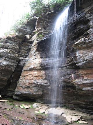
Upper Avery Creek Falls is a 25 foot waterfall on Avery Creek in Pisgah National Forest. From the small pullout on FR 477 marked for the blue-blazed Avery Creek Trail, the trail descends to Avery Creek and crosses it; the footbridge was gone when the route was described, so this was a wet crossing. Keep left on Avery Creek Trail past Avery Creek Falls to the junction with the orange-blazed Buckhorn Gap Trail. Where Buckhorn Gap Trail turns right over the creek toward Twin Falls, stay on Avery Creek Trail for just over half a mile, crossing four small side streams. When the trail starts to climb more steeply, listen for the falls on the right and look for a faint path down the bank to the base. Return the same way. The route description dates from 2025.
Plan your visit
Avery Creek Trail from FR 477, past Avery Creek Falls, to a scramble path down to Upper Avery Creek Falls
The legacy NC Waterfalls page gives 3.5 miles round trip to see both Avery Creek waterfalls, with Upper Avery Creek Falls the farther one. Waterfall Hero gives a 3.2 mile hike length from the Buckhorn Gap Trail parking.
Trail with a wet creek crossing, mud and small stream crossings. The last part is a faint, steep scramble path down a bank to the base. Rocks are slippery.
Where to start
Small pullout on the right of Avery Creek Road (FR 477), 2.2 miles past the stables turn area described by NC Waterfalls, at the Avery Creek Trail marker. Space is limited; the Buckhorn Gap trailhead about a quarter mile farther up is the alternative. NC Waterfalls reported part of FR 477 closed to vehicles, with a new parking area 1.4 miles up FR 477 and a 0.8 mile walk up the road to the trailhead. Whether the road is open to vehicles now was not confirmed.
Timing & water
Road access was limited by storm damage when the route was described; current FR 477 status not confirmed. Creek crossings can be impassable in high water.
Before you go
No fee or reservation is mentioned.
Visitor informationVisit sources
More waterfalls nearby
Within 40 straight-line miles. Road and trail distances will differ.
- Powerline FallsTransylvania County, NC0.2 miN
- Twin FallsPartial: forest trail documented; road gate status near the trailhead not confirmedTransylvania County, NC0.7 miNE
- Avery Creek FallsNational forest trail route documentedTransylvania County, NC1.0 miSE
- Clawhammer FallsPartial guide: short off-trail finish and the FR 477 vehicle closure status is unverifiedTransylvania County, NC1.2 miE
 Upper Moore Cove FallsTransylvania County, NC1.3 miSW
 Upper Little Moore Cove FallsPartial guide: off-trail Class III bushwhack on an unofficial path beyond the Forest Service trailTransylvania County, NC1.3 miSW
 Moore Cove FallsResearched visit notes49 ft (15 m) · Transylvania County, NC1.3 miSW
 Little Moore Cove FallsNational forest trail and short informal side path; post-Helene condition unverified26 ft (8 m) · Transylvania County, NC1.3 miSW
- Justus Cove FallsTransylvania County, NC1.5 miW