Panthertown Creek Falls
Jackson County, North Carolina
Your visit at a glance
- Waterfall height
- Not recorded
- Location
- Jackson County, North Carolina
- Access status
- Partial guide: the last section is an off-trail bushwhack with no path
- The walk
- About 4 to 5.4 miles return, including an off-trail section
- Ground & access
- Maintained backcountry trails, then an off-trail bushwhack through increasingly thick rhododendron and a steep climb down to the base. Rocks are very slippery. The hike out is mostly uphill.
From Salt Rock Gap, walk down the gated old road (Panthertown Valley Trail #474) and descend via Deep Gap Trail (#449) or Wilderness Falls Trail (#490) to Frolictown Falls. Take Granny Burrell Falls Trail (#486) and, just after the bridge over Panthertown Creek, turn right on Great Wall Trail (#489). Where the trail curves left and starts up Big Green Mountain, near the 3,760-foot contour, leave the trail to the right and contour to the creek. There is no path for this last part. Drop to the creek at the base of the falls.
Plan your visit
Salt Rock Gap parking, Panthertown Valley, via Granny Burrell Falls and Great Wall trails, then off trail to Panthertown Creek Falls
Take a Hike gives about 4 miles round trip; Waterfall Hero gives a 5.4-mile hike. The two describe slightly different trail connections from the same parking area.
Maintained backcountry trails, then an off-trail bushwhack through increasingly thick rhododendron and a steep climb down to the base. Rocks are very slippery. The hike out is mostly uphill.
Where to start
Salt Rock Gap parking area at the end of Breedlove Road: from Cashiers go east on US 64 about 2 miles, left on Cedar Creek Road 2.3 miles, right on Breedlove Road 3.5 miles. Friends of Panthertown says parking is limited and the gravel roads are heavily used on weekends.
Timing & water
Current trail conditions not verified. Cell service is unreliable. Off-trail section is harder when vegetation is dense.
Before you go
Friends of Panthertown says no permits, fees, or reservations are required for individuals for dispersed camping. Day-use fees were not separately confirmed.
Visitor informationVisit sources
More waterfalls nearby
Within 40 straight-line miles. Road and trail distances will differ.
- Granny Burrell FallsWest-entrance route and parking researchedJackson County, NC1.1 miN
- Pothole FallsShort backcountry trail from Cold Mountain GapJackson County, NC1.1 miNE
- Mac's FallsNational forest trail; short side pathJackson County, NC1.2 miNE
- Maidenhair FallsJackson County, NC1.2 miSW
- Frolictown FallsMarked Panthertown trails from the Salt Rock Gap accessJackson County, NC1.3 miNW
- Twin FallsJackson County, NC1.3 miSW
- Coolidge FallsJackson County, NC1.3 miN
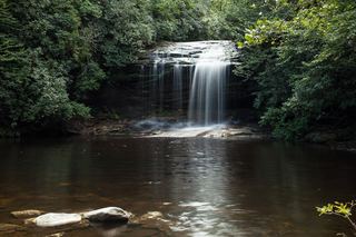 Schoolhouse FallsNational forest trailsJackson County, NC1.4 miNE
- Mount Toxaway FallsJackson County, NC1.4 miSE