Frolictown Falls
Jackson County, North Carolina
Your visit at a glance
- Waterfall height
- Not recorded
- Location
- Jackson County, North Carolina
- Access status
- Marked Panthertown trails from the Salt Rock Gap access
- The walk
- About 2 miles return (about 1.0 mile one way)
- Ground & access
- Old road grade with a moderate descent; short scramble to the base. Rocks are slippery and the water is naturally tannin-stained.
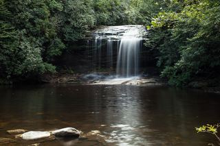
Frolictown Falls is a creek-wide, nearly vertical drop of about 15 feet on Frolictown Creek on the west side of Panthertown Valley. From the Salt Rock Gap gate, descend Panthertown Valley Trail (#474) 0.3 mile to the Salt Rock view and on to a road fork at 0.59 mile; take the right fork, Deep Gap Trail (#449), for about 0.43 mile to the ford of Frolictown Creek. Twenty yards before the ford a side path on the left leads a few yards to the base of the falls; the path on the right leads to Wilderness Falls.
Plan your visit
Salt Rock Gap trailhead via Panthertown Valley and Deep Gap trails to Frolictown Falls
Discover Jackson County gives 0.59 mile on Panthertown Valley Trail to the road fork and 0.43 mile on Deep Gap Trail to the Frolictown Creek ford, about 1.0 mile one way. Its listed distance of 1 mile is one way. Waterfall Hero lists a 3.8 mile outing that also visits Wilderness and Granny Burrell falls.
Old road grade with a moderate descent; short scramble to the base. Rocks are slippery and the water is naturally tannin-stained.
Where to start
Salt Rock Gap (west) parking area at the end of Breedlove Road: from US 64 about 2 miles east of Cashiers take Cedar Creek Road 2.3 miles, then Breedlove Road 3.5 miles to the gate. Trailhead GPS 35.16793, -83.03980 per Waterfall Hero.
Timing & water
Open year round. Carry a Panthertown trail map; the many old roads can confuse.
Before you go
Nantahala National Forest, Panthertown Valley backcountry area. No fee. Bear-resistant containers are required for overnight camping.
Visitor informationVisit sources
More waterfalls nearby
Within 40 straight-line miles. Road and trail distances will differ.
- Wilderness FallsWest-entrance route; old Salt Rock shortcut closedJackson County, NC0.3 miNW
- Granny Burrell FallsWest-entrance route and parking researchedJackson County, NC0.5 miE
- Coolidge FallsJackson County, NC0.7 miNE
- Packs FallsJackson County, NC1.0 miNW
- Pittypat FallsJackson County, NC1.0 miNW
- Panthertown Creek FallsPartial guide: the last section is an off-trail bushwhack with no pathJackson County, NC1.3 miSE
- Maidenhair FallsJackson County, NC1.5 miS
- Twin FallsJackson County, NC1.6 miS
 Schoolhouse FallsNational forest trailsJackson County, NC1.8 miE