Brooks Creek Falls
Macon County, North Carolina
Your visit at a glance
- Waterfall height
- Not recorded
- Location
- Macon County, North Carolina
- Access status
- Roadside waterfall on a gravel forest road
- The walk
- Roadside view; a short scramble path leads closer
- Ground & access
- Gravel forest road, then an optional short steep scramble path.
From Highlands, take NC 28 south from the US 64 stoplight for about 2 miles and turn right on Clear Creek Road. Drive 1.2 miles and turn right on gravel Forest Road 367, the first right after a hairpin on Clear Creek Road. Drive about 2.3 to 2.4 miles down FR 367 and the 50 foot waterfall is on the right, visible from the road. A short scramble path on the left bank (facing downstream) leads down for a closer view. FR 367 continues to FR 79 and the Picklesimer Rock House Falls area.
Plan your visit
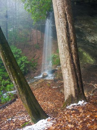
Roadside view of Brooks Creek Falls from Forest Road 367 south of Highlands
Waterfall Hero gives a hike length under 0.1 miles. Rich Stevenson says the falls is visible from the road with a small path down for a better view.
Gravel forest road, then an optional short steep scramble path.
Where to start
Pull off FR 367 at the falls. Published trailhead coordinates: 35.03067, -83.22510.
Timing & water
Gravel road. Trees partly block the view from the road in leaf.
Before you go
No fee is mentioned. The land is Nantahala National Forest, Nantahala Ranger District.
Visitor informationVisit sources
More waterfalls nearby
Within 40 straight-line miles. Road and trail distances will differ.
- Glen FallsParking and overlook approach researchedMacon County, NC0.8 miW
- Satulah FallsSafe stopping location unconfirmedMacon County, NC1.5 miE
 Picklesimer Rock House FallsEasy walk on a gated forest road in Nantahala National ForestMacon County, NC1.9 miSW
- Lower Satulah FallsDistant roadside view from an overlook; no access closerMacon County, NC2.0 miE
- Chasm FallsShort but difficult; creek crossing for the base viewMacon County, NC2.1 miSW
- Blue Valley FallsMacon County, NC2.1 miW
- Naiad FallsBoat access only; private land at the fallsMacon County, NC2.1 miN
- Kalakaleskies FallsRoadside pullout; short path to the top of the fallsMacon County, NC2.5 miN
- Sequoah FallsRoadside view of a dam spillwayMacon County, NC2.6 miN