Chasm Falls
Macon County, North Carolina
Your visit at a glance
- Waterfall height
- Not recorded
- Location
- Macon County, North Carolina
- Access status
- Short but difficult; creek crossing for the base view
- The walk
- About 0.4 miles return
- Ground & access
- Difficult for its length. Overgrown old road, steep ground at the top of the falls, and a creek crossing for the base view. Rocks are very slippery.
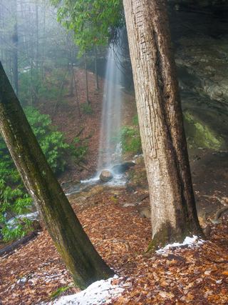
From Highlands, drive south on NC 28 for 6 miles and turn right on Blue Valley Road, which turns to gravel and becomes FR 79 in the national forest. Go 4.5 miles to where the road curves right and pull off. Walk down the old, overgrown logging road toward East Fork Overflow Creek for a little over 0.1 miles; it narrows to a trail and reaches the top of the 20 foot falls, where a fall would be fatal. For the base, backtrack and head down to the creek. You must cross the creek, which is difficult or dangerous in high water, to see the chasm from the other side.
Plan your visit
FR 79 (Blue Valley Road) pulloff south of Highlands, old logging road to the top of Chasm Falls, creek crossing for the base view
Waterfall Hero gives a 0.4 mile round trip, rated difficult. Take a Hike gives less than a half mile round trip.
Difficult for its length. Overgrown old road, steep ground at the top of the falls, and a creek crossing for the base view. Rocks are very slippery.
Where to start
Roadside pulloff on FR 79 at the right-hand curve, 4.5 miles from NC 28. Published trailhead coordinates: 35.00911, -83.25069.
Timing & water
Do not cross the creek in high water.
Before you go
No fee is mentioned. Nantahala National Forest, Nantahala Ranger District.
Visitor informationVisit sources
More waterfalls nearby
Within 40 straight-line miles. Road and trail distances will differ.
 Picklesimer Rock House FallsEasy walk on a gated forest road in Nantahala National ForestMacon County, NC0.8 miN
- Lower Serenity FallsMacon County, NC1.6 miW
- Serenity FallsMacon County, NC1.6 miW
- Glen FallsParking and overlook approach researchedMacon County, NC1.7 miN
- Blue Valley FallsMacon County, NC1.8 miNW
- Brooks Creek FallsRoadside waterfall on a gravel forest roadMacon County, NC2.1 miNE
- Catstairs FallsMacon County, NC2.2 miNW
- Satulah FallsSafe stopping location unconfirmedMacon County, NC3.3 miNE
- Lower Satulah FallsDistant roadside view from an overlook; no access closerMacon County, NC3.5 miE