Laurel Creek Falls
Watauga County, North Carolina
Your visit at a glance
- Waterfall height
- Not recorded
- Location
- Watauga County, North Carolina
- Access status
- Partial: short informal path; landowner and permission not confirmed
- The walk
- About 0.2 miles
- Ground & access
- Short, informal creekside path. The rocks are slippery. Crossing US 321 on foot needs care.
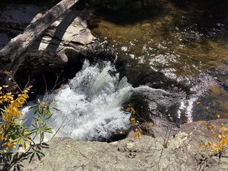
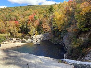
Park completely off the road at the pull-off. Carefully cross US 321 and pick up a makeshift path that follows Laurel Creek upstream past cascades just above the road. The 25-foot waterfall and its swimming hole are just above these cascades. Return the same way. Waterfall Hero does not know who owns the land.
Plan your visit
US 321 pull-off past the Watauga River bridge, path up Laurel Creek to the falls
Waterfall Hero lists the hike length as 0.2 miles. It does not say whether this is one way or return.
Short, informal creekside path. The rocks are slippery. Crossing US 321 on foot needs care.
Where to start
Pull-off on the right side of US 321, 5.4 miles west of the US 421/US 321 junction west of Boone, just past the bridge over the Watauga River. Park completely off the road. Published coordinates: 36.25405, -81.85268.
Timing & water
No closure is stated. Waterfall Hero says crowds are very high in warm weather.
Before you go
Landowner unknown. Waterfall Hero says public access seems to be permitted but could not confirm it. No fee.
Visitor informationVisit sources
More waterfalls nearby
Within 40 straight-line miles. Road and trail distances will differ.
- She Falls FallsWatauga County, NC3.3 miSW
- Buckeye Creek FallsTown park trail; loop bridge out since September 2024, out-and-back worksWatauga County, NC3.7 miSW
- Crab Orchard FallsPrivate conference center trail open to the public; freeWatauga County, NC4.8 miSE
- Dutch Creek FallsWatauga County, NC5.7 miSE
- Twisting FallsPartial guide: unofficial steep path; land ownership not statedCarter County, TN7.0 miW
 Splash Dam FallsPartial guide: unmarked side path and unofficial connector; scramble to the baseCarter County, TN7.4 miSW
 Elk River FallsSource-reviewed route and parking49 ft (15 m) · Avery County, NC7.5 miSW
- Otter FallsShort trail in a town park with a signed parking areaWatauga County, NC7.6 miS
- Mountaineer FallsCarter County, TN7.7 miW