Splash Dam Falls
Carter County, Tennessee
Your visit at a glance
- Waterfall height
- Not recorded
- Location
- Carter County, Tennessee
- Access status
- Partial guide: unmarked side path and unofficial connector; scramble to the base
- The walk
- The visitor guide gives a hike length of 3.6 miles
- Ground & access
- Moderate trail, then an unmarked side path. Getting below the falls needs a steep, slick scramble over rock; visitor accounts warn this is not for everyone.
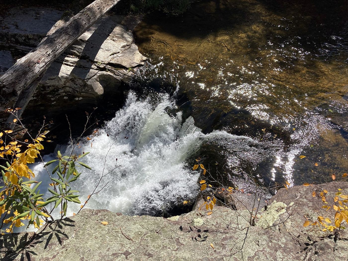
Splash Dam Falls is a short waterfall where the Elk River squeezes through a narrow rock channel, in Cherokee National Forest in Carter County, Tennessee. From the end of Elk River Road, follow the gated forest road to the river ford, do not cross, and take the path downstream past a campsite, across Jones Branch and up to the Appalachian Trail. Go straight (north) on the Appalachian Trail about 1 mile to where it starts to climb; an unsigned path on the right leads to the river at the top of the falls, where a large flat rock overlooks the channel. Visitor accounts say reaching the base is a tricky, steep rock scramble. The side path is unmarked and the connector to the Appalachian Trail is unofficial, so this is a partial guide.
Plan your visit
Elk River Road end, gated forest road, unofficial riverside path across Jones Branch to the Appalachian Trail, north on the Appalachian Trail, then an unmarked path to the top of the falls
Waterfall Hero gives a hike length of 3.6 miles and reaches the Appalachian Trail at 0.8 mile, then about 1 more mile on it to the side path. It does not state whether 3.6 miles is the round trip.
Moderate trail, then an unmarked side path. Getting below the falls needs a steep, slick scramble over rock; visitor accounts warn this is not for everyone.
Where to start
End of Elk River Road in Pisgah National Forest, North Carolina: from US 19E just north of Elk Park, take Old Mill Road 0.3 mile, then Elk River Road about 4 miles to the dead end. Park in the large turnaround and do not block the gate. The lot fills early in summer.
Timing & water
Best with decent water levels. The rocks are slippery, especially when wet or leaf-covered.
Before you go
No fee is mentioned in official sources.
Visitor informationVisit sources
More waterfalls nearby
Within 40 straight-line miles. Road and trail distances will differ.
- Jones FallsPartial guide: the link from the forest road to the Appalachian Trail is an unofficial pathCarter County, TN0.7 miSW
 Elk River FallsSource-reviewed route and parking49 ft (15 m) · Avery County, NC0.8 miS
- Mountaineer FallsCarter County, TN0.9 miNW
- Twisting FallsPartial guide: unofficial steep path; land ownership not statedCarter County, TN1.5 miN
- Buckeye Creek FallsTown park trail; loop bridge out since September 2024, out-and-back worksWatauga County, NC3.8 miE
- She Falls FallsWatauga County, NC5.5 miE
- Laurel Creek FallsPartial: short informal path; landowner and permission not confirmedWatauga County, NC7.4 miNE
- Dennis Cove WaterfallNational forest trail route documented; three wading fordsCarter County, TN7.6 miNW
- Coon Den FallsGuide: steep forest trail; park at the gravel area past the trailheadCarter County, TN8.6 miW