Jones Falls
Carter County, Tennessee
Your visit at a glance
- Waterfall height
- Not recorded
- Location
- Carter County, Tennessee
- Access status
- Partial guide: the link from the forest road to the Appalachian Trail is an unofficial path
- The walk
- 1.6 miles from the trailhead to the falls, per one visitor account
- Ground & access
- Moderate with a steep climb. Narrow riverbank path, a rock-hop crossing of Jones Branch, and rocky, rooty trail. Rocks around the falls are slippery.
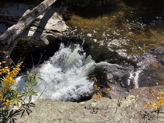
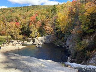
Jones Falls is a 100-foot waterfall on Jones Branch, a tributary of the Elk River, in Cherokee National Forest in Tennessee, reached from the Elk River Falls parking area in North Carolina. From the parking turnaround, follow the gated forest road through a powerline clearing toward the river. Where the road turns down to ford the river, do not cross; stay straight on the narrow path along the riverbank, rock-hop across Jones Branch, and climb steeply to the Appalachian Trail. Turn left (south) on the white-blazed Appalachian Trail, climb past a set of timber stairs, and turn left at the sign for Jones Falls; the blue-blazed side path leads to the base. The connector between the forest road and the Appalachian Trail is an unofficial path, so this is a partial guide. Return the same way.
Plan your visit
Elk River Road end, gated forest road toward the Elk River ford, unofficial riverside path across Jones Branch up to the Appalachian Trail, south on the Appalachian Trail to the signed Jones Falls spur
One visitor account gives 1.6 miles from the trailhead to the falls (3.2 miles round trip). Another reaches the spur at 1.4 miles and the base 0.1 mile later. Both start at the end of Elk River Road.
Moderate with a steep climb. Narrow riverbank path, a rock-hop crossing of Jones Branch, and rocky, rooty trail. Rocks around the falls are slippery.
Where to start
End of Elk River Road in Pisgah National Forest, North Carolina: from US 19E just north of Elk Park, take Old Mill Road 0.3 mile, then Elk River Road about 4 miles to the dead end. Park in the large turnaround and do not block the gate. The lot fills early in summer.
Timing & water
Best in wetter months; one visitor account rates winter as the best season.
Before you go
No fee is mentioned in official sources. A visitor account lists the fee as none.
Visitor informationVisit sources
- American Travel Journal: Jones Falls, Cherokee National Forest
- American Travel Journal: Jones Falls, Cherokee National Forest
- American Travel Journal: Jones Falls, Cherokee National Forest
- Hiking the Appalachians: Elk River Falls and Jones Falls
- Hiking the Appalachians: Elk River Falls and Jones Falls
- Waterfall Hero: Jones Falls (Elk River)
- Waterfall Hero: Jones Falls (Elk River)
More waterfalls nearby
Within 40 straight-line miles. Road and trail distances will differ.
 Splash Dam FallsPartial guide: unmarked side path and unofficial connector; scramble to the baseCarter County, TN0.7 miNE
 Elk River FallsSource-reviewed route and parking49 ft (15 m) · Avery County, NC0.8 miE
- Mountaineer FallsCarter County, TN1.1 miN
- Twisting FallsPartial guide: unofficial steep path; land ownership not statedCarter County, TN2.0 miN
- Buckeye Creek FallsTown park trail; loop bridge out since September 2024, out-and-back worksWatauga County, NC4.4 miE
- She Falls FallsWatauga County, NC6.0 miE
- Dennis Cove WaterfallNational forest trail route documented; three wading fordsCarter County, TN7.4 miNW
- Laurel Creek FallsPartial: short informal path; landowner and permission not confirmedWatauga County, NC8.0 miNE
- Coon Den FallsGuide: steep forest trail; park at the gravel area past the trailheadCarter County, TN8.4 miNW