Big Falls
Transylvania County, North Carolina
Your visit at a glance
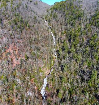
- Waterfall height
- 197 ft (60 m)
- Location
- Transylvania County, North Carolina
- Access status
- Partial guide: unofficial trail, dangerous ford and scramble; parking and land permission details unconfirmed
- The walk
- About 7.1 miles return (3.55 miles each way, 2018 GPS track)
- Ground & access
- Unofficial, unblazed trail. A ford that can be knee-deep or worse, and an extremely steep descent with rock scrambles. The legacy guide warns against going in high water or on wet days.
Begin behind the gate at the Brewer Road and NC 281 intersection. Follow the unofficial trail on an old logging road; ford the Thompson River at about 1.2 miles. Stay left at the Y-splits. At 3.3 miles a flagged side path on the left (N35 02.706 W82 59.091) drops about 450 feet very steeply to the river, including a 15-foot rock notch where a rope is often present. Turn left and scramble 250 feet upstream to the base.
Plan your visit
Brewer Road gate off NC 281 along the old logging road, Thompson River ford, then a steep side path into the gorge
Hiking the Appalachians reached the base at 3.55 miles from the Brewer Road trailhead; its full 8.5-mile figure includes side trips to other falls. Return figure doubled from 3.55 miles.
Unofficial, unblazed trail. A ford that can be knee-deep or worse, and an extremely steep descent with rock scrambles. The legacy guide warns against going in high water or on wet days.
Where to start
Brewer Road (SR 1189) at NC 281, 3.6 miles south of US 64 near Lake Toxaway. Exact legal parking spot is not described in the archived 2018 report.
Timing & water
Summer and fall recommended by the source. Do not attempt in high water. Sources date from before 2019; current conditions unverified.
Before you go
The 2018 report lists no fees.
Visitor informationVisit sources
More waterfalls nearby
Within 40 straight-line miles. Road and trail distances will differ.
- Standing Stone FallsTransylvania County, NC0.2 miN
- Rich FallsOld logging road, river wade and very steep side pathTransylvania County, NC0.4 miN
- Hidden Dome FallsNational forest; river ford and off-trail route, very difficultTransylvania County, NC1.0 miNW
- Hilliard FallsLong backcountry trail hike; about 12 miles returnTransylvania County, NC1.1 miNE
- Rudis FallsTransylvania County, NC1.3 miNE
- Simon FallsNational forest old road; river ford requiredTransylvania County, NC1.3 miN
- Unmentionable FallsTransylvania County, NC1.6 miN
- Reid Branch FallsNational forest old road; steep side path20 ft (6 m) · Transylvania County, NC1.8 miN
 Corbin Creek FallsFee recreation area; maintained trail reaches only the lowest section of a long cascadeTransylvania County, NC1.8 miSW