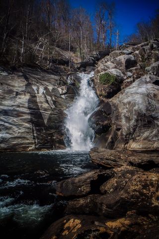
Rudis Falls
Transylvania County, North Carolina
Your visit at a glance
- Waterfall height
- Not recorded
- Location
- Transylvania County, North Carolina
- Ground elevation
- About 1,629 ft above sea level
- Within this boundary
- Nantahala National Forest
- Nearby mapped access
- No nearby parking or trailhead recorded
A nearby mapped parking area or trailhead may not connect to this waterfall. Confirm the route and public access before travelling.
Rudis Falls is mapped in Transylvania County, North Carolina, 17.8 miles southwest of Brevard. This entry shows its location and nearby mapped places; a visitor route has not been confirmed.
About this location
Land & access
The waterfall is mapped inside the boundary of Nantahala National Forest. This boundary can include private land. Public access at the waterfall has not been confirmed.
Nearby named trails
- Hilliard Falls Spur Trail
These paths are mapped within 250 metres (about 820 feet) of the waterfall. A connection to a viewpoint has not been verified.
Sources for these details
Nearby streams and paths: OpenStreetMap. Land names: USGS PAD-US ownership records, with planning boundaries used only where ownership has no usable name. Ground elevation: USGS 3D Elevation Program.
Map records do not verify a walking route or current access conditions.
Before you make the trip
No nearby trailhead or parking area is recorded. Check the land manager’s visitor information for a permitted route.
Trail length, parking rules and current conditions have not been confirmed for this entry.
More waterfalls nearby
Within 40 straight-line miles. Road and trail distances will differ.
- Hilliard FallsLong backcountry trail hike; about 12 miles returnTransylvania County, NC0.2 miSW
- Standing Up Rock FallsTransylvania County, NC1.0 miN
- Rooster Tail FallsTransylvania County, NC1.1 miN
- Hen Tail FallsTransylvania County, NC1.1 miN
- Rich FallsOld logging road, river wade and very steep side pathTransylvania County, NC1.2 miW
- Standing Stone FallsTransylvania County, NC1.2 miSW
 Windy FallsPartial guide: unofficial route to the top of a dangerous falls; trail name not in the current park trail list197 ft (60 m) · Transylvania County, NC1.3 miN
- Big FallsPartial guide: unofficial trail, dangerous ford and scramble; parking and land permission details unconfirmed197 ft (60 m) · Transylvania County, NC1.3 miSW
- Bearcamp Creek FallsPartial guide: route source is from 2006 and the match to this waterfall is probableTransylvania County, NC1.3 miSE