Paradise Falls
Jackson County, North Carolina
Your visit at a glance
- Waterfall height
- Not recorded
- Location
- Jackson County, North Carolina
- Access status
- National forest; steep unofficial paths and dam-controlled flow
- The walk
- About 0.4 to 0.75 miles each way
- Ground & access
- Difficult. Very steep, eroded unofficial paths with a landslide area, a creek crossing and cliffs. Stay away from the top of the falls.
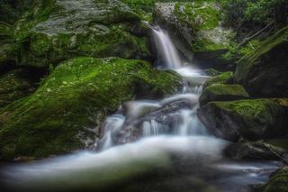
This is the waterfall on Wolf Creek below Wolf Creek Lake that many people call Paradise Falls. NC Waterfalls calls it by its traditional local name, Wolf Creek Falls. A different Paradise Falls on the East Fork Tuckasegee River is on Duke Energy and private land and is reached by boat. From the US 64 and NC 281 junction east of Lake Toxaway, drive north on NC 281 about 12.7 miles, past Tanasee Creek Lake and across Wolf Creek Dam, to a large pullout on the left 0.4 miles beyond the dam. Two paths drop from the parking area. The path from the middle of the lot descends steeply to a T junction; turn left to the creek, cross it, and follow the path up onto a ridge. Cross the ridge and make the very steep descent to the pool at the base. Staying on the ridge spine leads instead to the top of the falls, which is dangerous.
Plan your visit
NC 281 pullout past Wolf Creek Dam, steep unofficial paths across Wolf Creek to the base of the falls (Wolf Creek Falls)
NC Waterfalls gives a hike distance of about 0.4 miles. Take a Hike calls it a 1.5 mile round trip. The sources differ.
Difficult. Very steep, eroded unofficial paths with a landslide area, a creek crossing and cliffs. Stay away from the top of the falls.
Where to start
Large pullout on the left side of NC 281, 0.4 miles beyond Wolf Creek Dam. Do not park in the church lot just beyond it. Published trailhead coordinates: 35.225495, -83.003492.
Timing & water
Wolf Creek Dam upstream controls the flow, and water released from the dam can raise the creek without warning. Two people died here in 2004 after heavy rain. Crossing the creek may not be safe in high water.
Before you go
No fee is mentioned in the sources read. Nantahala National Forest, Nantahala Ranger District.
Visitor informationVisit sources
More waterfalls nearby
Within 40 straight-line miles. Road and trail distances will differ.
- Grandmas Kitchen FallsJackson County, NC0.8 miSW
- Bonas Defeat FallsJackson County, NC0.9 miS
- Slickens Creek FallsJackson County, NC1.0 miS
- Doe Branch FallsJackson County, NC1.0 miS
- Anvil Horn FallsJackson County, NC1.1 miS
- Tuckasegee River FallsJackson County, NC1.4 miSE
- Flat Creek FallsJackson County, NC1.6 miW
- Sols Creek FallsPartial guide: falls on private land; legal view only by boat from Bear Creek LakeJackson County, NC1.9 miNW
 Verde FallsJackson County, NC2.2 miW