Laughing Falls
Transylvania County, North Carolina
Your visit at a glance
- Waterfall height
- Not recorded
- Location
- Transylvania County, North Carolina
- Access status
- Partial guide: informal parking at gates, no trail to the base, private land beyond
- The walk
- About 0.6 mile return
- Ground & access
- Gated forest road and overgrown road, a rock-hop creek crossing that may be hard in high water, then a steep unofficial scramble. Rocks are very slippery; vegetation is thick at the base.
At the end of Turkey Creek Road both forks are gated. Walk down the right-hand gated road to South Prong Turkey Creek and cross on rocks. Right after the crossing, turn left on a more overgrown road that follows the creek upstream for about a quarter mile until you hear the 50-foot cascade. There is no real trail to the base; a steep path used by others leads down. If you reach a private property sign, you have gone too far.
Plan your visit
End of Turkey Creek Road to Laughing Falls on South Prong Turkey Creek
Waterfall Hero gives 0.6 mile for the whole out-and-back hike. The legacy account gives about a quarter mile from the creek crossing to the falls.
Gated forest road and overgrown road, a rock-hop creek crossing that may be hard in high water, then a steep unofficial scramble. Rocks are very slippery; vegetation is thick at the base.
Where to start
From US 64/US 276 east of Brevard, take NC 280 east 0.8 mile, turn left on Old NC 280, then left on Turkey Creek Road (SR 1361) after about 0.2 mile and drive 0.7 mile to the end. Park on the right without blocking either gate. This is not a signed trailhead.
Timing & water
Creek crossing can be difficult in high water. Current conditions unverified.
Before you go
Current fees and reservation requirements unknown.
Visitor informationVisit sources
More waterfalls nearby
Within 40 straight-line miles. Road and trail distances will differ.
- Silver Ribbon FallsTransylvania County, NC0.1 miE
- Sutton FallsTransylvania County, NC1.0 miNE
- Sitton Creek FallsTransylvania County, NC2.0 miNE
- Clawhammer FallsPartial guide: short off-trail finish and the FR 477 vehicle closure status is unverifiedTransylvania County, NC3.3 miNW
- Avery Creek FallsNational forest trail route documentedTransylvania County, NC3.4 miNW
- Key FallsPartial guide: private land, roadside view only, parking spot not confirmedTransylvania County, NC3.6 miSE
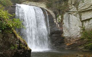 Looking Glass FallsResearched visit notes59 ft (18 m) · Transylvania County, NC3.8 miW
- High FallsPartial guide: unofficial path and river wade; trail beyond Billy Branch not checked since HeleneTransylvania County, NC4.1 miNW
- Upper Avery Creek FallsPartial guide: forest trail route described; vehicle access on FR 477 was limited and current status is unknownTransylvania County, NC4.4 miNW