Upper Middle Creek Falls
Macon County, North Carolina
Your visit at a glance
- Waterfall height
- Not recorded
- Location
- Macon County, North Carolina
- Access status
- Short path from a small highway pull-off to an overlook
- The walk
- About 0.1 miles return
- Ground & access
- Short steep path to a rock viewpoint. You can scramble to creek level, but the top of the falls cannot be seen from there. Rocks are very slippery.
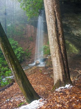
Upper Middle Creek Falls is a 40-foot waterfall on Middle Creek in Nantahala National Forest near Scaly Mountain. Follow the path from the pull-off down and under power lines to a split after a couple hundred feet. The left path goes to Middle Creek Falls. Turn right on the path that leads about 100 feet down to a rock above the creek with a view of the upper falls.
Plan your visit
NC 106 shoulder pull-off at the school bus stop sign, short path down to a rock overlook of Upper Middle Creek Falls
Waterfall Hero gives a 0.1-mile hike from the NC 106 pull-off to the overlook rock.
Short steep path to a rock viewpoint. You can scramble to creek level, but the top of the falls cannot be seen from there. Rocks are very slippery.
Where to start
Grassy, narrow pull-off on the right shoulder of NC 106 at a School Bus Stop Ahead sign, 9.3 miles south of the US 64 and NC 106 junction in Highlands. Room for one or two cars.
Timing & water
Pull fully off the highway.
Before you go
No fee is mentioned.
Visitor informationVisit sources
More waterfalls nearby
Within 40 straight-line miles. Road and trail distances will differ.
- Middle Creek FallsNational forest; unofficial path, very difficultMacon County, NC0.2 miNW
- Dome FallsPartial: no trail; extremely difficult bushwhackMacon County, NC0.6 miNW
- Serenity FallsMacon County, NC2.9 miE
- Lower Serenity FallsMacon County, NC2.9 miE
- Catstairs FallsMacon County, NC3.3 miNE
- Blue Valley FallsMacon County, NC4.1 miNE
 Picklesimer Rock House FallsEasy walk on a gated forest road in Nantahala National ForestMacon County, NC4.3 miE
- Chasm FallsShort but difficult; creek crossing for the base viewMacon County, NC4.5 miE
- Glen FallsParking and overlook approach researchedMacon County, NC5.3 miE