Twin Boulder Falls
Transylvania County, North Carolina
Your visit at a glance
- Waterfall height
- 66 ft (20 m)
- Location
- Transylvania County, North Carolina
- Access status
- Long national forest hike; last half mile on an unofficial path
- The walk
- About 5.4 to 5.6 miles return (2.8 miles each way)
- Ground & access
- Difficult. About 1,300 feet of climbing, a rock-hop crossing of Right Fork that can need wading, and an overgrown unofficial path for the last part.
Twin Boulder Falls is a 60-foot waterfall on Right Fork of the Davidson River in Pisgah National Forest. From the FR 475 lot, pass the gate on FR 5046, cross the Davidson River bridge and turn left on Daniel Ridge Loop Trail (#105). At about 1.9 miles turn left on Farlow Gap Trail (#106), cross Right Fork and climb the switchbacks. After the third left-hand switchback, follow the faint path straight up Right Fork, cross Lanning Branch, and continue to the two large boulders below the falls.
Plan your visit
FR 475 parking near Tom Spring Falls on Daniel Ridge Loop Trail and Farlow Gap Trail, then an unofficial path up Right Fork
Waterfall Hero lists 5.4 miles for the hike; the legacy page gives 2.8 miles one way, with the last half to three quarters of a mile off the official trail.
Difficult. About 1,300 feet of climbing, a rock-hop crossing of Right Fork that can need wading, and an overgrown unofficial path for the last part.
Where to start
Dirt lot on the right of FR 475, about 3.9 miles from US 276 near the Pisgah Center for Wildlife Education. Same parking as Tom Spring (Daniel Ridge) Falls.
Timing & water
FR 475 is not on the Forest Service storm-damage closure list. Avoid the Right Fork crossing in high water.
Before you go
No fee is mentioned in the reviewed sources.
Visitor informationVisit sources
More waterfalls nearby
Within 40 straight-line miles. Road and trail distances will differ.
- Second FallsResearched visit notes66 ft (20 m) · Haywood County, NC0.9 miN
- Upper FallsNational forest trails from Blue Ridge Parkway overlooks; busy area49 ft (15 m) · Haywood County, NC1.1 miNW
- Shuck Ridge Creek FallsLong Forest Service trail hike with a steep scramble to the baseTransylvania County, NC1.1 miSW
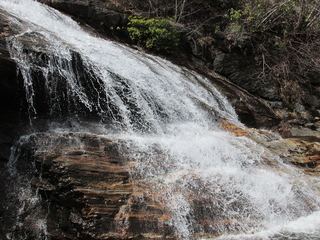 Yellowstone FallsNational forest trails, then a steep scramble path; base not recommended98 ft (30 m) · Haywood County, NC1.2 miNE
- Skinny Dip FallsShort trail from a Blue Ridge Parkway overlook; creek crossing without a bridgeHaywood County, NC1.3 miNE
- Upper Toms Spring FallsNational forest loop on a forest road and trailTransylvania County, NC1.3 miSE
- Serpentine FallsHaywood County, NC1.5 miNE
- Upper Dark Prong FallsHaywood County, NC1.6 miN
- Dark Prong FallsHaywood County, NC1.7 miNE