Skinny Dip Falls
Haywood County, North Carolina
Your visit at a glance
- Waterfall height
- Not recorded
- Location
- Haywood County, North Carolina
- Access status
- Short trail from a Blue Ridge Parkway overlook; creek crossing without a bridge
- The walk
- About 0.8 miles return
- Ground & access
- Moderate trail with stairs and a creek crossing without a bridge. Slippery rocks.
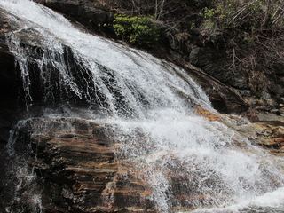
Cross the Parkway at the north side of the overlook and take the obvious spur trail, passing the Dragon Tree, to the Mountains-to-Sea Trail. Follow the MST toward Yellowstone Prong, down some stairs, for under half a mile. The bridge at the creek is gone, so you must rock hop or wade across below the falls. The trail continues up alongside the falls. Tropical Storm Fred in 2021 moved boulders and changed the falls.
Plan your visit
Looking Glass Rock Overlook (Blue Ridge Parkway milepost 417) via a spur and the Mountains-to-Sea Trail to Skinny Dip Falls
NCWaterfalls gives about 0.4 miles; Waterfall Hero gives a 0.8-mile hike from the same overlook.
Moderate trail with stairs and a creek crossing without a bridge. Slippery rocks.
Where to start
Looking Glass Rock Overlook at Blue Ridge Parkway milepost 417, about halfway between US 276 and NC 215. Waterfall Hero says this popular lot fills fast.
Timing & water
The National Park Service lists the Parkway from milepost 411.9 to 418.7 as open. Parkway sections can close in winter and bad weather; the creek crossing is harder in high water.
Before you go
Current fees and reservation requirements unknown.
Visitor informationVisit sources
More waterfalls nearby
Within 40 straight-line miles. Road and trail distances will differ.
 Yellowstone FallsNational forest trails, then a steep scramble path; base not recommended98 ft (30 m) · Haywood County, NC0.4 miW
- Dark Prong FallsHaywood County, NC0.4 miN
- Serpentine FallsHaywood County, NC0.6 miNW
- Second FallsResearched visit notes66 ft (20 m) · Haywood County, NC0.7 miW
- Upper Logging Road FallsNational forest; forest road then a short off-trail climbTransylvania County, NC1.1 miE
- Twin Boulder FallsLong national forest hike; last half mile on an unofficial path66 ft (20 m) · Transylvania County, NC1.3 miSW
- Logging Road FallsEasy walk on a gated forest roadTransylvania County, NC1.3 miE
- Lower Greasy Cove FallsHaywood County, NC1.4 miN
- GPS FallsHaywood County, NC1.4 miN