Upper Falls
Haywood County, North Carolina
Your visit at a glance
- Waterfall height
- 49 ft (15 m)
- Location
- Haywood County, North Carolina
- Access status
- National forest trails from Blue Ridge Parkway overlooks; busy area
- The walk
- About 1.5 miles each way from John Rock Overlook, or 1.3 miles from Graveyard Fields Overlook
- Ground & access
- Moderate. Rocky, rooty trail with braided side paths, a creek crossing or wade if you start at John Rock, and a rock scramble at the end. Wet rock is slippery.
Upper Falls is the farthest upstream of the three waterfalls on Yellowstone Prong in Graveyard Fields, Pisgah National Forest. From the south end of John Rock Overlook (Parkway milepost 419.4), cross the road and descend 0.6 miles on a wide gravel trail to the Graveyard Fields Loop Trail. Continue straight, past a second loop trail junction, to Yellowstone Prong. There is no bridge here: rock-hop or wade, or go back to the loop trail and use the footbridge downstream. About 75 yards past the creek, turn left on Upper Falls Trail. Stay on the widest path through a network of side paths for just under 0.4 miles, turn left at a T junction and cross a side stream. The trail climbs and becomes rocky. At a jumble of rocks about 0.4 miles from the creek, turn right and scramble up the obvious path to the base of the main upper section. From Graveyard Fields Overlook, take the loop trail from the west end of the lot to the footbridge over Yellowstone Prong; Upper Falls Trail splits left shortly after the bridge.
Plan your visit
Blue Ridge Parkway John Rock Overlook (or Graveyard Fields Overlook), trails across Yellowstone Prong and up the valley to Upper Falls
NC Waterfalls gives 1.5 miles from John Rock Overlook and 1.3 miles from Graveyard Fields Overlook. Waterfall Hero gives 2.8 miles for the out-and-back from Graveyard Fields Overlook.
Moderate. Rocky, rooty trail with braided side paths, a creek crossing or wade if you start at John Rock, and a rock scramble at the end. Wet rock is slippery.
Where to start
John Rock Overlook at Blue Ridge Parkway milepost 419.4, or Graveyard Fields Overlook at milepost 418.9. Graveyard Fields is very popular and parking fills fast. Published coordinates: John Rock 35.316691, -82.855117; Graveyard Fields 35.320426, -82.846946.
Timing & water
The Park Service road status page lists the Blue Ridge Parkway section at Graveyard Fields as open. Sections of the Parkway close in winter and for weather; check the road status page before you go.
Before you go
No fee is mentioned in the sources read. Pisgah National Forest, Pisgah Ranger District.
Visitor informationVisit sources
More waterfalls nearby
Within 40 straight-line miles. Road and trail distances will differ.
- Upper Dark Prong FallsHaywood County, NC1.1 miNE
- Twin Boulder FallsLong national forest hike; last half mile on an unofficial path66 ft (20 m) · Transylvania County, NC1.1 miSE
- Second FallsResearched visit notes66 ft (20 m) · Haywood County, NC1.2 miE
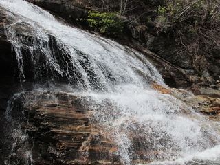 Yellowstone FallsNational forest trails, then a steep scramble path; base not recommended98 ft (30 m) · Haywood County, NC1.5 miE
- Shuck Ridge Creek FallsLong Forest Service trail hike with a steep scramble to the baseTransylvania County, NC1.6 miS
- Serpentine FallsHaywood County, NC1.6 miNE
- Upper Greasy Cove FallsHaywood County, NC1.7 miN
- Waterfalls of Flat Laurel CreekPartial: trail to the cascades documented; which cascade this listing marks is not confirmedHaywood County, NC1.8 miW
- Skinny Dip FallsShort trail from a Blue Ridge Parkway overlook; creek crossing without a bridgeHaywood County, NC1.8 miE