Walker Falls
Buncombe County, North Carolina
Your visit at a glance
- Waterfall height
- Not recorded
- Location
- Buncombe County, North Carolina
- Access status
- Partial guide: roadside falls on a road closed to vehicles since Hurricane Helene; walking distance unknown
- The walk
- Roadside view when the road is open to vehicles; walking distance from the current vehicle closure is unknown
- Ground & access
- Roadside. The scramble to the base is steep and the rocks are slippery. Storm damage along the road.
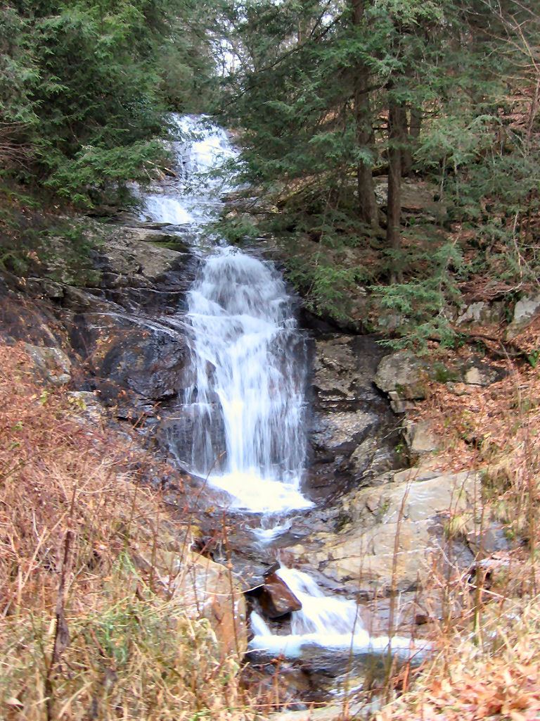
Walker Falls is a 40 to 45 foot waterfall on Walker Branch beside Big Ivy Road (FR 74), on the way to the Douglas Falls trailhead. Before Hurricane Helene, visitors drove about four miles up the unpaved road from the end of Dillingham Road and pulled off on the left just before the falls. A steep scramble leads to the base, where only the lower part is visible. After Helene the Forest Service closed the Big Ivy road to motor vehicles past the parking area on Ranger Road. A news report on the Forest Service recovery work says drivers can only reach the Ranger Road and Coleman Boundary Road intersection, and vehicle access to Douglas Falls is targeted for summer 2027. The walk from there to Walker Falls was not described.
Plan your visit
Roadside view from Big Ivy Road (FR 74) in the Big Ivy area of Pisgah National Forest
Waterfall Hero gives less than 0.1 miles, with the falls seen from the road. Romantic Asheville places the falls about four miles up the unpaved FR 74. The distance from the point where vehicles must now stop was not given by any reviewed source.
Roadside. The scramble to the base is steep and the rocks are slippery. Storm damage along the road.
Where to start
Before the closure: pull-off on the left of FR 74 just before the falls (published coordinates 35.75576, -82.35446). Now: vehicles must stop at the Ranger Road parking area or the Ranger Road and Coleman Boundary Road intersection; parking space there was not described.
Timing & water
FR 74 is closed to motor vehicles after Hurricane Helene damage. Romantic Asheville notes the road is usually closed in winter (December to March) even in normal years.
Before you go
No fee or reservation is mentioned.
Visitor informationVisit sources
More waterfalls nearby
Within 40 straight-line miles. Road and trail distances will differ.
 Glassmine FallsOverlook approach verified; no public access to the waterfallBuncombe County, NC1.9 miSE
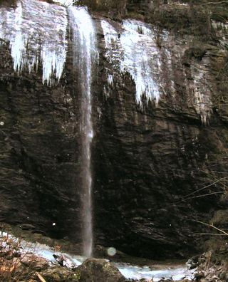 Douglas FallsGraybeard approach documented; Big Ivy road approach has a motor-vehicle closure.Buncombe County, NC2.7 miSW
- Cascades FallsBuncombe County, NC3.1 miS
- Mitchell Falls33 ft (10 m) · Yancey County, NC4.2 miE
- Falling Water Branch FallsPartial guide: no built trail, steep overgrown grades, route uncertain after Helene, parking not formalizedYancey County, NC4.3 miNE
- Middle Fork Rock Creek Falls79 ft (24 m) · Yancey County, NC5.8 miE
- Galvladi FallsYancey County, NC6.4 miNE
- Graybeard FallsPrivate conservation land open to hikers; blazed trailBuncombe County, NC6.8 miSE
- Guyot FallsYancey County, NC6.8 miNE