Little Creek Falls
Swain County, North Carolina
Your visit at a glance
- Waterfall height
- Not recorded
- Location
- Swain County, North Carolina
- Access status
- National park trails; long day hike; parking tag required
- The walk
- About 12.4 miles return
- Ground & access
- Long day hike on old road and narrow trail with a steady climb to Deeplow Gap and a descent to the falls, so the return includes a climb back to the gap. Rocks at the falls are very slippery.
Hike Thomas Divide Trail, which starts as a gated road. Stone Pile Gap Trail joins from the left in just over a mile. At 3.2 miles the road continues as Indian Creek Motor Trail; turn right to stay on Thomas Divide Trail, now a narrow path that is overgrown in places. At about 5.5 miles, at the four-way junction at Deeplow Gap, turn right on Deeplow Gap Trail. It descends, crosses Little Creek, and switchbacks back toward it; a footbridge crosses the creek below the 60-foot falls. Return the same way.
Plan your visit
Thomas Divide trailhead on Tom Branch Road near Deep Creek, Thomas Divide Trail to Deeplow Gap, then Deeplow Gap Trail down to Little Creek Falls
Waterfall Hero lists 12.4 miles round trip. Deeplow Gap is at about 5.5 miles, and the falls are just under a mile down Deeplow Gap Trail. The older 3-mile route from a private trout farm is no longer open to the public.
Long day hike on old road and narrow trail with a steady climb to Deeplow Gap and a descent to the falls, so the return includes a climb back to the gap. Rocks at the falls are very slippery.
Where to start
Thomas Divide trailhead parking on the left of Tom Branch Road, about 1 mile past the narrow bridge where the road turns to gravel, off West Deep Creek Road north of Bryson City. Published coordinates: 35.46504, -83.41919.
Timing & water
No closure is stated. The route description dates from September 2024.
Before you go
A Great Smoky Mountains parking tag is required for any vehicle parked longer than 15 minutes: $5 daily, $15 weekly or $40 annual. Dogs are not allowed on this trail.
Visitor informationVisit sources
More waterfalls nearby
Within 40 straight-line miles. Road and trail distances will differ.
- Indian Creek FallsOfficial park trail; parking tag required11 ft (3.5 m) · Swain County, NC3.9 miSW
- Tom Branch FallsEasy national park trail; parking tag required49 ft (15 m) · Swain County, NC4.2 miSW
- Juney Whank FallsOfficial park trail; parking tag requiredSwain County, NC4.5 miSW
- Cliff Branch FallsRoadside view on Newfound Gap Road with a narrow pulloutSwain County, NC5.3 miN
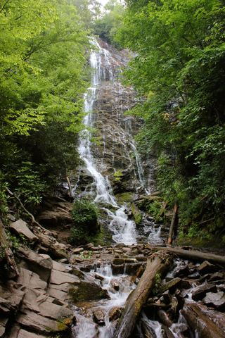 Mingo FallsResearched visit notesAbout 120 ft · Swain County, NC5.8 miE
- Hitchin Post FallsSwain County, NC6.3 miNE
- Chasteen Creek CascadeNational Park Service route, distance and parking rules documentedSwain County, NC6.6 miNE
- Taywa Creek CascadeSwain County, NC7.0 miN
- Sweat Heifer CascadesNational park trails; 7.4-mile return with a long climb back; parking tag requiredSwain County, NC7.8 miN