Drift Falls
Transylvania County, North Carolina
Your visit at a glance
- Waterfall height
- 33 ft (10 m)
- Location
- Transylvania County, North Carolina
- Access status
- Public trail to a boundary view; falls on private land
- The walk
- About 3.5 to 4 miles return
- Ground & access
- Graveled state park trail, then an earthen forest trail with moderate climbs and two easy creek crossings. Rocks at the river are slippery.
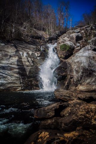
From US 64 west of Lake Toxaway, drive south on NC 281 for 0.9 miles and turn left into Gorges State Park. Drive 0.95 miles to the visitor center, turn left and drive 0.8 miles to the Grassy Ridge parking area. From the kiosks, hike 0.3 miles to a T-junction and turn right on the orange-blazed Rainbow Falls Trail. The trail leaves the state park and enters Pisgah National Forest, passing Hidden Falls, Rainbow Falls and Turtleback Falls. Above Turtleback Falls take the left fork; the trail ends at a fence a little under 0.2 miles later. The fence is the boundary with private land. Follow the path along the fence down to the riverbed for a view of Drift Falls, a 42 foot river-wide slide. Do not go up to the plunge pool, which is private property. Sliding is prohibited.
Plan your visit
Grassy Ridge parking in Gorges State Park, Rainbow Falls Trail past Rainbow and Turtleback Falls to the forest boundary view of Drift Falls
NC Waterfalls gives just under 2 miles one way. Waterfall Hero gives 3.4 miles round trip to the boundary viewpoint.
Graveled state park trail, then an earthen forest trail with moderate climbs and two easy creek crossings. Rocks at the river are slippery.
Where to start
Grassy Ridge parking area in Gorges State Park, 976 Grassy Ridge Road, Sapphire. Published trailhead coordinates: 35.088764, -82.95187.
Timing & water
Gorges State Park gates close in the evening; hours vary by month. The waterfall itself is on private land and is viewed only from the national forest side of the fence.
Before you go
No fee for day use at Gorges State Park or on the Rainbow Falls Trail. Dogs on a leash no longer than 6 feet.
Visitor informationVisit sources
More waterfalls nearby
Within 40 straight-line miles. Road and trail distances will differ.
- Turtleback FallsState park trailhead; national forest trail13 ft (4 m) · Transylvania County, NC0.2 miE
- Rainbow FallsMarked trail from Gorges State Park; steep, popular hike128 ft (39 m) · Transylvania County, NC0.3 miSE
- Stairway FallsState park trailhead; unofficial side path in the national forest39 ft (12 m) · Transylvania County, NC0.9 miSE
- Little FallsTransylvania County, NC0.9 miNW
- Sidepocket FallsPartial guide: rough unmaintained path below Stairway Falls; route last described in detail in 200349 ft (15 m) · Transylvania County, NC1.1 miSE
- Miller FallsTransylvania County, NC1.2 miNW
 Windy FallsPartial guide: unofficial route to the top of a dangerous falls; trail name not in the current park trail list197 ft (60 m) · Transylvania County, NC1.5 miSE
- Upper Bearwallow FallsState park trail; short steep walk to an overlook98 ft (30 m) · Transylvania County, NC1.6 miNE
- Hen Tail FallsTransylvania County, NC1.7 miS