Davids Falls
McDowell County, North Carolina
Your visit at a glance
- Waterfall height
- Not recorded
- Location
- McDowell County, North Carolina
- Access status
- National forest trail; river crossings on the spur
- The walk
- About 1.95 miles each way
- Ground & access
- Easy to moderate to Catawba Falls, then a long stair climb. The Davids Falls spur has four river crossings; the third and fourth may require wading.
From I-40 Exit 73 in Old Fort, follow Catawba River Road 3.1 miles to its end at the large Catawba Falls parking area. Take Catawba Falls River Trail past Lower Catawba Falls and Catawba Falls, then climb the stair system of about 500 steps to Upper Catawba Falls. Before the steps down to the Upper Catawba Falls viewing deck, a side path on the right climbs the bank beside the falls. It crosses the river four times, two of them usually rock hops, before a short side path on the left drops to Davids Falls, an 18 foot cascade and slide. Return the same way, or complete the loop on Catawba Falls Ridge Trail.
Plan your visit
Catawba Falls trailhead at the end of Catawba River Road to Upper Catawba Falls, then the side path to Davids Falls
NC Waterfalls gives a hike distance of 1.95 miles to Davids Falls. The Forest Service gives the Catawba Falls loop as 3.5 miles; Davids Falls is a spur off that loop.
Easy to moderate to Catawba Falls, then a long stair climb. The Davids Falls spur has four river crossings; the third and fourth may require wading.
Where to start
Large Forest Service lot at the end of Catawba River Road, 3.1 miles from I-40 Exit 73. Restrooms at the trailhead.
Timing & water
The Forest Service page says the loop trail is open but the upper viewing platform and Wildflower Trail remain closed after Hurricane Helene. Check the Forest Service page before visiting.
Before you go
No fee is stated on the Forest Service page.
Visitor informationMore waterfalls nearby
Within 40 straight-line miles. Road and trail distances will differ.
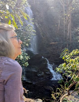 Upper Catawba FallsPartial: loop trail open; the Forest Service lists the upper viewing platform as closedMcDowell County, NC0.6 miNE
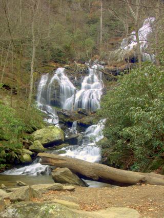 Catawba FallsLoop open; upper platform and Wildflower Trail closedMcDowell County, NC0.8 miNE
- Lower Catawaba FallsNational forest trail; view from the trail onlyMcDowell County, NC0.9 miNE
- Graybeard FallsPrivate conservation land open to hikers; blazed trailBuncombe County, NC5.6 miN
- Standing Rock FallsMcDowell County, NC6.8 miSE
- Slick FallsMcDowell County, NC7.1 miNE
- Hickory Branch FallsMcDowell County, NC7.7 miNE
- Broad River FallsBuncombe County, NC7.8 miS
- Tom's FallsBuncombe County, NC8.2 miS