North Shoal Creek Falls
Cherokee County, North Carolina
Your visit at a glance
- Waterfall height
- Not recorded
- Location
- Cherokee County, North Carolina
- Access status
- Partial: no trail for the first part; short steep bushwhack on national forest land
- The walk
- About 0.4 miles (Waterfall Hero hike length)
- Ground & access
- No trail on public land for the first part. Steep open slope down to the lake, then a creekside path. The rocks at the falls are very slippery.
From the pull-off on Prospect Road, bushwhack down toward Lake Apalachia while staying on national forest land. The slope is open but steep. At lake level, turn right and follow a path up North Shoal Creek, past cascades, to the base of the 30-foot falls. Return the same way.
Plan your visit
Prospect Road pull-off on national forest land, short bushwhack down to Lake Apalachia, then a creekside path up North Shoal Creek to the falls
Waterfall Hero lists the hike length as 0.4 miles. It does not say if this is one way or return. Most of the approach is off trail.
No trail on public land for the first part. Steep open slope down to the lake, then a creekside path. The rocks at the falls are very slippery.
Where to start
Pull-off on gravel Prospect Road about 0.6 miles from Morrow Road, just after the road enters national forest land. Waterfall Hero gives trailhead coordinates 35.17658, -84.23215. Route from Murphy: US 64 west, NC 294, Hiwassee Dam Road across Hiwassee Dam, then Morrow Road.
Timing & water
No closure is stated by the sources. Waterfall Hero says the falls look best in high water.
Before you go
Tusquitee Ranger District, Nantahala National Forest. No fee is stated by the sources.
Visitor informationVisit sources
More waterfalls nearby
Within 40 straight-line miles. Road and trail distances will differ.
- South Shoal Creek FallsCherokee County, NC2.6 miS
- Coker Creek Falls (4) 45Partial guide: Forest Service trailhead documented; which drop in the series this listing marks is not confirmedPolk County, TN7.8 miW
- Conasauga FallsRoute and parking researchedMonroe County, TN10 miNW
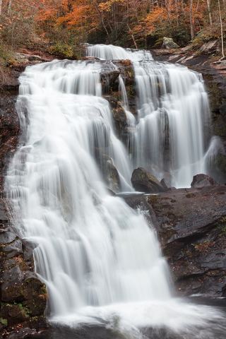 Bald River FallsRoadside viewing area and parking documented; USFS reports open.Monroe County, TN11 miN
- Baby FallsPartial notes: parking documented; pedestrian approach unverified.Monroe County, TN11 miN
- Tellico FallsNational forest old road; river ford requiredCherokee County, NC12 miNE
- Big Lost Falls164 ft (50 m) · Polk County, TN13 miW
- Mitchell Lick FallsGraham County, NC15 miNE
- Blue Boar FallsGraham County, NC15 miNE