Coker Creek Falls (4) 45
Polk County, Tennessee
Your visit at a glance
- Waterfall height
- Not recorded
- Location
- Polk County, Tennessee
- Access status
- Partial guide: Forest Service trailhead documented; which drop in the series this listing marks is not confirmed
- The walk
- A short distance down the trail to the first cascades, per a visitor account; no distance is published for this drop
- Ground & access
- Creekside trail. Farther down, the trail climbs high above the stream, with sheer drops off the bluff. Blowdowns may require short detours.
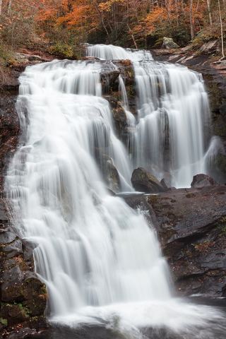
Coker Creek Falls is a series of cascades, single drops and pools on Coker Creek in the Cherokee National Forest. The Forest Service directions end at a trailhead at the end of Forest Road 2138. A visitor account describes the trail sign a short way down the trail from the parking area, then cascades and falls one after another downstream, with a spur trail closer to the stream. This listing sits about 110 m from the trailhead and appears to mark one drop in this series; which drop it marks is not confirmed. Return the same way.
Plan your visit
Coker Creek Falls trailhead at the end of Forest Road 2138, then the creekside Coker Creek Falls trail downstream
A visitor account says the first of many cascades comes just a short distance past the trail sign, and that a flat rock area is about a mile past the parking area. The Forest Service page gives no trail distance.
Creekside trail. Farther down, the trail climbs high above the stream, with sheer drops off the bluff. Blowdowns may require short detours.
Where to start
Trailhead parking at the end of Forest Road 2138. From Highway 68, take County Road 625 (Ironsburg Road) about 0.75 miles, turn left on Ducket Ridge Road (Forest Road 22) for about 2.25 miles, then left on Forest Road 2138 for about 1 mile to the end, per the Forest Service.
Timing & water
The Forest Service lists the site as open. No restrooms or drinking water at the site.
Before you go
No fee is mentioned.
Visitor informationVisit sources
More waterfalls nearby
Within 40 straight-line miles. Road and trail distances will differ.
- Big Lost Falls164 ft (50 m) · Polk County, TN6.1 miSW
- Conasauga FallsRoute and parking researchedMonroe County, TN7.7 miN
- North Shoal Creek FallsPartial: no trail for the first part; short steep bushwhack on national forest landCherokee County, NC7.8 miE
- South Shoal Creek FallsCherokee County, NC9.0 miSE
- Lowry FallsPartial guide: national forest trail documented; distance and the exact named falls are not confirmedPolk County, TN9.5 miW
- Benton FallsResearched route and starting areaPolk County, TN13 miW
- Rock Creek FallsNational forest trail route documented; two creek crossingsPolk County, TN13 miW
 Bald River FallsRoadside viewing area and parking documented; USFS reports open.Monroe County, TN14 miNE
- Baby FallsPartial notes: parking documented; pedestrian approach unverified.Monroe County, TN14 miNE