Lowry Falls
Polk County, Tennessee
Your visit at a glance
- Waterfall height
- Not recorded
- Location
- Polk County, Tennessee
- Access status
- Partial guide: national forest trail documented; distance and the exact named falls are not confirmed
- The walk
- About 0.25 to 0.3 mile, per two sources; a state park ranger hike describes about 2 miles up steep terrain to a waterfall on this trail
- Ground & access
- Old gravel road at first, then rougher and steeper toward the falls. Roots, rocks, wet sections and some steep spots that need handholds.
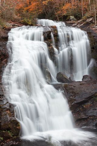
Lowry Falls Trail is a Cherokee National Forest trail off TN 30 in Polk County with several small waterfalls, rock bluffs and rhododendron. It begins on an old gravel road and gets harder as it nears the falls area. A hiking blog says that about 0.25 mile in, a rock bluff runs beside the trail; walk under the bluff to reach the best waterfall. A state park ranger program describes the same trailhead as a steep 2-mile climb past cascades to a waterfall, with roots, rocks and sections that need handholds. Which waterfall along the trail is the one named Lowry Falls is not confirmed, so this is a partial guide. Do not climb on the falls.
Plan your visit
Lowry Falls Trail (FS Trail 168) from its sign on TN 30, an old gravel road past small waterfalls to a rock bluff and the main falls
The Blue Ridge Highlander gives the trail as 0.25 mile long, and a hiking blog gives 0.3 mile, with the best waterfall under a rock bluff about 0.25 mile in. A Hiwassee Scenic River State Park ranger hike describes a 2-mile steep walk up to a waterfall from the Lowry Falls trailhead. The sources do not agree.
Old gravel road at first, then rougher and steeper toward the falls. Roots, rocks, wet sections and some steep spots that need handholds.
Where to start
Trailhead on TN 30, about 12 miles from US 64, at a small roadside pull-off big enough for one vehicle, per the Blue Ridge Highlander. A hiking blog instead parked at the Taylor's Island parking area on TN 30 and walked 0.15 miles along the road to the trail sign; walking on the highway shoulder carries traffic risk.
Timing & water
No season limits are stated. The trail can be wet.
Before you go
No fee is mentioned.
Visitor informationVisit sources
More waterfalls nearby
Within 40 straight-line miles. Road and trail distances will differ.
- Benton FallsResearched route and starting areaPolk County, TN6.5 miSW
- Rock Creek FallsNational forest trail route documented; two creek crossingsPolk County, TN7.1 miSW
- Big Lost Falls164 ft (50 m) · Polk County, TN7.2 miSE
- Coker Creek Falls (4) 45Partial guide: Forest Service trailhead documented; which drop in the series this listing marks is not confirmedPolk County, TN9.5 miE
- Conasauga FallsRoute and parking researchedMonroe County, TN13 miNE
- North Shoal Creek FallsPartial: no trail for the first part; short steep bushwhack on national forest landCherokee County, NC17 miE
- Jacks River Falls 80Published trail route and distance documented; long wilderness hikeFannin County, GA17 miS
- South Shoal Creek FallsCherokee County, NC18 miE
 Bald River FallsRoadside viewing area and parking documented; USFS reports open.Monroe County, TN21 miE