Linville Falls
Burke County, North Carolina
Your visit at a glance
- Waterfall height
- Not recorded
- Location
- Burke County, North Carolina
- The walk
- Normally 1.6 miles round-trip from visitor center
- Ground & access
- Moderate route with a strenuous climb near Chimney View.
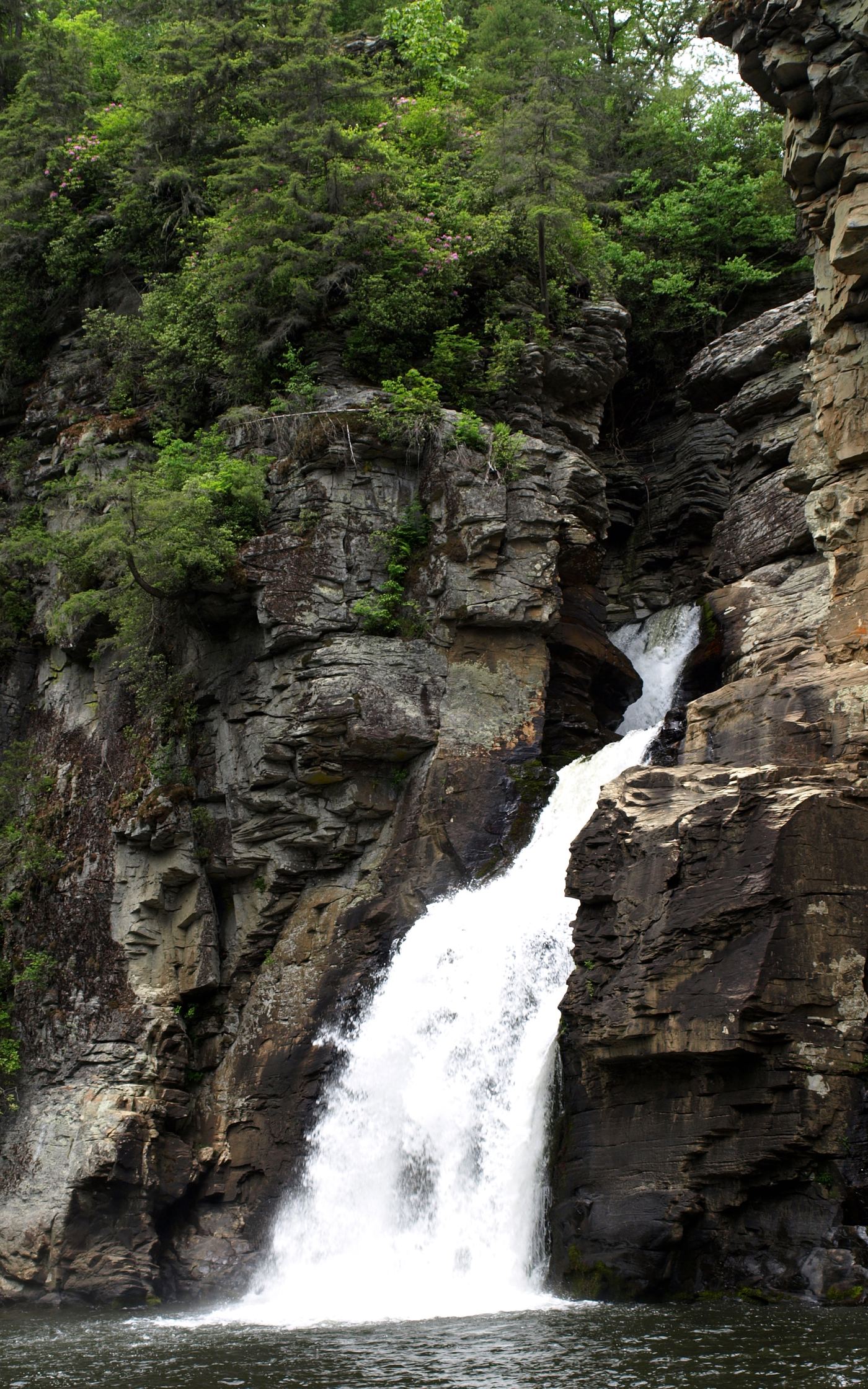
Photo credit
Photo: Ken Thomas, Public domain, via Wikimedia CommonsChimney View and Erwins View look toward the lower falls. The gorge route is listed closed.
Plan your visit
Erwins View overlooks, with restricted access
Published 1.6-mile round trip starts at visitor center; distance from the currently directed Old NC 105 parking is not established.
Moderate route with a strenuous climb near Chimney View.
Where to start
NPS status table directs access through the USFS parking area on Old NC 105.
Timing & water
Partial access listed on 2026-10-27.
Before you go
Unknown: not stated in opened sources.
Visitor informationMore waterfalls nearby
Within 40 straight-line miles. Road and trail distances will differ.
 Upper Linville FallsBlue Ridge Parkway trail to an overlook; some nearby trails closedBurke County, NC0.1 miNW
- Duggers Creek FallsShort Park Service trail from the Linville Falls lot; Helene trail closures in the area notedBurke County, NC0.5 miN
- Brushy Ridge FallsWilderness trails to a river-bend campsite view; difficultBurke County, NC1.2 miS
- Mill FallsMcDowell County, NC1.5 miSW
- English FallsMcDowell County, NC3.2 miSW
- Upper Creek FallsRoute and parking documented; secondary route details attributed98 ft (30 m) · Burke County, NC3.6 miE
- Laurel Leap FallsMcDowell County, NC3.8 miS
- Cathedral FallsWilderness trails to a view across the riverBurke County, NC3.8 miSE
- Upper Steels Creek FallsPartial: forest road closed to vehicles; walk-in parking not describedBurke County, NC3.9 miE