Cove Creek Falls
Transylvania County, North Carolina
Your visit at a glance
- Waterfall height
- Not recorded
- Location
- Transylvania County, North Carolina
- Access status
- Forest Service trails documented by two recent accounts
- The walk
- About 2.4 miles return
- Ground & access
- Gravel road and graded forest trails, with a steep, slippery spur to the base. Avoid the top of the falls. Downed trees near the base were reported after Tropical Storm Helene in October 2024.
From the parking area on FR 475, walk up the gated road toward the Cove Creek Group Campground, passing a cascade on Cove Creek at about 0.3 miles. Turn left on the blue blazed Caney Bottom Trail 361, then bear left on the yellow blazed Cove Creek Trail 340. At about 1.1 miles a signed spur on the right drops steeply to the base of the 50 foot falls. Return the same way.
Plan your visit
Cove Creek Group Camp road, Caney Bottom Trail and Cove Creek Trail to Cove Creek Falls
Waterfall Hero gives 2.4 miles for the out and back walk. A 5 mile loop over Caney Bottom Trail is a separate option described by Rich Stevenson.
Gravel road and graded forest trails, with a steep, slippery spur to the base. Avoid the top of the falls. Downed trees near the base were reported after Tropical Storm Helene in October 2024.
Where to start
Small parking area on the left of FR 475 just before the one lane bridge, about 3.1 to 3.2 miles from US 276 toward the fish hatchery. Fills early in summer; overflow is along the gravel road beyond the bridge without blocking traffic. Waterfall Hero gives GPS 35.28308, -82.81692.
Timing & water
Open year round. Waterfall Hero hiked it in August 2025; Rich Stevenson in October 2024.
Before you go
No fee reported. Pisgah National Forest, Pisgah Ranger District. Dogs on leash.
Visitor informationVisit sources
More waterfalls nearby
Within 40 straight-line miles. Road and trail distances will differ.
- Caney Bottom FallsTrailside view on a Forest Service trail; no safe path to the baseTransylvania County, NC0.3 miNE
- Toms Spring FallsNational forest gated road; easy walkTransylvania County, NC0.6 miSW
- Whaleback FallsNational forest; short path and a steep scramble to the riverTransylvania County, NC0.8 miS
- Upper Rockhouse Creek FallsTransylvania County, NC0.9 miNE
- Transylvania FallsTransylvania County, NC0.9 miE
- Middle Rockhouse Creek FallsPartial guide: 2014 description, no defined parking, steep informal pathTransylvania County, NC1.0 miE
- Upper Toms Spring FallsNational forest loop on a forest road and trailTransylvania County, NC1.0 miW
- Lower Rockhouse Creek FallsRoadside view with a short path; very small pull-offTransylvania County, NC1.0 miSE
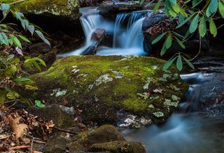 Lower Slick Rock FallsNational forest; short informal pathTransylvania County, NC1.0 miE