Lower Stick Falls
Macon County, North Carolina
Your visit at a glance
- Waterfall height
- Not recorded
- Location
- Macon County, North Carolina
- Access status
- Partial: short but steep bushwhack near cliffs; no trail
- The walk
- About 0.1 miles each way, off trail
- Ground & access
- Steep off-trail slope with cliffs near the creek; stay away from the cliff edges. Kevin Adams rates it difficult.
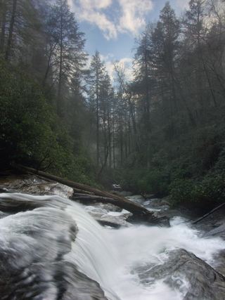
Walk a couple hundred feet upstream along the road (toward Horse Cove) to a point about halfway between two utility poles, then head into the woods on a heading of about 300 degrees. You can go straight to Lower Stick Falls using its published GPS point (35.018928, -83.163981), or visit Upper Stick and Stick Falls first and swing around the cliffs to descend to Lower Stick. Kevin Adams calls all of these falls close to the road but difficult and confusing to reach. The 12-foot falls has a pool where Little Creek joins.
Plan your visit
Walkingstick Road pullout, off-trail descent to Little Creek and Lower Stick Falls
Kevin Adams lists the hike distance as approximately 0.1 miles. There is no trail.
Steep off-trail slope with cliffs near the creek; stay away from the cliff edges. Kevin Adams rates it difficult.
Where to start
Small pullout on the right side of the unpaved Walkingstick Road (SR 1608), 1.7 miles from Horse Cove Road. Published coordinates: 35.020342, -83.162999.
Timing & water
No closure is stated.
Before you go
Nantahala National Forest; no fee is stated by the source.
Visitor informationVisit sources
More waterfalls nearby
Within 40 straight-line miles. Road and trail distances will differ.
- Slick Stick FallsPartial guide: no trail; bushwhack and creekwalk onlyMacon County, NC0.1 miW
- Stick FallsNational forest; short bushwhack with a cliffMacon County, NC0.1 miN
- Little Creek FallsPartial guide: steep bushwhack finish, parking spot not describedMacon County, NC0.8 miNW
- Walkingstick FallsPartial guide: roadside view only; private land and no parking spot describedMacon County, NC1.1 miN
 Secret FallsForest Service trail with steps to the base; road gated in winterMacon County, NC1.1 miS
- Lower Satulah FallsDistant roadside view from an overlook; no access closerMacon County, NC1.5 miW
- Cane Creek FallsPartial guide: no trail, steep bushwhack from a gated forest roadMacon County, NC1.8 miNE
- Satulah FallsSafe stopping location unconfirmedMacon County, NC2.1 miNW
- Pothole FallsRoadside bridge view; scramble to the baseMacon County, NC2.2 miE