Slick Stick Falls
Macon County, North Carolina
Your visit at a glance
- Waterfall height
- Not recorded
- Location
- Macon County, North Carolina
- Access status
- Partial guide: no trail; bushwhack and creekwalk only
- The walk
- No trail; about 0.25 miles straight-line, longer on foot
- Ground & access
- Class III bushwhack and Class II creekwalk on slippery rock, per NCWaterfalls. For experienced off-trail hikers only.
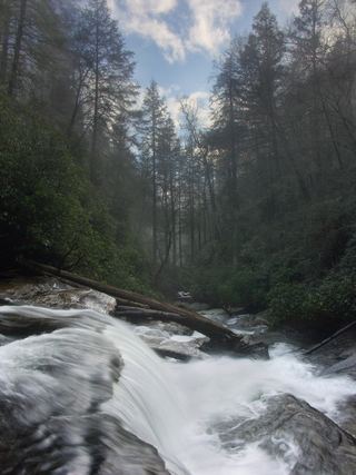
There is no trail. From the pullout, NCWaterfalls says to head through the woods on a bearing of about 220 degrees to the base of Lower Stick Falls, cross Little Creek at the downstream end of the pool, and follow the creek upstream, leaving it briefly once or twice. Slick Stick Falls is a long, steep slide about 200 feet high. Exploring higher means crawling through woods on the left bank (facing downstream) to one safe viewpoint. Return the same way rather than descending the right bank.
Plan your visit
Small pullout on Walkingstick Road (SR 1608), bushwhack to Lower Stick Falls, then creekwalk up Little Creek to Slick Stick Falls
NCWaterfalls gives only a straight-line distance of about 0.25 miles and warns the actual route feels much longer. No walking distance is published.
Class III bushwhack and Class II creekwalk on slippery rock, per NCWaterfalls. For experienced off-trail hikers only.
Where to start
Small pullout on the right side of unpaved Walkingstick Road (SR 1608), 1.7 miles from Horse Cove Road east of Highlands. NCWaterfalls gives this trailhead at 35.020342, -83.162999.
Timing & water
Creekwalk depends on low water. Current conditions not verified.
Before you go
Current fees and reservation requirements unknown.
Visitor informationVisit sources
More waterfalls nearby
Within 40 straight-line miles. Road and trail distances will differ.
- Lower Stick FallsPartial: short but steep bushwhack near cliffs; no trailMacon County, NC0.1 miE
- Stick FallsNational forest; short bushwhack with a cliffMacon County, NC0.2 miNE
- Little Creek FallsPartial guide: steep bushwhack finish, parking spot not describedMacon County, NC0.8 miNW
 Secret FallsForest Service trail with steps to the base; road gated in winterMacon County, NC1.0 miS
- Walkingstick FallsPartial guide: roadside view only; private land and no parking spot describedMacon County, NC1.1 miN
- Lower Satulah FallsDistant roadside view from an overlook; no access closerMacon County, NC1.4 miW
- Cane Creek FallsPartial guide: no trail, steep bushwhack from a gated forest roadMacon County, NC1.9 miNE
- Satulah FallsSafe stopping location unconfirmedMacon County, NC2.0 miNW
- Pothole FallsRoadside bridge view; scramble to the baseMacon County, NC2.3 miE