WaterfallNear Me

Washington waterfall visits

Compare 218 Washington waterfall visits by the approach, terrain, and where to start. Some routes have closures or unresolved details; read the individual guide before travelling.

218 visit options

Ancient Lake Falls, WA

Partial: route to the lakes documented; exact waterfall match and final approach unconfirmed

Washington

Ancient Lake Falls

4 to 5 miles round trip to Ancient Lake (Mountaineers); no separate figure to the falls

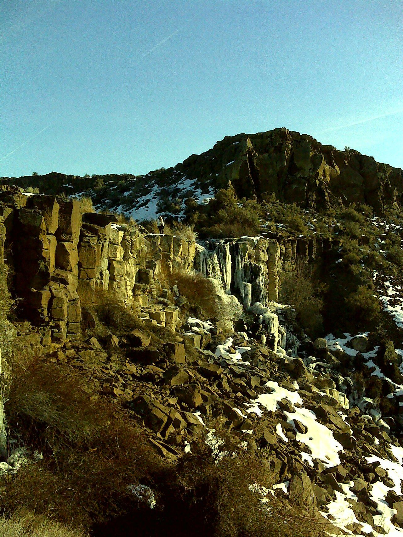
Ancient Lake Falls pours off the basalt benches into the Ancient Lakes basin in Potholes Coulee. WTA describes a waterfall dropping 160 feet into the basin below Judith Pool; this listing is probably that waterfall, but that is not confirmed. From the south end of the parking area on Babcock Bench, follow the old two-track 0.6 mile to a junction, take the left fork and follow it up the coulee 1.5 miles to the lakes. Several old two-tracks and game trails lead up the coulee. The falls are at the east end of the basin; around the lakes WTA says you can follow the numerous trails or walk cross-country.
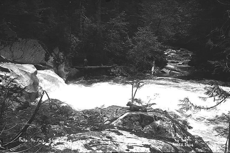
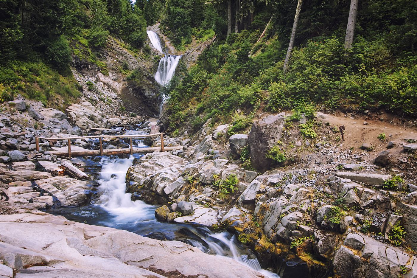
Photo creditPhoto: Richard Edwards, CC BY-SA 3.0, via Wikimedia Commons
Bear Creek Falls, WA

Partial notes: correct waterfall identified; sanctioned approach and parking unverified.

Washington

Bear Creek Falls

Unknown

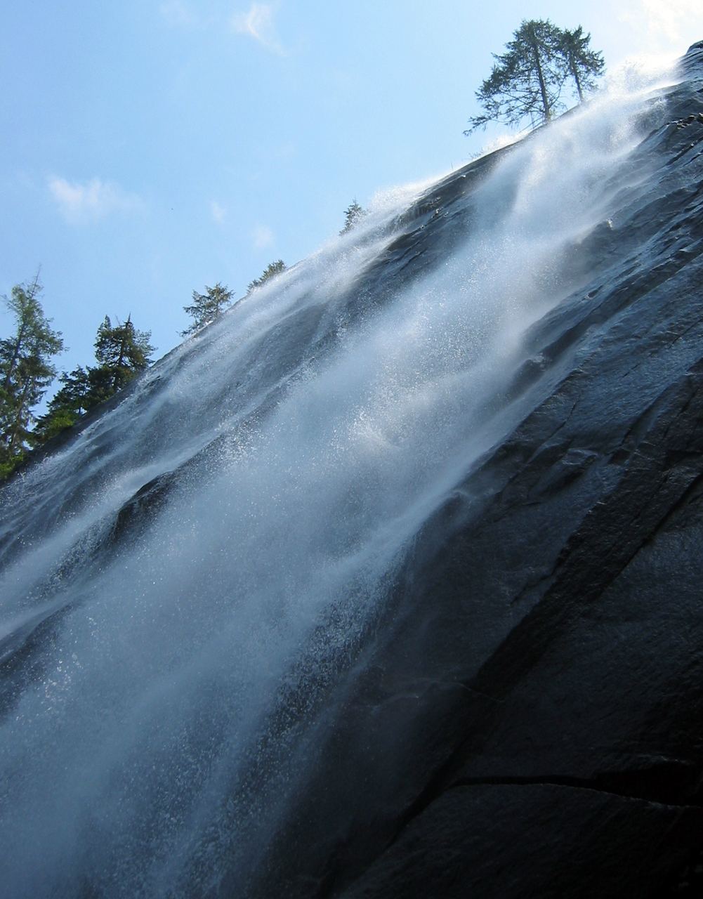
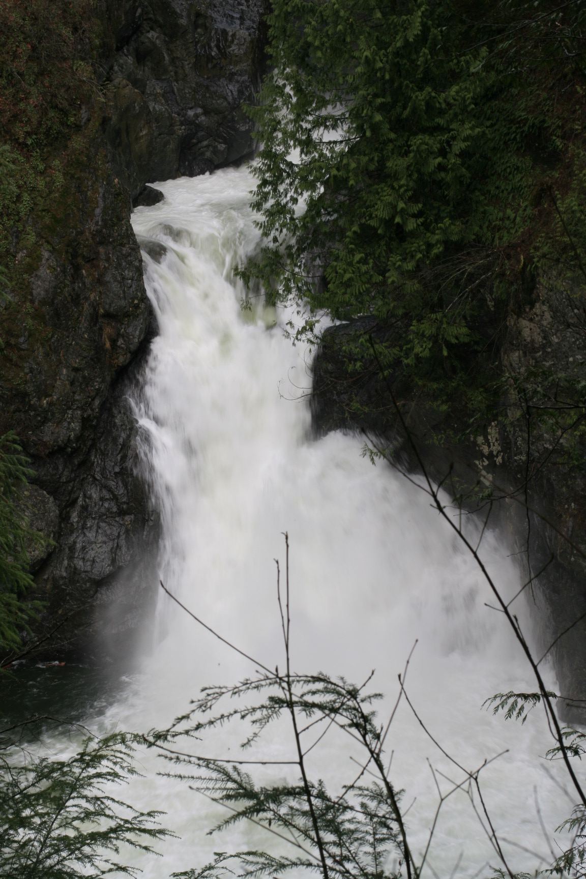
County tourism identifies Bear Creek Falls on the North Fork Skykomish River northeast of Index, where the river passes through a narrow granite gorge.

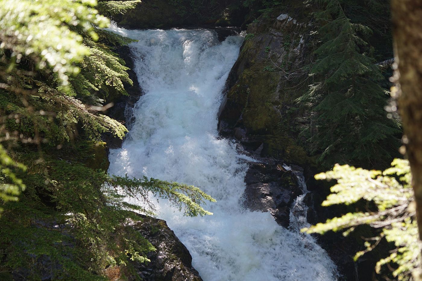
Photo creditPhoto: Lee Pickett, Public domain, via Wikimedia Commons
Bloucher Falls, WA

National park trail route and parking documented

Washington

Bloucher Falls

Under 1.9 miles one way (NPS figure for the hike that passes these falls on the way to Comet Falls)

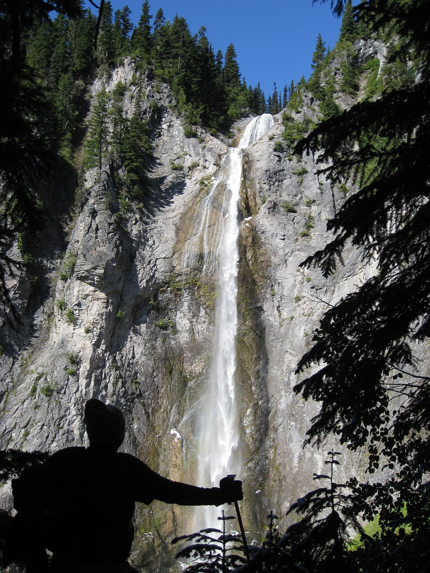
Bloucher Falls, also called Van Trump Falls, is a series of cascades on Van Trump Creek, the tallest drop about 65 feet, with upper tiers partly hidden by the canyon walls. It is on the Comet Falls Trail in Mount Rainier National Park, just before Comet Falls. From the Comet Falls trailhead on the road to Paradise, climb the trail steadily uphill; the falls are passed shortly before the base of Comet Falls. Return the same way.

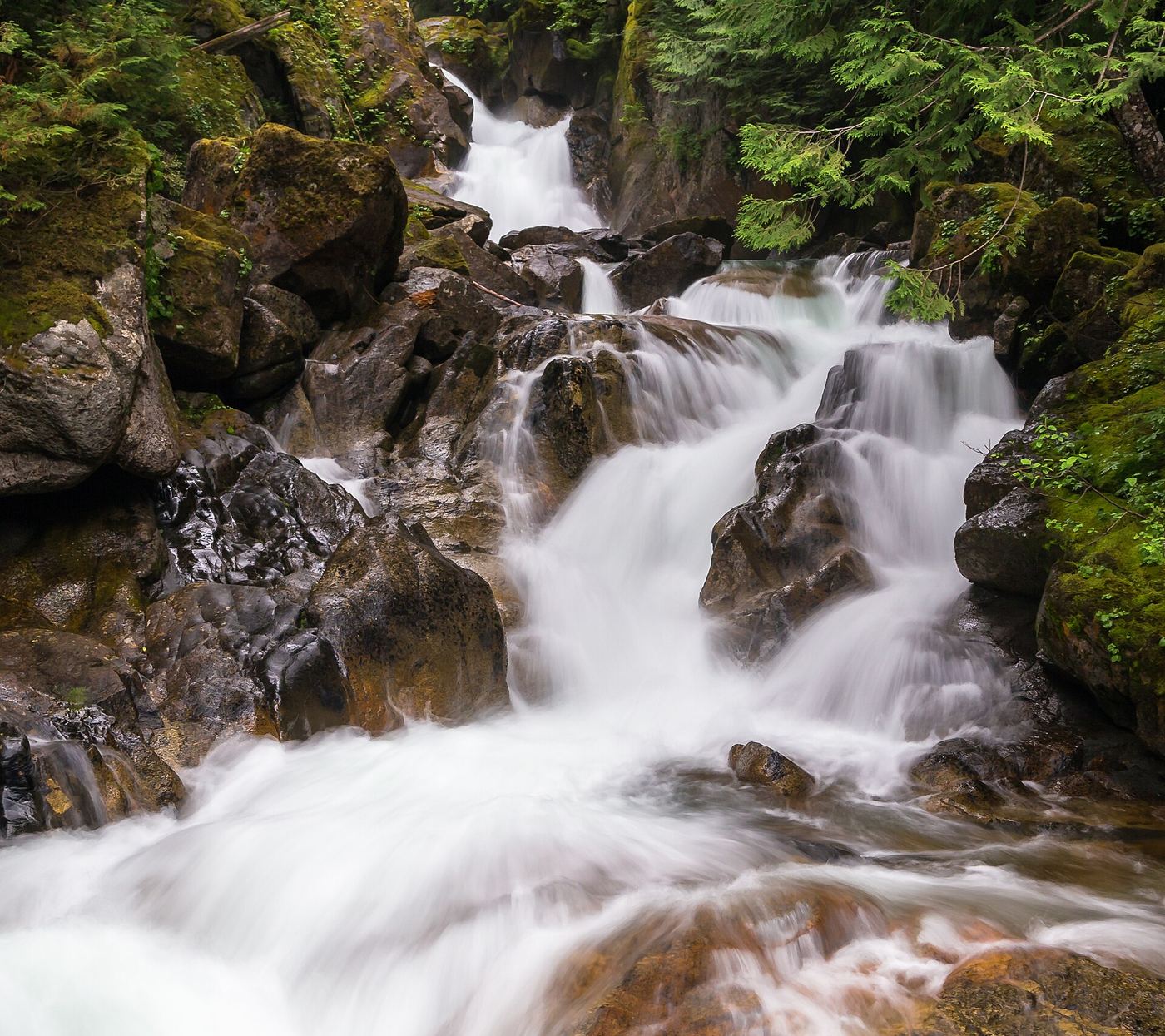
Photo creditPhoto: Steven Pavlov, CC BY-SA 4.0, via Wikimedia Commons
Boulder Falls, WA

Partial guide: falls only heard and glimpsed through trees from the trail; no access to the falls

Washington

Boulder Falls

Under about a mile; WTA places the glimpse before the Boulder River Wilderness sign, which is about a mile from the trailhead

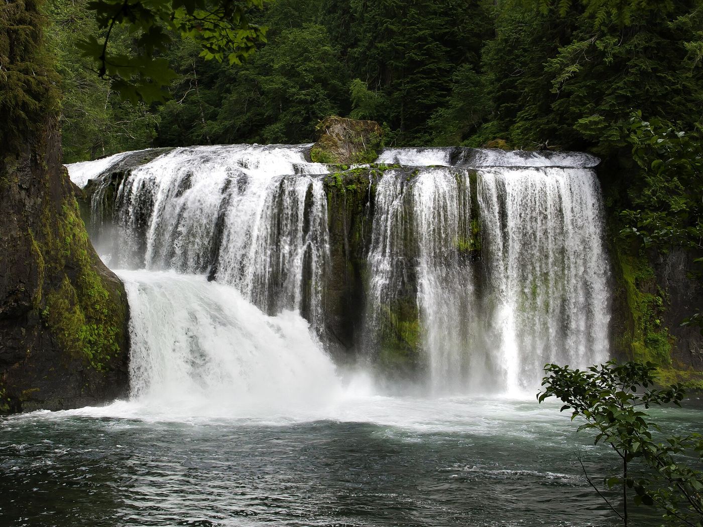
Boulder Falls is where the Boulder River drops about 40 feet through a large boulder garden, in the Mount Baker-Snoqualmie National Forest near Arlington. It is often confused with Feature Show Falls, the double falls farther up the trail, which has its own listing. From the trailhead, the Boulder River Trail follows a wide, flat old railroad grade. As it approaches the river you can hear Boulder Falls and glimpse it through the trees. WTA says the bank is steep and there is no access to the falls at this point; reaching the falls means going off trail, which this guide does not describe. Return the same way, or continue to the waterfalls that can be seen from the trail farther on.

Photo creditPhoto: brewbooks from near Seattle, USA, CC BY-SA 2.0, via Wikimedia Commons
Bridal Veil Falls-Lower East Cascade, WA

Established trail to Bridal Veil Falls; this cascade's viewpoint not confirmed

Washington

Bridal Veil Falls-Lower East Cascade

4.0 miles round trip to the end of the Bridal Veil Falls trail per Washington Trails Association

Bridal Veil Falls pours out of Lake Serene down the east side of Mount Index in several cascades. This listing is named as the lower east cascade, but the sources describe the falls as a whole and do not use that name, so which viewpoint shows this exact cascade is not confirmed. From the trailhead, follow the trail along an old road through forest. At 1.5 miles the Lake Serene Trail forks left and crosses a bridge with a view of the lower falls. The right fork climbs a rocky stretch and several stairways and ends at the falls at 2 miles. Return the same way.

Photo creditPhoto: pfly from Pugetopolis, CC BY-SA 2.0, via Wikimedia Commons
Canyon Falls, WA

Closed to general public access: private residential development

Washington

Canyon Falls

Not available to the general public

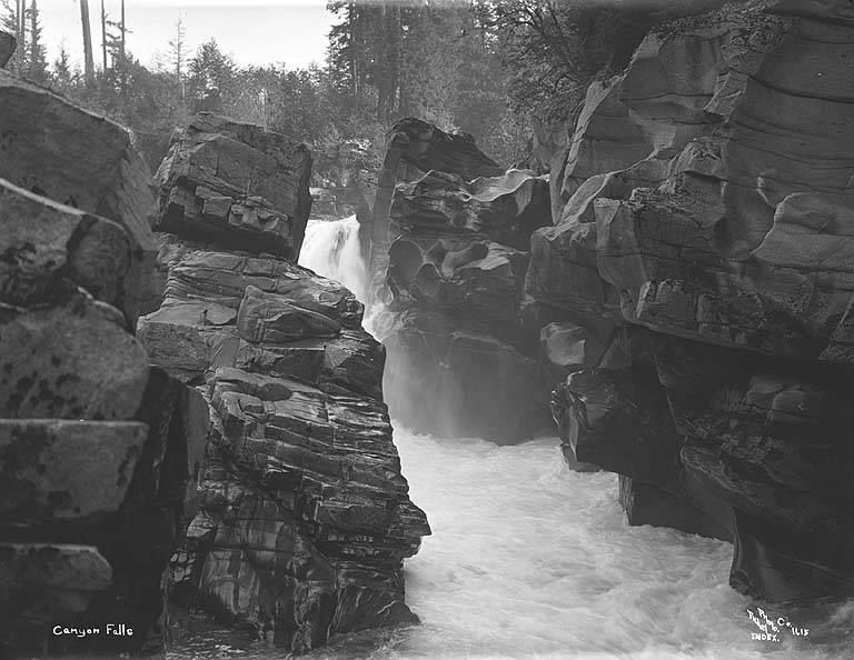
Canyon Falls is the South Fork Skykomish River waterfall within a private residential development. World Waterfall Database explicitly reports no general public access. Do not follow historic route descriptions through the development without explicit landowner permission.

Photo creditPhoto: Lee Pickett, Public domain, via Wikimedia Commons
Cape Horn Falls, WA

Guide: Gorge loop to a bridge in front of the falls; seasonal falcon closure

Washington

Cape Horn Falls

7.2-mile loop (WTA)

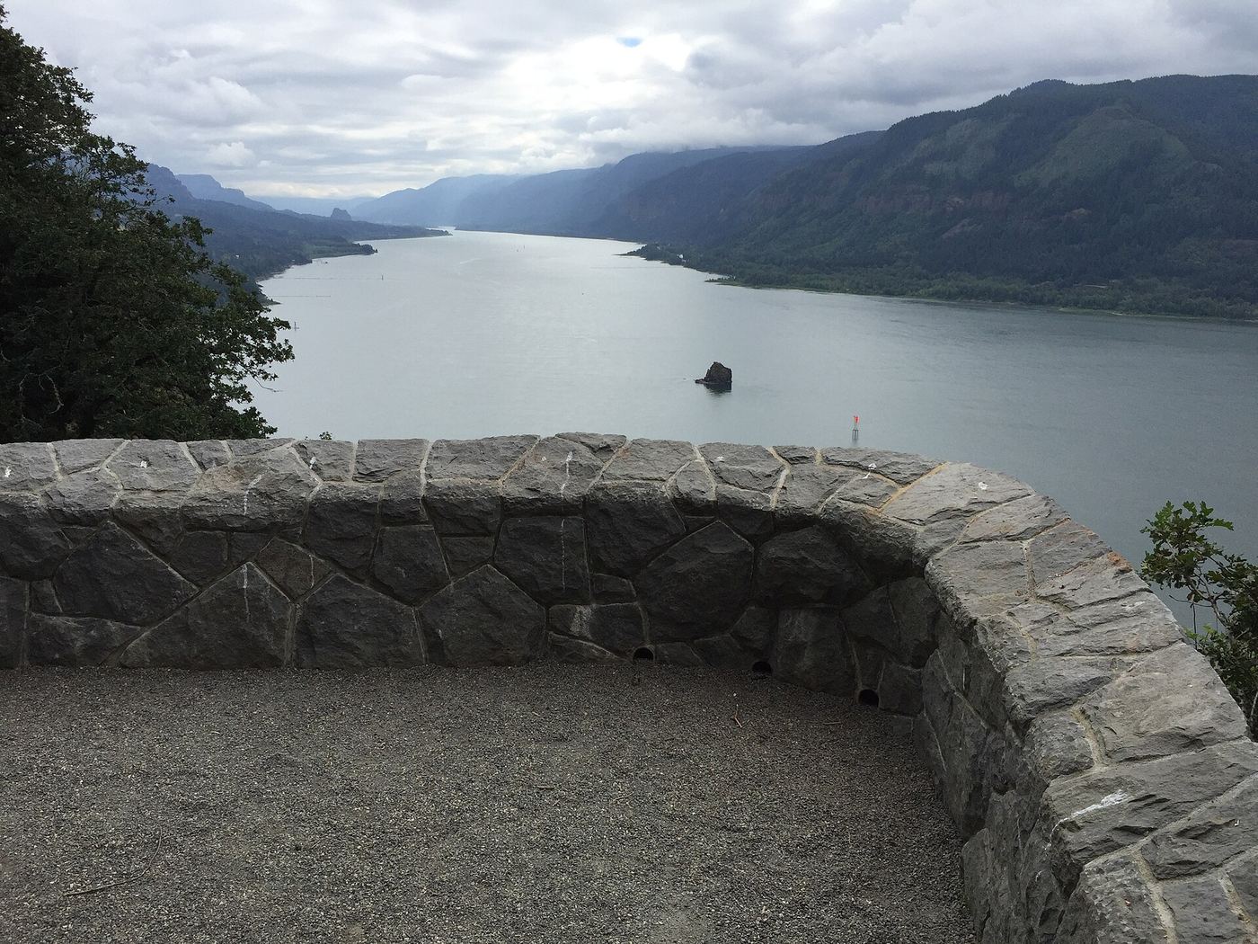
Cape Horn Falls is a seasonal, multi-tiered waterfall that drops off the Cape Horn cliffs toward the Columbia River. The Cape Horn Trail starts on the west side of Salmon Falls Road, opposite the Park and Ride. Climb over the top of Cape Horn, then descend 1.2 miles of switchbacks, cross the Bootlegger Bridge and go through the pedestrian underpass beneath Highway 14. Pass Cape Horn Waterfall Overlook and Oak View Overlook, then switchback down and follow the narrow, rocky trail east through two talus slopes to a bridge in front of Cape Horn Falls. Continue east to paved Cape Horn Road and walk 1.3 miles uphill back to the trail sign and underpass. The lower trail beyond Oak View Overlook closes for much of spring and early summer to protect nesting peregrine falcons; then the falls cannot be reached this way.

Photo creditPhoto: U.S. Forest Service- Pacific Northwest Region, Public domain, via Wikimedia Commons
Carter Falls, WA

National park trail route and parking documented

Washington

Carter Falls

2.2 miles round trip (NPS)

Carter Falls is a horsetail waterfall about 50 feet tall on the Paradise River in Mount Rainier National Park. The trail starts across the road from Cougar Rock Campground, about 2 miles north of Longmire; the Longmire trail sheet says it begins at the paved pullout 100 yards below the campground. Cross the Nisqually River on the log footbridge below the campground and follow the Wonderland Trail upriver toward Paradise to Carter Falls. Madcap Falls is a short distance farther along the trail. Return the same way.

Photo creditPhoto: NPS Photo, Public domain, via Wikimedia Commons
Chenuis Falls, WA

Official park route; road access closed until further notice

Washington

Chenuis Falls

7.4 miles round trip per the National Park Service

Chenuis Falls cascades into a pool on the north side of the Carbon River in Mount Rainier National Park. The National Park Service says there is no access to the Carbon River area by SR 165 until further notice, because the Fairfax Bridge outside the park is closed to vehicles, bicyclists and pedestrians and there is no alternate route. When access is possible, walk or bike the Carbon River Trail (former road) from the entrance to the Chenuis Falls Trailhead on the left, 3.5 miles in. Walk across the rocky riverbed and cross the log bridge, then follow the trail, which may be marked by cairns, to the falls. Return the same way.

Photo creditPhoto: NPS Photo, Public domain, via Wikimedia Commons
Clear Creek Falls, WA

Parking and short viewpoint approach documented; distance unknown.

Washington

Clear Creek Falls

Short walk; distance unknown

A roadside overlook east of White Pass Summit provides views into the waterfall's rocky canyon.

Photo creditPhoto: Z3lvs, CC0, via Wikimedia Commons
Coal Creek Falls, WA

County park trail route and trailhead documented

Washington

Coal Creek Falls

2.5 miles round trip (WTA)

Coal Creek Falls is a seasonal waterfall of about 28 feet in King County's Cougar Mountain Regional Wildland Park. From the Red Town Trailhead, bear left on the Red Town Trail. At the first junction, 0.1 mile in, bear left onto the Cave Hole Trail. Continue past a second junction for another 0.4 mile to a third junction, and bear right onto the narrower Coal Creek Falls Trail. After a short set of stairs going down, it is 0.3 mile to the falls. Return the same way, or continue toward the Quarry Trail for a loop.

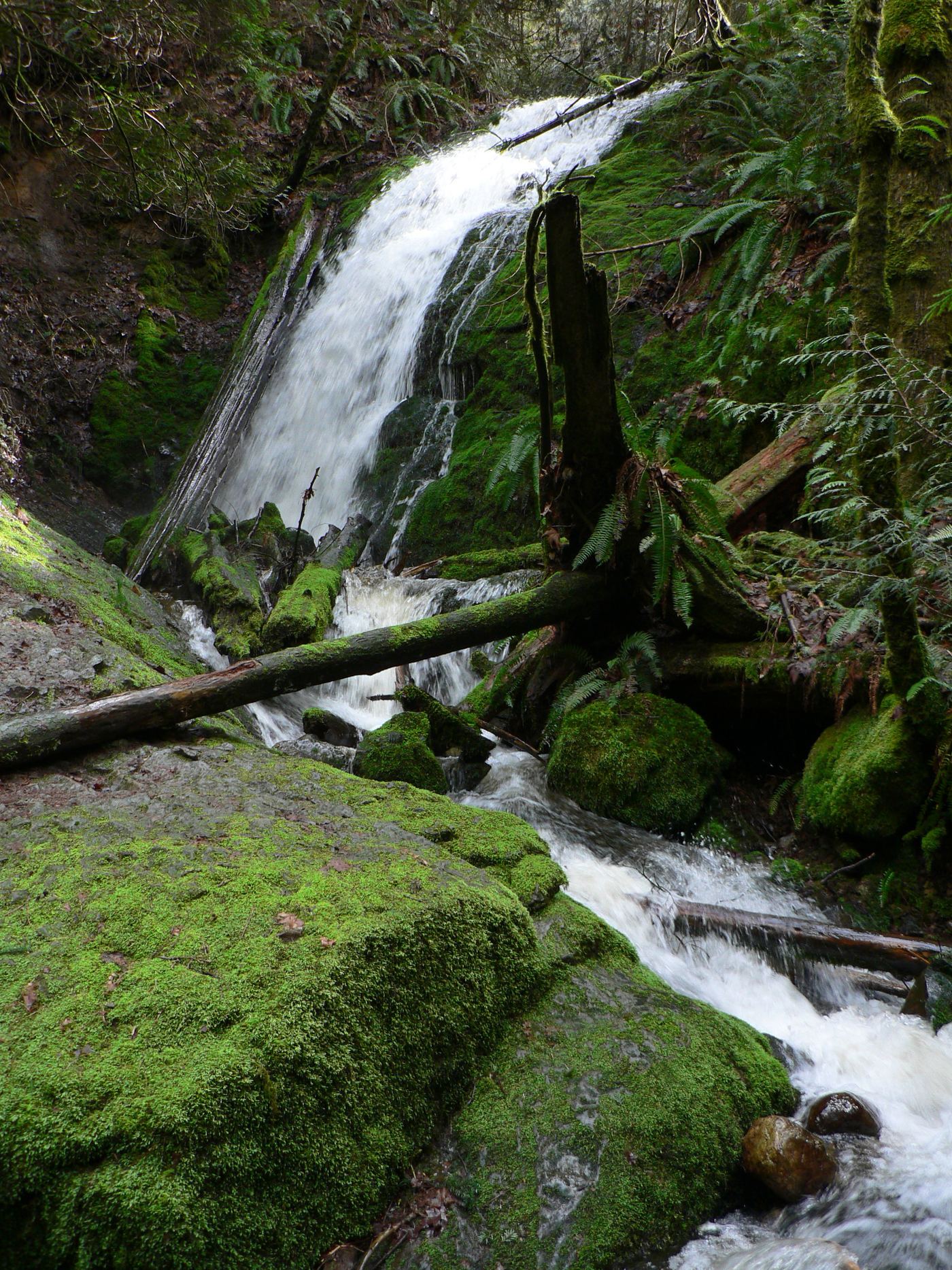
Photo creditPhoto: Walter Siegmund, CC BY 2.5, via Wikimedia Commons
Comet Falls, WA.

Source-reviewed route and parking

Washington

Comet Falls

Approximately 3.6–3.8 miles round trip

Follow Comet Falls Trail uphill to the base of Comet Falls and return the same way. Continuing uphill toward Van Trump Park adds substantial distance and climbing beyond this waterfall visit.

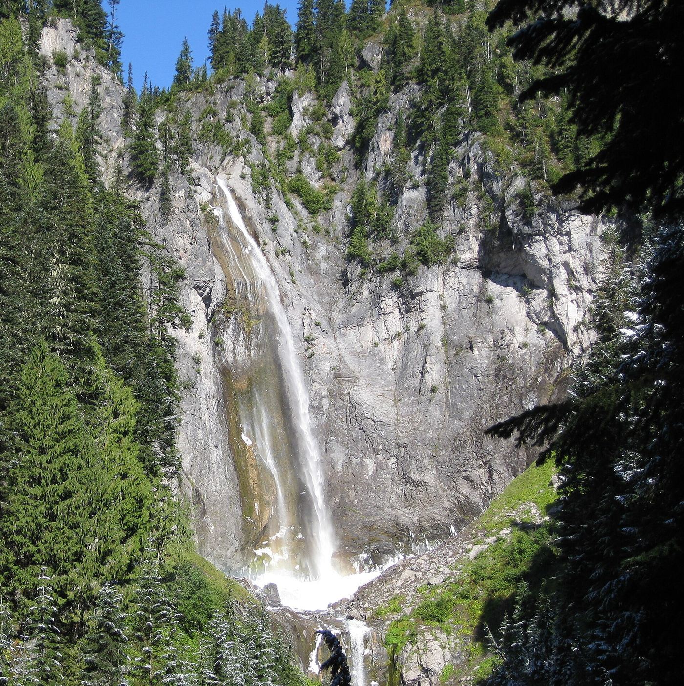
Photo creditPhoto: J Brew, CC BY-SA 2.0, via Wikimedia Commons
Deer Creek Falls, WA

Short official park trail from SR 123; road closed in winter

Washington

Deer Creek Falls

0.4 miles from the trailhead to the Eastside Trail junction, passing the falls, per the National Park Service

Deer Creek Falls is on Deer Creek just below SR 123 in Mount Rainier National Park. From the Deer Creek/Owyhigh Lakes Trailhead, look for the Owyhigh Lakes Trail sign and follow the trail downhill. The trail passes Deer Creek Falls on the way to the Eastside Trail junction 0.4 miles below the road. Return the same way, uphill.

Photo creditPhoto: NPS Photo, Public domain, via Wikimedia Commons
Depot Creek Falls, WA

Historical climbing approach; current access and parking unverified

Washington

Depot Creek Falls

Distance not verified

Remote waterfall on the Depot Creek mountaineering approach. Current access and parking remain unverified.

Photo creditPhoto: Chadneufeld, CC BY 3.0, via Wikimedia Commons
Domke Falls, WA.

Source-reviewed boat access, launch parking and short viewing trail

Washington

Domke Falls

Short trail; length not stated

Reach Domke Falls Campground by boat on Lake Chelan, then follow its short trail to the waterfall. USFS states there is no access from here to Domke Lake or the Domke Mountain trails.

Photo creditPhoto: Mr.B, CC BY 3.0, via Wikimedia Commons
Eagle Falls, WA

Guide: roadside view from a signed turnout

Washington

Eagle Falls

Roadside viewpoint next to the turnout; no distance given

Eagle Falls is a short, powerful cascade of the South Fork Skykomish River in a steep granite gorge right beside US 2. Drive east from Monroe and Sultan to a large turnout about 2 miles east of Index, where the river runs next to the road; a sign identifies the area as Eagle Falls. The Northwest Waterfall Survey says the best views are from just off the highway shoulder next to the falls. Paths lead down to the gorge and the large pool below, which is popular for swimming in summer. Take great care near the water.

Photo creditPhoto: Lee Pickett, Public domain, via Wikimedia Commons
Fantastic Falls, WA

Closed to all public access at landowners' request

Washington

Fantastic Falls

Closed to public access

Fantastic Falls lies on private land in Ernie's Canyon on the North Fork Snoqualmie River. World Waterfall Database reports that the landowners asked it to clarify the waterfall is closed to all public access. This is an access-restriction note, not a hiking route.

Photo creditPhoto: Kgrr, CC BY-SA 3.0, via Wikimedia Commons
Harmony Falls, WA

Lakeshore route; original falls submerged

Washington

Harmony Falls

About 2 miles return to former falls site

USFS says Harmony Falls was submerged by the 1980 eruption and is not visible. The trail reaches the lakeshore.

Photo creditPhoto: Ruth Hartnup from Vancouver, Canada, CC BY 2.0, via Wikimedia Commons
Ipsut Falls, WA

Partial: park trail documented; the only road access is closed at the Fairfax Bridge

Washington

Ipsut Falls

11.4 miles round trip (WTA)

Ipsut Falls is an 87-foot, two-tiered waterfall in a narrow canyon on Ipsut Creek, in the Carbon River area of Mount Rainier National Park. The National Park Service says there is no access to the Carbon River area by SR 165 until further notice, because the Fairfax Bridge outside the park is closed to vehicles, bicyclists and pedestrians and there is no alternate route. When access is possible, walk or bike the Carbon River Trail (former road) from the entrance to the Ipsut Creek backcountry camp. Bikes are allowed only on the former road. Continue on foot on the Carbon Glacier trail; at about a quarter mile, just past a creek crossing, a 200-foot side trail leads to the falls. Return the same way.

Photo creditPhoto: brewbooks from near Seattle, USA, CC BY-SA 2.0, via Wikimedia Commons
Ladder Creek Falls, WA

Short paved garden path and stairs from a Newhalem parking area

Washington

Ladder Creek Falls

0.5 miles round trip, per WTA

Ladder Creek Falls is behind the Gorge Powerhouse at the east end of Newhalem in Ross Lake National Recreation Area. J.D. Ross built a trail to the falls while the nearby hydroelectric project was under construction in the 1930s and 1940s, and the falls are lit with colored lights at night. Park across the river from the powerhouse, cross the river on the suspension bridge to the Ladder Creek Gardens, and follow the signed path and stairs along the creek to close views of the falls. WTA says a small suspension bridge offers a more direct way back to the car.

Photo creditPhoto: Feedmepaperr, CC BY-SA 4.0, via Wikimedia Commons
Little Mashel Lower Falls, WA

Crushed-rock trail and signed side trail to the lower falls; no pass required

Washington

Little Mashel Lower Falls

WTA puts the Lower Falls side trail 1.8 miles from the Bud Blancher Trailhead; the side trail is 0.4 mile round trip

Lower Little Mashel Falls is the lowest of three waterfalls in the gorge of the Little Mashel River near Eatonville, a 39-foot drop over a chunky ledge. From the Bud Blancher Trailhead walk the wide crushed-rock path downhill, cross a wooden bridge over the Mashel River and pass Smallwood Park. At the confusing intersection at 0.9 mile stay left on the road and trail with a yellow bollard, and note the spot for the return. Cross the Little Mashel River on a wooden bridge at 1.4 miles; 350 feet farther a sign points left to the Little Mashel Falls trail. After 100 yards follow the small yellow Falls Trail sign to the right and climb. At 1.8 miles take the side trail on the left with a brown sign reading Lower Falls, down to the water's edge with the help of crushed rock and a crib ladder. Return the same way. The middle and upper falls are farther up the Falls Trail. The land around the falls has mixed ownership by the University of Washington, the town of Eatonville and the City of Tacoma; the railroad above the upper falls is strictly off limits. The survey says access from Alder Cutoff Road is no longer permitted by the town.

Photo creditPhoto: Steven Pavlov, CC BY-SA 4.0, via Wikimedia Commons
Little Mashel Middle Falls, WA

Public trail from the Bud Blancher Trailhead; steep, slippery final section

Washington

Little Mashel Middle Falls

4.5 miles round trip for the Bud Blancher route, per WTA

This listing is the middle of the three Little Mashel River falls near Eatonville, officially named Little Mashel Falls: a 92-foot falls that spreads into a broad veil, with room to walk behind it. From the Bud Blancher Trailhead, walk the wide crushed-rock path downhill, cross the Mashel River bridge, and pass Smallwood Park. At a confusing road junction stay left on the path with the yellow bollard. At 1.4 miles cross the Little Mashel River bridge; about 350 feet farther a sign points left to the Little Mashel Falls trail. Bear right at the small Falls Trail sign and climb past the Lower Falls side trail to a 3-way junction. Turn sharply left and continue uphill about 450 feet to another junction; the unmarked trail to the left leads to Middle Falls. After 100 feet, left goes to the base and right goes to the top. Return the same way. Approaches from Alder Cutoff Road are no longer permitted.

Photo creditPhoto: Steven Pavlov, CC BY-SA 4.0, via Wikimedia Commons
Little Mashel Upper Falls, WA

Pack Forest trail to a viewpoint of the upper falls; mixed land ownership

Washington

Little Mashel Upper Falls

5.0 miles round trip for the Pack Forest route to all three falls (WTA)

This is the Upper Falls of the Little Mashel River, officially Tom Tom Falls, the highest of three waterfalls in the gorge near Eatonville. From the Pack Forest trailhead kiosk, walk uphill on 1000 Road North past the gate (closed to vehicles, open to hikers). At 1.9 miles go left at an unmarked Y onto Road 1070. At 2.1 miles a rock painted FALLS points left; follow the dirt trail around a pond and steeply down into the forest to a 3-way junction at 2.3 miles, shared with the Bud Blancher Trail. Go uphill 450 feet to another junction, where the unmarked left fork goes to the Middle Falls. Stay on the main trail and follow the sign right about 800 feet to a view of the Upper Falls, about 150 feet away. Return the same way. The land around the falls belongs to several owners and is not a park; the railroad above Tom Tom Falls is off limits.

Photo creditPhoto: Steven Pavlov, CC BY-SA 4.0, via Wikimedia Commons
Loowit Falls, WA

Monument trail to the falls overlook

Washington

Loowit Falls

9.2 miles round trip (WTA)

Loowit Falls plunges from the head of Loowit Canyon on the north side of Mount St. Helens, fed by meltwater from the glacier in the crater. From the Windy Ridge Viewpoint, walk 1.8 miles down the service road to where it ends in a parking area used by monument staff. Turn right and take the Windy Trail through a pumice field for about a mile to the Loowit Trail. Turn right (west) on the Loowit Trail and follow it about a mile, in and out of gullies, to the signed Loowit Falls junction. The spur, signed as a quarter mile but closer to half a mile, climbs to the falls overlook. Return the same way. Stay out of the canyon and away from the creek, on the east side: sudden surges of meltwater can pour over the falls on hot days.

Photo creditPhoto: Jeffhollett, CC BY-SA 4.0, via Wikimedia Commons
Lower Lewis River Falls, WA.

Washington

Lower Lewis River Falls

Short viewpoint approach; distance not specified

WTA directs visitors from the Lower Falls day-use parking area to the river trail and multiple Lower Lewis River Falls viewpoints.

Photo creditPhoto: U.S. Forest Service- Pacific Northwest Region, Public domain, via Wikimedia Commons
Lower Wallace Falls, WA

State park trail to the lower falls viewpoint

Washington

Lower Wallace Falls

About 2 miles one way via the Woody Trail (WTA)

Lower Wallace Falls is a set of six steps on the Wallace River in Wallace Falls State Park, the first major falls on the trail to the main Wallace Falls. From the parking lot, start at the kiosk and restrooms, walk under the power lines and continue into the forest. At the half-mile split, go right through the wooden gate onto the hiker-only Woody Trail; the left fork is the longer Railroad Grade. Follow the river, then climb, staying on the Woody Trail past side paths, to the picnic area at the Lower Falls. Only the upper steps can be seen from the trail: cascades in front of the picnic shelter and a 26-foot drop into a pool, seen from a fenced viewpoint. The Middle Falls overlook is less than half a mile farther. Return the same way.

Photo creditPhoto: Zincopper11, CC BY-SA 4.0, via Wikimedia Commons
Maidenhair Falls, WA

Researched walking route

Washington

Maidenhair Falls

1 mile return

USFS confirms the northern lakeshore route; WTA describes the short bridge-view hike and roadside parking.

Photo creditPhoto: U.S. Forest Service- Pacific Northwest Region, Public domain, via Wikimedia Commons
Middle Wallace Falls, WA

State park trail to the Middle Falls overlook; Discover Pass required

Washington

Middle Wallace Falls

WTA: Lower Falls picnic area at 2 miles, Middle Falls less than half a mile farther

This listing marks the middle of the three Wallace River falls in Wallace Falls State Park, the main Wallace Falls, whose first leap drops about 265 feet into a large amphitheater. From the trailhead by the kiosk and restrooms, walk under the power lines into the forest. At the split about half a mile in, go right through the wooden gate onto the hiker-only Woody Trail (the left fork is the longer Railroad Grade). Follow the river, then climb, staying on the Woody Trail past side paths to the picnic shelter at the Lower Falls, 2 miles from the trailhead. Continue less than half a mile to the Middle Falls overlook, the best view of the main falls. Return the same way, or continue up switchbacks to the Upper Falls. Stay at the designated viewpoints.

Photo creditPhoto: Heptazane, CC BY-SA 3.0, via Wikimedia Commons
Myrtle Falls, WA.

Washington

Myrtle Falls

About 1 mile return from the upper parking lot

Follow signs along Skyline Trail, then descend the stairs to the falls view.

Photo creditPhoto: NPS Photo, Public domain, via Wikimedia Commons
Nooksack Falls, WA

Short trail to a fenced viewpoint above the falls; stay behind the fence

Washington

Nooksack Falls

A short trail from the parking area; no distance is given

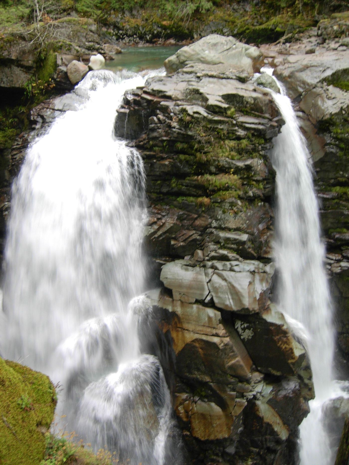
Nooksack Falls is an 88-foot falls on the North Fork Nooksack River in the Mount Baker-Snoqualmie National Forest, east of Glacier. From the parking area, take the short trail on the right side of the road to a rocky outcrop above the falls. The edge is fenced, and the viewpoint is as close as you can get. Do not cross the river on Wells Creek Road, or you will pass the falls. Signs at the site recall the many people who have died trying to get a better view; the survey says there is no safe way to reach the bottom of the falls from the parking lot and road. Return the same way.

Photo creditPhoto: Benjamin Cody, CC BY-SA 3.0, via Wikimedia Commons
Palouse Falls, WA.

Source-reviewed route and parking

Washington

Palouse Falls

Short park paths; no distance asserted

From the main day-use parking, use the steps to the lower viewpoint or the paved interpretive path. The interpretive path and secondary gravel parking also connect to Fryxell Overlook. Stay within designated viewing areas: all canyon and waterfall-base trails are permanently closed.

Photo creditPhoto: Стивен Лю, CC BY-SA 3.0, via Wikimedia Commons
Paradise Falls, WA

Partial guide: distant view from Skyline Trail footbridges; only one source describes this falls

Washington

Paradise Falls

No single figure; Northwest Waterfall Survey segments: 1/3 mile to the Skyline Trail, 8/10 mile to the Paradise Glacier Trail junction, then a couple hundred feet

Paradise Falls is the uppermost waterfall on the Paradise River, below the retreating Paradise Glacier at Mount Rainier: two drops of about 30 feet, about 300 feet apart, on either side of a moraine island. No trail goes close to the falls; it is seen from a distance from the Skyline Trail footbridges over the Paradise River, about 500 feet downstream. Off-trail travel is not allowed here. From Paradise, drive down the one-way Paradise Valley Road; just after crossing the Paradise River, park in the large lot on the right. Take the 4th Crossing Trail across the road uphill to the Skyline Trail, turn right, pass the Paradise Glacier Trail junction near the Stevens-Van Trump Memorial and continue a couple hundred feet to the footbridges. Return the same way or continue on the Skyline loop.

Photo creditPhoto: Walter Siegmund (talk), CC BY-SA 3.0, via Wikimedia Commons
Pearl Falls, WA

Distant roadside view only; exact viewing spot not described; summer road

Washington

Pearl Falls

Roadside view; no walking is described

Pearl Falls drops off a basalt cliff east of Pyramid Park into a basin in Mount Rainier National Park; the survey estimates it at about 310 feet from lidar data. Reaching the falls on foot is difficult and likely takes at least two days, so this listing covers only a distant view. The survey says the falls can be seen from near Ricksecker Point along the road to Paradise. Ricksecker Point is on a scenic side road about 6.5 miles from Longmire and 5 miles from Paradise, with parking and exhibit panels. The exact spot with a view of the falls is not described, and the falls look small at this distance.

Photo creditPhoto: National Park Service, Public domain, via Wikimedia Commons
Rainbow Falls, WA

Short walk from a parking lot to two viewpoints; lower viewpoint accessible

Washington

Rainbow Falls

Short walk from the parking lot; no distance stated

Rainbow Falls drops 312 feet into the Stehekin Valley in Lake Chelan National Recreation Area, part of the North Cascades National Park Service Complex. It is beside the Stehekin Valley Road about 3.5 miles from Stehekin Landing. Lower and upper viewpoints are a short walk from the parking lot; the lower viewpoint is wheelchair accessible. In summer a shuttle runs from the Stehekin dock to the falls. Travel to Stehekin itself is not described here.

Photo creditPhoto: NPS Staff, Public domain, via Wikimedia Commons
Rainbow Falls, WA

State park riverbank beside the falls; exact viewing spot not described; Discover Pass required

Washington

Rainbow Falls

Short; no distance to a view of the falls is given

Rainbow Falls is a small falls, no more than about 5 feet, where the Chehalis River tumbles over a broad basalt ledge in Rainbow Falls State Park west of Chehalis. The ledge is nearly submerged in heavy runoff. The survey places the falls next to the bridge that crossed the river to the campground; that park bridge was washed out in a flood, so the campground side and the trail side of the park are now reached separately. WTA describes the trailhead clearing on State Route 6 under a very large Douglas fir beside the river, and says the easiest approaches to the river are west of the large fir. The exact spot with a view of the falls is not described. WTA says that at low flow the river can be forded between the campground and the trailhead.

Photo creditPhoto: ECTran71, CC BY-SA 4.0, via Wikimedia Commons
Salmon Cascades, WA

Roadside parking and a short path to a viewing deck; entrance pass required

Washington

Salmon Cascades

A short path from the parking area; no distance is given

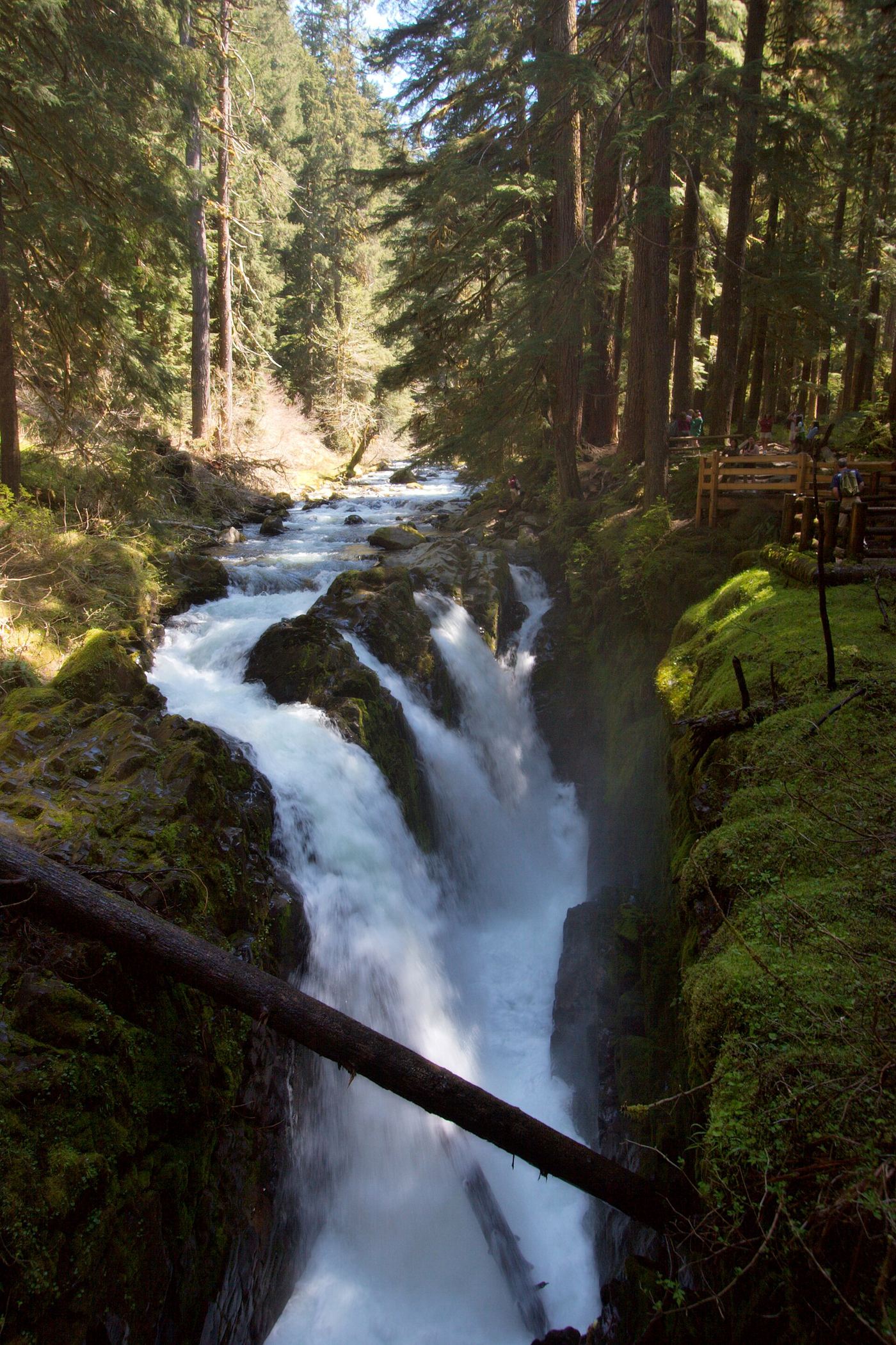
Salmon Cascades is a short, steep rapid where the Sol Duc River squeezes through a narrow rock gorge in Olympic National Park; the drop is about 5 feet at low flow and close to 15 feet in high water. It is about 7 miles up Sol Duc Valley Road from Highway 101. The cascade is easily seen from the road, and there is parking a short way farther along, with a short path to a deck overlooking the cascade. Return the same way.

Photo creditPhoto: Sea Cow, CC BY-SA 4.0, via Wikimedia Commons
Silver Falls, WA

National park trail loop to a falls viewpoint; slippery ledges near the falls

Washington

Silver Falls

About 1.3 miles to the viewpoint spur, per Visit Rainier; the full loop is 2.7 miles

Silver Falls is a 60-foot drop of the Ohanapecosh River into an amphitheater of old-growth forest in Mount Rainier National Park. Visit Rainier describes a loop from the Ohanapecosh Visitor Center: walk a short way up the campground's B loop road to the trail on the left, pass the old Ohanapecosh Hot Springs site on a boardwalk, cross Laughingwater Creek, and continue upstream. Cross the river on a high bridge over a narrow chasm; at about 1.3 miles a short spur leads to a viewpoint at the falls. Return the same way, or continue to the Eastside Trail junction, keep left, and follow the loop back to the campground amphitheater. The National Park Service also lists trail access from the Grove of the Patriarchs and Laughingwater Creek trailheads.

Photo creditPhoto: VitaleBaby, Public domain, via Wikimedia Commons
Spray Falls, WA

Partial: park trail documented; the only road access is closed at the Fairfax Bridge

Washington

Spray Falls

About 2 miles, then a 0.2-mile spur, one way (National Park Service)

Spray Falls is a 354-foot veiling waterfall where Spray Creek drops over a lava cliff below Spray Park, in Mount Rainier National Park. The National Park Service says there is no access to Mowich Lake by SR 165 until further notice, because the Fairfax Bridge outside the park is closed to vehicles, bicyclists and pedestrians and there is no alternate route. When access is possible, start at the trailhead to the left of the privy at the Mowich Lake walk-in campground. Follow the Wonderland Trail for three-tenths of a mile, keep left at the first signed junction, pass the Eagle Cliff viewpoint spur and Eagle's Roost Camp, and at a little over two miles take the signed spur to the base of the falls. Return the same way.

Photo creditPhoto: Joanna Poe from Munith, MI, USA, CC BY-SA 2.0, via Wikimedia Commons
Sunset Falls, WA

Public access closed; reopening not confirmed

Washington

Sunset Falls

No public walking approach verified

American Whitewater, which works directly on river-access negotiations, reports that WDFW closed public access at Sunset Falls because of conflicts with fish-trap operations and traffic on the narrow road. Proposed access improvements do not establish an open visitor route.

Photo creditPhoto: Loco Steve, CC BY 3.0, via Wikimedia Commons
Sweet Creek Falls, WA

Short trails from a highway rest area to the base and an observation area

Washington

Sweet Creek Falls

Short trails from the rest area parking lot; no distance is given

Sweet Creek Falls drops about 65 feet in three steps on Sweet Creek beside SR 31 between Ione and Metaline in Pend Oreille County. WTA describes the site as a small county park at the Sweet Creek rest area with two trailheads. From the south end of the parking lot, the lower trail crosses a footbridge, turns right and leads downhill on packed gravel to a clear pool at the base of the falls. From the north end, a paved then gravel trail leads to a fork: the left fork goes to a well-built observation area with views of the upper and lower falls, and the right fork climbs steeply on a poorly maintained path past the upper falls. Beyond the observation area, the path along a set of railings is not well maintained and suits only sure-footed walkers. Return the same way.

Photo creditPhoto: zak11527, CC BY-SA 3.0, via Wikimedia Commons
Twin Falls (Upper), WA

State park trail to the bridge and upper overlook

Washington

Twin Falls (Upper)

2.4 miles round trip to the falls (WTA)

The upper part of Twin Falls is on the South Fork Snoqualmie River in Olallie State Park near North Bend. Above the tall lower drop, the river falls about 45 feet into a pool and then cascades about 25 feet just upstream of a high footbridge (the Big Bridge) that spans the gorge. From the Twin Falls Trailhead, follow the trail beside the river, cross a short bridge over a swampy area, then climb switchbacks to The Benches. Descend past the Big Tree, climb the second hill, and take the final stairs down to the Big Bridge, which looks up at the two upper cascades. A few more stairs and a steep slope lead to the upper overlook for a better view of the upper falls. The topmost tier is mostly hidden from the trail. Return the same way. The trail can also be reached from the Homestead Valley Trailhead (I-90 exit 38) by walking about a third of a mile on the Palouse to Cascades Trail.

Photo creditPhoto: markjhandel, CC BY 2.0, via Wikimedia Commons
Upper Ancient Lake Falls, WA

Partial guide: informal paths on state wildlife land; who manages the gate parking area is not stated

Washington

Upper Ancient Lake Falls

About 3/4 mile from the parking area to the base of the falls, per the Northwest Waterfall Survey

Upper Ancient Lakes Falls is a 25-foot segmented falls where a small stream from Stan Coffin and H Lakes drops over a columnar basalt cliff above the Ancient Lakes basin, in the state wildlife lands of the Quincy Lakes area. Judith Pond lies just above the falls. From I-90 at George, take Highway 281 north just over 5 miles to Road 5 NW and turn left. Drive Road 5 NW for 3 miles, then turn sharply left on an unmarked gravel road; the trailhead is 1/3 mile down the hill at a gate. Follow the gated road right at the first junction, then a path right across the stream in a marshy area and left along a path. The path reaches the top of the falls and descends steeply to the base. This falls is separate from the larger Ancient Lake Falls, which has its own listing. Return the same way.

Photo creditPhoto: Richard Edwards, CC BY-SA 3.0, via Wikimedia Commons
Upper Comet Falls, WA

Partial guide: national park trail; distance to this falls not confirmed and the creek crossing has no bridge

Washington

Upper Comet Falls

Distance to this falls is not confirmed; NPS gives 1.8 miles to the base of Comet Falls

Upper Comet Falls is a 35-foot falls on Van Trump Creek in Mount Rainier National Park, above Comet Falls. Hike the Comet Falls Trail to Comet Falls; NPS says the trail then switchbacks uphill to the junction with the Comet Falls/Rampart Ridge Trail, with Van Trump Park to the right. Waterfalls Northwest says to stay left at this first junction above Comet Falls and descend to the crossing of Van Trump Creek. The falls are visible upstream from the crossing. Getting closer means rock hopping among large boulders in the creek bed. Return the same way.

Photo creditPhoto: brewbooks from near Seattle, USA, CC BY-SA 2.0, via Wikimedia Commons
Upper Lewis River Falls, WA

National forest river trail from the Quartz Creek Trailhead

Washington

Upper Lewis River Falls

About 3/4 mile from the Quartz Creek Trailhead (Northwest Waterfall Survey)

Upper Lewis River Falls is the tallest of the four major falls on this stretch of the Lewis River in the Gifford Pinchot National Forest, a 58-foot drop where most of the river stair-steps down a trough beside a sheer plunge. From the Quartz Creek Trailhead on Forest Road 90, follow the Lewis River Trail downstream, passing Taitnapum Falls at about the halfway point, to the falls. WTA describes a lower viewpoint and a second viewpoint, up a steep climb, about a quarter mile upstream of the lower one. The Northwest Waterfall Survey says the best access to the pool below the falls is from the north side of Alec Creek where it enters the river. The falls can also be reached by walking upstream from the Middle Falls trailhead. Return the same way.

Photo creditPhoto: Sheila Sund from Salem, United States, CC BY 2.0, via Wikimedia Commons
Upper Snow Creek Falls, WA

Long wilderness trail that passes the base of the falls

Washington

Upper Snow Creek Falls

About 9 miles one way from the Snow Creek trailhead, with about 4,600 feet of gain (Northwest Waterfall Survey)

Upper Snow Creek Falls is a series of slides and cascades of about 180 feet where Snow Creek leaves the Enchantment Lakes basin, between Upper Snow Lake and Lake Viviane in the Alpine Lakes Wilderness near Leavenworth. From the Snow Lakes Trailhead, the trail crosses Icicle Creek and climbs through switchbacks into the Snow Creek drainage, past Nada Lake to the Snow Lakes. The falls are about half a mile upstream of the footbridge at the inlet to Upper Snow Lake, where the trail passes their base. The upper part of the falls is hard to see, especially at low flow. Return the same way.

Photo creditPhoto: Buidhe, CC BY-SA 4.0, via Wikimedia Commons
Upper Wallace Falls, WA

Published state park trail to the Upper Falls viewpoint; Discover Pass required

Washington

Upper Wallace Falls

2.8 miles each way; WTA lists 5.6 miles round trip with 1,300 feet of gain

Upper Wallace Falls is the uppermost of the three waterfalls on the Wallace River in Wallace Falls State Park. From the trailhead by the information kiosk and restrooms, walk under the power lines into the forest. At the split about half a mile in, go right through the wooden gate onto the hiker-only Woody Trail. Stay on the Woody Trail past side paths to the picnic area at the Lower Falls, about 2 miles from the trailhead, then continue to the Middle Falls overlook. From there a steep half-mile of switchbacks leads to the Upper Falls, where the trail ends. Two of the upper drops can be seen from the fenced viewpoint. Return the same way.

Photo creditPhoto: Zincopper11, CC BY-SA 4.0, via Wikimedia Commons
Viviane Falls, WA

Long wilderness trail; free day-use permit at the trailhead; scramble for a clear view

Washington

Viviane Falls

About 9.75 miles one way and 5,100 feet of gain from the Snow Creek trailhead, per the Northwest Waterfall Survey

Viviane Falls is the largest waterfall in the Enchantment Lakes Basin in the Alpine Lakes Wilderness near Leavenworth. Snow Creek leaves Lake Viviane and drops about 215 feet down a fractured granite cliff, split into two channels. From the Snow Lakes Trailhead, follow the Snow Lakes Trail up past Nada Lake and the Snow Lakes toward Lake Viviane. The survey says a clear view needs a scramble up the creek about 100 vertical feet from the trail. The stretch between Upper Snow Lake and Lake Viviane is rugged, with some scrambling. This is a long, strenuous trip; the survey says day hiking is discouraged for all but the strongest hikers. Return the same way.

Photo creditPhoto: Buidhe, CC BY-SA 4.0, via Wikimedia Commons

Researched walking route

Washington

Angel Falls

Shorter route distance unknown

The county identifies a specific alternative parking area and trail that reaches Angel Falls first.

Location map; no photo available.

Distant viewing route identified; precise sighting point unverified

Washington

Angeline Falls

Long strenuous hike; falls-specific distance not verified

Northwest Waterfall Survey reports Angeline Falls visible from the high point between Little Heart and Big Heart Lakes. WTA describes the maintained West Fork Foss route through Trout and Copper Lakes to that high point. This is a distant viewing option, not a route to the waterfall base.

Location map; no photo available.

Partial guide: user-maintained trail on public and land trust property; no distance to this falls

Washington

Apron Falls

No distance is published to Apron Falls; the full hike to Railcar Falls, beyond it, is 4.3 miles round trip

Apron Falls (called Slide Falls by canyoneers) is a wide cascade down a sloping rock face on the East Fork Duncan Creek, in the Washington side of the Columbia River Gorge. From the turnaround, walk back down the road, cross the road bridge over Duncan Creek, go around the crash barrier on the north side and take the obvious path up; about 25 yards from the road the trail branches left up the bluff. Cross a plank bridge over the West Fork Duncan Creek, climb to the ridge, then drop to a campsite above the East Fork and hike upstream past Lower Quad Falls and Quad Falls, through the Columbia Land Trust parcel called Good's Woods. Apron Falls comes into view ahead; at the junction signed for Railcar Falls, the spur to the right gives a closer view. Return the same way. Oregon Hikers says this trail is rooty and steep in places, not a standard built trail.

Location map; no photo available.

Source-reviewed route and parking

Washington

Big Creek Falls

9.2 miles round trip

WTA describes crossing the Taylor River bridge, taking the right fork at the Quartz Creek junction, crossing Marten Creek and continuing past the Otter Falls turnoff to Big Creek Falls at the concrete bridge. The shared approach includes the landslide-damaged crossing described by WTA; check its condition before committing to the route.

Location map; no photo available.

Waterfall viewing approach unconfirmed

Washington

Big Heart Falls

7.3 miles each way to Big Heart Lake, not a confirmed waterfall viewpoint

Big Heart Falls descends from Big Heart Lake toward Delta Lake. WTA documents the maintained lake approach, but the waterfall survey warns that base access is difficult and much of the falls is obscured even across Delta Lake.

Location map; no photo available.

Long trail hike to a signed spur; Discover Pass required

Washington

Black Hole Falls

10.4 miles round trip per Washington Trails Association

Black Hole Falls is on North Siouxon Creek in Skamania County. Washington Trails Association describes the hike: start at the North Siouxon Creek Trailhead, which is also the south end of the Mitchell Peak Trail. The trail mostly runs high on the north wall of the gorge above the North Fork of the Siouxon. Small streams cross the trail and there are a few log crossings over larger side creeks. Near the five-mile mark a sign marks the short spur trail down to Black Hole Falls. Return the same way.

Location map; no photo available.

State land trail route and trailhead documented

Washington

Buck Creek Falls

3.0-mile loop (WTA); the falls are a quarter mile from the end of the loop

Buck Creek Falls is a small waterfall that runs through a slot into a basalt-rimmed, bowl-shaped pool on Buck Creek, the White Salmon water supply, on Washington DNR land. From the Buck Creek Falls Loop Trailhead and campground, cross the road carefully, walk a short way down the road and turn onto the trail beside the creek, following signs marked Buck Creek and white diamond tags. The loop climbs to a valley overlook, descends to a low concrete bridge, then returns upstream along the water pipeline corridor. A quarter mile from the end of the loop is the overlook of the falls; cross a bridge to return to the trailhead. WTA says you can also visit the falls first.

Location map; no photo available.

Short river trail from the BZ Corner launch to a viewing deck

Washington

BZ Falls

About a quarter mile from the river to the viewing deck, per an Oregon Hikers forum account

BZ Falls is a waterfall on the White Salmon River upstream of BZ Corner. The access parcel at BZ Corner is public land managed by the Forest Service as part of the Lower White Salmon Wild and Scenic River, with an access trail for boaters. An Oregon Hikers forum account describes the walk: park at the boat launch at BZ Corner, walk down to the river, and turn left on a trail that runs upstream about a quarter mile to a viewing deck. Return the same way.

Location map; no photo available.

Guide: short forest trail to an overlook at the base

Washington

Camp Creek Falls

0.6 mile round trip (WTA)

Camp Creek Falls pours out of a narrow canyon into a bowl on the north side of the Cispus River valley in Gifford Pinchot National Forest. From Randle, drive south on SR 131 and bear left onto Forest Road 23. Follow Road 23 about 8.4 to 8.5 miles to a small parking area on the right; the signed trail starts on the left side of the road, just before the road crosses Camp Creek. The trail runs gently through forest, climbs briefly along a steep side slope, and ends at a natural overlook about 15 feet above the plunge pool. Return the same way.

Location map; no photo available.

Short national forest loop from the Quinault Ranger Station

Washington

Cascade Falls

1.7-mile loop per the Northwest Washington Scenic Waterfall Trail

Cascade Falls is a 20-foot waterfall fanning out of a small gorge on Cascade Creek in the Quinault Rain Forest, Olympic National Forest. From the trailhead just past the Quinault Ranger Station, first look at Falls Creek Falls beside the parking area. Cross the road and follow the trail along Falls Creek. Cross the creek on a bridge and keep right at a junction. Climb gently to a bridge over Cascade Creek just above the falls; there are several good viewing spots. To finish the loop, cross Falls Creek again, keep right at a junction, and walk through big trees to a trailhead near Lake Quinault Lodge, then back along the road.

Location map; no photo available.

Short signed state park trail; Discover Pass required

Washington

Cascade Falls

WTA says this approach is about half a mile out and back

Cascade Falls is a 40-foot falls on Cascade Creek in Moran State Park on Orcas Island, the tallest waterfall in the San Juan Islands. From the small trailhead lot on Mount Constitution Road, take the hiker-only trail to the left (the right-hand trail is for bicycles). After 0.1 mile a sign shows Rustic Falls straight ahead, Cascade Falls to the right, and Cavern and Hidden Falls to the left. Go right and follow Cascade Creek to the top of the falls, then descend beside them to an upper viewpoint and a lower viewpoint. The lower viewpoint trail crosses the creek on a bridge; a trip report counts about 63 steps down and back up. Return the same way. Longer approaches start from the Cascade Lake day-use area.

Location map; no photo available.

Partial: monument trail documented; access road crosses private land and may be gated

Washington

Cathedral Falls

About 1 mile one way (Waterfalls Northwest)

Cathedral Falls is a 248-foot plunge on a small tributary of Goat Creek in the Mount St. Helens National Volcanic Monument. The trail starts where Forest Road 2750 ends at a turnout; do not park in the turnout itself. The Goat Creek Trail follows an old roadbed through old cedar and hemlock forest and climbs gently to the falls, then passes behind them under a huge overhang. Return the same way. The access road crosses private land and may be gated.

Location map; no photo available.

Partial guide: signed state park trail junction; the last section to this falls is not described

Washington

Cavern Falls

No distance to Cavern Falls is published; the signed junction is 0.1 mile from the trailhead

Cavern Falls is on Cascade Creek in Moran State Park on Orcas Island, upstream of Rustic Falls. From the small trailhead lot on Mount Constitution Road, take the hiker-only trail to the left (the right-hand trail is for bicycles). After 0.1 mile a sign shows Rustic Falls straight ahead, Cascade Falls to the right, and Cavern and Hidden Falls to the left. Turn left for Cavern Falls. The sources do not describe the trail beyond the junction or the view of Cavern Falls itself. Return the same way.

Location map; no photo available.

National forest trail from a signed trailhead; forest pass required

Washington

Cedar Falls

1.7 miles to the falls, per Okanogan Country; WTA lists 3.5 miles round trip

Cedar Falls is a two-tier waterfall on Cedar Creek in the Okanogan-Wenatchee National Forest west of Mazama, where the creek pours from pool to pool and drops 50 to 60 feet in a series of falls. From the trailhead, the Cedar Creek Trail climbs gradually through open forest and wildflower meadows with views back to Goat Peak. The falls are below the trail. There are no fences or barriers and the ground around the falls is steep, so take care near the edges. Return the same way. The trail continues to Abernathy Pass and the Lake Chelan-Sawtooth Wilderness.

Location map; no photo available.

Partial guide: first half mile crosses private land under a homeowner courtesy easement

Washington

Cherry Creek Falls

About 2.5 miles from the trailhead to the base of the falls, per WTA; 5.0 miles round trip

Cherry Creek Falls is a 20- to 25-foot falls over a wide ledge into a large pool, the last waterfall on Cherry Creek outside Duvall. WTA says access is part of an agreement with nearby homeowners: the first half mile of the trail is a courtesy easement within private property, so stay on the main path, keep dogs leashed, keep noise down and pack out trash. From the blue DNR gate, follow the old road. Cross Margaret Creek on a bridge at about three-quarters of a mile, stay left at the first junction and right at the second, then right at the third and downhill. At the sharp hairpin at 1.5 miles, go left on a muddy track through the woods, then rejoin the old road and go straight about another mile to Hannan Creek, which you ford. The path to the falls branches right just past the creek, sometimes hidden behind a dirt pile, and leads to a firepit area above the falls and a short path to the base. Return the same way.

Location map; no photo available.

Long national forest trail; ford of Siouxon Creek required

Washington

Chinook Falls

Oregon Hikers lists Chinook Falls at 13.6 miles from the Siouxon Trailhead

Chinook Falls is a 60-foot waterfall on Chinook Creek in the Siouxon Roadless Area of Gifford Pinchot National Forest. Oregon Hikers says the old Siouxon Trailhead and the last three miles of road to it are closed after fire damage, so start at the newer Siouxon Trailhead. Walk down the road past the vehicle barrier about 125 yards to where the trail leaves on the left, and follow the Siouxon Trail upstream past Horseshoe Creek Falls and Siouxon Falls to the Siouxon-Chinook Trail Junction, where a footbridge once crossed a narrows. The bridge is out: ford Siouxon Creek below the chasm, then take the Chinook Trail 130A up Chinook Creek to the crossing below the falls. The falls are best seen from mid-creek or the west bank. Return the same way.

Location map; no photo available.

National volcanic monument trail with lava-field crossings; falls often dry by midsummer

Washington

Chocolate Falls

5.7 miles round trip with 1,150 feet of gain, per Oregon Hikers

Chocolate Falls is a 40-foot waterfall on the south side of Mount St. Helens, named because its water can carry so much volcanic ash that it looks like chocolate milk. From the June Lake Trailhead, follow the June Lake Trail up through forest along June Creek and across a footbridge. Just before June Lake, the trail continues ahead and climbs steeply about 0.3 mile to the Loowit Trail. Turn west (left) on the Loowit Trail and continue just over a mile, crossing several lava fields, to the falls. Return the same way. Oregon Hikers notes the lava-field crossings may be hard for children.

Location map; no photo available.

Guide: short forest hike to a fenced viewpoint

Washington

Chuckanut Falls

2.6 miles round trip (WTA); the county lists 2.7 miles as a loop

Chuckanut Falls is a small waterfall on the north side of Chuckanut Mountain, south of Bellingham. From the North Chuckanut Mountain Trailhead, climb gently through Arroyo Park; where forks are confusing, WTA advises taking the right-hand trail. You cross boardwalks and creeks. After about one mile, at a sharp hairpin turn, a sign on the left marks Chuckanut Falls. Head downhill on switchbacks, keep going downhill at the next junction, and about 0.3 mile from the signed junction reach a viewpoint with a wooden fence and a small bench. The falls are just beyond. Return the same way.

Location map; no photo available.

Washington

Copper Lake Falls

About 7.5 miles round trip

Follow West Fork Foss Lakes Trail beyond the Malachite Falls views toward Copper Lake. Northwest Waterfall Survey places Copper Lake Falls downstream of the lake, with its lower cascades among boulders.

Location map; no photo available.

National forest trail from a forest road trailhead; two creek crossings

Washington

Cora Falls

Within the first half mile of the trail, per WTA

Cora Falls is a series of tiers on Big Creek in the Gifford Pinchot National Forest, below Cora Lake and northwest of Packwood. Big Creek Trail #252 starts on Forest Road 8420 and climbs steeply beside Big Creek. In the first half mile it crosses the creek twice between different parts of Cora Falls. Return the same way, or continue about another half mile to Cora Lake on a short spur. WTA says the crossings are easy at low water but can be tricky early in the season.

Location map; no photo available.

Tribal land open to the public only in set periods; check dates and fees

Washington

Crooked Creek Falls

Falls at just over 1 mile on the Bird Lake Trail per Washington Trails Association

Crooked Creek Falls is on the Bird Lake Trail in Bird Creek Meadows, on Yakama Nation land on the southeast side of Mount Adams. The Yakama Nation opens this area to the general public only at certain times of year, usually for a short period in late summer, and may close it for fire danger. Check open dates and day-use fees with the Yakama Nation before going. From the south end of Bird Lake, walk the short spur road to the left and find the unsigned start of the Bird Lake Trail, marked by flagging through burned trees. The trail crosses Crooked Creek three times; at the second bridge it turns 90 degrees left, and hikers have gotten lost by going straight. Crooked Creek Falls appears at just over a mile. Return the same way or continue on the loop.

Location map; no photo available.

Partial guide: roadside parking; informal paths to the view

Washington

Crystal Falls

A few steps to a short walk from the parking area; no distance given

Crystal Falls is a waterfall on the Little Pend Oreille River in Crystal Falls State Park, east of Colville. From Colville, drive east on Highway 20 for 14.7 miles to the Park Rapids sign and parking area. The falls are next to the parking area, and the usual view is from the top. The paths around the falls are informal user paths, not a built trail. Keep well back from the edge.

Location map; no photo available.

Researched route and starting area

Washington

Curly Creek Falls

Distance to Curly Creek viewpoint unknown.

From the trailhead, walk west on Trail #31A to the viewpoint across the river from Curly Creek Falls.

Location map; no photo available.

National forest trail to a walk-behind waterfall

Washington

Curtain Falls

Half a mile to a signed junction, then half a mile on to the falls, per WTA

Curtain Falls, officially Covell Creek Falls and also called Covel Creek Falls or Phantom Falls, drops about 75 to 80 feet over a basalt cliff on Covell Creek in the Gifford Pinchot National Forest near the Cispus Center. The cliff is undercut, and the trail passes behind the falls. From the trailhead across from the Cispus Environmental Learning Center entrance, switchback up half a mile to a signed junction. Go right for Covel Creek Falls; the trail runs under basalt cliffs over 200 feet high for another half mile to the falls. Return the same way, or continue on the loop past Angel Falls, which has its own listing. The best full views are from the far side of the creek; stay on the trail because the vegetation is fragile.

Location map; no photo available.

Guide: steep forest trail to a side view of the falls

Washington

Dalles Creek Falls Lower

About 1 mile one way to the falls (WTA)

Lower Dalles Falls is on Dalles Creek near Highway 410 in Mt. Baker-Snoqualmie National Forest. From the wide parking area on the left side of the highway, the trail climbs steeply. At 0.4 mile, keep left at the junction with the White River Trail and follow the Palisades Trail up switchbacks beside the Dalles Creek canyon. Listen for the falls about one mile from the trailhead and take the side trail to the right for a closer look. Return the same way. The creek is fed by snowmelt and is only a trickle by midsummer.

Location map; no photo available.

National park route documented; long approach on a closed road

Washington

Denman Falls

7.7 miles one way on Westside Road (NPS), then a 0.3-mile loop trail

Denman Falls is a free-falling plunge of about 140 feet on St. Andrews Creek in Mount Rainier National Park. Westside Road is closed to vehicles at Dry Creek. From the closure, hike or bike Westside Road 7.7 miles to the St. Andrews Creek trailhead. A short loop trail starts on the downstream side of the road next to the bridge and leads to a viewpoint of the falls. Bicycles are not allowed on the trail. Trees partly block the view. Return the same way.

Location map; no photo available.

County park path to a railed viewing deck

Washington

Deschutes Falls

About a quarter mile, per Thurston County

Deschutes Falls is a 25-foot waterfall on the Deschutes River in Deschutes Falls Park, a mostly undeveloped 155-acre Thurston County park southeast of Yelm. Take the main path down the hill from the parking lot for about a quarter mile. Where the path divides at the bottom of the hill, stay right to reach the railed viewing deck above the falls. Return the same way. The park also has a historic log cabin.

Location map; no photo available.

Partial guide: private tree farm open to visitors by owner permission

Washington

Dickerson Falls

Just over one mile to the signed falls trail, then a short descent (Northwest Waterfall Survey)

Dickerson Falls is a two-step waterfall on Dickerson Creek in the privately owned Ueland Tree Farm near Bremerton. The Northwest Waterfall Survey says the owners openly grant and welcome public visitation and built the trail. From WA-3, take Kitsap Way west 1.4 miles, bear left onto Northlake Way NW for just under two-thirds of a mile, then turn hard left onto Leber Lane NW to the large parking area before the gate under the powerlines. Follow the gated road or the designated trail beside it for just over a mile to a signed trail on the right. It descends to a bridge over the creek just above the falls and winds down steps to the base of the upper tier. Two smaller falls farther downstream are closed to the public.

Location map; no photo available.

Partial: short viewpoint near the trailhead from one visitor report; rough access road

Washington

Dingford Creek Falls

Short walk past the trailhead gate; no distance given

Dingford Creek Falls is next to the Dingford Creek Trailhead at the end of the Middle Fork Snoqualmie Road in the Mount Baker-Snoqualmie National Forest. WTA says the gate at the far end of the trailhead lot leads onto the old Middle Fork Road toward Dutch Miller Gap. A WTA trip report viewed Dingford Creek Falls from a concrete bridge past that gate, calling it a waterfall with no effort to get to. Return the same way.

Location map; no photo available.

Route and parking documented; confirm current conditions.

Washington

Dog Creek Falls

100 feet one way; about 200 feet return

Skamania County's visitor guide documents a short trail from the roadside pullout to Dog Creek Falls.

Location map; no photo available.

Roadside falls at a state forest day-use site; Discover Pass

Washington

Dougan Falls

Roadside view; short paths to the water

Dougan Falls is a 19-foot falls on the Washougal River, the last major waterfall on the river, with a deep pool below. It can be seen from roadside pullouts and from the road at the Dougan Falls day-use area. A small network of short paths from the picnic area leads down to the river over rocky, uneven ground. Stay off social trails: there is private land close to the day-use area and campground. Do not wade near the top of the falls; the current is strong.

Location map; no photo available.

Partial guide: park trail route assembled from trip reports; no distance to this falls

Washington

Doughty Falls

No distance to the falls is published; a trip report gives 6.6 miles for a loop that includes two other falls

Doughty Falls is a waterfall of about 20 to 25 feet on Cabbage Creek, on the Deceiver Trail in King County's Cougar Mountain Regional Wildland Park near Issaquah. A WTA trip report describes a loop that starts at the Sky Country trailhead: go up Clay Pit Road to Fred's Railroad, turn right on Fred's Railroad to the Shy Bear Trail and Shy Bear Pass, then take the Long View Peak Trail, which becomes the Deceiver Trail and drops to Cabbage Creek just above Doughty Falls. Later trip reports mention new steps, a railing, a viewing landing and a bridge at the falls. Return the same way, or continue on the Shy Bear and Far Country trails as a loop. The trails are well marked, but carry a park map.

Location map; no photo available.

Guide: short park loop past the falls

Washington

Douglas Falls

1.5-mile loop (WTA); the falls are a short walk from the parking area

Douglas Falls is a waterfall on Mill Creek in Douglas Falls Grange Park, a small park and campground run by the Washington Department of Natural Resources. From the parking area, cross the bridge above the creek toward the picnic area and look for the Nature Loop Trail sign. Spur trails lead to the bottom of the falls, and a short steep section climbs to the top. The loop also crosses a suspended footbridge over the creek; the falls cannot be seen from that bridge. Do not follow the creekside spur that ends at a barbed wire fence; that is the edge of public land.

Location map; no photo available.

Partial: highway-side view documented; no designated parking or walkway

Washington

Drury Falls

About 500 feet along the highway from either pullout (Waterfalls Northwest)

Drury Falls is a tall, seasonal waterfall on Fall Creek that plunges over the rim of Tumwater Canyon across the Wenatchee River from US 2. The 455-foot upper tier is visible from the side of US 2 in the heart of Tumwater Canyon, about 3 miles east of Tumwater Campground or 6 miles west of Leavenworth. There is no parking where the view is best; park at a pullout about 500 feet away in either direction and walk along the side of the highway. The lower tiers are hidden in a narrow canyon; the only full view is from the summit of Tumwater Mountain.

Location map; no photo available.

Short wildlife area loop past the falls; avoid the posted private parcel

Washington

Duncan Creek Falls

Short loop; Oregon Hikers gives 0.2 miles of road between the two trailheads but no total distance

Duncan Creek Falls is where the East Fork of Duncan Creek splits, with one cascade funneled through a narrow slot and the other sliding down a rock face. It is in the Nellie Corser Unit of the Mount Saint Helens Wildlife Area. Oregon Hikers suggests starting at the Duncan Creek Trailhead and walking 0.2 miles up the gravel road to the Nellie Corser Trailhead. Pass the concrete barrier and follow the old homestead driveway through old-growth forest, crossing two small creeks, to the homestead site above the East Fork. Continue down the creek past the Nellie Corser Cascades to Duncan Creek Falls. At the next junction keep left to return to Duncan Creek Road; the right fork goes to a small private parcel posted no trespassing.

Location map; no photo available.

Short nature preserve trail; seasonal falls

Washington

Dutch Henry Falls

Wenatchee Outdoors calls it a very easy half-mile out-and-back hike

Dutch Henry Falls is a seasonal waterfall in a large cleft in the basalt cliff on the northwest side of Moses Coulee, in The Nature Conservancy's Moses Coulee Preserve. From the north trailhead, follow the open path through shrub-steppe to the riparian area below the falls, where the water forms a small pool. Return the same way. The Conservancy asks hikers to stay on trails because the soil crust is fragile. Bring water and sun protection and watch for rattlesnakes.

Location map; no photo available.

State park viewpoint near the Access Road; exact path not described

Washington

Eightmile Creek Falls

Short walk; no distance given

Eightmile Creek Falls spills over rimrock into a narrow slot canyon on Eightmile Creek north of SR 14, east of Horsethief Lake, and dries up late in the season. Wikipedia says there is a viewpoint just east of the Access Road off SR 14. A Washington Trails Association trip report describes hiking from the Crawford Oaks trailhead on the Access Road in Columbia Hills Historical State Park and seeing high water going over the falls. Neither source describes the exact path to the viewpoint.

Location map; no photo available.

Researched route and starting area

Washington

Elk Creek Falls

Loop distance unknown.

From the upper lot, cross the road and follow Trail #560 past Elk Creek Falls before returning to the trailhead.

Location map; no photo available.

Unmaintained side paths and creek crossings; Discover Pass

Washington

Explorer Falls

A little over 2 miles round trip per South Sound Magazine

Explorer Falls is next to the City of Everett's Lake Chaplain Watershed. South Sound Magazine describes the route: at the end of Monroe Camp Road, walk around the bright yellow gate and follow the tree-lined road about three-quarters of a mile. Watch for signs in the trees pointing left to Explorer Falls and take the small trail past fallen trees. Look left for a pile of logs on a dirt mound; a small trail goes through the logs, over the mound and across a creek. Go around a second gate and walk a little over a quarter mile up a gentle grade. Ignore the first narrow trail on the right; about 100 yards farther, just before a fork in the road, the falls trail crosses the creek to the falls. The route relies on side paths and creek crossings rather than a maintained trail.

Location map; no photo available.

Distant roadside view in a national park; entrance fee

Washington

Fairy Falls

Roadside distant view; the NPS says the falls are best viewed from a distance

Fairy Falls is a tiered waterfall of nearly 600 feet over a headwall of upper Stevens Canyon in Mount Rainier National Park. The NPS says its location is inaccessible and it is best viewed from a distance, with binoculars. Go to the Snow Lake trailhead on Stevens Canyon Road and look north across the upper end of Stevens Canyon; it can also be seen from the hairpin pull-off on Stevens Canyon Road below the trailhead. Visit Rainier discourages going to the falls because they are off trail.

Location map; no photo available.

Guide: roadside view into the gorge

Washington

Fall into the Wall

Roadside viewpoint; look down into the gorge from the stone wall

Fall Into The Wall is a 22-foot drop where the South Fork Snoqualmie River plunges into a small gorge and nearly hits a rock wall, forcing a sharp bend. From I-90, take the Alpental exit at Snoqualmie Pass, turn left at the light and drive under I-90, then turn left almost at once onto Forest Road 58, which follows the South Fork. Soon after passing under the westbound lanes of I-90, look for a stone wall on the river side of the road. Pull out there and look down into the gorge. The road can also be reached by driving east from the Franklin Falls area for about 1.5 miles.

Location map; no photo available.

Parking location unconfirmed

Washington

Falls Creek Falls

4.4 miles round trip, per county chamber

The county chamber describes a suspension-bridge crossing and a climbing forest trail to the waterfall’s lower level. Confirm current Forest Service trail and road details.

Location map; no photo available.

Washington

Feature Show Falls

About 1.25 miles each way

Follow Boulder River Trail to the double waterfall across the river. The survey distinguishes Feature Show Falls from Boulder Falls downstream.

Location map; no photo available.

Short creek trail; no nearby legal parking; exact falls not located

Washington

Fifteenmile Waterfall

1.4 miles round trip per Washington Trails Association

Washington Trails Association describes the Grand Canyon of Fifteenmile Creek as a short, secluded walk along Fifteenmile Creek on Tiger Mountain with views of waterfalls, cliffs and old coal mines. The trail is a connector from Tiger Mountain Road to a trailhead inside the forest. The sources do not say which of the creek's waterfalls is this listing or where along the trail it is seen.

Location map; no photo available.

Identity context documented; waterfall route and parking unresolved

Washington

Florence Falls

Waterfall route distance unknown

Northwest Waterfall Survey places Florence Falls on the East Fork Miller River below Lake Dorothy and documents historical ambiguity in its mapped location. Its description identifies a long gorge cascade but provides no sanctioned approach. WTA’s lake trail description does not establish a waterfall viewing route.

Location map; no photo available.

National forest trail along the creek; falls location on the trail not given

Washington

Foggy Dew Falls

Washington Trails Association lists 14.0 miles round trip for the full hike; no distance to the falls is given

Washington Trails Association describes the Foggy Dew Creek Trail as a valley walk along Foggy Dew Creek with two large waterfalls, before a steep climb to Merchants Basin. The first section follows the north side of the creek through ponderosa pine and Douglas fir forest, and is fairly flat. The page does not say where along the trail Foggy Dew Falls is, so turn back once you have seen the falls.

Location map; no photo available.

National park trail from Paradise; falls beside a switchback on the Golden Gate Trail

Washington

Golden Gate Falls

About 1.3 miles from the Paradise Lodge parking lot to the switchback below the falls, per the Northwest Waterfall Survey

Golden Gate Falls is the uppermost waterfall on Edith Creek in Mount Rainier National Park. Two streams drop side by side, just under 120 feet in all, down the headwall of Paradise Valley. The name was suggested by the Northwest Waterfall Survey; no historical name is known. From the Paradise Lodge parking lot, follow the Skyline Trail to the bridge at Myrtle Falls, then turn left on the Golden Gate Trail. The falls are visible high on the headwall as the trail climbs, and the trail reaches a switchback at the bottom of the falls. Return the same way, or continue up the Golden Gate Trail to its junction with the Skyline Trail.

Location map; no photo available.

Logging road walk on DNR land, then an off-trail scramble; road damaged at the stream

Washington

Gossamer Falls

The Northwest Waterfall Survey places Switchback Falls at the 2.6-mile mark of the road walk; Gossamer Falls is a short distance beyond and upstream

Gossamer Falls is a 102-foot veiling falls on a small branch of Big Blowout Creek on the south side of Bessemer Mountain, on a parcel of Department of Natural Resources land near North Bend. Walk up the gated Bessemer Road, which climbs gently for the first mile to where it meets the CCC Trail. Keep to the main road uphill where trails and spurs branch off. About a mile and three-quarters from the gate is an active quarry where trucks and heavy equipment may work on weekdays; stay out of the quarry area. Continue straight past the quarry and up three sharp switchbacks to Switchback Falls beside the road. One more switchback and a fifth of a mile further, the road crosses the top of Switchback Falls, and Gossamer Falls can be seen upstream. For a closer view, scramble up the slope to the left of the stream and traverse through open forest about 300 feet to the base. The survey reports that a debris flow stripped the trees beside the falls and destroyed the road in four places where it crosses this stream, so the last part of the approach can be rough and changeable. Return the same way.

Location map; no photo available.

Partial guide: short campground trail; day-use parking for non-campers is not stated

Washington

Grant Purcell Falls

About a quarter mile to the falls, per the Northwest Waterfall Survey

Grant Purcell Falls (also called Purcell Falls) is a series of small slides and cascades where Purcell Creek drops toward the Cowlitz River, inside La Wis Wis Campground in the Gifford Pinchot National Forest. The Purcell Falls Trail (No. 162A) starts halfway through the C loop of the campground and reaches the falls in about a quarter mile. Return the same way. The slopes above the falls are steep, trees often fall into the gorge, and fallen logs can block parts of the view. The trail itself can be damaged by fallen trees.

Location map; no photo available.

Source-reviewed route and parking

Washington

Hamma Hamma Falls

Roadside view; no measured walk

Northwest Waterfall Survey describes views over the top of the falls from the high concrete bridge near Mildred Lakes Trailhead. Its direct-view path is steep, narrow and beside unguarded cliffs; this guide does not endorse descending it.

Location map; no photo available.

Signed state park trail to a viewpoint above the falls; Discover Pass required

Washington

Hardy Falls

The Northwest Waterfall Survey gives 1.3 miles up the trail to the marked spur; WTA puts the side trail at about 1 mile

Hardy Falls is a 90-foot falls on Hardy Creek, the lower of the two major falls on the creek in Beacon Rock State Park on the Washington side of the Columbia River Gorge. From the Hamilton Mountain Trailhead, climb the wide, well-built Hamilton Mountain Trail through old-growth forest. Watch for the marked side trail down to the Hardy Falls viewpoint; it is a short, steep pitch. The developed viewpoint is about 200 feet above the creek and trees partly block the view. Rodney Falls and the Pool of the Winds are a little farther up the main trail. Return the same way. The survey describes a steep, hazardous scramble to the base through vine maple and Oregon grape; it is not a trail.

Location map; no photo available.

Partial guide: signed state park trail junction; the last section to this falls is not described

Washington

Hidden Falls

No distance to Hidden Falls is published; the signed junction is 0.1 mile from the trailhead

Hidden Falls is a small falls, about 15 feet tall, the first in a series of small waterfalls on Cascade Creek in Moran State Park on Orcas Island. A bridge crosses right over the top of the falls. From the Cascade Falls trailhead lot on Mount Constitution Road, take the hiker-only trail to the left (the right-hand trail is for bicycles). After 0.1 mile a sign shows Cascade Falls to the right and Cavern and Hidden Falls to the left. Turn left. The trail beyond the junction to Hidden Falls is not described. Return the same way.

Location map; no photo available.

State forest trail to a bridge view of the falls

Washington

Hidden Falls

10.4 miles round trip (Oregon Hikers)

Hidden Falls drops down a mossy cliff on the South Fork Coyote Creek in Yacolt Burn State Forest, managed by the Washington State Department of Natural Resources. From the Tarbell Picnic Area, take the railed trail up past the picnic tables, go right past Milepost 0.0, and at the signed Tarbell Trailhead Junction go left for Hidden Falls. The trail climbs through clearcuts and forest, crosses gravel road L1121, keeps left at the Tarbell-Silver Shadow junction, traverses Kloochman Butte and keeps straight at the Tarbell-Chinook junction. At a logging road go right about 25 yards to pick up the trail again, switchback down to the footbridge over the North Fork Coyote Creek, pass Milepost 5.0 and the Appaloosa Trail junction, and descend to a bridge over the South Fork Coyote Creek with a view up to the falls and a bench. Return the same way. The trail is shared with mountain bikers and horses.

Location map; no photo available.

National forest trail from the relocated Siouxon Trailhead; spur trail to the base

Washington

Horseshoe Creek Falls

About 4.4 miles one way along the trail, per the Northwest Waterfall Survey

Horseshoe Creek Falls is a three-tier, roughly 57-foot falls where Horseshoe Creek drops toward Siouxon Creek in the Gifford Pinchot National Forest. The road to the old trailhead is closed, so the hike now starts at the Siouxon Trailhead about 3 miles farther back. From the parking area, walk down the road past the vehicle barrier about 125 yards to where the trail leaves on the left. Stay right at the Huffman Peak Trail junction, keep left at the connector from the closed old trailhead, cross the West Creek footbridge and pass the Horseshoe Ridge Trail junction. At Horseshoe Creek you get a side view of the upper tier from the trail. Cross the footbridge; an unsigned spur trail drops to a bench with campsites and a fuller view of all three tiers. Return the same way.

Location map; no photo available.

Closed to public access according to the landowner's 2025 report; no public approach or parking verified.

Washington

Horseshoe Falls

No public access documented

Horseshoe Falls on the East Fork Lewis River is protected by Columbia Land Trust. Its 2025 conservation report says a life estate restricts public access.

Location map; no photo available.

Roadside falls with a short paved path to a bench

Washington

Horsetail Falls

Short paved path; no distance is published

Horsetail Falls is a 50-foot seasonal waterfall on a small creek beside the Little Naches River road, east of Chinook Pass. Driving east on Highway 410 from Chinook Pass, turn north on the Little Naches River road 22 miles from the pass. Drive three-quarters of a mile to a large pullout on the right; the falls can be seen through the trees. A paved path leads to a bench and a sign naming the falls. Several short paths from the bench lead to the best view, directly in front of the falls.

Location map; no photo available.

Pedestrian approach unconfirmed

Washington

Husum Falls

Roadside viewing; distance not specified

The firsthand survey identifies Husum Falls beside the Highway 141 bridge over the White Salmon River in Husum. It places parking north of the bridge.

Location map; no photo available.

Current approach and precise location unconfirmed

Washington

Immigration Falls

Walking distance not confirmed

Northwest Waterfall Survey records this colloquially named cascade on the West Fork Miller River and says it can be seen from the trail. Its field observation dates to about 2001 and has not been rechecked.

Location map; no photo available.

Short national forest trail to a viewpoint beside Forest Road 25

Washington

Iron Creek Falls

About 500 feet to the viewpoint, per WTA

Iron Creek Falls pours over an erosion-resistant rock band on Iron Creek in the Gifford Pinchot National Forest, close to Forest Road 25 south of Randle. From the signed trail on the east side of the road, walk about 500 feet down a wide trail to the viewpoint. The trail ends at the viewpoint. Several boot paths lead down to the creek; watch your footing and keep children close if you use them. Return the same way.

Location map; no photo available.

Partial: roadside parking and a short unmaintained path; no formal lot or trail

Washington

John Pierce Waterfall

About 200 feet one way (Waterfalls Northwest)

John Pierce Falls, once called Horsetail Falls, is a 66-foot waterfall on Horsetail Creek beside the North Cascades Highway in Ross Lake National Recreation Area. It is about 11 and a half miles east of Newhalem, half a mile west of the Ross Dam Trailhead, and can be seen from passing cars. To reach the base, park next to the cliff on the east side of the bridge and follow the brushy bench along the drainage for about 200 feet. The bench is what remains of the original road to Ross Dam; trees and fallen boulders are taking it over, and it is not a maintained trail. Return the same way.

Location map; no photo available.

Road walk and trail in a state wildlife area; Discover Pass required

Washington

Kalama Falls

Oregon Hikers lists this route as 4.6 miles round trip

Kalama Falls is a single main plunge of the Kalama River into a large pool, in the Washington Department of Fish and Wildlife Merrill Lake Wildlife Area west of Mount St. Helens. WTA says the falls and trails are public access. There is no vehicle access into the unit, so park at the gate and walk the gravel road. Stay on the main road past an information kiosk at a junction. Where the road flattens, the Kalama Falls Trail crosses it; Oregon Hikers suggests taking the trail, which skirts an old lava flow and returns to the road. Walk left about 40 yards to a sign reading Kalama Falls Trail near the road bridge over Merrill Lake Creek, and follow that trail through old-growth trees to the bluff above the falls. A narrow, rooty path leads down to the riverbank for closer views. Return the same way or by the road.

Location map; no photo available.

National park trail to a distant viewpoint of the falls at Mildred Point

Washington

Kautz Creek Falls

About 3.5 miles one way to Mildred Point (WTA)

Kautz Creek Falls is a 140-foot plunge below the Kautz Glacier in Mount Rainier National Park. It is seen at a distance from Mildred Point, a bluff overlooking the Kautz Creek valley. From the Comet Falls Trailhead, climb the Comet Falls Trail along Van Trump Creek past Bloucher Falls to the side path for Comet Falls at about 1.9 miles. Continue uphill steeply to a junction; stay left (Van Trump Park is to the right), cross Van Trump Creek on a log, and at the next junction turn right for Mildred Point. The last half mile is narrow, steep, rutted and overgrown. The muddy glacial water can make the falls hard to pick out against the canyon walls. Return the same way.

Location map; no photo available.

National forest wilderness trail with an unbridged creek ford

Washington

Keekwulee Falls

5 miles round trip to Keekwulee Falls, per WTA

Keekwulee Falls drops about 125 feet in two steps on Denny Creek in the Alpine Lakes Wilderness near Snoqualmie Pass. Follow the Denny Creek Trail through old-growth forest, cross Denny Creek on a large bridge after half a mile, pass under the I-90 viaduct, and enter the wilderness. Just over a mile from the trailhead, the trail crosses Denny Creek at the water slide rocks, where there is no bridge and the creek must be forded. Continue 0.7 mile to a rock outcrop just off the trail with a view of Keekwulee Falls. Return the same way.

Location map; no photo available.

Private land open for walking; long logging road walk and an unmaintained footpath

Washington

Kennedy Falls

WTA gives a little under three miles on the main logging road, then about half a mile on the footpath

Kennedy Falls is a small set of waterfalls on Kennedy Creek west of Highway 101 near Totten Inlet. The land west of the highway is owned by Taylor Shellfish, a private company; WTA says the land and dirt roads are open for the public to walk around. Walk past the usually locked yellow gate along a gravel road for about half a mile to a wide field under power lines, and cross under the power lines to the first junction. Continue on the main logging road for a little under three miles to a small, unmaintained, overgrown footpath on the right, and follow it about half a mile through the forest to the creek and the falls. WTA does not describe every junction on the logging roads, so carry a map. Return the same way. Do not touch the shellfish equipment stored in the field.

Location map; no photo available.

National forest trail with a side trail to the falls

Washington

Labyrinth Falls

No separate distance to the falls; the full Labyrinth hike is 3.6 miles round trip

Labyrinth Falls is a small, officially unnamed waterfall on Labyrinth Creek just east of the Coyote Wall area, in the Washington side of the Columbia River Gorge (Gifford Pinchot National Forest). From the parking area, walk west on the abandoned section of old Highway 8, past Lower Labyrinth Falls on the road cut, to the Labyrinth Trail junction. Climb the Labyrinth Trail #4423, keep right at a junction, drop into a hollow and follow Labyrinth Creek upstream past Labyrinth Cave. A side trail gives a better view of the falls; two switchbacks higher there is a view of the upper tier. Return the same way, or continue to the Rowland Basin Viewpoint. Stay on the designated trails.

Location map; no photo available.

Source-reviewed route and parking

Washington

Langfield Falls

0.3 mile round trip

Follow the trail downhill from the parking area to the ranger memorial viewpoint, then continue to the base of the falls. WTA describes this short forest walk; USFS confirms the trailhead.

Location map; no photo available.

Monument trail; steep cliff-edge section past a closed bridge

Washington

Lava Canyon Falls

Half a mile paved, then one-fifth of a mile and about 700 more feet of steep trail (Waterfalls Northwest)

Lava Canyon Falls is a 132-foot plunge on the Muddy River in Lava Canyon, in Mount St. Helens National Volcanic Monument. From the trailhead at the end of Forest Road 83, the paved trail switchbacks down past a viewing platform to the end of the pavement above Upper Lava Canyon Falls. The trail then becomes rough and steep and drops close to the cliff edge to the suspension bridge, which is closed because of cable damage. Do not cross it; continue down the steep face past Twin Falls, using the hand cable on the slippery tread. A side path leads to a wide rock ledge above the lip of the falls, and the main trail beyond gives a view of the falls. Return the same way. People have died after entering the river above the falls or slipping from the unprotected rim.

Location map; no photo available.

County park trail to the Liberty Creek waterfalls; which falls this listing marks is not confirmed

Washington

Liberty Creek Falls

Trip accounts put the first waterfall about 2.5 to 3 miles from the trailhead

Liberty Creek Falls is on Liberty Creek in Liberty Lake Regional Park, a Spokane County park southeast of the town of Liberty Lake. Trip accounts describe two waterfalls on the creek above the cedar grove; which one this listing marks is not confirmed. From the parking area walk to the Liberty Creek Trail, which starts just past the campground. After just under a mile, at the junction where the loop begins, take the left fork. In just under half a mile the trail forks again: the Split Creek Trail on the left stays close to the creek and the Liberty Creek Trail on the right stays in the trees; they rejoin after 0.85 mile at a cedar grove. Climb a dozen switchbacks above the grove to the first waterfall. About half a mile and 400 feet higher, a second waterfall can be glimpsed to the right below a footbridge, before Camp Hughes Cabin. Return the same way, or finish the full loop past the cabin and down the Edith Hansen Trail.

Location map; no photo available.

Partial guide: national scenic area trail loop; the exact falls location is not described

Washington

Little Maui Falls

WTA gives 3.8 miles round trip for the full Moab/Maui loop; the position of the falls on the loop is not stated

Little Maui Falls is on the Little Maui Trail (listed by WTA as Maui Falls, #Co5) in the Coyote Wall area of the Columbia River Gorge National Scenic Area, east of Bingen. WTA describes a loop from the Coyote Wall Trailhead: walk east on the abandoned highway for half a mile, climb the Old Ranch Road, keep left at two junctions to the Little Moab Trail, follow it along the top of Coyote Wall to the old jeep road, then go east 0.2 mile and turn left onto the Little Maui Trail. The lower part of the Little Maui Trail follows a stream with small cascading waterfalls, then rejoins the Old Ranch Road, which leads back down to the old highway. Exactly where Little Maui Falls sits on this stream is not described.

Location map; no photo available.

National park trail to a bridge above the falls; entrance pass required

Washington

Lover's Lane Falls

The Northwest Waterfall Survey gives about 1.2 miles from the trailhead to the Canyon Creek bridge

Lover's Lane Falls is a 53-foot falls where Canyon Creek drops into the gorge of the Sol Duc River, about a quarter mile downstream from Sol Duc Falls in Olympic National Park. The survey named it for the Lover's Lane Trail. From the trailhead at the end of Sol Duc Road, follow the wide path through old-growth forest to Sol Duc Falls at 0.8 mile and cross the river on the bridge. Turn right on the Deer Lake Trail, then after a short distance branch right onto the Lover's Lane Trail and follow it to the bridge over Canyon Creek. The falls are just downstream of the bridge. The survey says a clear view requires pushing through head-high huckleberry on the east side of the creek, off trail. A smaller 13-foot cascade is just upstream of the bridge. Return the same way, or continue down the Lover's Lane Trail toward Sol Duc Hot Springs Resort.

Location map; no photo available.

Short national forest trail from a fee trailhead; summer parking reservation required

Washington

Lower Copper Creek Falls

The Northwest Waterfall Survey says both trails from the lot reach Middle Lewis River Falls in half a mile; this falls is passed on the way by the lower trail

Lower Copper Creek Falls is a 32-foot, two-tier falls on Copper Creek just above the Lewis River, in the Lewis River Recreation Area of the Gifford Pinchot National Forest. Two trails leave the Middle Falls parking lot. The lower trail descends to the Lewis River Trail; head upstream to where the trail crosses Copper Creek directly above the falls. WTA describes a short side trail up to the falls from the Lewis River Trail. The upper trail instead crosses Copper Creek above the larger Copper Creek Falls and descends to Middle Lewis River Falls, from where you can walk downstream to this falls. Return the way you came, or use both trails as a short loop.

Location map; no photo available.

County park trail from the 3rd Avenue trailhead

Washington

Lower Falls

Under a mile from the 3rd Avenue trailhead; no exact figure is published to the falls

Lower Falls is a broad slide falls on Lacamas Creek in Lacamas Regional Park, Camas, where the creek slides about 45 feet over a long domed rock face. From the Lacamas Creek Trailhead, follow the gated road and trail north above the creek; trails joining from the left lead to the Saint Thomas Aquinas Trailhead. After about 0.7 mile you hear Lower Falls and reach the steel McEnry Bridge over the creek at the top of the falls. For a better view, cross the bridge and turn right on the McEnry Trail, which has a couple of viewpoints of the falls. Return the same way, or continue on a loop past Pothole Falls and Round Lake. The park has many unmarked side trails; carry a map.

Location map; no photo available.

Waterfall identity documented; visitor approach unresolved

Washington

Lower Foss River Falls

Unknown

The firsthand Northwest Waterfall Survey identifies Lower Foss River Falls as the lower multi-tier waterfall on West Fork Foss River between Delta and Trout lakes. It says the waterfalls are difficult to see and withholds directions where developed or sanctioned access is absent. WTA’s maintained Foss Lakes route does not identify this specific waterfall as a reachable viewpoint.

Location map; no photo available.

Short trail to a viewpoint at the base of the falls

Washington

Lower Granite Falls

About 365 feet one way to the lower viewpoint (Inland NW Routes)

Lower Granite Falls is where Granite Creek cascades down a narrow, sheer rock wall beside the Roosevelt Grove of Ancient Cedars, in Pend Oreille County near the Idaho border. From the south end of the parking area, take the little spur trail along the creek to the viewpoint at the base of the falls. For a view from above, return to the main trail and turn left at the junction toward the overlook, a viewing platform above the falls. That trail continues up switchbacks past Upper Granite Falls to the upper cedar grove as part of a 2.5-mile loop. Take extra care around the falls, the overlook and the trails.

Location map; no photo available.

Short walk on an abandoned highway from a forest trailhead; Northwest Forest Pass listed

Washington

Lower Labyrinth Falls

A short walk on the old highway; no distance to the falls is given

Lower Labyrinth Falls splashes down the rock cutting of the abandoned Old Highway 8 on the Washington side of the Columbia River Gorge, east of Bingen in the Gifford Pinchot National Forest. Oregon Hikers says the falls formed when Highway 8 was built and gained a second tier when Highway 14 was built later. From the gravel parking area at the junction of Highway 14 and Old Highway 8, walk west along the abandoned roadbed below basalt cliffs. Cross a rock slide and pass the falls where they come down over the road cutting. Return the same way, or continue a short way past a grassy promontory to the Labyrinth Trail junction and climb Trail 4423 to Labyrinth Falls.

Location map; no photo available.

National monument trails from Windy Ridge; falls seen from the Loowit Trail ford

Washington

Lower Loowit Falls

No single figure is published; Northwest Waterfall Survey segments: 2 3/4 miles to the Loowit Trail, 3/4 mile to the Loowit Falls trail, then about a mile to the ford

Lower Loowit Falls is a plunge of about 35 to 60 feet where Loowit Creek leaves its canyon in the breached crater of Mount St. Helens. It is seen from the Loowit Trail at the Loowit Creek ford, about a third of a mile away. From Windy Ridge, walk the Truman Trail, which follows an old service road, and follow signs for Loowit Falls. About 2 miles in, the Windy Trail climbs to the Loowit Trail; turn right (west). Pass the junction for the Loowit Falls viewpoint trail and continue downhill on the Loowit Trail, staying left where the Willow Springs Trail joins, to the ford of Loowit Creek. Lower Loowit Falls is visible to the south. Return the same way or loop back by the Willow Springs and Truman trails. Off-trail travel is prohibited in this area, so view the falls from the trail.

Location map; no photo available.

Park trail to a fenced viewpoint

Washington

Lower Marble Creek Falls

1.2 miles round trip (Oregon Hikers)

Lower Marble Creek Falls is a 33-foot plunge where Marble Creek drops into a small inlet of Lake Merwin, reached from PacifiCorp's Merwin Park beside Merwin Dam. From the parking area, head down toward the beach and pick up a paved trail that switchbacks up to another paved path. Go right, and just past a shed turn right on a gravel trail to a gate and sign for the Marble Creek Falls Trail. Follow the wide, level old road grade under maples and firs to a fenced viewing area; a couple of maples partly block the view. Signs ask visitors to stay behind the fence. Return the same way. Upper Marble Creek Falls, just upstream above Highway 503, is on private land with no public access.

Location map; no photo available.

Partial guide: user-maintained trail; no distance or close viewpoint for this falls is described

Washington

Lower Quad Falls

No distance is published to Lower Quad Falls; the full hike to Railcar Falls, well beyond it, is 4.3 miles round trip

Lower Quad Falls is a series of cascades that tumble in several drops through a narrow defile on the East Fork Duncan Creek, on the Washington side of the Columbia River Gorge. From the turnaround, walk back down the road, cross the road bridge over Duncan Creek, go around the crash barrier on the north side and take the obvious path up; about 25 yards from the road the trail branches left up the bluff. Cross a plank bridge over the West Fork Duncan Creek, climb to the ridge, then drop to a campsite above the East Fork. Hike upstream past an old water intake and a clearcut across the creek. The trail passes above a narrow defile; above it is a wider waterfall, part of the Lower Quad Falls group. Quad Falls is next, upstream. Return the same way. Oregon Hikers says this trail is rooty and steep in places, not a standard built trail.

Location map; no photo available.

Partial guide: long forest trail with creek crossings; partial trail view and no distance to this falls

Washington

Lower Wildcat Falls

Distance to Lower Wildcat Falls is not stated; Oregon Hikers gives 14.0 miles for the full Siouxon Creek lollipop loop

Lower Wildcat Falls is a 40-foot drop on Wildcat Creek in the Siouxon Creek area of the Gifford Pinchot National Forest, below the much taller Wildcat Falls. Oregon Hikers describes the approach from the Siouxon Trailhead: follow the Siouxon Trail upstream to the crossing below Chinook Falls and cross on a large chained log, or ford the shallow stream. Beyond, the trail is very brushy. At the Chinook-Wildcat Trail Junction keep left on the Wildcat Trail #136, which rises above the creek and then drops to Wildcat Creek. Cross Wildcat Creek over slippery logs and rocks to the Wildcat-Siouxon Crossing Trail Junction, then head up the Wildcat Trail toward Wildcat Falls. On the way you pass Lower Wildcat Falls and a 25-foot slide falls, both only partly visible from the trail. Return the same way.

Location map; no photo available.

Short path in a county park; no swimming

Washington

Lucia Falls

WTA lists the loop at 1.1 miles round trip; the falls come into view just past the fork at 0.3 mile

Lucia Falls is a 10-foot drop of the East Fork Lewis River over a channeled bedrock ledge into a large pool, in Lucia Falls Regional Park, a 24-acre Clark County park east of Battle Ground. From the parking area walk down the paved path for 0.3 mile to a fork and go right; the falls and river come into view almost immediately. Continue along the river to Hantwick Road, where the trail turns west and doubles back to the parking area. The county says the park gives a front-row view of steelhead leaping up the falls. Swimming and other water contact are not allowed because the areas near the falls are fish spawning grounds.

Location map; no photo available.

Partial guide: short interpretive loop; land ownership and parking rules not stated

Washington

Ludlow Falls

0.6 mile round trip for the loop, per WTA; about a quarter mile to the falls counter-clockwise, per the Northwest Waterfall Survey

Ludlow Falls is a 33-foot series of cascades on Ludlow Creek at the edge of Port Ludlow, near the Hood Canal Bridge. From the trailhead, walk a short way to a junction and go left through fern and moss forest past interpretive signs. At the next junction turn right and go downhill, past an old pumphouse, to the creek, then climb some stairs to the falls overlook, which is fenced in places. Continue across a small bridge and turn left at the first junction to return to the start. Fallen logs and a logjam at the base can clutter the view. Who owns the trail land and the parking area is not stated; WTA lists the Port Ludlow Village Council for this trail.

Location map; no photo available.

National forest wilderness trail to the base and top of the falls

Washington

Mackintosh Falls

About 3.8 miles to the base of the falls and 4 1/4 miles to the top, per the Northwest Waterfall Survey

Mackintosh Falls is a large, multi-step falls of about 266 feet on Elliott Creek at the outlet of Goat Lake in the Henry M. Jackson Wilderness. From the Goat Lake trailhead, the trail soon splits at a signed junction into the Upper Elliott (old road) and Lower Elliott (creekside) trails, which rejoin about three miles later; the lower trail is shorter. Avoid the Chokwich Creek Trail on the left. After the trails rejoin, the trail gets rockier and switchbacks uphill; WTA says to watch for a large waterfall on the right. The trail approaches the base of the falls at about 3.8 miles and reaches the top at about 4 1/4 miles, just before the lake. Several user paths lead to viewpoints of different parts of the falls. Return the same way.

Location map; no photo available.

National park trail to a fenced viewpoint; map placement of the name is disputed

Washington

Madcap Falls

The Northwest Waterfall Survey puts Madcap Falls about 500 feet past Carter Falls

Madcap Falls is a 34-foot cascade of the Paradise River in Mount Rainier National Park, a short way upstream from Carter Falls. From the marked trailhead just down the road from the Cougar Rock Campground entrance, the Wonderland Trail crosses the changeable Nisqually River on footbridges that are sometimes out, then climbs above the river and follows the Paradise River upstream to the signed Carter Falls viewpoint. Continue about 500 feet past Carter Falls to a fenced viewpoint above Madcap Falls. Return the same way. The survey notes that maps have placed the name Madcap Falls at different spots on this stretch of river; it treats this cascade above Carter Falls as Madcap Falls, and this listing is at that cascade.

Location map; no photo available.

Short paved national park trail

Washington

Madison Falls

0.1 mile one way, per the National Park Service

Madison Falls is a waterfall on Madison Creek near the Elwha River in Olympic National Park, about 60 to 76 feet tall depending on the source. From the gravel parking area, which looks over the Elwha River, follow the paved, gently sloping trail 0.1 mile to the falls. A bench at the end looks at the falls. The trail is wheelchair accessible, though roots have buckled the pavement in a couple of places. Pets on leash are allowed on this trail. Return the same way.

Location map; no photo available.

Washington

Malachite Falls

About 5–6 miles round trip to trail views

Follow West Fork Foss Lakes Trail past Trout Lake and climb the switchbacks for partial views of Malachite Falls. The waterfall is on Copper Lake’s outlet; the separately named Malachite Lake outlet falls are not visible from this trail.

Location map; no photo available.

Road walk on PUD land to a view across the canyon; current visitor rules not confirmed

Washington

Marsh Creek Falls

The Northwest Waterfall Survey says the falls come into view about 8/10 mile from the gate

Marsh Creek Falls drops into the Sultan River canyon north of Sultan, on land owned by the Snohomish County PUD. Both sources describe parking at the gated road and walking in, and Aaron's Waterfall World says to sign in at the PUD sign; no source states the PUD's current rules for visitors. Walk down the gated road, keeping left at the first fork and right at the second (not up the steep hill). At about 0.8 mile the falls come into view across the canyon. The view from the road is partial. Both sources describe a steep scramble down to a bench below the road for a better view; climbing back up is difficult without a rope or a second person, and the slope below the bench drops to the river. Return the same way. Reaching the bottom of the falls would cross private land.

Location map; no photo available.

National park roadside viewpoint and Wonderland Trail viewpoint

Washington

Martha Falls

0.6 mile from the upper Stevens Canyon Road crossing to the trailside cascade, per the National Park Service

Martha Falls is a long series of falls where Unicorn Creek drops from the Snow Lake basin into Stevens Canyon, ending in a 121 to 125-foot plunge. The main falls is seen across the upper end of Stevens Canyon from a viewpoint along Stevens Canyon Road; the Northwest Waterfall Survey describes it as an unsigned large pullout with an interpretive sign, about half a mile down the road from the Wonderland Trail crossing. For the trailside drop, park where the Wonderland Trail crosses the upper Stevens Canyon Road, about half a mile east of the sharp hairpin called The Bench, and follow the trail downhill about 0.6 mile to the bridge over Unicorn Creek, with falls upstream. The return is uphill. Sylvia Falls is 0.9 mile farther down the trail. The whole series cannot be seen at once.

Location map; no photo available.

Distant roadside view only; the falls are on private land and a closer visit needs the owners' permission

Washington

McCauley Falls

A short walk along the highway shoulder; no distance is given

McCauley Falls is a seasonal 75-foot falls on Hanstead Creek on the hillside north of the Cherry Creek valley near Duvall. The falls are on private land. The survey says the landowners have not closed access but ask that anyone who wants to visit the falls get permission in advance, because of past vandalism, dumping and illegal parking. Without permission, the survey says the best view is from beside SR 203 just north of the parking area for the Snoqualmie Wildlife Area Cherry Valley Unit. Walk a short way along the highway to get clear of the trees. The view is distant and partial, mainly in winter when the trees are bare and the creek is flowing. Do not go onto the private land without permission.

Location map; no photo available.

Wilderness trail along the river; falls viewed from the opposite bank

Washington

Meditation Falls

The Northwest Waterfall Survey says the falls are just under 3 miles from the trailhead

Meditation Falls is a 94-foot veil that pours into the Boulder River from the opposite canyon wall, in the Boulder River Wilderness of the Mount Baker-Snoqualmie National Forest. Meditation Falls is a colloquial name. From the trailhead follow the wide, flat old railroad grade, then the trail along the river. Pass Feature Show Falls, the double waterfall across the river, and continue as the trail climbs away from the river and back, with rocky, rooty and muddy spots. Short paths lead down to the riverbank opposite the falls, where large boulders make a good place to view them. Return the same way.

Location map; no photo available.

Roadside waterfall on South Shore Road

Washington

Merriman Falls

No walk needed; the falls are visible from the road

Merriman Falls is a waterfall of about 40 feet on Merriman Creek, beside South Shore Road east of Lake Quinault in the Olympic National Forest, just outside Olympic National Park. Drive South Shore Road east from US 101 and pull off on either side of the road just before the bridge over Merriman Creek. The falls are clearly visible from the road when flowing well. A scramble over rocks to the base is possible at low water but is not a built trail. Flow drops in summer and fall.

Location map; no photo available.

Short national forest trail from a fee trailhead; summer parking reservation required

Washington

Middle Lewis River Falls

The Northwest Waterfall Survey says both trails from the parking lot reach the falls in half a mile

Middle Lewis River Falls is a 33-foot falls almost 300 feet wide on the Lewis River, in the Lewis River Recreation Area of the Gifford Pinchot National Forest. The Forest Service calls it Middle Falls. Two trails leave the Middle Falls parking lot and reach the falls in about half a mile. The lower trail drops to the Lewis River Trail; follow it upstream across Copper Creek, passing Lower Copper Creek Falls, to the falls. The upper trail crosses Copper Creek above Copper Creek Falls and descends directly to the falls. Return the same way or use both trails as a short loop. The trailside viewpoints are limited; the survey says better views need care on wet rocks beside deep water, and you should stay off the rocks when the river is high.

Location map; no photo available.

Partial guide: steep national forest trail with a ford; no distance and only a partial trailside view

Washington

Middle Siouxon Falls

Distance to the falls is not stated; Oregon Hikers gives 10.1 miles round trip from this trailhead to Chinook Falls, which is beyond this falls

Middle Siouxon Falls is the highest waterfall on Siouxon Creek itself, about 37 to 40 feet, in the Gifford Pinchot National Forest. Oregon Hikers describes an approach from the Upper Siouxon Creek Trailhead: the trail descends steeply through many switchbacks to the bottom of the slope near Siouxon Creek. Stay on the west side of the creek, where the trail is maintained; the old trail on the east side is in very bad shape. The trail drops to wide but shallow Calamity Creek, which must be forded, passes a short spur to 16-foot Upper Siouxon Falls, then rises above Middle Siouxon Falls. The trailside view is not ideal. A better view needs a scramble down from a low point on the trail and a bushwhack along the creek to some large logs. Return the same way, climbing back up the long descent.

Location map; no photo available.

Short national park trail to a fenced viewpoint; entrance pass required

Washington

Middle Steven's Creek Falls

The Northwest Waterfall Survey says the trail meets Stevens Creek at this falls in just over half a mile

Middle Stevens Creek Falls is a small two-step drop of about 15 feet on Stevens Creek in Stevens Canyon, Mount Rainier National Park, overlooked by a developed viewpoint. From the Box Canyon Picnic Area, west of the Box Canyon tunnel on Stevens Canyon Road, take the Stevens Creek Trail, which drops moderately steeply. Just as the creek comes into view, take the fenced spur trail that drops down to the viewpoint. Return the same way. The survey notes that a small cascade at the Wonderland Trail footbridge, about an eighth of a mile downstream, has been called Lower Stevens Falls in some guidebooks; the true Lower Stevens Creek Falls is farther downstream. Neither is this falls.

Location map; no photo available.

Washington

Miller Creek Falls

Distance not stated

Follow Trail #31A west past the Curly Creek viewpoint and continue west to the separate Miller Creek Falls viewpoint.

Location map; no photo available.

State forest trail loop from a signed trailhead; Discover Pass

Washington

Mima Falls

5.5-mile loop, per WTA

Mima Falls is in Capitol State Forest southwest of Olympia, a working forest managed by the Washington State Department of Natural Resources. From the Mima Falls trailhead, pass the kiosk and horse mounting ramp, walk through a young planting, cross the E-9000 road, and continue through older forest and past wetlands to the junction of the Mima Falls West and Mima Falls Tie trails. Take the Mima Falls West trail half a mile to the falls, where there is a picnic table. A small bridge crosses above the falls, and a side trail leads to a viewpoint at the bottom. Return to the junction and take the Mima Falls Tie trail, cross the E-9000 road again, then follow the Campground trail and the Mima Falls East trail back to the trailhead. Many horse trails, roads and hiking trails meet here; WTA advises carrying a map.

Location map; no photo available.

National park trail to a bridge view of the falls; entrance pass required

Washington

Mineral Creek Falls

Olympic National Park lists Mineral Creek Falls as 2.7 miles one way on the Hoh River Trail

Mineral Creek Falls is a 65-foot falls on Mineral Creek beside the Hoh River Trail in the Hoh Rain Forest of Olympic National Park. From the trailhead next to the Hoh Rain Forest Visitor Center, follow the signs for the Hoh River Trail and stay straight at the signed junctions. Mineral Creek is the first significant stream the trail crosses. From the bridge the falls are visible about 200 feet upstream. Return the same way.

Location map; no photo available.

Lower loop reported closed in 2026; Monkey Cage viewing-deck access unconfirmed

Washington

Monkey Cage Falls

Current permitted walking distance unknown

Northwest Waterfall Survey identifies Monkey Cage Falls on the Tye River and documents a viewing deck reached by the downstream Nature Loop from Deception Falls picnic area. A June 23, 2026 firsthand report says the lower loop was closed. The current USFS picnic-area page says site open but does not resolve access to this particular deck. Do not cross closed bridges or use the unmaintained opposite-bank approach.

Location map; no photo available.

County park; the falls are a few steps from parking

Washington

Moulton Falls

A few steps from the lower parking area (Oregon Hikers)

Moulton Falls is a 10-foot cascade where the East Fork Lewis River pours through a cleft in a lava layer, in Clark County's Moulton Falls Regional Park. It is just a few steps from the lower parking area; a flight of steps leads to the rocks beside the top of the falls. The falls can also be seen from the trail on the opposite bank: from the large lot near NE Sunset Falls Road, go down the slope from the trailhead sign and take the side path to the right. At high water the falls become more of a long rapid. Swimming is allowed but there are no lifeguards, and currents can be swift. Do not dive or jump from the arch bridge.

Location map; no photo available.

Partial guide: city park trail to the top; only steep side trails reach the base

Washington

Mystic Falls

Short loop trail; no distance stated

Mystic Falls is a small seasonal waterfall that drops over a basalt cliff into a ravine and grotto in Indian Canyon Park, in the Palisades Park area on Spokane's west side. The Spokesman-Review says to park in the trailhead lot at 4812 W. Canyon Drive, walk to the short loop trail and follow the sound of rushing water to the top of the falls. Shrubs screen the view from above; a few side trails lead steeply down to the base. A walking blog also mentions parking at the Palisades parking lot or at a pull-out at Indian Canyon Drive and Assembly. Return the same way.

Location map; no photo available.

Roadside view in the national park; entrance pass required

Washington

Nahunta Falls

The Northwest Waterfall Survey says to walk up the road a few hundred feet from the pullout

Nahunta Falls is a tall series of steep cascades, about 275 feet in all, on a small stream from Cushman Crest, between Van Trump Creek and the Nisqually River in Mount Rainier National Park. It is visible from the park road between Longmire and Paradise. Park in the large pullout just past the Nisqually River bridge and walk up the road a few hundred feet for a good view; only parts of the falls show where the road crosses the stream itself. Brush hides almost half of the falls. Walk along the road edge with care and watch for traffic.

Location map; no photo available.

Partial guide: private land open for a paid parking pass; trail details not described

Washington

Naked Falls

Short, steep trail from the road to the river; no distance is published

Naked Falls is a waterfall and set of swimming holes on the Washougal River in Skamania County. It is on private land, separate from the surrounding Weyerhaeuser land. The landowner has reopened the falls to the public for a fee and requires a parking pass. From the Dougan Falls bridge, follow the gravel extension of the Washougal River Road (signed for Stevenson) about 1.8 miles to where the river comes back near the road. A day-use trail leads down to the falls. The pass covers Naked Falls only, not other falls on private land farther upstream. Camping is by separate reservation only. Follow the owner's rules: no jumping from trees, pack out all litter, and do not remove anything.

Location map; no photo available.

Short wildlife area loop past the cascades; avoid the posted private parcel

Washington

Nellie Corser Cascade

1.0 mile round trip loop with spur from the Nellie Corser Trailhead (Oregon Hikers)

The Nellie Corser Cascades are a series of small falls and cascades on the East Fork Duncan Creek in the Nellie Corser Unit of the Mount Saint Helens Wildlife Area, in the Washington side of the Columbia River Gorge. Pass the concrete barrier at the Nellie Corser Trailhead and follow the old homestead driveway through old-growth forest, crossing two small creeks (one on a single plank), to the homestead site. Back in the conifers above the creek, a slide falls that is part of the cascades splashes below. At a junction, a spur on the right reaches the creek at another cascade. Return to the junction and head down the creek for views of more plunges and drops, ending at Duncan Creek Falls. At the next junction keep left to follow the path out to Duncan Creek Road; the right fork leads to a small private parcel posted no trespassing. Steep terrain makes parts of the cascades hard to see.

Location map; no photo available.

Short park trail from the Red Town Trailhead

Washington

North Fork Falls

About a quarter mile from the Red Town Trailhead, per the Northwest Waterfall Survey

North Fork Falls is a small year-round waterfall on Coal Creek, in the Coal Creek Natural Area across Lakemont Boulevard from the Red Town Trailhead on Cougar Mountain. From the Red Town lot, cross Lakemont Boulevard to the signpost for the Coal Creek Park Trail and descend into the forest. Pass an information kiosk about the old coal mines, cross a wooden bridge over Coal Creek, and take the short spur to North Fork Falls, where there are benches. Return the same way. Old railroad planks can be seen in the creek just below the falls.

Location map; no photo available.

Source-reviewed trail and pullout parking

Washington

North Fork Sauk Falls

0.4 mile round trip

WTA describes the short trail descending 200 feet to the waterfall, then returning uphill. The bottom steps can be slippery.
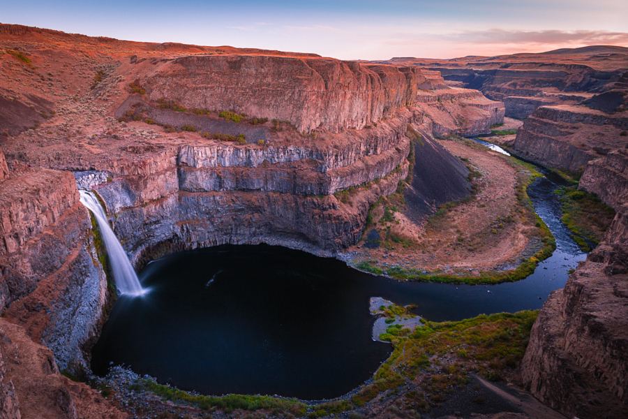
Location map; no photo available.

Partial: burned trail with washouts and a bridgeless creek crossing

Washington

North Fork Union Creek Falls

4.5 miles round trip (WTA)

North Fork Union Creek Falls, also called North Union Falls, is a set of tiered plunges on the North Fork Union Creek east of Chinook Pass, in the Okanogan-Wenatchee National Forest. The area burned in the Norse Peak Fire. From the Union Creek Trail 956 signboard, take a free wilderness permit from the box. Cross Union Creek on a foot log at 0.2 mile, go left at the unmarked junction and switchback uphill. At 0.25 mile two side trails lead to Union Creek Falls viewpoints. The main trail climbs steeply, then stays near 4,000 feet. Between 1.3 and 1.6 miles, gullies have washed out the trail and it may be impassable. At 2.1 miles the trail reaches the top of the lower cascade, where the fire destroyed the bridge over the North Fork. If you can cross safely (you might have to wade), a side trail upstream leads less than 200 feet to a grotto below the 35-foot upper tier. Return the same way.
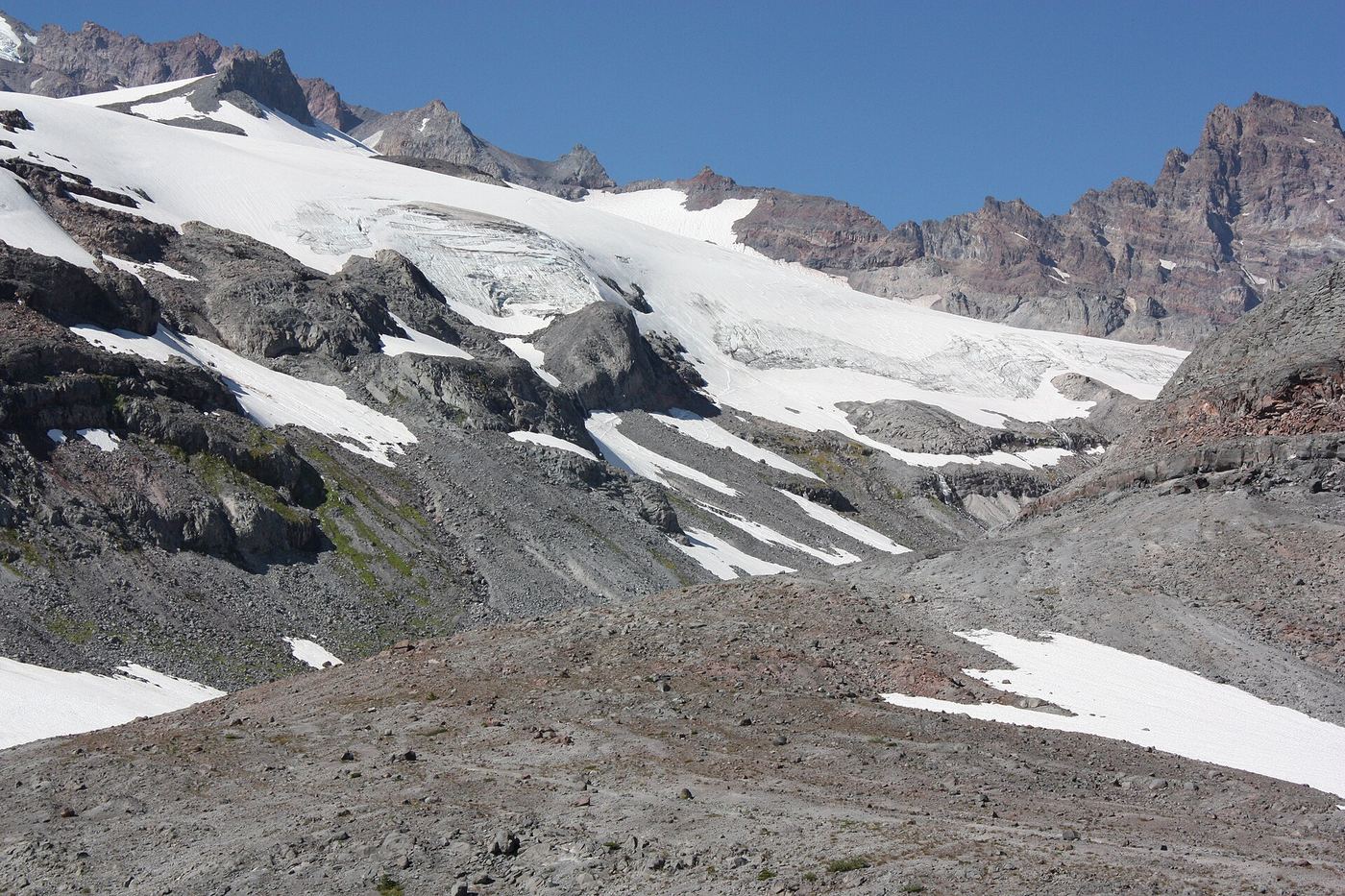
Location map; no photo available.
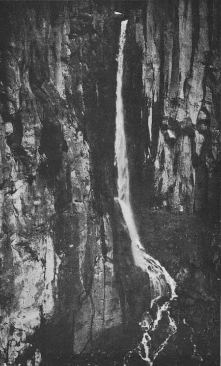
Partial: informal roadside viewpoint above cliffs; no formal parking

Washington

Outlet Falls

About 50 feet from the turnout (Waterfalls Northwest)

Outlet Falls is a 69-foot plunge where Outlet Creek drops into a huge bowl in the Klickitat Canyon, east of Glenwood. It is in the Klickitat Canyon Natural Resources Conservation Area, managed by the Washington State Department of Natural Resources. The falls are just under 6 miles east of Glenwood on the Glenwood Highway, at an unmarked viewpoint 8/10 mile west of the marked Klickitat Canyon viewpoint. Watch for a pullout where a road circles a small group of trees; the falls are visible about 50 feet from the turnout. There is no signage, formal viewpoint or formal parking. The canyon rim has steep cliffs, and paths toward the canyon bottom are informal and dangerous.

Location map; no photo available.

Washington

Panther Creek Falls

Less than 500 feet of trail, plus roadside approach

The short trail descends to an observation deck. Use the published roadside approach rather than assuming the trail begins at the parking area.

Location map; no photo available.

Researched route and starting area

Washington

PeeWee Falls

Overlook approach length unknown.

The overlook provides a distant view of Peewee Falls and Boundary Lake.

Location map; no photo available.

National forest trail to a view over the top of the falls; forest pass required

Washington

Perry Creek Falls

About 3 1/2 miles one way, per the Northwest Waterfall Survey

Perry Creek Falls is a 101-foot, two-tier falls where Perry Creek crashes through a narrow gorge, in a research natural area of the Mount Baker-Snoqualmie National Forest. Start at the Mount Dickerman trailhead; the Perry Creek Trail leaves from the west end of the lot. The first mile is mostly flat, joining an old road that leads a fifth of a mile to the former trailhead. The trail then traverses the east side of the valley across talus slopes and through old forest to the falls, where it passes the top. The falls face away from the trail, so you look down over them; much is hidden under an overhang. Approach the edge with great caution. Return the same way. The trail continues across the creek above the falls with no bridge.

Location map; no photo available.

State forest trail to the falls

Washington

Porter Falls

2.2 miles round trip (WTA); another guide gives 1.6 miles round trip

Porter Falls is at the meeting of the West Fork and South Fork of Porter Creek in Capitol State Forest, managed by the Washington State Department of Natural Resources. One branch cuts through a cleft while the other plunges over a ledge into a punchbowl. From the trailhead, the trail climbs several switchbacks and levels out partway up the hillside, then drops back to the creek and rises again to the West Fork of Porter Creek. Follow the West Fork down to the confluence and the falls. Return the same way.

Location map; no photo available.

County park trail to a fenced viewpoint; view partly blocked by foliage

Washington

Pothole Falls

1.1 miles out and back to the falls, or 1.6 miles with the full Round Lake loop, per Hikespeak

Pothole Falls is a broad, roughly 15-foot cascade on Lacamas Creek in Lacamas Lake Regional Park in Camas, with natural potholes carved in the bedrock. From the park lot on NE Everett Street, walk east along the channel between Lacamas Lake and Round Lake to a kiosk near the playground and restrooms. Follow the Round Lake Loop Trail past the fish screen to a junction about a third of a mile from the start, turn left and cross the Round Lake dam. Past marker #8, turn right on a path through the forest for about 150 yards to a fenced viewpoint at the edge of the ravine. Foliage can block the view. A steep, badly eroded path through a gap in the fence leads down to the creek bank. Return the same way, or continue around Round Lake.

Location map; no photo available.

Steep national forest trail; falls about a mile from the trailhead

Washington

Pumpkinseed Creek Falls

About a mile from the trailhead, per WTA

Pumpkinseed Falls slides about 25 feet down a granite face into a small pool on Pumpkinseed Creek, fed by Pumpkinseed Lake, beside the Dingford Creek Trail in the Mount Baker-Snoqualmie National Forest. From the Dingford Creek trailhead, take the trail marked for Dingford Creek and climb steeply up the hillside past moss-covered boulders, with Dingford Creek to your right. About a mile in, the trail passes the falls. Return the same way. This is a separate falls from Dingford Creek Falls at the trailhead bridge.

Location map; no photo available.

User-built trail on public and land trust property to a spur viewpoint

Washington

Quad Falls

Oregon Hikers gives 4.3 miles round trip for the full hike to Railcar Falls, which passes Quad Falls partway

Quad Falls is a four-tier falls of about 60 feet on the East Fork Duncan Creek, on the Washington side of the Columbia River Gorge. Oregon Hikers says the route crosses State of Washington, Gifford Pinchot National Forest and Friends of the Gorge Land Trust property, and that the trail is user-built, rooty and steep in places but usually easy to follow. From the turnaround, walk back down the road, cross the road bridge over Duncan Creek, go around the crash barrier on the north side and take the obvious path up; about 25 yards from the road the trail branches left up the bluff. Cross a plank bridge over the West Fork Duncan Creek, climb to the ridge, then drop to a campsite above the East Fork and hike upstream. Pass above a narrow defile and a wider waterfall that is part of the Lower Quad Falls group. The trail drops and rises to a spur with a view of Quad Falls roaring down a narrow gorge; a little higher, after crossing an old roadbed, there is a view of its highest tier. Return the same way. The survey says clear views of the whole falls need a steep scramble into the gorge.

Location map; no photo available.

Partial: user-maintained trail with blocked views; the road above the falls is private timberland

Washington

Railcar Falls

4.3 miles round trip (Oregon Hikers)

Railcar Falls is a steep, boulder-choked cascade on the East Fork Duncan Creek in the Washington side of the Columbia River Gorge, the biggest waterfall on the Duncan Creek hike. Blowdown and thick brush make it very hard to see. From the turnaround, walk back down the road, cross the road bridge, go around the crash barrier on the north side and take the obvious path up; about 25 yards from the road the trail branches left up the bluff. Cross the plank bridge over the West Fork, climb to the ridge, drop to a campsite above the East Fork and hike upstream past Lower Quad Falls, Quad Falls and Apron Falls to the junction signed for Railcar Falls. Continue up the main trail; from a switchback you can make out the lower cascades. A rugged user path across a steep, thorny slope gives a closer but unsatisfying view. Higher up, near the edge of a clearcut, a track leads right to a rocky rim with the best view of the upper tier. The logging road beyond is Longview Timberlands property. Return the same way.

Location map; no photo available.

Former viewpoint damaged; current approach unverified

Washington

Rainbow Falls

Current approach unverified

The firsthand waterfall survey reports slope failure and removal of the former viewpoint signs and fencing. It says the falls are no longer clearly visible there and advises against the difficult canyon route.

Location map; no photo available.

Partial: park trail documented; the only road access is closed at the Fairfax Bridge

Washington

Ranger Falls

About 1 mile of trail beyond the Green Lake Trailhead, which is 3.2 to 3.6 miles up the former road (National Park Service)

Ranger Falls drops 172 feet in three segments on Ranger Creek in the Carbon River area of Mount Rainier National Park. The National Park Service says there is no access to the Carbon River area by SR 165 until further notice, because the Fairfax Bridge outside the park is closed to vehicles, bicyclists and pedestrians and there is no alternate route. When access is possible, hike or bike the Carbon River Trail (former road) to the Green Lake Trailhead on the right, leave bikes at the rack (bikes are not allowed on trails), and climb the Green Lake Trail about a mile. Several false way trails drop to the left; the true overlook, 200 feet off the trail, is marked by a sign. Return the same way, or continue to Green Lake.

Location map; no photo available.

State park trail to the falls and the Pool of the Winds viewpoint

Washington

Rodney Falls

2.2 miles round trip (Oregon Hikers, Pool of the Winds hike)

Rodney Falls is a two-tiered waterfall on Hardy Creek in Beacon Rock State Park, in the Washington side of the Columbia River Gorge. Its upper tier drops into a rock alcove called the Pool of the Winds. From the Hamilton Mountain Trailhead, climb the wide, well-graded Hamilton Mountain Trail. At about 1 mile a side trail drops to the Hardy Falls viewpoint, where trees block much of the view. Continue to a split where Rodney Falls comes into view. The left fork leads shortly to the railed Pool of the Winds viewpoint; the right fork crosses Hardy Creek on a footbridge at the base of the falls. Return the same way, or continue up to Hamilton Mountain.

Location map; no photo available.

Roadside and short trail view in the national park; entrance pass required

Washington

Ruby Falls

The upper part is visible from the road; the lower part is a short walk along the Narada Falls trail

Ruby Falls is a two-part falls of the Paradise River at the road bridge near Paradise in Mount Rainier National Park: a 21-foot cascade above the bridge and a 31-foot plunge just below it. Coming from the Nisqually Entrance, drive toward Paradise; where the main road makes a sweeping turn uphill to the left, about 0.8 mile past Narada Falls, turn right toward Stevens Canyon and park in the large pullout where the two roads meet. Coming from the Stevens Canyon Entrance, park on the left soon after crossing the Paradise River. The upper part of the falls can be seen from the road; for the lower part, walk a short way along the Narada Falls trail. The Washington Cascades are about 1/10 mile farther downstream.

Location map; no photo available.

Short state park trail; the falls are visible from the trail

Washington

Rustic Falls

About 500 feet (Waterfalls Northwest)

Rustic Falls is a small falls, about 10 feet high, on Cascade Creek in Moran State Park on Orcas Island, and usually the first falls reached on the Cascade Creek trails. From the trailhead lot on Mount Constitution Road, take the hiker-only trail to the left (the right-hand trail is for bicycles). After 0.1 mile a sign shows Rustic Falls straight ahead; it can be seen from the trail. Cascade Falls is to the right, and Cavern and Hidden Falls are to the left. Return the same way.

Location map; no photo available.

Washington

Shoestring Falls

Less than one mile round trip to distant trail views

Look for distant Shoestring Falls views along the first half mile of West Fork Foss Lakes Trail. Only part of the long cascade can be seen from the valley trail.

Location map; no photo available.

Little Giant Fire closure affects trailhead and access

Washington

Silver Falls

1.5-mile loop; fire closure

This is Silver Falls near Entiat in Chelan County. The October 14–31, 2026 fire closure affects its normal access.

Location map; no photo available.

National forest trail from the relocated Siouxon Trailhead

Washington

Siouxon Falls

9.8 miles round trip, per Oregon Hikers

Siouxon Falls is a short falls where Siouxon Creek flumes about 28 to 30 feet through a narrow rock cleft into a large blue pool, in the Gifford Pinchot National Forest. The road to the old trailhead is closed, so the hike starts at the Siouxon Trailhead about 3 miles farther back. From the parking area, walk down the road past the vehicle barrier about 125 yards to the trail on the left. Stay right at the Huffman Peak Trail junction, keep left at the connector from the closed old trailhead, cross the West Creek footbridge, pass the Horseshoe Ridge Trail junction and cross Horseshoe Creek on a footbridge. Continue past campsites to the old bench at the Siouxon Falls viewpoint. Return the same way, or continue upstream to more waterfalls.

Location map; no photo available.

Distant view from the Skyline Trail at Paradise

Washington

Sluiskin Falls

Myrtle Falls is 0.4 mile from the Paradise Inn; the viewing stretch is farther east on the Skyline Trail (distance not stated)

Sluiskin Falls is a veil-like cascade of roughly 150 feet down the side of Mazama Ridge at the head of Paradise Valley in Mount Rainier National Park. The National Park Service says it is best seen from a distance along the lower, eastern part of the Skyline Trail past Myrtle Falls, and that it is visible from most of the Paradise area. From the Paradise Inn, walk northeast on the paved Skyline Trail 0.4 mile to Myrtle Falls at Edith Creek, then continue east on the Skyline Trail for views of the falls. Return the same way.

Location map; no photo available.

Short state park trail to an interpretive spur; Discover Pass required

Washington

Small Falls

One visitor account puts the Small Falls interpretive trail about 0.4 mile past the fork where the Woody Trail goes right

Small Falls is a small, steep stream that works its way around boulders and fallen logs into the Wallace River, the first waterfall on the trail in Wallace Falls State Park near Gold Bar. From the parking lot, the trail first follows an access road under a power line, then enters the forest. At the fork, the Railroad Grade goes left; go right on the Woody Trail. After about 0.4 mile you reach the Small Falls interpretive trail and amphitheater. Return the same way, or continue on the Woody Trail to the Lower, Middle and Upper Wallace Falls.

Location map; no photo available.

Researched route and starting area

Washington

Snoquera Falls

Official page lists a 0.3-mile connector and falls at mile 1.4 on Trail #1167; full-distance wording is inconsistent.

Use the public Buck Creek connector to the south side of Snoquera Falls Trail. The optional north-side loop is more difficult.

Location map; no photo available.

National forest wilderness trail with an unbridged creek ford; partial view of the falls

Washington

Snowshoe Falls

6 miles round trip to Snowshoe Falls, per WTA

Snowshoe Falls is a 150-foot falls on Denny Creek in the Alpine Lakes Wilderness, above Keekwulee Falls. Follow the Denny Creek Trail past the large bridge at half a mile and under the I-90 viaduct. Just over a mile from the trailhead, ford Denny Creek at the water slide rocks, where there is no bridge. Continue 0.7 mile to Keekwulee Falls, then another half mile on a steeper, rockier trail to a viewpoint for Snowshoe Falls. WTA says the falls are much harder to see from the trail than Keekwulee Falls. Return the same way.

Location map; no photo available.

Washington

Spoon Creek Falls

0.3-mile trail; return distance not explicitly stated

Descend Trail #885 to the creek near the base of Spoon Creek Falls.

Location map; no photo available.

National park trail from a roadside trailhead; steep climb on the return

Washington

Stafford Falls

4 miles round trip, per WTA

Stafford Falls drops about 25 to 30 feet into a basalt punch bowl on Chinook Creek in Mount Rainier National Park. From the road-shoulder parking on State Route 123, cross the road to the Owyhigh Lakes trailhead sign. The trail drops almost 300 feet in 0.4 mile beside Deer Creek to the Eastside Trail. Turn south (right first if you want a short look at Chinook Creek from a second bridge), pass Deer Creek Camp, and follow Chinook Creek downstream past pools and a bridge over a rocky chute. About 1.5 miles from the junction, a short side trail leads to a viewpoint level with the top of the falls. Return the same way. This is not the Owyhigh Lakes trailhead near the White River entrance.

Location map; no photo available.

Partial guide: roadside view from a gravel road; no designated parking; land ownership not stated

Washington

Steep Creek Falls

No walk needed for the roadside view

Steep Creek Falls is a 52-foot falls where Steep Creek veils directly into Rock Creek, striking a ledge halfway down. It is beside Rock Creek Road about 5 miles northwest of Stevenson. Take Rock Creek Drive north from Highway 14 past Skamania Lodge, turn left on Ryan Allen Road, then left on Red Bluff Road, which becomes Rock Creek Road. Follow the gravel road about 5 1/2 miles, staying left where a road drops to the right about 2 1/2 miles in, to the bridge over Rock Creek with the falls on the left. Side and head-on views are possible from the road. Visitor guides describe scrambling down beside the bridge to the creek; that is not a built trail and is not described here. Who owns the land along the road is not stated.

Location map; no photo available.

Monument trail; the falls are seen from the Loowit Trail near the Loowit Creek ford

Washington

Step Falls

About 9 miles as a loop returning by the Willow Springs and Truman trails (Waterfalls Northwest)

Step Falls is a plunge on Step Creek, which drains the crater of Mount St. Helens beside Loowit Creek. Its canyon is very unstable, and the falls have changed greatly in height and position. It is best seen from the Loowit Trail near the ford of Loowit Creek. From the south end of the Windy Ridge parking lot, follow the Truman Trail (the old road for the first two miles), following signs for Loowit Falls: stay right at the first junction and left at the second, to meet the Loowit Trail about 2 3/4 miles from the lot. Turn right on the Loowit Trail, pass the Loowit Falls Trail junction in about 3/4 mile, and continue downhill about another mile, staying left where the Willow Springs Trail joins, to the Loowit Creek ford at the foot of the breached crater. Return the same way, or loop back by the Willow Springs and Truman trails.

Location map; no photo available.

Federal day use area with a view of the falls; open mid-April to mid-October

Washington

Summer Falls

No walk is described; the falls are viewed from the day use area

Summer Falls is a waterfall formed by irrigation water from Banks Lake, falling over the cliffs at the head of Trail Lake Coulee into Billy Clapp Lake. The Bureau of Reclamation runs the Summer Falls Day Use Area here, with picnic tables, barbecues and views of the falls. From US 2 in Coulee City, follow signs for Summer Falls through town to McEntee Street, which becomes Pinto Ridge Road. Drive about 8 miles to a dirt road on the left, about 2 1/2 miles after crossing the Main Canal; the sign and gate are hard to see from the main road. The park is 1 mile down the dirt road. Flow depends on the nearby hydroelectric plant and can be low. Do not enter the water: releases can raise water levels without warning.

Location map; no photo available.

Source-reviewed route and parking

Washington

Sunset Falls

Short walk; length not stated

USFS describes a paved shaded trail from Sunset Falls Campground and Day Use Area to views of the falls on the East Fork Lewis River.

Location map; no photo available.

Partial: walk on an active logging road with debris-flow damage near the falls

Washington

Switchback Falls

2.6 miles one way (Waterfalls Northwest)

Switchback Falls is a small two-step waterfall on an unnamed branch of Big Blowout Creek, between two sharp switchbacks of the Department of Natural Resources Bessemer Road in the Middle Fork Snoqualmie valley near North Bend. From the gated road, walk uphill; it climbs gently for the first mile to where it meets the CCC Trail. Keep following the main road up the hill past all branching trails and spurs. About a mile and three-quarters from the trailhead is an active quarry; stay clear of trucks, equipment and the quarry area. Continue straight past the quarry and up three sharp switchbacks. At 2.6 miles the road crosses the stream directly below the falls. Return the same way. A large debris flow stripped the trees around the falls and destroyed the road in four places where it crosses this stream, so expect rough crossings.

Location map; no photo available.

Wonderland Trail to an unsigned viewpoint; entrance pass required

Washington

Sylvia Falls

The Northwest Waterfall Survey gives half a mile on the Stevens Creek Trail and then 2 miles on the Wonderland Trail

Sylvia Falls is a 43-foot falls on Stevens Creek in the middle of Stevens Canyon in Mount Rainier National Park, seen from the Wonderland Trail. From the north end of the Box Canyon Picnic Area parking lot, take the Stevens Creek Trail down to the Wonderland Trail in half a mile, then follow the Wonderland Trail west (toward Maple Creek camp) for another 2 miles to the obvious but unsigned viewpoint. Return the same way. A second approach starts at a small pullout below The Bench, 2.9 miles east of Reflection Lakes, and goes 1.6 miles down the Wonderland Trail; the survey says that route crosses a wide active slide area east of Martha Falls that may not be passable. The survey also says USGS maps mark the falls too far upstream.

Location map; no photo available.

Short national forest trail from the Quartz Creek Trailhead

Washington

Taitnapum Falls

About a third of a mile from the Quartz Creek Trailhead, per WTA and the Northwest Waterfall Survey

Taitnapum Falls is the uppermost and smallest of the four major falls on this stretch of the North Fork Lewis River, in the Gifford Pinchot National Forest. The river drops about 16 to 20 feet over a ragged, undercut ledge across about 60 feet of river. From the Quartz Creek Trailhead on Forest Road 90, about 2 3/4 miles east of the Lower Falls Recreation Area just before the road crosses Quartz Creek, walk downstream on the Lewis River Trail a little over a third of a mile to the falls. Steep canyon walls and trees prevent a full view. Return the same way, or continue downstream to Upper Lewis River Falls.

Location map; no photo available.

Signed DNR trail with steep switchbacks to the falls; Discover Pass required

Washington

Teneriffe Falls

WTA lists 5.6 miles round trip

Teneriffe Falls, formerly called Kamikaze Falls, is a three-tier falls of about 390 feet on Teneriffe Creek between Mount Si and Mount Teneriffe, in the Department of Natural Resources Mount Si Natural Resources Conservation Area near North Bend. From the trailhead, follow the gently climbing Mount Teneriffe Trail, a former road, for nearly a mile to the junction signed for Teneriffe Falls and turn right. The grade stays mellow for the first mile, then the last 0.9 mile gains 850 feet on 22 switchbacks. Near the end you get a view of the lower falls; continue up the last switchbacks to a small, mostly flat viewpoint for the upper falls, which has a steep drop-off. Stay on the new trail rather than the old bootleg route beside the stream. Return the same way.

Location map; no photo available.

BLM ranch-road trail along Rock Creek to the falls

Washington

Towell Falls

6.5 miles round trip (WTA)

Towell Falls is where Rock Creek splits around a large island, with a separate drop in each channel, in the Channeled Scablands south of Sprague on Bureau of Land Management land. From the trailhead kiosk and picnic shelter at Escure Ranch, follow the old ranch road south beside Rock Creek and go through a pedestrian gate at about 0.4 mile (close it behind you). After about a mile and a half the trail climbs away from the creek, passes high basalt cliffs and descends again toward the falls. A side track to the left reaches the creek near the lower falls but has a poor view. WTA suggests staying on the main trail until you are level with the upper falls, then walking cross country to the creek. Return the same way. The trail is shared with horse riders and mountain bikers, and cattle may graze along it.

Location map; no photo available.

Parking location unconfirmed

Washington

Twin Falls

Walking distance not confirmed

The firsthand waterfall survey places these Twin Falls midway through the walk-in campground off Forest Road 90. This is the Skamania County waterfall, not Twin Falls near North Bend.

Location map; no photo available.

Wildlife area trail to the top and base of the falls

Washington

Umtanum Creek Falls

2.2 miles round trip (WTA)

Umtanum Creek Falls is a 40-foot waterfall that pours into a pool surrounded on three sides by basalt walls, in the Wenas Wildlife Area of the Washington Department of Fish and Wildlife. The trail follows the creek through Douglas-fir and ponderosa pine. About 0.3 mile in, the trail is confusing: it goes straight up the rocks along logs; do not go right and cross the creek. The trail then opens up at the falls. A rough trail leads to the bottom of the falls, or you can stay at the top for the view. Return the same way.

Location map; no photo available.

Researched route and starting area

Washington

Union Creek Falls

Waterfall-specific distance unknown.

The trailhead page explicitly identifies Union Creek Falls on Trail #956.

Location map; no photo available.

Gated forest road walk on state land; one source, road junctions not confirmed

Washington

Upper Cherry Creek Falls

Just over 1.5 miles on a gated road from the parking junction to the bridge below the falls (Northwest Waterfall Survey)

Upper Cherry Creek Falls is a 25-foot horsetail on Cherry Creek just above a logging road, on Washington Department of Natural Resources land in Marckworth State Forest. From Duvall, take Highway 203 north and bear right on NE Cherry Valley Road, which becomes Kelly Road NE. At 6.6 miles from Highway 203 turn hard left on NE Stossel Creek Way. The pavement ends after 1.4 miles at the state forest sign; continue on gravel for another 6.3 miles, keeping left at the junction at 4.5 miles. Just after the road crosses Cherry Creek beside a small 7-foot falls, park at the junction with the gate ahead, without blocking the gate. Walk the gated road for just over a mile and a half, keeping right at all junctions, to a second bridge over Cherry Creek with the falls just upstream. Closer views need a scramble up the creek from a small informal campsite past the bridge. Fallen trees in the gully can block a clear view of the falls.

Location map; no photo available.

Short national forest trail from a fee trailhead; summer parking reservation required

Washington

Upper Copper Creek Falls

Several hundred feet from the parking lot to the bridge above the falls, per the Northwest Waterfall Survey

This is the upper and larger of the two main falls on Copper Creek, just above its meeting with the Lewis River in the Lewis River Recreation Area of the Gifford Pinchot National Forest. The Northwest Waterfall Survey calls it Copper Creek Falls. From the Middle Falls Trailhead, take the trail on the left side of the parking area that parallels the road for several hundred feet to a bridge over Copper Creek above the falls. The trail then bends around in front of the falls. Tree branches can block parts of the view; for a full view the survey describes climbing down the slope about 25 feet. The same trail continues down to Middle Lewis River Falls. Return the same way.

Location map; no photo available.

Trail connection supported; precise viewing point and distance unconfirmed

Washington

Upper Copper Falls

Falls-specific walking distance not established

The firsthand World Waterfall Database reports Upper Copper Falls glimpsed from Foss Lakes Trail after its long switchback away from Copper Creek and back. Stay on the established trail. Clearer views would require a scramble that is not described here as an authorized approach.

Location map; no photo available.

City park bridges over the falls

Washington

Upper Falls

Short walk within Riverfront Park; no distance is published

Upper Spokane Falls is the section of Spokane Falls where the Spokane River splits around Canada Island (snxw meneɂ) in Riverfront Park, downtown Spokane. Lonely Planet names the footbridge across Canada Island and the Howard Street bridge as the best places to view the Upper Falls. Pedestrian suspension bridges cross the Upper Falls toward the west end of the park, and the Howard Street Promenade crosses the island. Vehicles cannot drive through the park.

Location map; no photo available.

Approach and parking unconfirmed

Washington

Upper Foss River Falls

Walking distance not confirmed

The waterfall survey documents this cascade below Delta Lake. Aaron’s Waterfall World describes an informal path continuing about half a mile beyond Lower Foss River Falls, but calls the overall journey very difficult; developed access and the complete starting route remain unconfirmed.

Location map; no photo available.

Partial guide: forest loop trail passes an upper falls; exact match to this listing not confirmed

Washington

Upper Granite Falls

Part of a one-mile loop to the vista points (Visit North Idaho) or WTA's 2.5-mile round-trip loop; no separate distance to this falls

Upper Granite Falls is on Granite Creek above Lower Granite Falls, beside the Roosevelt Grove of Ancient Cedars in Pend Oreille County near the Idaho border. From the south end of the Stagger Inn parking area, follow the main trail to a junction and turn left toward the overlook. The trail climbs to a viewing platform above Lower Granite Falls, then continues up switchbacks past Upper Granite Falls before meeting Trail 301. Visit North Idaho says both Lower and Upper Granite Falls can be seen from the vista points on this loop. Return to the parking area on Trail 301, or continue to the upper cedar grove. The Northwest Waterfall Survey uses the name Upper Granite Falls for a different, unnamed 20-foot drop much farther up the creek; this guide is for the falls passed on the loop trail, and which drop the loop trail sources mean is not confirmed.

Location map; no photo available.

Roadside falls on a forest road; one source, current road status not confirmed

Washington

Upper Morovitz Falls

Roadside; no walk is described

Upper Morovitz Falls is a 40-foot bow-tie shaped falls in a narrow gully beside National Forest Road 1130 in the Baker Lake area, Mount Baker-Snoqualmie National Forest. From US 20 at Birdsview, take the signed Baker Lake road (Road 11) for 18.5 miles to the Boulder Creek bridge. Just past the bridge turn left on Road 1130 and drive 5.5 miles, 1.1 miles past the Rainbow Falls overlook, to the second crossing of Morovitz Creek. The falls nearly spray onto the road before entering a culvert. Views of Mount Shuksan are a few hundred feet further up the road.

Location map; no photo available.

Partial: last section is an unsigned, possibly abandoned trail

Washington

Upper Sheep Canyon Falls

No total distance is published; about 2 miles on the Blue Lake Trail and about 2/3 mile on the Toutle Trail, then a short way on the Loowit and Sheep Canyon trails

Upper Sheep Canyon Falls is an 88-foot falls just below the Loowit Trail bridge over Sheep Canyon Creek, on the west side of Mount St. Helens in the Gifford Pinchot National Forest. The old Sheep Canyon Trailhead is closed because its road washed out, so the hike now starts at the Blue Lake Trailhead. The Blue Lake Trail climbs past the lake to the Toutle Trail in about two miles. Go north on the Toutle Trail about 2/3 of a mile to the Loowit Trail, turn left on the Loowit Trail, then left again on the unsigned Sheep Canyon Trail. The promontory viewpoint across the canyon is about 300 feet along. This stretch of the Sheep Canyon Trail may be abandoned and is becoming overgrown. Return the same way.

Location map; no photo available.

Partial guide: steep national forest trail with a ford; distance to the falls not stated

Washington

Upper Siouxon Falls

Distance to the falls is not stated; Oregon Hikers gives 10.1 miles round trip from this trailhead to Chinook Falls, which is farther along the same trail

Upper Siouxon Falls is the uppermost waterfall on Siouxon Creek, a 16-foot plunge off a ledge into a pool, in the Gifford Pinchot National Forest. Oregon Hikers describes the approach from the Upper Siouxon Creek Trailhead: the trail drops steeply through many switchbacks to the bottom of the slope near Siouxon Creek. Keep to the west side of the creek, where the trail is maintained; the old trail on the east side is in very bad shape. The trail drops to wide but shallow Calamity Creek, which must be forded, then descends through mossy woods. A short spur on the right leads to the view of the falls. Return the same way, climbing back up the long descent.

Location map; no photo available.

Partial guide: short walk to a fenced viewpoint; who manages the viewpoint is not stated

Washington

Victor Falls

A few yards from the parking area (Waterfalls Northwest)

Victor Falls is a 68-foot curtain of water on Fennel Creek within the city limits of Bonney Lake. From Highway 410 in Bonney Lake, turn south on Sky Island Drive E and follow it 1.6 miles to Rhodes Lake Road. Turn left and go about 3/4 mile to a large parking area lined with a wooden fence on the right, next to a house. A park sign may or may not be present. Trails lead from the parking area to a fenced viewpoint above the falls. The sources do not say who manages the viewpoint, and a local newspaper says much of Fennel Creek is reached mainly through private land.

Location map; no photo available.

Short national park trail from a road pullout; park entrance fee

Washington

Washington Cascades

No more than 1/5 mile from the bridge to the viewpoint at the bottom, per the Northwest Waterfall Survey

The Washington Cascades are a series of falls on the Paradise River in Mount Rainier National Park, spread over roughly 100 yards. No single drop is over 20 feet. They begin about 200 feet downstream of the road bridge, below Ruby Falls, which has its own listing. Coming from the Nisqually Entrance, drive toward Paradise; where the main road makes a sweeping turn uphill to the left, about 8/10 mile past Narada Falls, turn right toward Stevens Canyon and park in the large pullout where the two roads meet. Find the signed Narada Falls trail on the east side of the bridge and follow it downstream to views back up into the cascades. The whole series can be seen from the trail. Alternatively, walk upstream from Narada Falls on the same trail. Return the same way.

Location map; no photo available.

Partial guide: garden water feature matched to this listing by description and position

Washington

Waterwall

Short walk from the garden parking lot; distance not stated

This listing appears to mark the waterfall wall at Bellevue Botanical Garden, a built water feature, not a natural falls. No source uses the name Waterwall, so the match is based on the description and position. Seattle's Child describes the garden welcoming visitors with tree-lined paths, a moving sculpture and a waterfall wall, and says children touch the water at the wall on the way back to the parking lot. The garden paths are paved and stroller-friendly.

Location map; no photo available.

Long national park trail to a bridge across the falls

Washington

Wauhaukaupauken Falls

14.4 miles round trip (WTA)

Wauhaukaupauken Falls is on the Ohanapecosh River at Indian Bar on the Wonderland Trail in Mount Rainier National Park. From the Box Canyon Comfort Station parking lot, cross Stevens Canyon Road to the signed Wonderland Trail and bear right toward Nickel Creek and Indian Bar. Pass Nickel Creek Camp, climb about 1.75 miles to the Cowlitz Divide trail junction and stay left on the Wonderland Trail. The trail rolls through forest and meadow along the divide to a high point of about 5,900 feet, then descends about 800 feet into Indian Bar. At the bottom, a sign points right to a bridge across the falls. Return the same way. Nickel Creek is the last reliable water before Indian Bar.

Location map; no photo available.

Location corrected; route and parking documented

Washington

Whirlpool Falls

About one-third mile downstream from Whatcom Falls; total from parking unconfirmed

A separate waterfall downstream from the main Whatcom Falls, near Waterline Bridge in Whatcom Falls Park.

Location map; no photo available.

Partial guide: long forest trail with fords; no distance to this falls

Washington

Wildcat Falls

Distance to Wildcat Falls is not stated; Oregon Hikers gives 14.0 miles for the full Siouxon Creek lollipop loop

Wildcat Falls is the tallest waterfall in the Siouxon Creek drainage of the Gifford Pinchot National Forest, about 250 feet in four drops. From the Siouxon Trailhead, follow the Siouxon Trail upstream to the Siouxon-Chinook Trail Junction, where the footbridge over the narrows is out. Oregon Hikers describes fording Siouxon Creek between the chasm and the mouth of Chinook Creek, then taking the Chinook Trail #130A up Chinook Creek to the crossing below Chinook Falls on a chained log or a shallow ford. At the Chinook-Wildcat Trail Junction keep left on the Wildcat Trail #136 and cross Wildcat Creek over slippery logs and rocks to the Wildcat-Siouxon Crossing Trail Junction. Head up the Wildcat Trail about a third of a mile, past Lower Wildcat Falls and a slide falls, to a sharp switchback below a rock face with a view across to the lower 125 feet of Wildcat Falls. Return the same way.

Location map; no photo available.

National park trail to a distant viewpoint

Washington

Wilson Glacier Falls

About a mile and a quarter from the Paradise visitor center to Glacier Vista (Northwest Waterfall Survey)

Wilson Glacier Falls is a 315-foot falls where meltwater from the Wilson Glacier pours over a cliff onto the Nisqually Glacier in Mount Rainier National Park. There is no way to get close to it, so it is seen from a distance. From the Paradise parking lot, find the Skyline Trail behind the Jackson Visitor Center and follow signs north. At about 0.4 mile keep right at the split for the Deadhorse Creek Trail and Glacier Vista, climb stone steps, and reach Glacier Vista on the left. The falls can also be seen from the Panorama Point area further up the Skyline Trail. Return the same way.

Location map; no photo available.

Park paths and a short dirt path to a seasonal falls

Washington

Woodburn Falls

About 1 mile from the trailhead (Waterfalls Northwest)

Woodburn Falls is a seasonal 20-foot falls on Woodburn Creek in Lacamas Regional Park, in Camas. From the Lacamas Park lot, follow the paved paths downstream for half a mile to Pothole Falls, crossing the dam that holds back Round Lake on the way. Just past Pothole Falls, take the service road on the left for a third of a mile, then a poorly signed but obvious path on the right for a quarter mile to the falls. Oregon Hikers says the viewpoint above the creek is good enough, because the descent to the creek is deep and treacherous. Return the same way.

Location map; no photo available.

Route and parking documented by Washington Trails Association.

Washington

Wynoochee Falls

0.5 mile return

WTA's firsthand guide documents a short forest approach to Wynoochee Falls and its gravel-bar viewing area.

Location map; no photo available.

County park falls a flight of stairs from a roadside pullout

Washington

Yacolt Falls

A flight of stairs from the pullout to the footbridge; no distance given

Yacolt Falls is a two-step falls of about 25 feet on Yacolt Creek, about a quarter mile above its meeting with the East Fork Lewis River, in the northern part of Clark County's Moulton Falls Regional Park. The creek drops about 15 feet over a broad ledge, then 6 to 7 feet beneath a rotating swinging footbridge. From Battle Ground, take SR 503 north 5 1/2 miles to NE Lucia Falls Road and turn right. About 8 2/3 miles from Highway 503, watch for concrete pillars, picnic tables and a large pullout on the left, directly across from Sunset Falls Road. A flight of stairs leads to the bridge, and a trail continues downstream to Moulton Falls on the East Fork. Return the same way.

Location map; no photo available.

Choose another state All mapped waterfalls in Washington