Upper Copper Creek Falls
Skamania County, Washington
Your visit at a glance
- Waterfall height
- 26 ft (7.9 m)
- Location
- Skamania County, Washington
- Access status
- Short national forest trail from a fee trailhead; summer parking reservation required
- The walk
- Several hundred feet from the parking lot to the bridge above the falls, per the Northwest Waterfall Survey
- Ground & access
- Forest trail with a bridge over Copper Creek. The full view needs a short climb down a slope off the trail.
This is the upper and larger of the two main falls on Copper Creek, just above its meeting with the Lewis River in the Lewis River Recreation Area of the Gifford Pinchot National Forest. The Northwest Waterfall Survey calls it Copper Creek Falls. From the Middle Falls Trailhead, take the trail on the left side of the parking area that parallels the road for several hundred feet to a bridge over Copper Creek above the falls. The trail then bends around in front of the falls. Tree branches can block parts of the view; for a full view the survey describes climbing down the slope about 25 feet. The same trail continues down to Middle Lewis River Falls. Return the same way.
Plan your visit
Middle Falls Trailhead on Forest Road 90, the upper trail along the road to the bridge above the falls, where the trail bends around in front of them
The Northwest Waterfall Survey says the trail on the left side of the parking area runs several hundred feet to a bridge above the falls. No exact figure is given. The return distance is not stated.
Forest trail with a bridge over Copper Creek. The full view needs a short climb down a slope off the trail.
Where to start
Middle Falls Trailhead on Forest Road 90, about 40 miles east of Cougar. The trailhead is on the right. No restrooms or drinking water.
Timing & water
The survey says the falls are best during spring melt and during or after long rain, because the stream flow is low.
Before you go
Day use costs $5 per vehicle per day or $30 for an annual pass. From June 15 through Labor Day weekend, a parking reservation ticket from Recreation.gov is also required.
Visitor informationVisit sources
- Northwest Waterfall Survey: Copper Creek Falls
- Northwest Waterfall Survey: Copper Creek Falls
- Northwest Waterfall Survey: Copper Creek Falls
- Northwest Waterfall Survey: Copper Creek Falls
- Northwest Waterfall Survey: Copper Creek Falls
- Northwest Waterfall Survey: Lower Copper Creek Falls
- USDA Forest Service: Middle Falls Trailhead
- USDA Forest Service: Middle Falls Trailhead
- USDA Forest Service: Middle Falls Trailhead
- USDA Forest Service: Middle Falls Trailhead
More waterfalls nearby
Within 40 straight-line miles. Road and trail distances will differ.
- Lower Copper Creek FallsShort national forest trail from a fee trailhead; summer parking reservation required32 ft (9.8 m) · Skamania County, WA0.2 miSE
- Middle Lewis River FallsShort national forest trail from a fee trailhead; summer parking reservation required33 ft (10.1 m) · Skamania County, WA0.2 miE
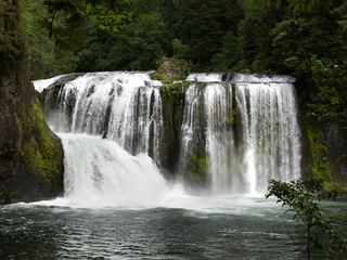 Upper Lewis River FallsNational forest river trail from the Quartz Creek Trailhead58 ft (17.7 m) · Skamania County, WA0.9 miNE
- Taitnapum FallsShort national forest trail from the Quartz Creek Trailhead16 ft (4.9 m) · Skamania County, WA1.1 miNE
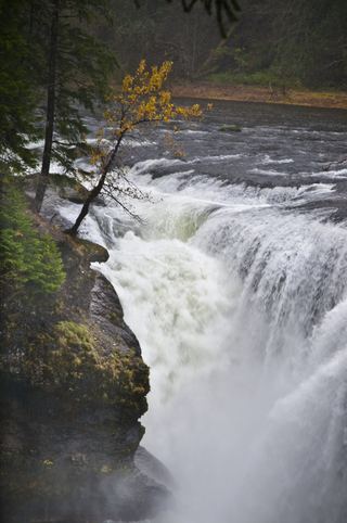 Lower Lewis River FallsResearched visit notes43 ft (13.1 m) · Skamania County, WA1.1 miSW
- Chickoon Creek Falls78 ft (23.8 m) · Skamania County, WA1.5 miSW
- Little Niagara Falls74 ft (22.6 m) · Skamania County, WA3.3 miE
- Tribulation Falls277 ft (84.4 m) · Skamania County, WA5.2 miS
- Big Creek FallsSkamania County, WA5.4 miS