Middle Lewis River Falls
Skamania County, Washington
Your visit at a glance
- Waterfall height
- 33 ft (10.1 m)
- Location
- Skamania County, Washington
- Access status
- Short national forest trail from a fee trailhead; summer parking reservation required
- The walk
- The Northwest Waterfall Survey says both trails from the parking lot reach the falls in half a mile
- Ground & access
- Forest trails with a descent to the river. Rocks beside the falls are slick and the river is deep below the falls.
Middle Lewis River Falls is a 33-foot falls almost 300 feet wide on the Lewis River, in the Lewis River Recreation Area of the Gifford Pinchot National Forest. The Forest Service calls it Middle Falls. Two trails leave the Middle Falls parking lot and reach the falls in about half a mile. The lower trail drops to the Lewis River Trail; follow it upstream across Copper Creek, passing Lower Copper Creek Falls, to the falls. The upper trail crosses Copper Creek above Copper Creek Falls and descends directly to the falls. Return the same way or use both trails as a short loop. The trailside viewpoints are limited; the survey says better views need care on wet rocks beside deep water, and you should stay off the rocks when the river is high.
Plan your visit
Middle Falls Trailhead on Forest Road 90, down either trail to the Middle Falls on the Lewis River
The Northwest Waterfall Survey says two trails leave the Middle Falls parking lot and reach Middle Lewis River Falls in half a mile. WTA says the Middle Falls are about a mile and a half upstream from the Lower Falls on the Lewis River Trail, a longer alternative.
Forest trails with a descent to the river. Rocks beside the falls are slick and the river is deep below the falls.
Where to start
Middle Falls Trailhead on Forest Road 90, about 1 mile east of the Lower Lewis River Falls Recreation Area and roughly 40 miles east of Cougar. The Forest Service says there are no restrooms or drinking water at this trailhead.
Timing & water
Parking reservations apply in summer. Stay off the riverside rocks in high water.
Before you go
Day use costs $5 per vehicle per day or $30 for an annual pass. From June 15 through Labor Day weekend, a parking reservation ticket from Recreation.gov is required daily.
Visitor informationVisit sources
- Northwest Waterfall Survey: Middle Lewis River Falls
- Northwest Waterfall Survey: Middle Lewis River Falls
- Northwest Waterfall Survey: Middle Lewis River Falls
- Northwest Waterfall Survey: Middle Lewis River Falls
- Washington Trails Association: Lewis River Falls
- Washington Trails Association: Lewis River Falls
- USDA Forest Service: Middle Falls Trailhead
- USDA Forest Service: Middle Falls Trailhead
- USDA Forest Service: Middle Falls Trailhead
More waterfalls nearby
Within 40 straight-line miles. Road and trail distances will differ.
- Lower Copper Creek FallsShort national forest trail from a fee trailhead; summer parking reservation required32 ft (9.8 m) · Skamania County, WA0.1 miSW
- Upper Copper Creek FallsShort national forest trail from a fee trailhead; summer parking reservation required26 ft (7.9 m) · Skamania County, WA0.2 miW
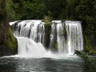 Upper Lewis River FallsNational forest river trail from the Quartz Creek Trailhead58 ft (17.7 m) · Skamania County, WA0.8 miNE
- Taitnapum FallsShort national forest trail from the Quartz Creek Trailhead16 ft (4.9 m) · Skamania County, WA1.0 miNE
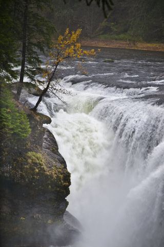 Lower Lewis River FallsResearched visit notes43 ft (13.1 m) · Skamania County, WA1.2 miSW
- Chickoon Creek Falls78 ft (23.8 m) · Skamania County, WA1.5 miSW
- Little Niagara Falls74 ft (22.6 m) · Skamania County, WA3.1 miE
- Tribulation Falls277 ft (84.4 m) · Skamania County, WA5.2 miS
- Big Creek FallsSkamania County, WA5.5 miSW