Dalles Creek Falls Lower
Pierce County, Washington
Your visit at a glance
- Waterfall height
- Not recorded
- Location
- Pierce County, Washington
- Access status
- Guide: steep forest trail to a side view of the falls
- The walk
- About 1 mile one way to the falls (WTA)
- Ground & access
- Steep climb on switchbacks from the start; short side trail to the viewpoint.
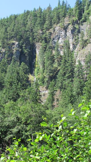
Lower Dalles Falls is on Dalles Creek near Highway 410 in Mt. Baker-Snoqualmie National Forest. From the wide parking area on the left side of the highway, the trail climbs steeply. At 0.4 mile, keep left at the junction with the White River Trail and follow the Palisades Trail up switchbacks beside the Dalles Creek canyon. Listen for the falls about one mile from the trailhead and take the side trail to the right for a closer look. Return the same way. The creek is fed by snowmelt and is only a trickle by midsummer.
Plan your visit
Palisades trailhead on Highway 410, White River Trail 1199 to the Palisades Trail 1198, up beside Dalles Creek to a side trail to Lower Dalles Falls
WTA places Lower Dalles Falls one mile from the trailhead. Its 15.9-mile figure is for the whole Palisades loop, not this falls.
Steep climb on switchbacks from the start; short side trail to the viewpoint.
Where to start
Wide area on the left (north) side of Highway 410, 28.1 miles east of Enumclaw and a quarter mile past the Skookum Falls viewpoint.
Timing & water
Best in late spring and early summer; the creek is a trickle by midsummer.
Before you go
WTA lists no parking pass. No booking is needed.
Visitor informationMore waterfalls nearby
Within 40 straight-line miles. Road and trail distances will differ.
- Dalles Creek Falls UpperPierce County, WA0.1 miNE
 Skookum FallsNorth trailhead parking and return route documented by WTA.Pierce County, WA0.6 miW
- Snoquera FallsResearched route and starting areaPierce County, WA0.9 miSE
- Van Horn FallsPierce County, WA9.2 miSW
- Upper Van Horn FallsPierce County, WA9.3 miSW
- Affi FallsPierce County, WA9.7 miSW
- North Fork Union Creek FallsPartial: burned trail with washouts and a bridgeless creek crossingYakima County, WA11 miSE
- Garda FallsPierce County, WA12 miSW
- Cress FallsPierce County, WA12 miSW