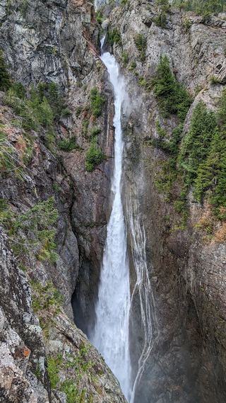
Rainbow Falls
Whatcom County, Washington
Your visit at a glance
- Waterfall height
- 157 ft (48 m)
- Location
- Whatcom County, Washington
- Access status
- Former viewpoint damaged; current approach unverified
- The walk
- Current approach unverified
- Ground & access
- Steep, unstable canyon terrain described by the survey.
The firsthand waterfall survey reports slope failure and removal of the former viewpoint signs and fencing. It says the falls are no longer clearly visible there and advises against the difficult canyon route.
Plan your visit
Former Rainbow Falls viewpoint in Baker Lake basin
Current route length unknown.
Steep, unstable canyon terrain described by the survey.
Where to start
No current sanctioned viewpoint parking or approach verified.
Timing & water
Current land-manager access status unknown; survey warning checked October 27, 2026.
Before you go
Unknown.
Visitor informationMore waterfalls nearby
Within 40 straight-line miles. Road and trail distances will differ.
- Upper Morovitz FallsRoadside falls on a forest road; one source, current road status not confirmedWhatcom County, WA0.6 miSW
- Lower Morovitz FallsWhatcom County, WA0.8 miS
 Sulphide Creek FallsWhatcom County, WA5.0 miE
- Mazama FallsWhatcom County, WA6.2 miNW
- Bacon Lake Falls446 ft (136 m) · Whatcom County, WA9.8 miSE
- Upper Green Lake Falls92 ft (28 m) · Whatcom County, WA9.8 miSE
- Berdeen Falls899 ft (274 m) · Whatcom County, WA10.0 miSE
- Green Lake Falls981 ft (299 m) · Whatcom County, WA10.0 miSE
- Middle Berdeen Falls85 ft (26 m) · Whatcom County, WA10 miSE