Dingford Creek Falls
King County, Washington
Your visit at a glance
- Waterfall height
- Not recorded
- Location
- King County, Washington
- Access status
- Partial: short viewpoint near the trailhead from one visitor report; rough access road
- The walk
- Short walk past the trailhead gate; no distance given
- Ground & access
- Short walk on an old road to a bridge.
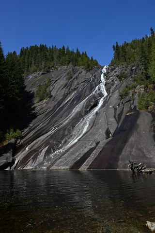
Dingford Creek Falls is next to the Dingford Creek Trailhead at the end of the Middle Fork Snoqualmie Road in the Mount Baker-Snoqualmie National Forest. WTA says the gate at the far end of the trailhead lot leads onto the old Middle Fork Road toward Dutch Miller Gap. A WTA trip report viewed Dingford Creek Falls from a concrete bridge past that gate, calling it a waterfall with no effort to get to. Return the same way.
Plan your visit
Dingford Creek Trailhead at the end of Dingford Road (Middle Fork Snoqualmie Road), around the gate at the far end of the lot, to a concrete bridge with a view of the falls
A WTA trip report viewed the falls from a concrete bridge just past the gate at the trailhead and gives no distance.
Short walk on an old road to a bridge.
Where to start
Dingford Creek Trailhead. The road to it is rough; WTA calls it a tooth-rattling drive, and the trip report rated it for high-clearance vehicles only.
Timing & water
No seasonal closure is mentioned. Road washouts have closed the road in the past; check road status with the Forest Service.
Before you go
Northwest Forest Pass or America the Beautiful Pass required (WTA).
Visitor informationVisit sources
More waterfalls nearby
Within 40 straight-line miles. Road and trail distances will differ.
- Pumpkinseed Creek FallsSteep national forest trail; falls about a mile from the trailheadKing County, WA0.7 miNE
- Lower Tin Cup Joe FallsKing County, WA1.7 miW
- Tin Cup Joe Falls463 ft (141.1 m) · King County, WA1.8 miW
- Nine Hour FallsKing County, WA2.7 miW
- Nellie Falls150 ft (45.7 m) · King County, WA4.7 miE
- Big Creek FallsSource-reviewed route and parking236 ft (72 m) · King County, WA4.7 miN
 Otter FallsRoute documented; landslide-damaged creek crossing reported by WTA.1,200 ft (365.8 m) · King County, WA5.1 miN
- Snowshoe FallsNational forest wilderness trail with an unbridged creek ford; partial view of the falls150 ft (45.7 m) · King County, WA5.7 miS
- Keekwulee FallsNational forest wilderness trail with an unbridged creek ford171 ft (52.1 m) · King County, WA5.9 miS