Otter Falls
King County, Washington
Your visit at a glance
- Waterfall height
- 1,200 ft (365.8 m)
- Location
- King County, Washington
- Access status
- Route documented; landslide-damaged creek crossing reported by WTA.
- The walk
- 8.5 miles return
- Ground & access
- Rocky former road, multiple creek crossings, uphill spur and lake-edge descent. A winter 2025 landslide created a deep, primitive crossing about 3.5 miles in.
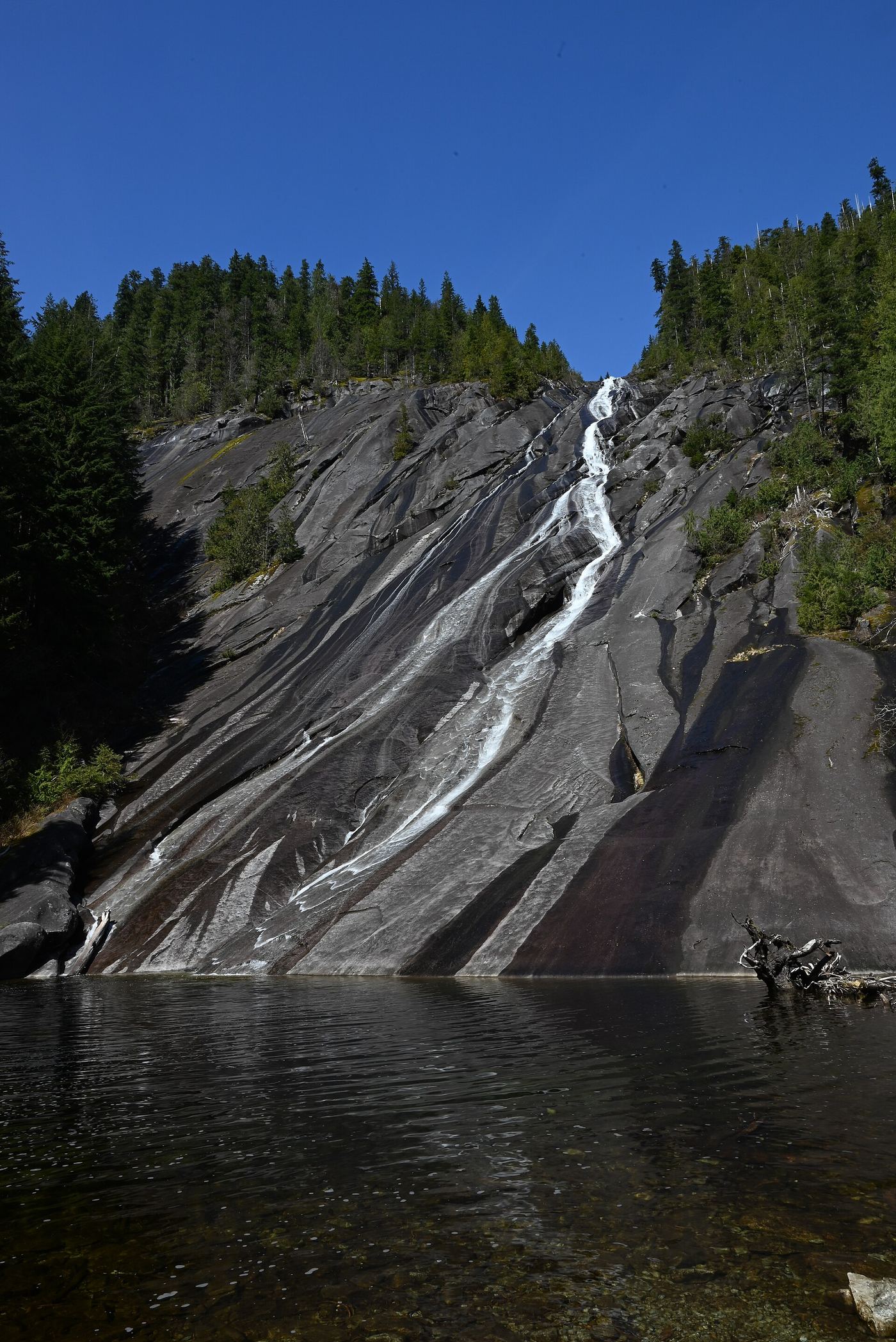
WTA documents the approach to the lower visible portion of Otter Falls from Lipsy Lake.
Plan your visit
From Snoqualmie Lake parking, cross the Taylor River bridge and take the right fork at the Quartz Creek junction. Continue past Marten Creek and several drainages. Follow the signed Otter Falls turn left, uphill to Lipsy Lake, then the short path down to the viewing beach. Return the same way.
WTA labels the full falls hike 8.5 miles round trip.
Rocky former road, multiple creek crossings, uphill spur and lake-edge descent. A winter 2025 landslide created a deep, primitive crossing about 3.5 miles in.
Where to start
From I-90 exit 34, follow the Middle Fork Snoqualmie Road route described by WTA to Garfield Ledges; continue approximately half a mile to Snoqualmie Lake parking.
Timing & water
WTA warns that spring high water makes crossings difficult and that landslide boulders may be unstable.
Before you go
WTA lists an America the Beautiful or Northwest Forest Pass.
Visitor informationMore waterfalls nearby
Within 40 straight-line miles. Road and trail distances will differ.
- Big Creek FallsSource-reviewed route and parking236 ft (72 m) · King County, WA0.7 miSE
- Florence FallsIdentity context documented; waterfall route and parking unresolved141 ft (43 m) · King County, WA3.9 miE
- Nine Hour FallsKing County, WA4.8 miSW
- Pumpkinseed Creek FallsSteep national forest trail; falls about a mile from the trailheadKing County, WA4.9 miS
- Kanim Falls280 ft (85.3 m) · King County, WA5.0 miN
- Dingford Creek FallsPartial: short viewpoint near the trailhead from one visitor report; rough access roadKing County, WA5.1 miS
- Lower Tin Cup Joe FallsKing County, WA5.3 miS
- Tin Cup Joe Falls463 ft (141.1 m) · King County, WA5.4 miS
- Borderline Falls20 ft (6.1 m) · King County, WA5.4 miNE