Foggy Dew Falls
Okanogan County, Washington
Your visit at a glance
- Waterfall height
- Not recorded
- Location
- Okanogan County, Washington
- Access status
- National forest trail along the creek; falls location on the trail not given
- The walk
- Washington Trails Association lists 14.0 miles round trip for the full hike; no distance to the falls is given
- Ground & access
- Fairly flat forest trail at first; the surface becomes rocky farther up.
Washington Trails Association describes the Foggy Dew Creek Trail as a valley walk along Foggy Dew Creek with two large waterfalls, before a steep climb to Merchants Basin. The first section follows the north side of the creek through ponderosa pine and Douglas fir forest, and is fairly flat. The page does not say where along the trail Foggy Dew Falls is, so turn back once you have seen the falls.
Plan your visit
Foggy Dew Trailhead at the end of Forest Road 4340-200, Foggy Dew Creek Trail 417 up the north side of Foggy Dew Creek
The 14.0-mile round trip in Washington Trails Association is for the whole hike to the Sawtooth Ridge. The page says the creek walk passes two large waterfalls but does not give their distance from the trailhead.
Fairly flat forest trail at first; the surface becomes rocky farther up.
Where to start
Foggy Dew Trailhead at the end of Forest Road 4340-200. From Twisp, take SR 20 east 3 miles, then at the SR 153 junction take County Road 1029 to County Road 1034, which joins Forest Road 4340.
Timing & water
No season limits are stated.
Before you go
Washington Trails Association lists no parking pass or entry fee.
Visitor informationVisit sources
More waterfalls nearby
Within 40 straight-line miles. Road and trail distances will differ.
- Big Creek FallsChelan County, WA11 miSW
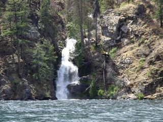 Domke FallsSource-reviewed boat access, launch parking and short viewing trailChelan County, WA12 miW
- Bridal Veil FallsChelan County, WA18 miW
- Silver FallsLittle Giant Fire closure affects trailhead and accessChelan County, WA19 miSW
- Bridal FallsChelan County, WA19 miSW
- McCrea FallsChelan County, WA20 miSW
- Preston FallsChelan County, WA21 miS
- Monkey Bear FallsChelan County, WA21 miW
- 10 Mile FallsChelan County, WA22 miW