Dickerson Falls
Kitsap County, Washington
Your visit at a glance
- Waterfall height
- Not recorded
- Location
- Kitsap County, Washington
- Access status
- Partial guide: private tree farm open to visitors by owner permission
- The walk
- Just over one mile to the signed falls trail, then a short descent (Northwest Waterfall Survey)
- Ground & access
- Gravel road or forest trail, then a descent with steps. Best flow in winter; by midsummer the creek is a trickle.
Dickerson Falls is a two-step waterfall on Dickerson Creek in the privately owned Ueland Tree Farm near Bremerton. The Northwest Waterfall Survey says the owners openly grant and welcome public visitation and built the trail. From WA-3, take Kitsap Way west 1.4 miles, bear left onto Northlake Way NW for just under two-thirds of a mile, then turn hard left onto Leber Lane NW to the large parking area before the gate under the powerlines. Follow the gated road or the designated trail beside it for just over a mile to a signed trail on the right. It descends to a bridge over the creek just above the falls and winds down steps to the base of the upper tier. Two smaller falls farther downstream are closed to the public.
Plan your visit
Large parking area on Leber Lane NW before the gate, gated road or parallel trail into the Ueland Tree Farm, then a signed trail down to a bridge above the falls and steps to the base of the upper tier
The Northwest Waterfall Survey says to follow the road or trail for just over one mile to the signed falls trail, which then descends to the bridge and steps. No round-trip figure is given.
Gravel road or forest trail, then a descent with steps. Best flow in winter; by midsummer the creek is a trickle.
Where to start
Large parking area on the right side of Leber Lane NW, just before the gate where the road passes under the powerlines.
Timing & water
Best in winter. The survey says the creek is a trickle by midsummer.
Before you go
No fee is mentioned. No booking is needed.
Visitor informationVisit sources
More waterfalls nearby
Within 40 straight-line miles. Road and trail distances will differ.
- Rocky Brook Falls164 ft (50 m) · Jefferson County, WA14 miNW
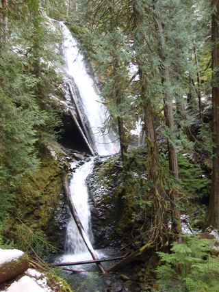 Murhut FallsRoute and trailhead parking documented.Jefferson County, WA16 miNW
- Lilliwaup FallsMason County, WA19 miW
- Upper Lilliwaup FallsMason County, WA20 miW
- Ludlow FallsPartial guide: short interpretive loop; land ownership and parking rules not statedJefferson County, WA24 miN
- Hamma Hamma FallsSource-reviewed route and parkingMason County, WA25 miW
- Whitehorse FallsMason County, WA25 miW
- WaterwallPartial guide: garden water feature matched to this listing by description and positionKing County, WA26 miE
- North Fork FallsShort park trail from the Red Town TrailheadKing County, WA28 miE