Chuckanut Falls
Whatcom County, Washington
Your visit at a glance
- Waterfall height
- Not recorded
- Location
- Whatcom County, Washington
- Access status
- Guide: short forest hike to a fenced viewpoint
- The walk
- 2.6 miles round trip (WTA); the county lists 2.7 miles as a loop
- Ground & access
- Forest trail with boardwalks and a moderate climb; WTA lists 640 feet of elevation gain.
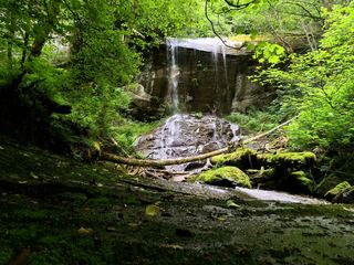
Chuckanut Falls is a small waterfall on the north side of Chuckanut Mountain, south of Bellingham. From the North Chuckanut Mountain Trailhead, climb gently through Arroyo Park; where forks are confusing, WTA advises taking the right-hand trail. You cross boardwalks and creeks. After about one mile, at a sharp hairpin turn, a sign on the left marks Chuckanut Falls. Head downhill on switchbacks, keep going downhill at the next junction, and about 0.3 mile from the signed junction reach a viewpoint with a wooden fence and a small bench. The falls are just beyond. Return the same way.
Plan your visit
North Chuckanut Mountain Trailhead, trail through Arroyo Park to the signed Chuckanut Falls junction at a hairpin turn, then down to the viewpoint
WTA gives 2.6 miles round trip, out and back. Whatcom County gives 2.7 miles round trip to Chuckanut Falls via a loop from the same trailhead.
Forest trail with boardwalks and a moderate climb; WTA lists 640 feet of elevation gain.
Where to start
North Chuckanut Mountain Trailhead, which serves the Hemlock Trail and Arroyo Park.
Timing & water
No season limits are stated.
Before you go
WTA lists no parking pass for this hike. No booking is needed.
Visitor informationVisit sources
More waterfalls nearby
Within 40 straight-line miles. Road and trail distances will differ.
- Silver Creek Falls128 ft (39 m) · Whatcom County, WA3.9 miE
- Whirlpool FallsLocation corrected; route and parking documentedWhatcom County, WA4.1 miNE
 Anderson Falls167 ft (51 m) · Whatcom County, WA11 miNE
- Hard Scrabble Falls280 ft (85.3 m) · Whatcom County, WA12 miE
- Hidden FallsPartial guide: signed state park trail junction; the last section to this falls is not describedSan Juan County, WA16 miW
- Cavern FallsPartial guide: signed state park trail junction; the last section to this falls is not describedSan Juan County, WA17 miW
- Rustic FallsShort state park trail; the falls are visible from the trailSan Juan County, WA17 miW
- Cascade FallsShort signed state park trail; Discover Pass requiredSan Juan County, WA17 miW
- Racehorse FallsWhatcom County, WA20 miNE