Lower Granite Falls
Pend Oreille County, Washington
Your visit at a glance
- Waterfall height
- Not recorded
- Location
- Pend Oreille County, Washington
- Access status
- Short trail to a viewpoint at the base of the falls
- The walk
- About 365 feet one way to the lower viewpoint (Inland NW Routes)
- Ground & access
- Short, easy trail to the lower viewpoint. The overlook loop climbs switchbacks.
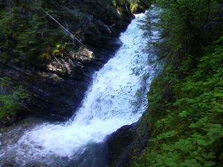
Lower Granite Falls is where Granite Creek cascades down a narrow, sheer rock wall beside the Roosevelt Grove of Ancient Cedars, in Pend Oreille County near the Idaho border. From the south end of the parking area, take the little spur trail along the creek to the viewpoint at the base of the falls. For a view from above, return to the main trail and turn left at the junction toward the overlook, a viewing platform above the falls. That trail continues up switchbacks past Upper Granite Falls to the upper cedar grove as part of a 2.5-mile loop. Take extra care around the falls, the overlook and the trails.
Plan your visit
Stagger Inn Day Use Area / Roosevelt Grove of Ancient Cedars on Forest Road 302, then the short spur trail along Granite Creek to the Lower Granite Falls viewpoint
Inland NW Routes gives 365 feet for the creekside trail to the viewpoint. WTA's 2.5-mile loop also passes an overlook above the falls and Upper Granite Falls.
Short, easy trail to the lower viewpoint. The overlook loop climbs switchbacks.
Where to start
Stagger Inn Day Use Area / Roosevelt Grove of Ancient Cedars on Forest Road 302 (Nordman Metaline Road). From Idaho 57 north of Priest River the road becomes good gravel and is suitable for all vehicles. The route from Metaline Falls over Pass Creek Pass can be rough and suits high-clearance vehicles. Toilet at the trailhead.
Timing & water
Not stated. WTA advises checking with Forest Service staff before going, especially early in the season.
Before you go
WTA lists no parking pass or entry fee.
Visitor informationVisit sources
More waterfalls nearby
Within 40 straight-line miles. Road and trail distances will differ.
- Upper Granite FallsPartial guide: forest loop trail passes an upper falls; exact match to this listing not confirmedPend Oreille County, WA0.1 miNW
- LaSota FallsPend Oreille County, WA0.1 miNW
- Elk Creek FallsResearched route and starting areaPend Oreille County, WA12 miNW
 Sweet Creek FallsShort trails from a highway rest area to the base and an observation areaPend Oreille County, WA16 miW
- American FallsOfficial trail to the falls; remote gravel road; steep section near fallsBoundary County, ID16 miN
- Hunt FallsShort walk on state land road; careful at viewpointsBonner County, ID18 miSE
- PeeWee FallsResearched route and starting areaPend Oreille County, WA19 miNW
- Mission FallsPartial guide: undated directions; bridge, junctions and land status not confirmedBonner County, ID25 miS
- Myrtle FallsResearched visit notesBoundary County, ID30 miE