American Falls
Boundary County, Idaho
Your visit at a glance
- Waterfall height
- Not recorded
- Location
- Boundary County, Idaho
- Access status
- Official trail to the falls; remote gravel road; steep section near falls
- The walk
- About 2.1 miles each way (4.2 miles return)
- Ground & access
- Steady descent with switchbacks and boardwalks. The Forest Service warns that a short section near the falls is steep and lacks tread.
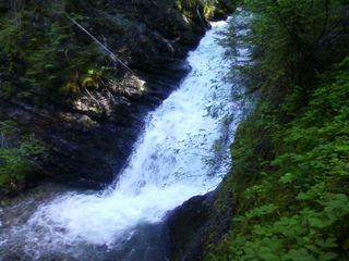
The official name is Upper Priest Falls; it is commonly called American Falls. The Forest Service says Continental Creek Trail #28 switchbacks down from Road #1013 through old-growth cedar to the river bottom and follows a fork of the Upper Priest River to the falls near the Canadian border. Hiking Project describes reaching a junction on the valley floor; go right (north), cross Malcom Creek on a bridge and follow the river for the last half mile to the 40-foot falls. Trail numbers for this last stretch differ between sources: the Forest Service says Trail #308 ends at that junction and Trail #28 continues to the falls, while Hiking Project calls it Trail #308. Return the same way, climbing about 1,000 feet.
Plan your visit
Continental Creek Trail #28 from the end of Road 1013 down to the Upper Priest River, then north at the valley-floor junction to American Falls
Hiking Project gives 4.2 miles for the out-and-back, made of 1.5 miles on Trail #28 and 0.6 mile on Trail #308. Forest Service pages give no distance to the falls.
Steady descent with switchbacks and boardwalks. The Forest Service warns that a short section near the falls is steep and lacks tread.
Where to start
Trailhead is near the end of Road #1013 on the left, just before a locked gate (Forest Service). Hiking Project describes a turnaround area there. The Forest Service says the road past the Trail #308 trailhead is rough with tight switchbacks.
Timing & water
Trailhead road access varies with season and weather; the Priest Lake Ranger District is at (208) 443-2512.
Before you go
No fee or permit mentioned by the Forest Service trail page.
Visitor informationVisit sources
More waterfalls nearby
Within 40 straight-line miles. Road and trail distances will differ.
- LaSota FallsPend Oreille County, WA16 miS
- Upper Granite FallsPartial guide: forest loop trail passes an upper falls; exact match to this listing not confirmedPend Oreille County, WA16 miS
- Lower Granite FallsShort trail to a viewpoint at the base of the fallsPend Oreille County, WA16 miS
- Elk Creek FallsResearched route and starting areaPend Oreille County, WA18 miSW
- PeeWee FallsResearched route and starting areaPend Oreille County, WA19 miW
 Sweet Creek FallsShort trails from a highway rest area to the base and an observation areaPend Oreille County, WA24 miSW
- Hunt FallsShort walk on state land road; careful at viewpointsBonner County, ID30 miS
- Myrtle FallsResearched visit notesBoundary County, ID31 miSE
- Snow Creek FallsResearched visit notesBoundary County, ID32 miSE