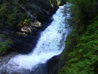
Elk Creek Falls
Pend Oreille County, Washington
Your visit at a glance
- Waterfall height
- Not recorded
- Location
- Pend Oreille County, Washington
- Access status
- Researched route and starting area
- The walk
- Loop distance unknown.
- Ground & access
- Climbs a south-facing slope, descends into a steep draw, and crosses Sullivan Lake Road twice.
From the upper lot, cross the road and follow Trail #560 past Elk Creek Falls before returning to the trailhead.
Plan your visit
Elk Creek Trail #560 loop from Mill Pond Historic Site
Loop distance unknown.
Climbs a south-facing slope, descends into a steep draw, and crosses Sullivan Lake Road twice.
Where to start
Upper parking area at Mill Pond Historic Site; 3.3 miles along Sullivan Lake Road from WA 31.
Timing & water
Year-round listing; current snow and road conditions unknown.
Before you go
No day-use fee; reservations not stated.
Visitor informationVisit sources
More waterfalls nearby
Within 40 straight-line miles. Road and trail distances will differ.
 Sweet Creek FallsShort trails from a highway rest area to the base and an observation areaPend Oreille County, WA5.6 miSW
- PeeWee FallsResearched route and starting areaPend Oreille County, WA8.2 miN
- LaSota FallsPend Oreille County, WA12 miSE
- Upper Granite FallsPartial guide: forest loop trail passes an upper falls; exact match to this listing not confirmedPend Oreille County, WA12 miSE
- Lower Granite FallsShort trail to a viewpoint at the base of the fallsPend Oreille County, WA12 miSE
- American FallsOfficial trail to the falls; remote gravel road; steep section near fallsBoundary County, ID18 miNE
- Lower Sheep Creek FallsStevens County, WA24 miW
- Upper Sheep Creek FallsStevens County, WA24 miW
- Marble Creek FallsStevens County, WA25 miSW