Little Mashel Middle Falls
Pierce County, Washington
Your visit at a glance
- Waterfall height
- 66 ft (20 m)
- Location
- Pierce County, Washington
- Access status
- Public trail from the Bud Blancher Trailhead; steep, slippery final section
- The walk
- 4.5 miles round trip for the Bud Blancher route, per WTA
- Ground & access
- Crushed-rock path, then a dirt trail with a moderate climb and often muddy steps near the falls. Footing at the falls is very slippery and people have died here. The cliffs at the top of the falls have no railings.
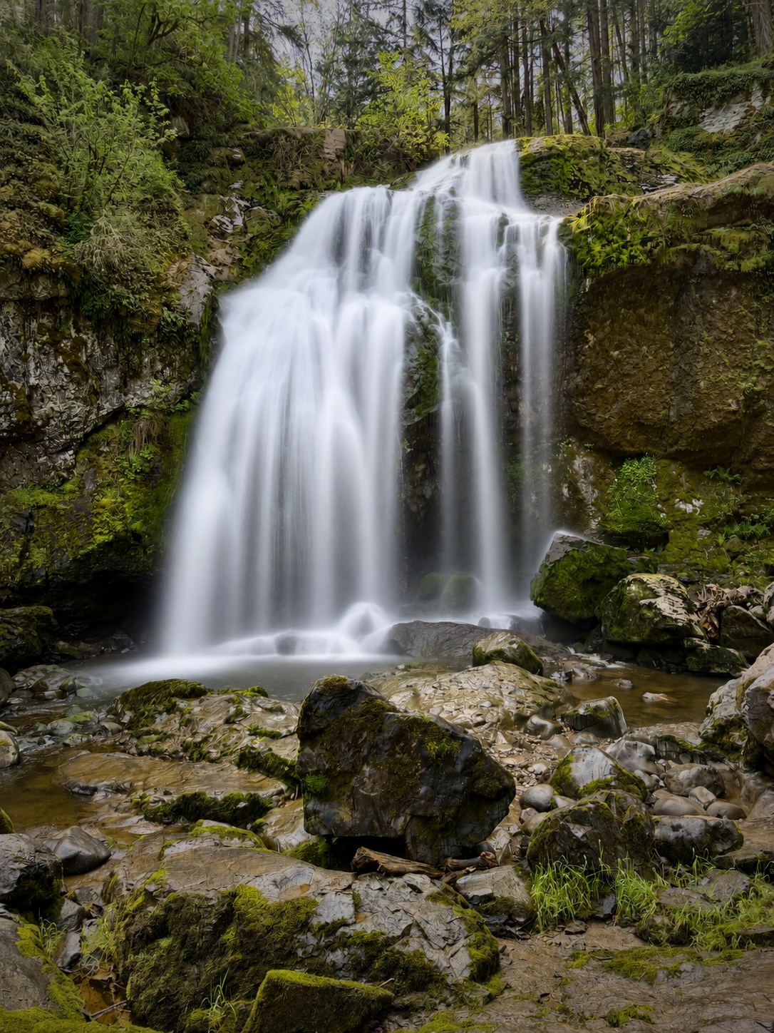
This listing is the middle of the three Little Mashel River falls near Eatonville, officially named Little Mashel Falls: a 92-foot falls that spreads into a broad veil, with room to walk behind it. From the Bud Blancher Trailhead, walk the wide crushed-rock path downhill, cross the Mashel River bridge, and pass Smallwood Park. At a confusing road junction stay left on the path with the yellow bollard. At 1.4 miles cross the Little Mashel River bridge; about 350 feet farther a sign points left to the Little Mashel Falls trail. Bear right at the small Falls Trail sign and climb past the Lower Falls side trail to a 3-way junction. Turn sharply left and continue uphill about 450 feet to another junction; the unmarked trail to the left leads to Middle Falls. After 100 feet, left goes to the base and right goes to the top. Return the same way. Approaches from Alder Cutoff Road are no longer permitted.
Plan your visit
Bud Blancher Trailhead on Weyerhaeuser Road S in Eatonville, along the Bud Blancher Trail across the Mashel and Little Mashel rivers, then the Falls Trail uphill to the unmarked left turn for Middle Falls (Little Mashel Falls)
WTA lists 4.5 miles round trip for the Little Mashel Falls hike from the Bud Blancher Trailhead, which also visits the other falls. WTA says starting at Smallwood Park cuts the hike by one mile.
Crushed-rock path, then a dirt trail with a moderate climb and often muddy steps near the falls. Footing at the falls is very slippery and people have died here. The cliffs at the top of the falls have no railings.
Where to start
Bud Blancher Trailhead: from the 4-way stop on Highway 161 in Eatonville, head east on Center Street E, then turn right on Weyerhaeuser Road S; the trailhead is on the right. Smallwood Park at the end of 436th Street E is a shorter start.
Timing & water
WTA says both trailheads are open year-round. Flow is much higher in winter and spring than in late summer.
Before you go
WTA lists no parking pass or entry fee.
Visitor informationVisit sources
- Washington Trails Association: Little Mashel Falls, Bud Blancher Trail
- Washington Trails Association: Little Mashel Falls, Bud Blancher Trail
- Washington Trails Association: Little Mashel Falls, Bud Blancher Trail
- Washington Trails Association: Little Mashel Falls, Pack Forest
- Northwest Waterfall Survey: Little Mashel Falls
More waterfalls nearby
Within 40 straight-line miles. Road and trail distances will differ.
 Little Mashel Lower FallsCrushed-rock trail and signed side trail to the lower falls; no pass requiredPierce County, WA0.0 miN
 Little Mashel Upper FallsPack Forest trail to a viewpoint of the upper falls; mixed land ownershipPierce County, WA0.2 miSE
- Wildcat FallsPierce County, WA2.7 miNE
- Deschutes FallsCounty park path to a railed viewing deckThurston County, WA7.5 miSW
- Larrupin FallsPierce County, WA17 miE
- Ethania FallsPierce County, WA17 miE
- Denman FallsNational park route documented; long approach on a closed roadPierce County, WA17 miE
- Tornado FallsLewis County, WA17 miS
- Fisher Creek FallsLewis County, WA18 miS