Loowit Falls
Skamania County, Washington
Your visit at a glance
- Waterfall height
- 186 ft (56.7 m)
- Location
- Skamania County, Washington
- Access status
- Monument trail to the falls overlook
- The walk
- 9.2 miles round trip (WTA)
- Ground & access
- Gravel service road, then trail across pumice and in and out of gullies. The spur is harder to follow. Very little clean water; bring extra.
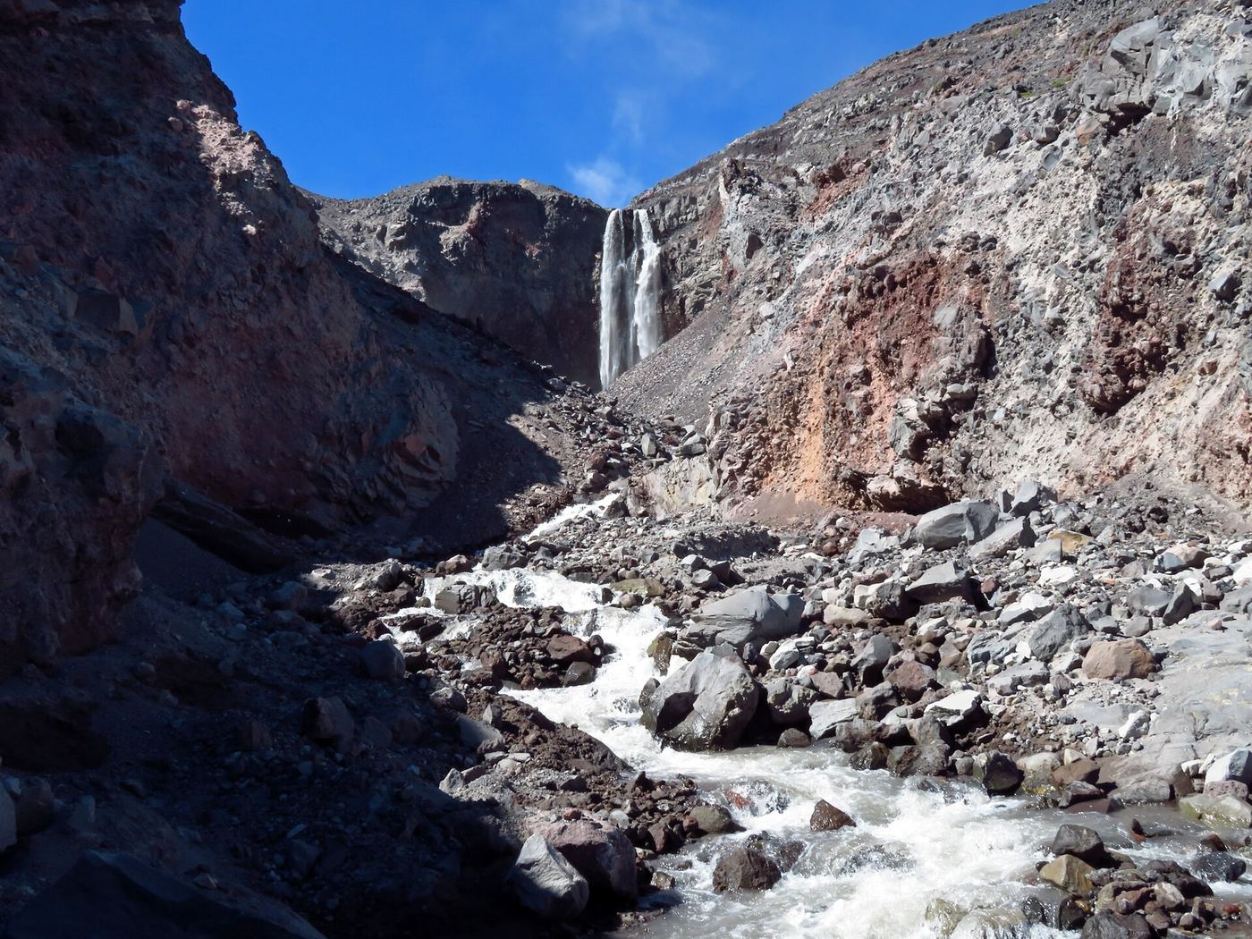
Loowit Falls plunges from the head of Loowit Canyon on the north side of Mount St. Helens, fed by meltwater from the glacier in the crater. From the Windy Ridge Viewpoint, walk 1.8 miles down the service road to where it ends in a parking area used by monument staff. Turn right and take the Windy Trail through a pumice field for about a mile to the Loowit Trail. Turn right (west) on the Loowit Trail and follow it about a mile, in and out of gullies, to the signed Loowit Falls junction. The spur, signed as a quarter mile but closer to half a mile, climbs to the falls overlook. Return the same way. Stay out of the canyon and away from the creek, on the east side: sudden surges of meltwater can pour over the falls on hot days.
Plan your visit
Windy Ridge Viewpoint at the end of Forest Road 99, down the service road, the Windy Trail to the Loowit Trail, west on the Loowit Trail, then the Loowit Falls spur to the overlook
WTA gives 9.2 miles round trip with 1,200 feet of gain. Waterfalls Northwest gives about 4 miles from the parking lot by the Truman Trail.
Gravel service road, then trail across pumice and in and out of gullies. The spur is harder to follow. Very little clean water; bring extra.
Where to start
Windy Ridge Viewpoint at the end of Forest Road 99. From Randle take SR 131 and Forest Road 25 south to Road 99; from Woodland take SR 503 and Forest Road 90 to Forest Road 25. Pit toilet.
Timing & water
Not stated. Weekday closures can apply to this trail in summer; check current Forest Service notices.
Before you go
WTA lists a Northwest Forest Pass or America the Beautiful Pass.
Visitor informationVisit sources
More waterfalls nearby
Within 40 straight-line miles. Road and trail distances will differ.
- Step FallsMonument trail; the falls are seen from the Loowit Trail near the Loowit Creek ford115 ft (35 m) · Skamania County, WA0.3 miW
- Lower Step Falls98 ft (30 m) · Skamania County, WA0.3 miNW
- Middle Loowit FallsSkamania County, WA0.4 miN
- Lower Loowit FallsNational monument trails from Windy Ridge; falls seen from the Loowit Trail ford36 ft (11 m) · Skamania County, WA0.7 miN
- Upper Sheep Canyon FallsPartial: last section is an unsigned, possibly abandoned trail98 ft (30 m) · Cowlitz County, WA4.0 miSW
- Sheep Canyon Falls89 ft (27 m) · Cowlitz County, WA4.0 miSW
- Middle Sheep Canyon FallsCowlitz County, WA4.2 miW
- Lower Sheep Canyon FallsCowlitz County, WA4.2 miW
- Chocolate FallsNational volcanic monument trail with lava-field crossings; falls often dry by midsummerSkamania County, WA4.6 miS