Upper Sheep Canyon Falls
Cowlitz County, Washington
Your visit at a glance
- Waterfall height
- 98 ft (30 m)
- Location
- Cowlitz County, Washington
- Access status
- Partial: last section is an unsigned, possibly abandoned trail
- The walk
- No total distance is published; about 2 miles on the Blue Lake Trail and about 2/3 mile on the Toutle Trail, then a short way on the Loowit and Sheep Canyon trails
- Ground & access
- Forest and volcanic-terrain trails with climbs; the last section is on an unsigned, overgrowing trail.
Upper Sheep Canyon Falls is an 88-foot falls just below the Loowit Trail bridge over Sheep Canyon Creek, on the west side of Mount St. Helens in the Gifford Pinchot National Forest. The old Sheep Canyon Trailhead is closed because its road washed out, so the hike now starts at the Blue Lake Trailhead. The Blue Lake Trail climbs past the lake to the Toutle Trail in about two miles. Go north on the Toutle Trail about 2/3 of a mile to the Loowit Trail, turn left on the Loowit Trail, then left again on the unsigned Sheep Canyon Trail. The promontory viewpoint across the canyon is about 300 feet along. This stretch of the Sheep Canyon Trail may be abandoned and is becoming overgrown. Return the same way.
Plan your visit
Blue Lake Trailhead at the end of the drivable part of Forest Road 8123, Blue Lake Trail to the Toutle Trail, north to the Loowit Trail, then the unsigned old Sheep Canyon Trail a short way to a promontory viewpoint across the canyon
The Northwest Waterfall Survey gives two miles on the Blue Lake Trail to the Toutle Trail and about 2/3 of a mile on the Toutle Trail to the Loowit Trail. It gives no distance for the Loowit Trail section. WTA says starting at Blue Lake adds 2.4 miles to the former Sheep Canyon hike.
Forest and volcanic-terrain trails with climbs; the last section is on an unsigned, overgrowing trail.
Where to start
Blue Lake Trailhead at the end of the drivable portion of Forest Road 8123, reached from Road 81 (Merrill Lake Road).
Timing & water
No season limits are stated.
Before you go
WTA lists an America the Beautiful Pass or Northwest Forest Pass.
Visitor informationVisit sources
More waterfalls nearby
Within 40 straight-line miles. Road and trail distances will differ.
- Sheep Canyon Falls89 ft (27 m) · Cowlitz County, WA0.1 miNW
- Middle Sheep Canyon FallsCowlitz County, WA0.5 miNW
- Lower Sheep Canyon FallsCowlitz County, WA0.5 miNW
- Step FallsMonument trail; the falls are seen from the Loowit Trail near the Loowit Creek ford115 ft (35 m) · Skamania County, WA3.8 miNE
- Lower Step Falls98 ft (30 m) · Skamania County, WA3.9 miNE
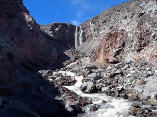 Loowit FallsMonument trail to the falls overlook186 ft (56.7 m) · Skamania County, WA4.0 miNE
- Middle Loowit FallsSkamania County, WA4.3 miNE
- Lower Loowit FallsNational monument trails from Windy Ridge; falls seen from the Loowit Trail ford36 ft (11 m) · Skamania County, WA4.4 miNE
- Chocolate FallsNational volcanic monument trail with lava-field crossings; falls often dry by midsummerSkamania County, WA5.1 miSE